
|
|
Mountain/Rock |
|---|---|
|
|
33.82982°N / 111.48886°W |
|
|
Maricopa |
|
|
Hiking |
|
|
Fall, Winter |
|
|
3832 ft / 1168 m |
|
|
Overview
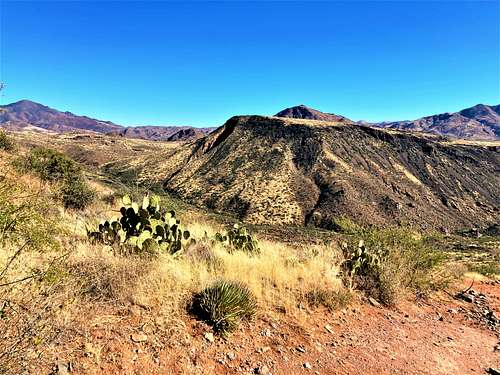
Black Mesa is a prominent mesa off of the Beeline Highway in the northeast corner of Maricopa County – one of many summits in Arizona with the name Black Mesa. From the north, a road leads up to the base of the mountain, within 400’ of the summit. The remaining route is off trail.
Black Mesa is 0.7 miles north of Black Mesa South 3,570’. The two are not normally hiked together because of a steep drop off between them and different primary access points. However, Black Mesa can be combined with nearby Diamond Mountain 5,120'.
Like its southern neighbor Black Mesa South, Black Mesa is fairly accessible from the Phoenix metro area, with starting points less than a mile off of the Beeline Highway. Also, like Black Mesa South, there is a short off-trail section to the top of the mesa. The off-trail section on Black Mesa is a bit harder than the one on Black Mesa South, but not a significant challenge.
Black Mesa isn’t often hiked, being overlooked by more popular hikes in the area, but it makes for a simple outing during late fall and winter months. It is best hiked between November and March.
Getting There
From the Phoenix metro area, take the Beeline Highway (87) for 28.6 miles from the junction between Shea Blvd and 87. There is a turn off on the left, which is easy to miss, which crosses over the Beeline Highway to the southbound lanes. It is a little seven miles past the Ballantine Trailhead. If you reach Sunflower, you’ve gone too far, but you can cross over the highway and go back southbound to the entrance in a couple minutes.
Once at the entrance to the forest service road, continue for 300 yards at which point the road heads back to the left. Continue for another two thirds of a mile, and there is parking on the left at 33.848, -111.474. This should be suitable for most passenger vehicles. The road deteriorates further up the road.
One thing to keep in mind is that to reach Black Mesa from the parking area, hikers need to go down 400’ and then go back up again on the return.
Route
From the parking area, walk down the road for a little over half a mile and the take a right on a lesser forest service road.
Continue down this road for about an eighth of a mile towards the Rincon Tank, which isn't necessarily visible from the road. Once at the bottom of the road, there is a long ridge to the right. Take a right on a road that continues below this ridge. After about a half a mile, the road reaches a saddle and then turns to the left towards Black Mesa. Continue up the road, which ascends to the ridge, and then descends back down to the base of Black Mesa. After almost half a mile from the saddle, the road ends. From here, off-trail hiking is required to reach the top of the mesa. It starts off not too bad for the first 150’ or so, but once the thicker brush is reached, it is a steep 180’ up to the top of the mesa. There are some game trails cutting through the brush that make it tolerable.
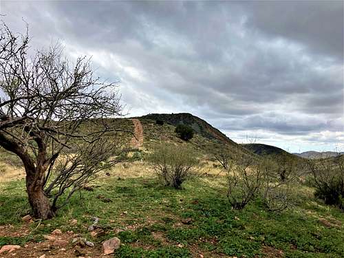
Once on the top of the mesa, there is faint path that goes in and out along the right edge of the mesa. Once topping out it is about 200 yards to the summit. There is no marker, but several areas of rocks within not too large an area appear to be candidates for the highest point.
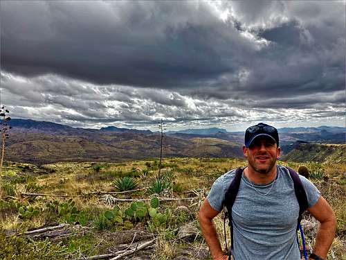
While the parking area is at 3,680’, the route descends down to about 3,270’. From the low point on the road, elevation gain to the summit is over 700’, including some ups and downs along the way. Add another 570’ on the way back to the parking area. The total distance is about 5 ¾ miles.
While reaching the base of the summit isn’t completely obvious, if reviewing satellite maps, it is pretty easy to figure out the route.
Red Tape
There is no red tape of note. The trailhead and the mountain are within Tonto National Forest.