Better Than Sitting At Home
I’d been planning my hiking trip for a week now, carefully checking the weather and making sure I had everything I would need. First, the waiver that must be sent in; it's pretty straight forward and can be mailed or faxed in. There are spaces on there for a "witness", so I called to ask if I needed to get the waiver notorized. The nice lady who answered the phone told me the witness space was just there to confuse people. I got a good chuckle out of that. Friday’s weather called for rain all day, and it was correct. I figured I wouldn’t be doing much hiking in the rain, so I decided to make the long drive out to Black Mountain before going to Mt Rogers. This sure beats sitting around the apartment!
I left home at 7:00 Friday morning and headed for Abingdon, Virginia. From Abingdon I took Rt 58 West straight through the town of Norton and merged with Rt 23 to the town of Appalachia. Once in Appalachia, I found Rt 160 on my right. Almost there now!
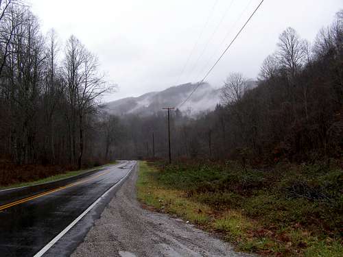
![Bottom of Rt 160]() Rt. 160 before the climbing to Black Mountain
Rt. 160 before the climbing to Black Mountain
Rt 160 up to the Kentucky/Virginia border was a winding road with very few guardrails. All I could do was laugh when I saw the 55 mph speed limit sign. I wanted to make it there and back in one piece, so I stayed well under 55. Just before the “Welcome to Kentucky” sign, I spotted the road to the left going up. It was still raining so I opted to drive up.
I reached the summit and wasn’t very impressed I hate to say. Five or six towers, old decrepit buildings and trash laying around just really took away from the outdoor experience. I parked by the old fire tower and walked over to the USGS marker on a big rock just inside the woods. After stretching my legs a little (it was barely raining now), I hopped back in the Montero to head back down.
![The nice side]() My trusty Montero at the summit.
My trusty Montero at the summit.
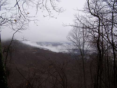
There were several spots to pull off along the way back to town. I got a few pictures and enjoyed the post-storm views. I always look forward to adventuring out in not-so-nice weather because it can create such a unique atmosphere. With the clouds hanging low and blowing through the mountains, it's just a great experience to take the time to enjoy it. The drive up and back is what makes the trip to this highpoint worth it. What the summit lacks in beauty, the drive surely makes up for.
![December in Coal Country]() View from Along Rt. 160 back from Black Mountain
View from Along Rt. 160 back from Black Mountain
This is coal mining country and therefore there are plenty of trucks hauling coal around. I was unfortunate enough to get stuck behind a couple of these trucks and my vehicle was pretty messy after a few miles before they turned off the road. I was glad when the rain picked up again afterwards and cleaned some of the mess off. It’s about 75 miles from Abingdon to Black Mountain and all in all a good day for a drive. Also, highpoint #4 for me.
Comments
No comments posted yet.