Introduction
Trail: Wagon trail form Blue Mountain, Arkansas
Length: 12¼ miles round trip
Elevation Gain: 2026 feet
I visited Magazine Mountain the high point of Arkansas back in 2001 by driving up to the top and hiking the ½ mile trail to the summit. Coming from Missouri I don’t have any real mountains to climb, so I have to make the best of what I have nearby.
Looking at a topo map of Magazine Mountain, I noticed that the south side offers a good hike as well as a shortage of any real trails other than an old wagon trail to the summit. I figured that this is the side that would offer the best experience.
After calling the forest service and asking about the trail on SP, I came to the conclusion that this is indeed the obscure trail that I had in mind. Both parties said the trail existed, but was severely overgrown in places. The adventure was about to begin.
It Begins
I met up with my friend Jody 6:00am on Saturday, August 25th. This was going to be his first experience climbing as well as my first in a while. While sitting in my driveway loading up my car, we contemplated how the weather would treat us. With the reported weather being sunny with a high of 95º, we were a bit confused by thunderstorms that had been off and on all morning. Having roughly 4 hours to drive, I thought we would surely drive out of the storm path, but we should bring our rain gear just in case.
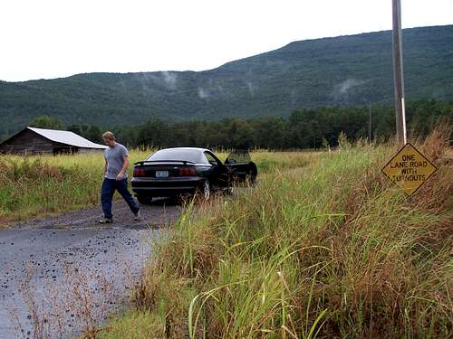
As we reached the town of Blue Mountain, Arkansas, we had a hard time finding the trailhead. We drove up to a Beauty Supply shop in hopes someone inside might know where the old wagon trail might be, and we hit the jackpot. There happened to be a group of guys sitting outside who take their 4 wheelers out there on a regular basis and directed us straight to the trail head and even told us a good place to park the car. It seems that there is a small dirt road that leads to a local 4WD road.
![Dirt road to the trailhead]() Hard to find Road
Hard to find Road
We pulled up to the trail at 11:15am and shouldered our packs. We were finally getting started on our hike.
The weather was beautiful with a slight overcast and constant breeze. We couldn’t have asked for a better day to climb. The trail starts out along the ATV road and continues up a series of switchbacks until the trail reaches National Forest Land. There are several side roads on this part of the trail but if you stick to the main wide road you will be on track. However, once you enter the National Forest the trail begins to deteriorate, but still easy to follow.
At 1500ft elevation, the trail “Y”’s with the wide trail (right path) heading north and at a slight incline. The left trail is quite smaller and more overgrown and begins to head west. Here you want to take the less traveled west trail to your left. We continued to head north on the wider trail and ended up in a clearing about 100ft up the trail. If you come to this clearing at 1500ft elevation, you are off course.
![Clearing in the Forest]() Too Far
Too Far
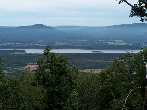
Our biggest mistake was that we took for granted that the more used trail is the way to go, and didn’t recheck our map until we were over a mile down the wrong trail. We followed road thinking that it would weave around the mountain in a series of switchbacks and were not concerned with the minimal elevation that we were gaining. We just enjoyed the windows that the forest allowed us to see into the beautiful Petit Jean River Valley below.
![View through the window]() Window in the trees
Window in the trees
After orientating our position using a compass, GPS, and Map we discovered how far off course we really were. We now had two options. We could back track a mile to the real trail or we could bushwhack northwest, gain the ridge and meat the trail at a higher elevation. Being fresh, we decided to bushwhack up to the ridge and meet the trail later.
As we climbed up to the ridge we once again found the trail and began to follow it. Although, not to our surprise the trail became so overgrown with thicket, that it was now impossible to follow. Again we took off to bushwhacking North up the mountain and regained the trail again at 1800ft. We followed the trail until it ended at a pond at about 1900ft. From here the steepest climbing began. We worked our way through the brush up the mountain. We had to constantly zigzag back and forth across the mountainside to avoid the thickest of the brush and avoid the massive amounts of spiders that seem to own the mountain.
We kept on climbing until we reached 2421 feet. Here we encountered the most fun we had all day. We came across what looked like a boulder field/washout area that we had to carefully cross and then scramble up.
![Washout Area]() Washout area
Washout area
At the top of the boulder field we came to the base of the cliff band that runs along the south side of the mountain. On the western side of the south face the cliff are only about 20 feet high with plenty of groves so you have more of a scramble then a climb to the top. At the top we took a break to each lunch and enjoy the views from the cliffs since it is much more beautiful here than at the summit.
![On top of the Cliffs]() Jody and I (left) on top of the cliffs
Jody and I (left) on top of the cliffs
After a 45-minute lunch break we checked our gear to make sure we were sufficiently supplied with enough water to get us back down the mountain and we headed off for the 2½ mile hike to the summit of the mountain. When we reached the lodge, I had to go in and ask where to find the high-point trail since I couldn’t find it. That had to be one of the most embarrassing moments of my life. First there was a wedding going on and by the looks on the faces of the guest, I looked like a homeless guy who was going to ask them for spare change. Even the ranger I asked (who was very helpful by the way), looked at first like he didn’t even want to talk to me. The best part to me was the fact if had I walked another 30 feet past the lodge; I could have found the trail on my own.
We summited at 5:18 pm after a very long afternoon of hiking. We only stayed at the top long enough to sign the register and take a picture of the sign and headed back to the car so we could be off the mountain by dark.
![The Lodge]() Mt Magazine Lodge
Mt Magazine Lodge
On a side note, the lodge is a very beautiful building. I for one am not much for buildings on mountains, but it is in a state park and blends into the mountainside beautifully. We reached the summit at 5:18 pm, a full 6 hours after we left the car and hurried back toward the trail so we could be off the mountain before dark.
We did find the wagon road trail on the way back. On the far west side of the mountain, there is a gate blocking the trail for 4WD traffic with several huge boulders to make sure no vehicles can get through. It is right beneath a lookout tower that is fenced off with a tall chain link and barbed wire. (Sorry I did not take any pictures on the way down due to time constraints. We were trying to beat the clock.)
We followed the trail for a while until we were worried about the long hike ahead of us and the trail was wrapping around toward the north side of the mountain. In our haste we decided to bushwhack down the mountain using only the GPS and forgoing the map. That was a very, very big mistake! If we had coordinated our position we would have seen that we were almost to the large area called Huckleberry Flat. We could have stayed on the trail and had a decent hike back.
So we started heading southeast down the mountain toward where we parked the car. The terrain was steep and slick and on three occasions, our path ended on a band of cliffs with very unstable rock. On the way back down, both of us stumbled on several occasions. I’m not sure if it was because we were trying to go to fast, or because we were so fatigued. Most likely it was a mixture of both. We finally reached a trail and Jody said we had been on this one before. I thought the man was crazy since every trail looks alike on this part of the mountain. I thought I would humor him since I figured at least were back on a trail before dark when it turns out that apparently he has a photographic memory. We were indeed on this trail earlier in the day. We follow the trail back until we reached the flat area where we took the wrong turn at the beginning of our adventure and mumbled a few choice words our idiocy.
We finally reached the car at 8:30 pm and changed into some clean clothes for our 4-hour drive home. As we drove away from the trailhead, we stopped for a look back at the mountain. We could see the lodge on the east side all lit up and the long expanse of the ridge we hiked. All in all, that was the most fun I had hiking in a long time!
Important Note
Almost all the rock we encountered on the south west side of the mountain was very loose and unstable. Also the massive amount of spiders we encountered should be noted. They were everywhere. If it was not for SP members Cookie Addict and Allan Ellis I would nave not brought a trekking pole and spider webs would have been a huge annoyance! Thanks for your advice guys.


Comments
Post a Comment