

-
 15058 Hits
-
 81.18% Score
-
 13 Votes
|
|
Area/Range |
|---|---|
|
|
35.59925°N / 107.09747°W |
|
|
Hiking, Trad Climbing, Sport Climbing, Scrambling |
|
|
Spring, Summer, Fall |
|
|
7785 ft / 2373 m |
|
|
Area Description
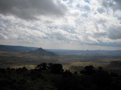
Cabezon County is located 20 miles west of the town of San Ysidro. The main attraction of the area is Cabezon Peak, which is at an elevation of 7,785 feet. Cabezon Peak and Cerro Cuate are actually a volcanic necks much like Devils Tower in Wyoming, but on a smaller scale.
To the north is Mesa San Luis, this area offers cliffs and sandstone canyons. Mesa Crotalo is found on the western edge of this area, this area offers open grasslands divided by a series of sandstone mesas. To the south Mesa Chivato rises sharply and tops out at over 8,000 feet. This now pine forest covered mesa is actually a lave flow that erupted from Mount Taylor millions of years ago. The eastern edge of Cabezon County is the Ojito unit. This area also know as the Blanco Mesa area offers badlands, box canyons, and a diverse flora and fauna area. It is also in the Ojito area that one of the largest dinosaur skeletons ever discovered was found.
The Rio Puerco flows through Cabezon Country, passing close by Cerro Cuate before making a dramatic bend to the south. Three of this region's major drainages, La Cañada Santiago, La Cañada de la Leña, and Arroyo Chico, all join the Rio Puerco as it winds through the Cerro Cuate unit. Sections of Arroyo Chico are a perennial stream and support riparian habitat.
Ecological Values

Grasslands, juniper dotted grasslands, pinyon-juniper woodlands, old growth ponderosa pine, and riparian habitats are all represented in Cabezon Country. The Rio Puerco region is a vital biotic link between the Colorado Plateau and the Southern Rockies, providing habitat and dispersal corridors for far ranging species such as the mountain lion. The Rio Puerco, which traverses the area, is also a major tributary of the Rio Grande. As such, it is a key riparian corridor in an otherwise arid landscape.
The Rio Puerco basin is home to approximately 282 species of vertebrate animals including nearly 200 species of birds, 38 species of amphibians and reptiles, 1 species of fish, and 66 species of mammals. Large elk herds graze in the forests of Mesa Chivato and winter in the valleys of the Cabezon Country. Also present in here are black bear, mountain lion, bobcat, gray fox, mule deer, pronghorn, Gunnison's prairie dog, badger, porcupine, and a variety of reptiles, including collared lizards. Because of the presence of prairie dogs, the area is also potential habitat for the endangered black-footed ferret. Three special-status plant species, Knight's milkvetch, Wright's pincushion cactus and grama grass cactus, can be found in the area.
Cultural Values

According to Navajo legend, Cabezon Peak is the head of a large giant that was slain by the Twin War Gods. Prehistoric cultural resources include numerous Paleo-Indian, Archaic, Navajo, and Pueblo sites. A Chacoan shrine rests atop Cabezon Peak and petroglyphs exist on canyon walls. This area is also home to current sacred and religious sites of the Zia, Jemez, and Santa Ana Pueblos.
In Spanish, El Cabezon, means "the big head." Cerro Cuate is named for the Spanish word "cuate", which means "twins," referring to the pair of rugged peaks that grace the top of this volcanic plug. Spanish cultural sites are also found in this area. These sites include the historic town of Cabezon with a century-old church that is still in use today. There are also numerous remnants of abandoned homesteads along the banks of the Rio Puerco.
