
-
 7540 Hits
-
 82.19% Score
-
 15 Votes
|
|
Mountain/Rock |
|---|---|
|
|
35.58940°N / 107.1279°W |
|
|
Sandoval |
|
|
Hiking |
|
|
Spring, Fall, Winter |
|
|
6652 ft / 2028 m |
|
|
Overview
Cerro Chato is one of many volcanic peaks in the Rio Puerco Valley near the prominent Cabezon Peak. Cerro Chato translates as "flat", or "pug-nosed" hill. This is a fitting description for this peak, especially compared to the steep faced volcanic plugs in the area. Cerro Chato barely rises more than 300' above the flat plains but due to the wide open area there are incredible views from the summit. The summit area is a broad flat circle. A USGS benchmark can be found in the NW corner of the summit not far from the remains of a wooden cross.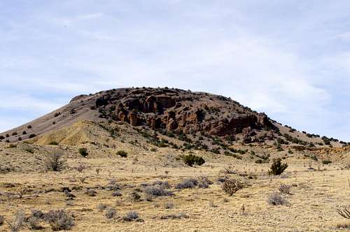 Cerro Chato's East Face
New Mexico Rank: 2077
Prominence: 322'
Quadrangle: Guadalupe
Rank and Prominence information from
Lists of John
Getting There
From Albuquerque go north on I-25 to the Bernalillo exit (routes 550 and 165). Turn left (west) from the exit ramp onto route 550 passing through the town of Bernalillo. Continue past San Ysidro and mile marker 41 to NM State route 279. This left turn will be marked with a sign for San Luis, Cabezon, and Torreon. One on route 279 reset your odomoeter. Pass through the town of San Luis and continue to 8.3 miles where the pavement ends and a dirt road continues straight. Go another 3.8 miles (11.1 total) to a fork in the road, take the left fork. Continue another 2.9 miles (15.0 total) to the turnoff for Cabezon Peak. Go about 100 meters past this turnoff to a faint double track road on the right. There is a sign stating “Foot Traffic Welcome; No Motor Vehicles Beyond This Point.” Pull off the road and park here.Route Overview
This hill can be hiked from just about any direction but is most easily accessed from the north. Regardless of which direction to start from this is a short easy hike with tremendous views. Hiking this peak is best done in a season other than summer since it can get quite hot. If you do plan to hike in the summer go early in the morning and carry plenty of water.Northern Slope: You could strike out directly for the summit from the parking area but it is easier to follow the road around then make your way up the hill from there. Either way it is a short, easy, and fun hike.
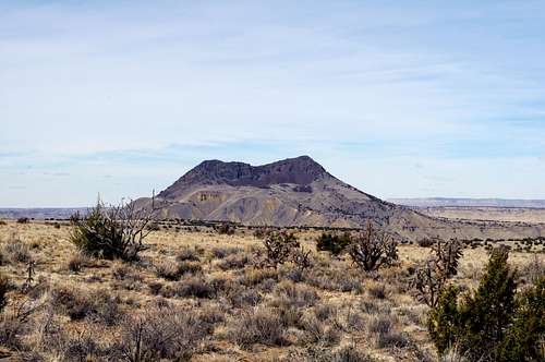
Views from the summit:
 Cerro Cuate
 Cerro Guadalupe and Cerro de Santa Clara
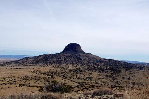 Cabezon Peak
Red Tape
Do not drive past the sign indicating foot traffic only. There can be livestock in the area; they should be left alone.Camping
There are no restrictions on BLM land although this is a very short hike and spending the night is not necessary.External Links
Local weather: Cerro ChatoLocal Search and Resuce Team: Cibola SAR
PeakFreak1325 - Jan 18, 2021 1:01 pm - Hasn't voted
Incorrect Spelling of Volcanic PlugThe volcanic plug between Cabezon and Guadalupe, according to USGS Maps, is Cerro Chafo, not Cerro Chato which is located much further south in Cibola County.