
-
 87072 Hits
-
 91.37% Score
-
 35 Votes
|
|
Route |
|---|---|
|
|
47.46483°N / 120.90119°W |
|
|
Download GPX » View Route on Map |
|
|
Hiking, Mountaineering, Scrambling |
|
|
Spring, Summer, Fall |
|
|
One to two days |
|
|
Walk Up |
|
|
Class 3 |
|
|
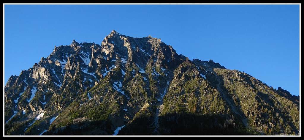
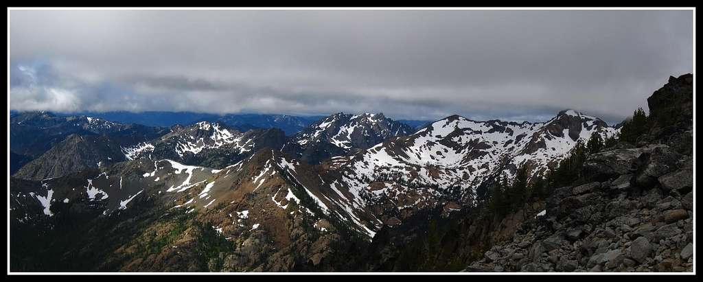
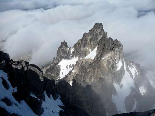
Overview

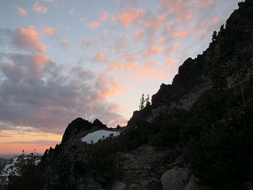
Sunset on Mount Stuart
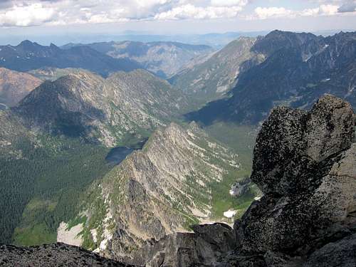
 Fog over the Ridge |  Upper Snowfield |  Sherpa Peak View |  Heading Down | 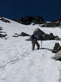 Hiking the Snowfield |
Getting There


Mount Stuart from the Road
From Seattle:
Drive East on I-90 for about 80 miles, turn right at exit 85. Turn left onto WA-10/WA-970 which crosses over the bridge over I-90. Then take a right onto Highway 970, (it may also be called highway 10) which goes east for 6.5 miles until you reach a road on your left called "Teanaway Road", be sure to take this road. As your traveling along you may see views of the Enchantments as well as Mount Stuart, I consider this to be a beautiful drive. After 7.3 miles be sure to stay on the North Fork Teanaway Road (the road changes automatically when passing by the West Fork Teanaway). In 5.8 miles you reach another fork in the road, take a right onto forest road 9737. Stay on this road until you get to the Esmerelda Basin Trailhead.
From Leavenworth:
Head East on Highway 2 for about 4.3 miles (depends on what part of town you start out at). Take the ramp on your right which takes you onto Highway 97 which goes south for about 35.2 miles. Continue straight which the road changes to Highway 970 which you follow for 3.4 miles. Take a right onto "Teanaway Road". After 7.3 miles be sure to stay on the North Fork Teanaway Road (the road changes automatically when passing by the West Fork Teanaway). In 5.8 miles you reach another fork in the road, take a right onto forest road 9737. Stay on this road until you get to the Esmerelda Basin Trailhead.
Route Description
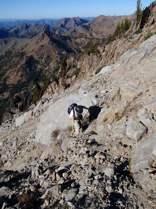
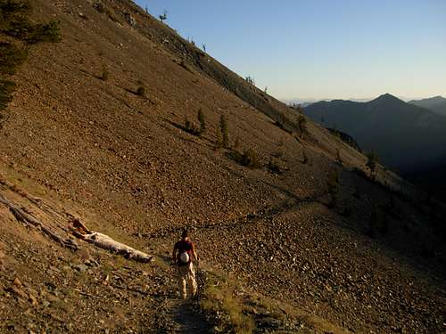
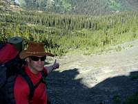
Start out hiking along the Esmerelda trail which follows along an old jeep road for about .5 miles of mostly flat well maintained trail. Very soon you reach a fork in the trail, take a right here which it's labeled as Ingalls Way. The trail gently switch backs up the side of Fortune Peak. At the intersection with the Long's Pass Trail and Ingalls Pass Trail, be sure to take a right which goes up to Longs Pass. Longs Pass is estimated to be at an elevation of 6,300 feet high with a decent view of Mount Stuart and the rest of the Stuart Range. Stuart's South Face |  Rainier from Longs Pass |  Marsh Lands after the Pass |  Purple Lupines |
Now you head over the other side of the pass heading Northeast, be careful scrambling down the loose rock to get down to the trail. At first the trail goes down in zipper-like fashion towards the basin. The trail then goes into swampy like terrain with mud and a few small creeks running through it in places. This then descends down into a basin at en elevation of 4,800 feet. When you get to the creek crossing it might be a good idea to find a log crossing. In recent times the big log broke, is wobbly, and is getting rotted. It may still be usable.
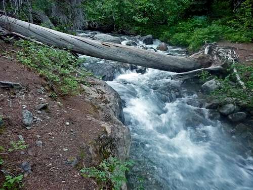
Log Crossing of Ingalls Creek (before it broke)
In a 100 yards north or so you arrive on the Ingalls Creek trail which heads slightly downwards in the eastern direction. In about 1/3 of a mile you will start to see a major clearing to your left. You may start heading up any time you want, but from personal experience the best spot to head up was from the main camp. The main camp is on the south side of the trail (right) which has a flag. The turn off for the CC is on the left (north). There is a boot path that leads all the way to the bottom of the Cascadian Couloir. Keep in mind it may be brushy depending on the time of year.
 Cascadian Couloir Beginning |  Ingalls Peak with Clouds |  Ingalls Creek during Evening |  Longs Pass in the Morning |
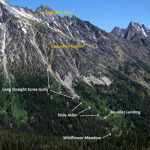
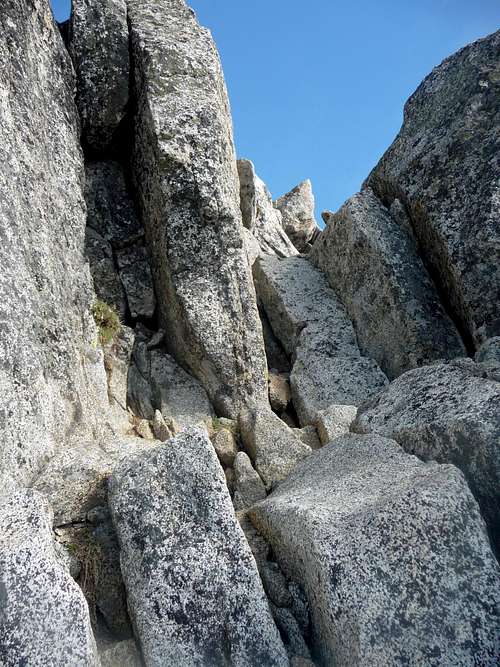
There are cairns along the way to help guide you in case you have troubles staying on trail (which shouldn't be a problem). After about 700 feet of elevation gain you finally arrive at the bottom of the Cascadian Couloir. The slope gets steeper and rocks become abundant. Perhaps the biggest danger of this route is the human factor, watch out for rocks falling and try not to knock rocks down as you head up. There is at least one section that has a lot of dirt which depending on where you are can get deep. Some people don't like this route because of this, but nothing a mountaineer couldn't handle. Later on you top out of the Cascadian Couloir and start gently hiking up between the false summit and the saddle.
 Looking up the CC |  View to the South |  View from inside the CC |  Looking down the CC |
Views to the South from inside the Cascadian Coulour
 Redwic Ascending the Upper Cascadian | 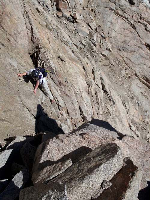 Off Route near the Summit |
Exiting the Cascadian Couloir
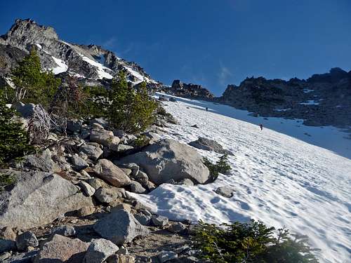
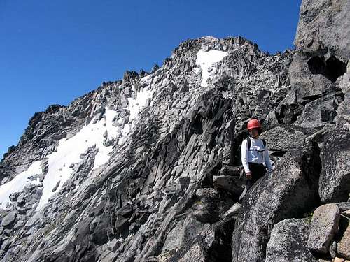
Ascent the snow field and head to the upper snowfield on the right. Eventually you come to the ridge where an ice axe comes in handy if it's snow covered. There are a few spots of some exposure which if you take your time it's easy to get by. After some more scrambling you should aim for a hundred or so feet below the false summit on the left side. This is a great place to ditch your pack for the last part of the scramble.
 Looking towards Sherpa |  Snowfield near False Summit |  Scrambling near False Summit |  False Summit of Mount Stuart |
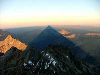
West Horn above the Clouds
The last part traverses around the corner where you see the true summit which is considered a easy class 3 scramble. For the first part try not to gain too much elevation in order to avoid big rocks and mini cliffs. As you get closer to the summit, it becomes easier to navigate as well as the scrambling. The last 20 or so feet is a slab with cracks in it. With a little bit of caution, you arrive on the second highest non volcano of Washington State.
 Scramble near the Summit | 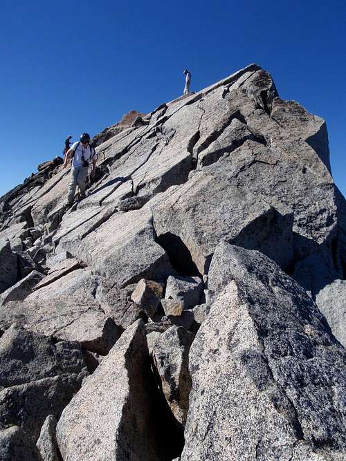 Stuart Summit |
The Summit Scramble
Looking Down on Stuart Lake
The weather changes pretty quickly here, so enjoy your stay but keep an open eye on the horizon. When I was here, the summit clouded over very fast. Be sure to get down before it gets dark to prevent getting off route and getting lost.
Heading Down Longs Pass late in the Day
Red Tape & Camping
Sunset near the Summit
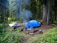
Camping near Ingalls Creek
You have quite a few options for camping:
- The Trailhead
- Ingalls Pass
- The Meadows Below Mount Stuart
- Above the Couloir
- And an Emergency Bivy Spot near the Summit
Filtering Water:
Near the Bottom of Mount Stuart in the meadows there is a creek which one could filter water from. Also there is a creek near the trailhead if your out for the way home. Fill up where possible because I don't recall there being a lot of water filtering zones.
Be sure you have enough time for this route if your doing this in a single day push. If you are a slower hiker, it is advised that you leave from the trailhead in early morning to avoid the heat of the day and to maximize on day light. For many this requires a full day of traveling.
Route Conditions

Clouds Coming In

Swirling Clouds Above
For the Avalanche Forecast be sure to check in with the North West Avalanche Center (seasonal).
For road conditions check with the Wenatchee National Forest, the road conditions that you would want is the "Teanaway" (#9737). The Cle Elm Ranger District can be contacted at (509) 852-1100 and are located at 803 W. 2nd Street, Cle Elum, WA 98922
 |  |
Sunset Above the Cascadian Couloir
Essential Gear

Using Polls and a Helmet
Wearing a Hat

Gaiters, Camera, and Glasses
- Helmet (although there is not a whole lot of rock fall, people often knock rocks down the gully on accident)
- Sun/Glacier Glasses
- Sunscreen
- 2-3 Nalgene Bottles (1 Liter Each)
Gear Needed for Early Season Conditions
- Ice Axe
- Crampons
- Extra Clothing (jacket, synthetic long sleeve, ect.)
Gear for Overnight Travel
- Tent/Bivy
- Sleeping Bag
- Sleeping Pad
- Stove & Fuel
- Filter/Water Tablets
I would also recommend bringing the camera on this beautiful mountain.
Topographic Maps
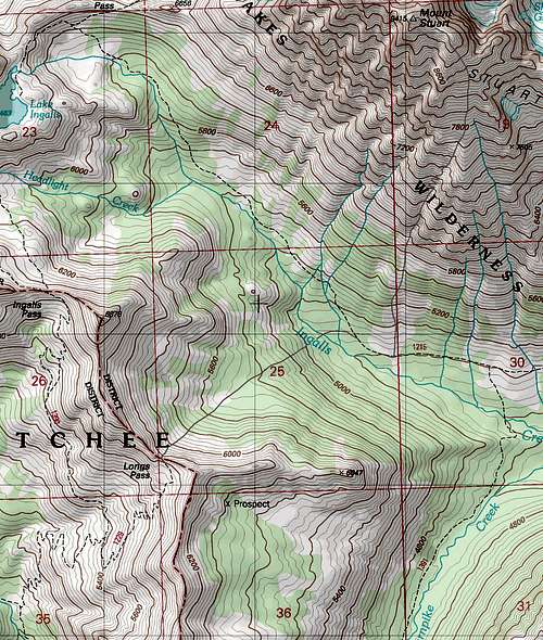
Topographic Map of the Route
Flowers and Wildlife
 Yellow Flowers |  Lupines with Mount Stuart |  Purple Flowers |  Beetle in the Gully |
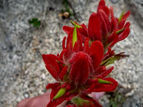
Paintbrush on Stuart
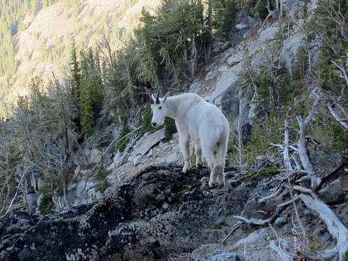
Mountain Goat on the way down the Cascadian Couloir
External Links & Trip Reports
- Most Recent Trip Report - Shows the log situation as of last July.
- Aug 23, 2011: as seen on Nwhikers.net
- Photo Gallery of the Cascadian Couloir: as seen on Flickr.
- July 30, 2011: Some basic info with a rant ending about how they didn't like it.
- Cascadian Coulior from Sherpa Basin - 6/25/2011: A trip report with a different variation of climbing this Route as seen on CascadeClimbers.