
|
|
Mountain/Rock |
|---|---|
|
|
37.60069°N / 107.83069°W |
|
|
La Plata |
|
|
10441 ft / 3182 m |
|
|
Overview
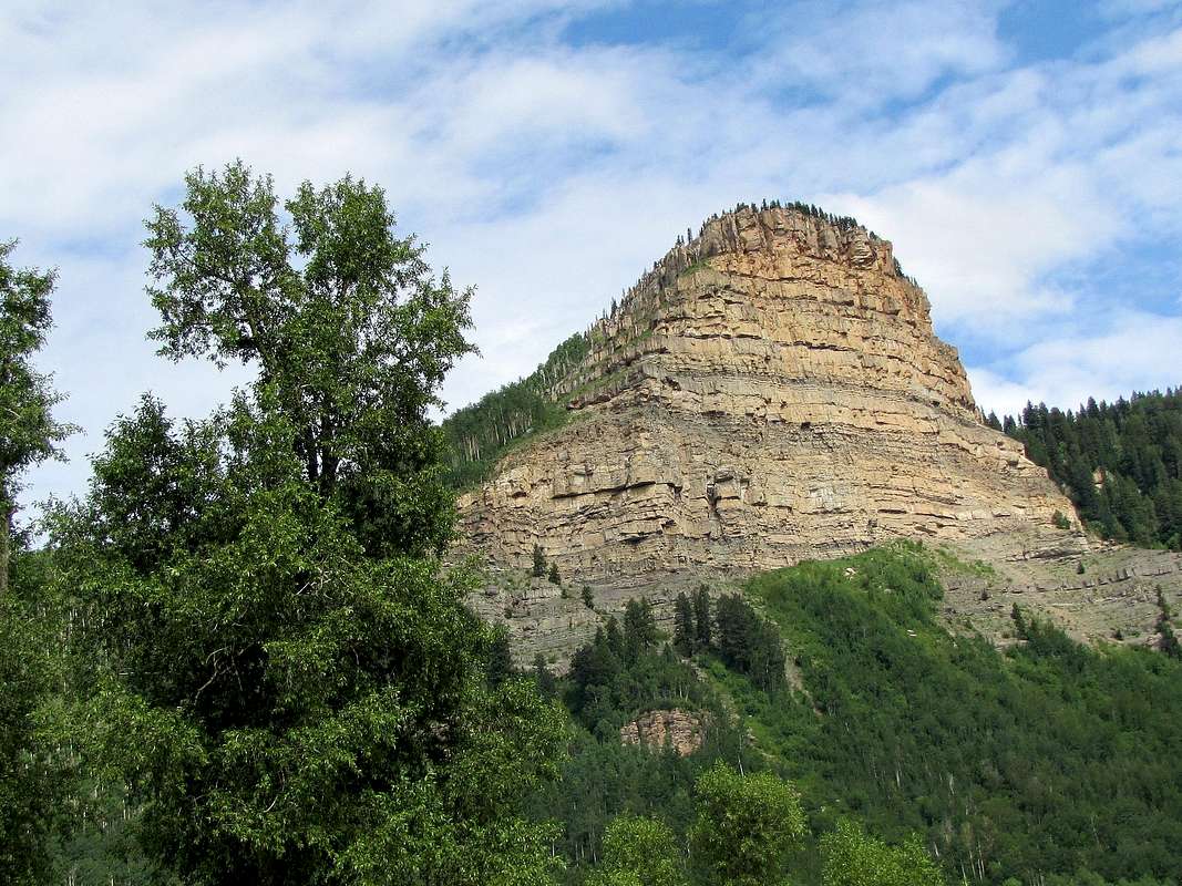
Zoomed view of Castle Rock from near Elbert Creek Trailhead
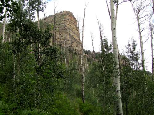
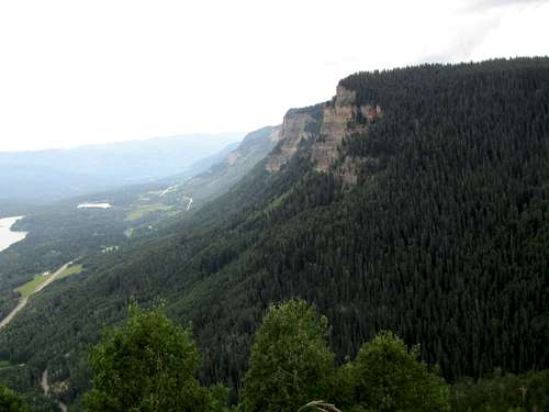
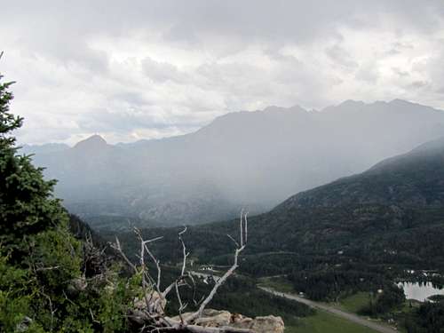
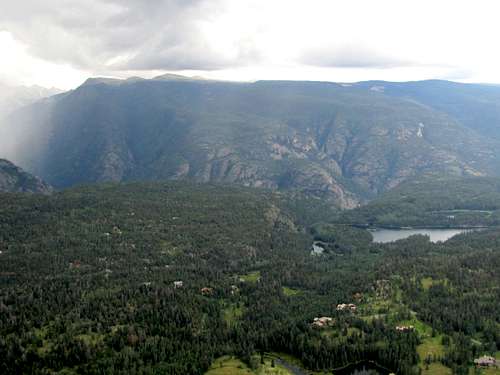
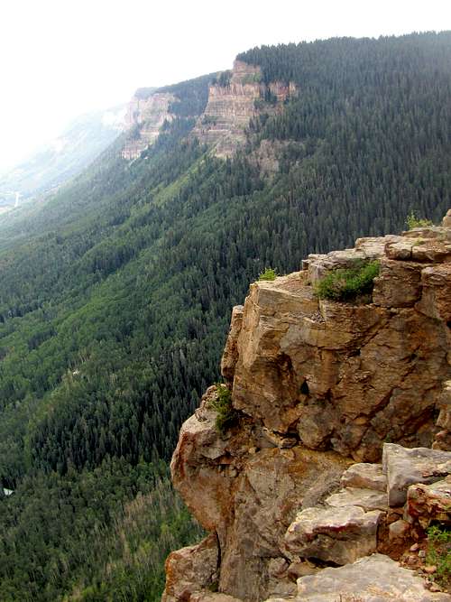
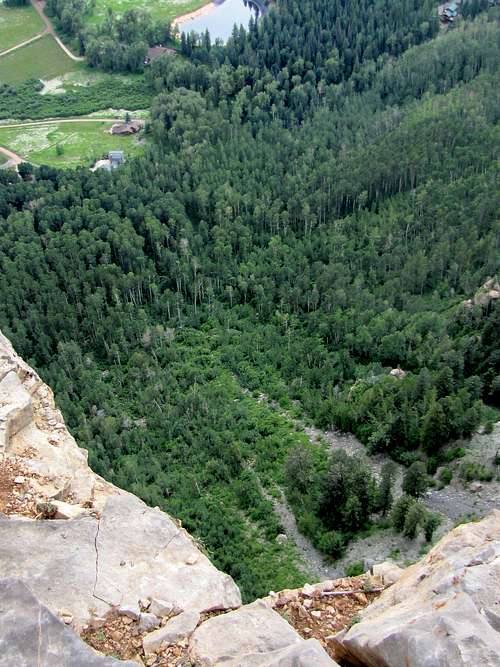
Castle Rock is a part of Hermosa Cliffs, a long line of cliffs that rise to the west of Route 550 south of Purgatory Ski Resort (aka Durango Mountain Resort) in the San Juan Mountains of southwestern Colorado. Looking east, from the summit of Castle Rock, you will see cliffs/steep slopes dropping 1600 ft below your feet to where Route 550 runs. Electra and Haviland Lakes as well as some of the peaks of the area will also be in good view. Looking west, however, you will find yourself standing on the edge of a forested plateau and your only view will be that of the trees immediately in front of you. Castle Rock has only 100 ft of prominence and is therefore not a ranked peak.
Castle Rock is usually approached from the south via Elbert Creek Trail. I will also describe a descent route north down the ski slopes of Purgatory Resort.
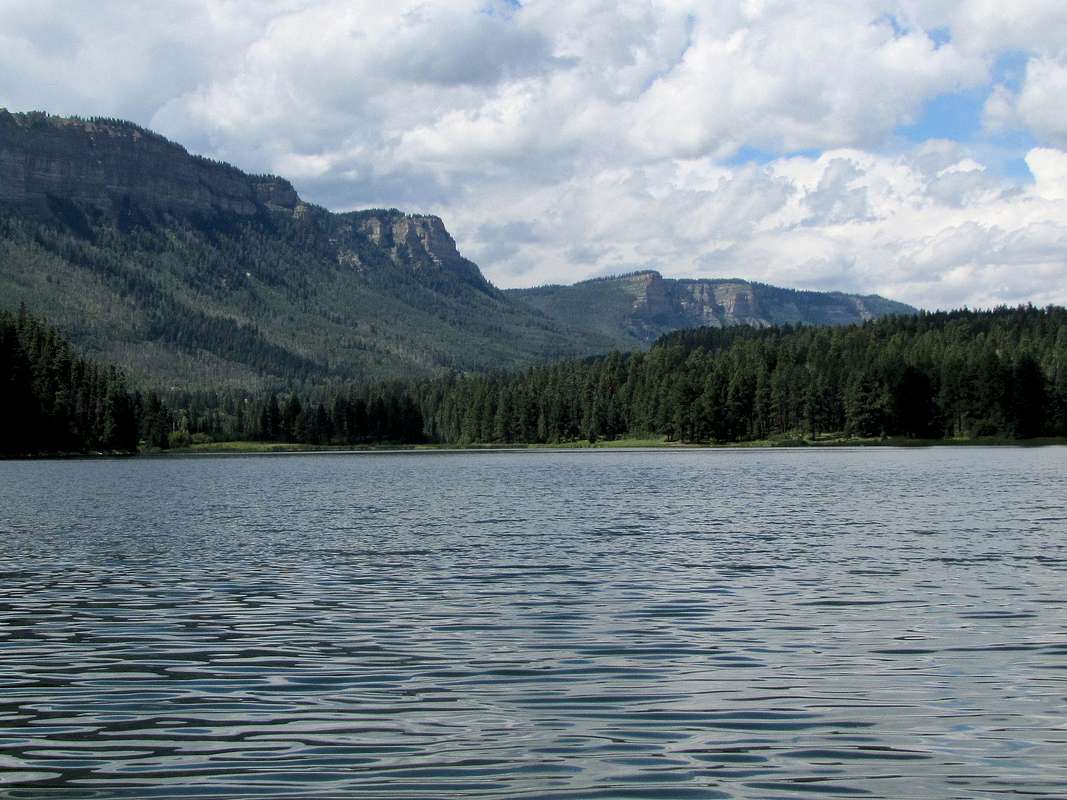
Hermosa Cliffs from Haviland Lake, Castle Rock to the right of the opening in the cliffs
Getting There
From Durango, drive roughly 25 miles north on Route 550 (3 miles south of Purgatory Ski resort) to Needles Country Store on the west side of the road. Elbert Creek Trailhead can be found on the south side of the store. Parking is available.
Route, ascend Elbert Creek, descend Purgatory ski slopes
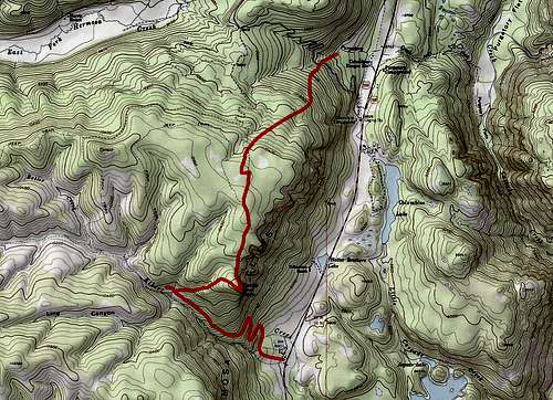
Here are the elevations and distances (per my GPS) for a one way hike from Elbert Creek Trailhead to Purgatory Ski Village.
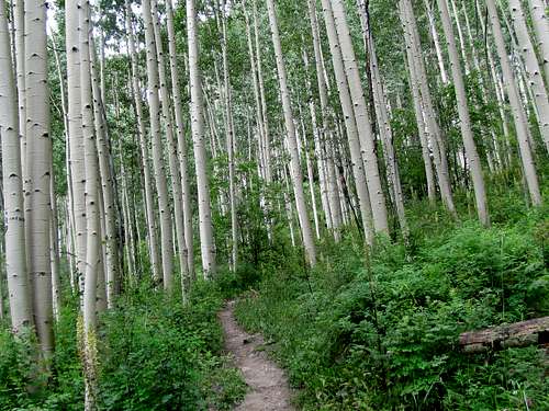
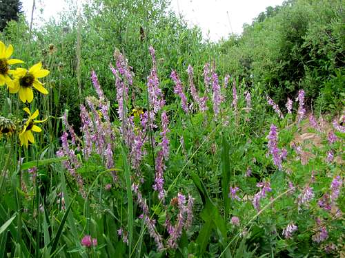
Head west on the trail going toward a valley created by Elbert Creek in Hermosa Cliffs. The first part of the trail is a narrow easement through private property.
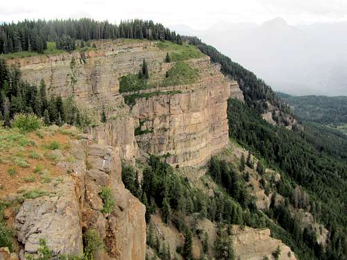
 Hermosa Cliffs
The trail goes into a mostly aspen forest and makes a number of switchbacks going up in elevation. Highway noise can be heard in this area.
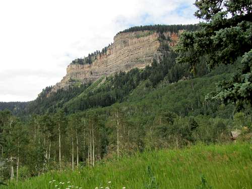
Castle Rock from the forest.
 Castle Rock
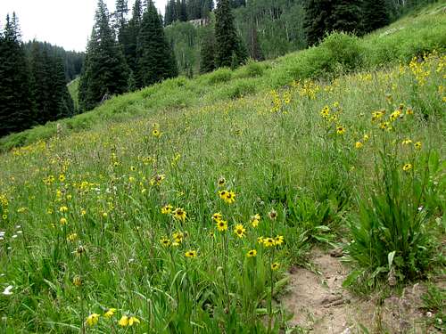
The trail will then take you into the Elbert Creek Valley. After going by an abandoned cabin, a meadow opens up.
 |
 |
 |
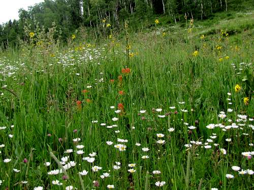 |
Shortly after the cabin, you will see a trail branching on the right. This junction is not signed. Leave Elbert Creek Trail and follow the new trail up the meadow and into the forest to reach the top of Castle Rock. Views from the top.
 Hermosa Cliffs Hermosa Cliffs |
 Potato Hill Potato Hill |
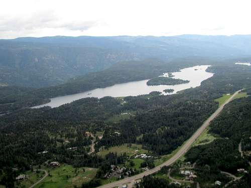 Electra Lake Electra Lake |
 Looking east Looking east |
 Hermosa Cliffs Hermosa Cliffs |
 Route 550 Route 550 |
 |
 |
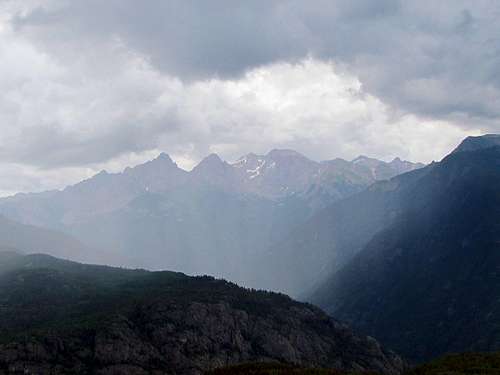 The Needle Mountains
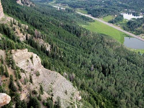
You can go back the way you came or can go north to Purgatory Skis Resort. It is hard to give exact directions here. Look at aerial photos to familiarize yourself with the area. I continued the trail north into the forested plateau until it turned into an abandoned Jeep road. At a T, I turned left and then right where I reached the top of ski lifts. I then followed the ski runs 1500 vertical feet to reach Purgatory Village. Some of the ski slopes were covered by very tall grass. Be sure you follow the correct ski runs. If you follow some of the western lifts, you may end up down in Hermosa Creek Valley far from Purgatory Village.
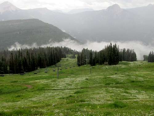 Top of ski slopes
Red Tape
No fees or permits for Elbert Creek Trail.
When the ski slopes are open, you must obviously contact the ski resort.