
-
 12137 Hits
-
 76.48% Score
-
 7 Votes
|
|
Mountain/Rock |
|---|---|
|
|
37.07819°N / 3.48157°W |
|
|
Download GPX » View Route on Map |
|
|
Hiking, Scrambling |
|
|
Spring, Summer |
|
|
6847 ft / 2087 m |
|
|
Overview
 Cerro del Trevenque Cerro del Trevenque |
The Sierra Nevada is continental Spain's highest mountain range - only Pico del Teide on Tenerife than Mulhacen, the Sierra Nevada's highest mountain - and its name already indicates that it is snow covered until late in the year. It''s highest mountains are easily accessible but access routes tend to be long, especially if you cannot take advantage of the shuttle bus services which take you high up into the range reducing ascent times to several hours. There are ski lifts to the ski area around Veleta facilitating winter ascents a lot. In late spring and early summer, however, neither shuttles nor lifts will take you to the regular trailheads and most of the refugios are closed as well. Either you're in for long ascents or you have to look for an alternative nearby.
 W W | 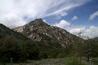 NE NE | 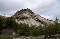 S S |
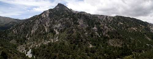
One of these alternatives is Cerro del Trevenque, a 2000er which is located to the north-west of the range, directly facing the westernmost 3000ers of the Sierra Nevada. Its trailhead, Mirrador de los Alayos, is easily accessible for most of the year as a dirt road heads straight up into the mountains from La Zubia, a town south of Granada, the provincial capital. Two routes lead to the summit, both of them very easy for most of the part but the actual ascent is a tricky affair regardless from which side you tackle it. You may wonder why?
El Trevenque is a limestone mountain, actually composed of very rotten rock. It rises out of strange looking sand dunes,, called La Cuerda del Trevenque, probably leftovers of glacial activity. These dunes - or morraines - stretch all the way from the summit (also surrounding it) towards the trailhead to the left, offering the most beautiful access route, however a very strenuous one. The sand is baked together so that going is not too difficult, on steep sections, however, it becomes very slippery and tricky.
 E E |  W W |  S S |
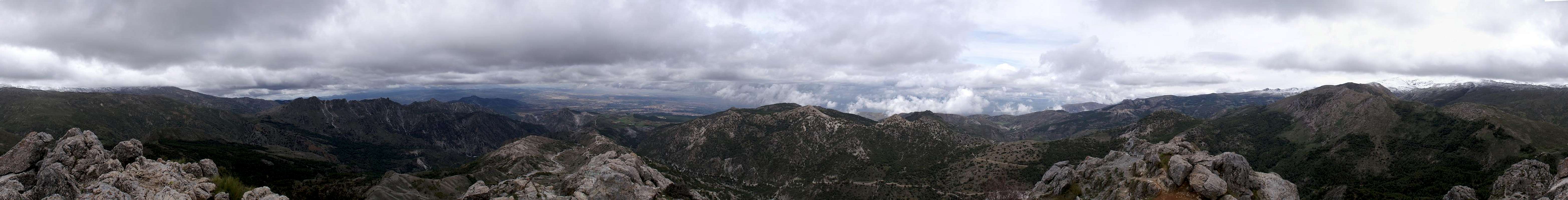
Naturally the steepest part of the ascent is around the summit, leaving the trickiest section for last. The western route winds between big gendarmes while the southern route heads up the sand dunes directly, to reach more solid terrain only close to the summit block. In the end both routes join for a rather exposed rocky last steps to the top. Thanks to its perfect position close to the north-western main ridge of the Sierra Nevada there's probably no better place for views. If the weather is fine, of course, which on our ascent day it wasn't as you'll see from the pictures on this page.
360° Summit Panorama
  |
Getting There
 |
The trailhead at the Mirador de los Alayos can be easily reached from Granada (also the clostest airport). From the airport take motorway A329 west in direction of Granada. Turn onto A44 south, direction Motril, until you reacht the southern loop-motorway near Ogijares. Follow it for one exit and at the ensuing roundabout take the first exit in direction of La Zubia.
In the town follow the signs for Cumbres Verdes. You need to leave the main street to the left to follow a parallel road south into the mountains. The first half of this road is solid (asphalt, concrete) but after you reach the last houses it turns into a well kept dirt road. You pass a hotel to the right before the road finally winds up to Mirador de los Alayos.
Red Tape
 Orchis mascula on the slopes of Trevenque
Cerro del Trevenque is located within the Parque Nacional de la Sierra Nevada, one of the oldest national parks of Spain. Here the usual rules for national or natural parks apply.
The Cuerda del Trevenque, the dune like sand morraine is very fragile. If you leave the trails to follow a new or shorter line you will most likely damage the fragile environment. The next downpour of rain will wash out your tracks and after a considerably short time they will have morphed into gullies. The lowest part of the Cuerda, close to the trailhead at Mirador de los Alayos shows a lot of this kind of damage. Here the progress of erosion is studied scientifically.
Mountain biking is not allowed on the Cuerda, even though a dirt road leads across it to the west ridge of Trevenque.
Finally, there is a botanical garden right underneath the mountain on its north-eastern slopes. It is open for the public in summer only and shows a collection of plants and flowers typical for the Sierra Nevada.
Accommodation
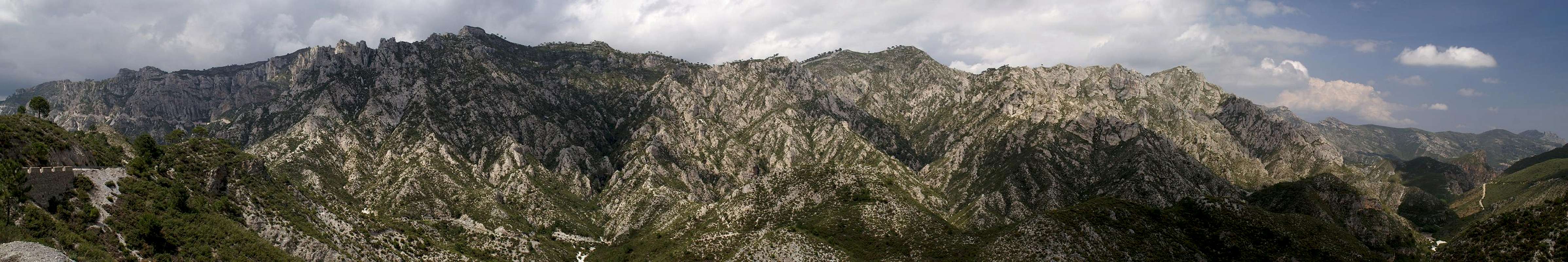
 Cerro and Cuerda del Trevenque from N
Granada is the largest town close by and you can have lotts of hotel rooms out there. La Zubia also offers accommodation and the cllosest ones to Trevenque can be found at the settlement Cumbres Verdes and Cortijo del Hervidero on the dirt road from the town to the trailhead. Also, to the south of Trevenque's summit there is Refugio Rosales
Camping is not allowed in the national park.
Apart from this you can easily find accommodation in Andalucia from any travel office as the region is one of the most popular vacation getaways from Europe.
Weather Conditions

Maps & Books
There is a good map of Sierra Nevada, complete with a small hiking guide booklet.- Sierra Nevada / La Alpujarra
Editorial Alpina
1:40000
ISBN: 84-8090-255-8
As guidebook I can recommend the following one which is available in German and English
- Andalucia South / Andalusien Süd
Costa del Sol – Costa de la Luz – Sierra Nevada
Bernhard Plikat (translation: Gill Round)
Rother Verlag
ISBN 978-3-7633-4824-4 (English)
ISBN 978-3-7633-4147-4 (German)