|
|
Mountain/Rock |
|---|---|
|
|
23°S / 68°W |
|
|
Hiking, Mountaineering, Scrambling |
|
|
Spring, Summer, Fall, Winter |
|
|
16386 ft / 4994 m |
|
|
Overview
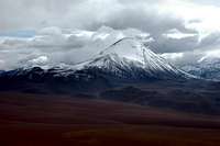
Cerro Jorquencal provides the climber with some of the best views possible of the surrounding big mountains, such as Volcan Lincancabur (5,916m) & Volcan Sairecabur (5,971m), and plenty of others not quite so well known. The real beauty of this mountain is that it is located in the high plains, sits alone like a small volcano, and it is far enough away from the big mountains to the east to give one awesome views of the enormous mountain range which make up the border between Chile and Bolivia. In addition, this mountain is an easy scramble, so if you're looking for a little elevation gain to acclimate, Cerro Jorquencal could be a perfect choice. Because it sits alone in the high plains, it also gives one 360 degree views for miles and miles.We stopped at several of the tourist / climbing agencies in town, and this mountain was not offered as an option for a guided climb (& I should add that you would not want a guide for this simple climb). I mention this here because one would need their own transportation or would need to hire a taxi to get here, or possibly one could hitch hike. I'm quite certain that buses do not travel this road. We were in this area for several days and did not see a single bus.
Getting There
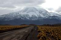
From San Pedro de Atacama, the nearest town of any significance, take highway B-235 (I don't recall this road being marked, but it'd be hard to mess up here) north. This a dirt and stone road all the way. After approximately 25 kilometors, you'll encounter a "Y" in the road, and you'll want to stay to the right. The road to the left will take you on to Machuca. Another 7 kilometers will take you to Banos de Puritama. These are well known hot springs which tourist from town seem to frequent ($10 US for entry). So, stay north on the highway for about another 20 to 25 kilometors. The road will now arc around Cerro Jorquencal, which lies driectly to your left (west). You really can't miss it as sticks up like a sore thumb.I'll also note here that there are buses which travel to San Pedro de Atacama and there is an airport on the eastern side of town. I did see a bus station, although I never actually saw an airport (which is shown on my map). Speaking of maps, we purchased a map in town from one of the local tourist agencies and it was invaluable. It covers all the way to Calama to the west and beyond the border with Bolivia abd Argentina. It's a topographic map at a scale of 1:350,000 with all the roads, peaks, routes, contours and whatever else you might want. We paid $10 US. It is produced by Technische Universitat Dresden.
Red Tape
Well, we actually didn't run into any red tape to climb here, so I think that anyone can climb this peak at any time without problem.Camping
We camped along the side of the road & felt quite safe. While we were in Calama, we were told not to camp in that area without being in a campsite due to the high crime rate. Anyhow, there are places to pull off just about anywhere you want around San Pedro de Atacama. We used our altimeter and camped at certain elevations as we wanted. You'll have some incredible views and sunsets from most anywhere you pick here. Also, we found that there is very little traffic on this road, so we didn't camp far from the roadside. There was one exception to this when at about 2:00 a.m., trucks from the north traveled south into San Pedro de Atacama. I'm not sure what that is all about, but each night while we there, it happened for maybe 15 or 30 minutes, and then it was silent again.As this climb can easily be done in a day, you might consider camping in town, that is in downtown San Pedro de Atacama. There are campgrounds within the city limits. There is a huge crowd of foreigners using these campgrounds. Although we didn't camp at any of these, I checked one out and it looked pretty nice, with lots of amenities. As I recall, they quoted me a price of $7 per person per night.
The Route
Cerro Jorquencal can be climbed easiest from the eastern most slope. There is a gradual rise from the high plains to the summit of Cerro Jorquencal. So, from the lowest point on the eastern side of the mounatin, head west up the long ridge to the summit. Once on top, you'll see two summits, both of which are marked with cairns and large branches. Using my GPS, we found the second summit to be a little higher. You should allow maybe two hours at most to the top, and one can fly down the steep face for their descent on the north side and return back to the high plains.The mountain / start of the climb sits several kilometers from the main road. We dug ourselves an entrance from the main road onto a 4x4 trail and drove to the base of the mountain.
Current Weather
Weather Link HereBanos de Puritama
I mentioned the hot springs earlier, but I thought I'd add a little more information. We did not actually access the hot springs here, since we did not want to pay the $10 entrance fee, nor did I really care to lay around in a hot spring with a bunch of people. But I've added a link here which seems to have some good information regarding Banos de Puritama.Hot Springs
If you're looking for hot springs that are a little more remote than Banos de Puritama, then go south of the entrance of Banos de Puritama, maybe several miles at most, and you'll see a small parking area along the right side of the road. If you park here and walk down the well worn path to the creek, you'll encounter the overflow from the hot springs. You can access hot pools here and it's free, and it seems to be barely used (no people). This is what we did and it worked great for us, as we hadn't had baths / showers for nearly a week.


