
-
 704 Hits
-
 76.66% Score
-
 7 Votes
|
|
Mountain/Rock |
|---|---|
|
|
41.90536°N / 14.02952°E |
|
|
Download GPX » View Route on Map |
|
|
Hiking, Skiing |
|
|
Spring, Summer, Fall, Winter |
|
|
6398 ft / 1950 m |
|
|
Overview
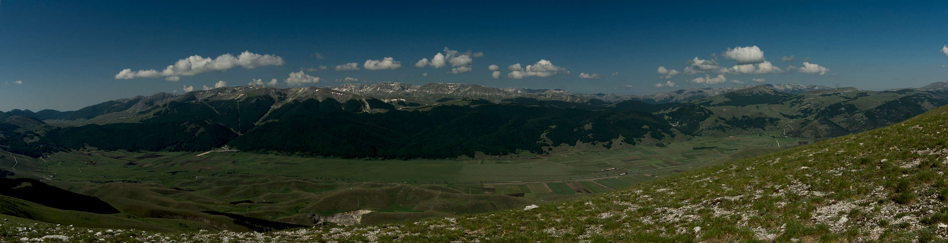
 Cima della Fossa during the approach from the south
 |  |  |
Both summits lie centrally on this south-to-north running ridgeline with Cima della Fossa a few hundred metres south of Monte Rotella. At 1950m it is lower than most of the mountains of Appennino Centrale but thanks to ots location and the aforementioned barrenness it is a wonderful lookout. The huge plain of Piano delle Cinque Miglia lies at its western feet an further west rise the mountains of the Parco nazionale d'Abruzzo, Lazio e Molise. The Majella Range is up close in the east, Montagne del Morrone to the north-east, Velino-Sirente to the north.
 |  |  |
Like all surrounding mountains, Cima della Fossa is made up from limestone. It is a withered type of limestone, which makes the mountains look like smooth, rolling hilltops. At closer inspection there are a lot of nooks and crevices which are perfect beds for wildflowers. In spring the slopes of the mountain are covered in blue and yellow violets (viola della majella, Viola magellensis)
Getting There
- From Rome:
- Take motorway E80 / A24 from Rome to Torano.
- Switch to motorway A25, direction Pescara.
- At the exit Pratola Peligna / Sulmona switch to SS17 south, passing Sulmona.
- After Rivsindoli switch to SS84 and after a few km you'll reach Pescocostanzo
- Take motorway E80 / A24 from Rome to Torano.
- From Pescara
- Take motorway E80 / A25 westward in direction Rome.
- At the exit Pratola Peligna / Sulmona switch to SS17 south, passing Sulmona.
- After Rivsindoli switch to SS84 and after a few km you'll reach Pescocostanzo
- Take motorway E80 / A25 westward in direction Rome.
Route
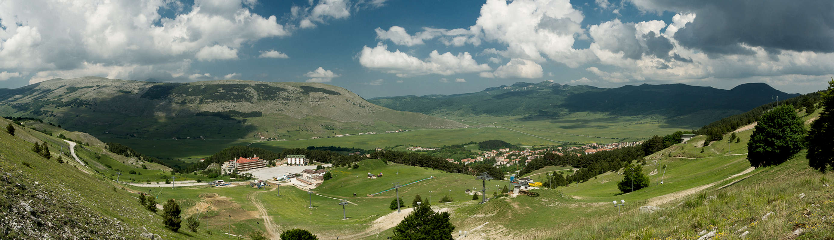
The route from either side of the ridge is absolutely straightforward. From Sulmona just follow the ridge. From Pescocostanzo head up the road to the ski lift, which turns into a dirt road to the upper ski station. From there a path heads up across the east slope of the mountain until it reaches the ridgeline. Follow this across Cima della Fossa until you reach the summit of Monte Rotella.Red Tape
 Orchis militans on the south ridge of Cima della Fossa
Parco Nazionale della Majella.
On the slopes above Pescocostanzo ski runs have been developped. The usual national park restricions apply to the area above the runs. Sheep, cattle and horses graze on the mountain but there are neither gates nor fences.
Weather Conditions
Accommodation
welcometosulmona.com
Maps & Books
Maps
- Digital Maps
- Regular Maps
I haven't been able to find a map for this area. Any suggestions are welcome!
Books
- Abruzzen
Heinrich Bauregger
Rother Verlag
ISBN 978-3-7633-0413-2
- Abruzzen