
-
 6916 Hits
-
 74.92% Score
-
 5 Votes
|
|
Route |
|---|---|
|
|
45.99829°N / 11.46834°E |
|
|
Hiking |
|
|
Summer, Fall |
|
|
A long day |
|
|
For all |
|
|
Overview
 Pano from the summit toward north
 Approaching to the summit along the war roads...
Route info card
| LOCATION INFO | ROUTE ABSTRACT | RED TAPE |
|
● SP area&range: Prealpi Venete e Trentine. ● SP group: Altopiano di Asiago. ● SP mountain/rock: Cima Dodici, Cima Undici, Monte Ortigara. ● SP huts&campgrounds: bivouac Busa delle Dodese.
 street map street map
|
 hiking map hiking map |
● When to climb: racomanded on summer or harvest. ● Summer gear: normal trekking shoes and light wind-jacket; water; no rope or other technical equipments. If you spend the nigtt into a shelter: sleeping-bag, food, lamp for the night. ● Winter gear: in addition you must carry heavy dressed for cold and raquets for snow because the wind can accumulate on the distance great heaps of snow. Into Val delle Trappole avalange danger is really!
|
Route description
| APPROACHING INFO | ROUTE DESCRIPTION | RED TAPE |
|
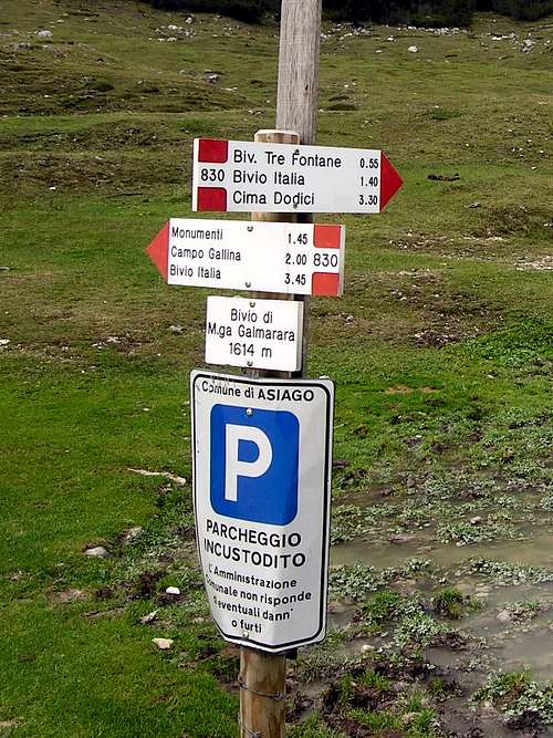
1) By car from Asiago: leave the city in direction Passo Vezzena by road SP 339 until Roana.  Val Galmarara white street Val Galmarara white street2) By car from Trento: abandon the freeway A22 del Brennero at the Trento Centro escape; then follow the indications for Padova-Venezia and to take SS 47 of the Valsugana; continue on SS 47 until the escape for Altipiani di Folgaria and Lavarone. Val Galmarara white street |
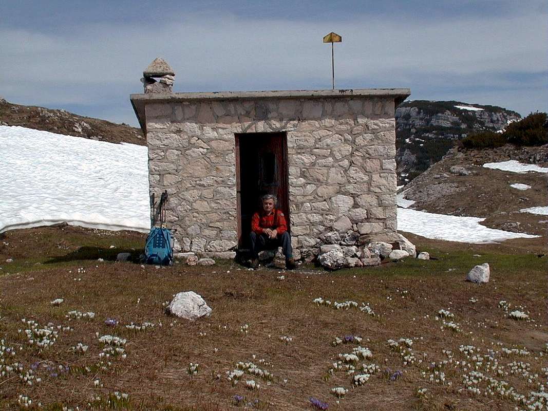
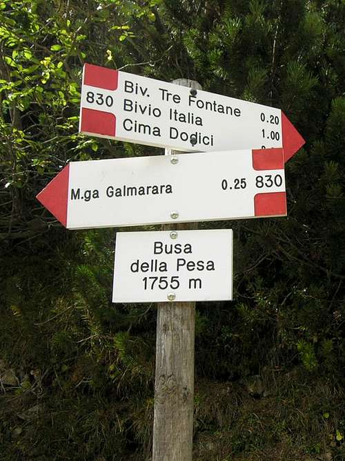
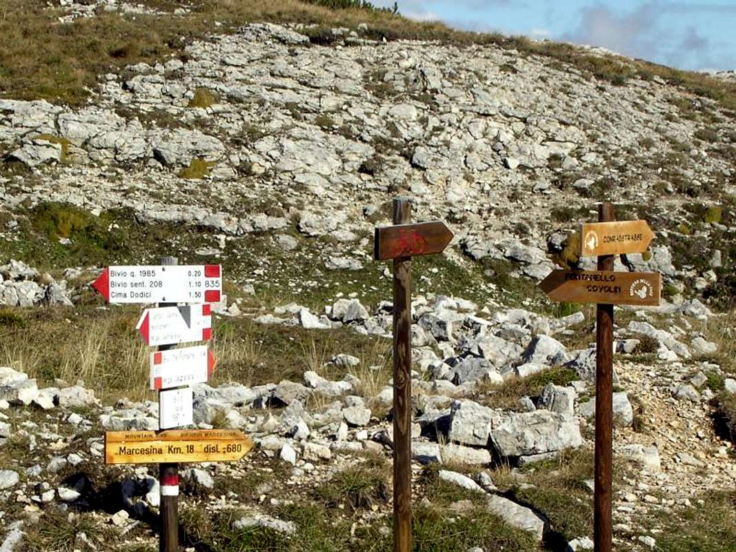
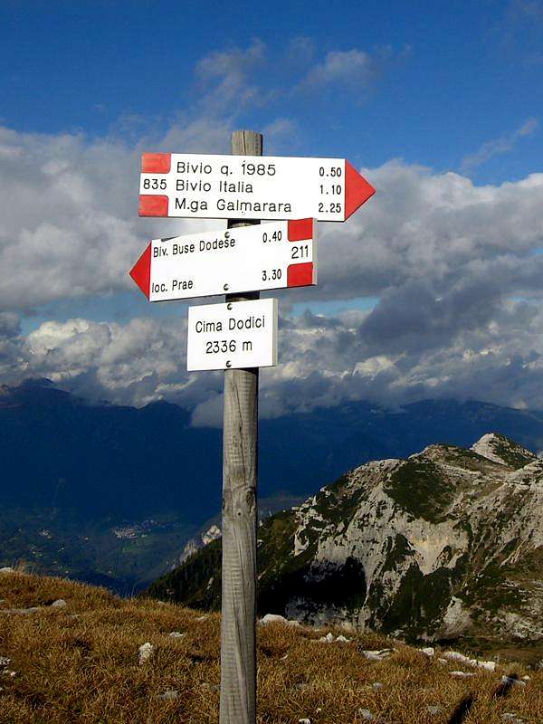
● From parking place you follow the old road of war (path SAT 830). After approximately half hour in Busa della Pesa locality (m. 1,755) path SAT 830 abandons the military road. I council instead continuing along the road, is for its historical value, is because in reality not ago to lose much time and the progression is easyr. Leaving on the left the Tre Fontane bivouac you reach the crossing with the road of war "Mecenseffy Strasse", that you ignore continuing straight until the Bivacco Italia bivouac and to the crossing Bivio Italia. Here you abandon the road and follow the path SAT 835 until the crossroad of quota m. 1,985 where you continue along SAT 835. It is arrived shortly to the crossroad of quota m. 2,175 where path SAT 835 continues towards the summit, that it comes caught up without particular problems (two crosses of summit and sign SAT). Return by the same path. In alternatives: from the top follow the indication to Bus a delle Dodese bivouac and spend the night to there.
● Unevennesses and times: Parking place-crossroad Bivio Italia: m. 373 - 1,30 hours. Crossroad Bivio Italia-Cima Dodici: m. 354 - 1,30 hours. Totally parking place-Cima Dodici: total unevennesses m. 727 - 3,00 hours.
● Italian version: Dal parcheggio seguire la vecchia strada di guerra (sentiero SAT 830). Dopo circa mezz'ora in località Busa della Pesa (m. 1,755) il sentiero SAT 830 abbandona la strada militare e sale fra i mughi. Io consiglio invece di continuare lungo la strada, sia per il suo valore storico, sia perchè in realtà non fa perdere molto tempo e la progressione è più agevole. Lasciando a sinistra il Bivacco Tre Fontane si giunge all'incrocio con la strada di guerra Mecenseffy Strasse, che ignoriamo proseguendo diritti fino al Bivacco Bivio Italia e all'incrocio Bivio Italia. Qui abbandoniamo la strada e seguiamo il sentiero SAT 835 fino al bivio di quota m. 1,985 dove proseguiamo lungo il SAT 835. Si arriva in breve al bivio di quota m.2,175 dove il sentiero SAT 835 prosegue verso la vetta, che viene raggiunta senza particolari problemi (due croci di vetta e segnavia SAT). Ritorno dallo stesso percorso. In alternativa dalla cima si può raggiungere in 40 minuti il bivacco Busa delle Dodese per passarvi la notte. |
● Bivouacs and emergency shelters along the route or in the vicinities: •
•
•
•
• Bivouac "Baito Ortigara-Caldiera" (no image for it) m. 1,937: is situated at north of the Passo di Val Caldiera pass along the path SAT 840, enough far away from the zone of our interest but useful for who want to come down in Valsugana valley. |


