
-
 10413 Hits
-
 87.76% Score
-
 25 Votes
|
|
Mountain/Rock |
|---|---|
|
|
46.42427°N / 11.84682°E |
|
|
Hiking, Mountaineering, Trad Climbing, Scrambling, Via Ferrata |
|
|
Summer, Fall |
|
|
9879 ft / 3011 m |
|
|
Overview
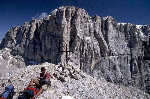

Ombretta from the S-SW

Even if Cime d'Ombretta are less important and also a bit lower group of summits in comparaison with Sasso Vernale, they are more attractive in the mountaineering sense. On their summits we stand just before the huge southern face of the queen Marmolada and can see in it just every detail. Beautiful are also the ascents on top. They go from two wonderful valleys: from Val de Contrin on the west and from Valle d'Ombretta on the east.
Geographically, on Cima d'Ombretta we see two ridges crossing. The main one runs from Marmolada towards the south-southwest, on Sasso Vernale. The shortest ridge runs paralelly with the south wall of Marmolada, and all the three main summits of Cime d'Ombretta are rising in that ridge. It is rocky and rugged, that is why the Ombretta group is seen from both sides, from the west and from the east as a nice, towering mountain, which together with the wall of Marmolada closes the two valleys. On the eastern ridge, above Val d'Ombretta we can also see an interesting rock tower, called Il Fungo d' Ombretta. It is also worth mentioning that we should not confuse Cima d'Ombretta with Cima Ombrettola. The latter is lower and is situated even south of Sasso Vernale, beyond the Ombrettola Pass.
The ascent on the highest point of Cime d'Ombretta is not a difficult one. But for a one day tour it is quite long, so the majority of visitors stays overnight in one of the two mountain huts (or in the bivouac).
Summit Views
As said, in the summit panorama of Cime d'Ombretta the major attraction is the view on the huge south wall od Marmolada, which is towards the west continuing to the wild, rocky massif of Grand Vernel. Along the two valleys, towards the east and the west we see many of more remote summits of Dolomites, and towards the south we see the ridge towards Sasso Vernale. The southern part of Marmolada Group is also more or less clearly overseen.
Getting There


The ascent into Val Ombretta
1. West of the Ombretta group lies the well known Val de Contrin. The road by the valley is closed for public traffic, so we have to leave our car on some 1500 m, near Alba village. At the end of the valley Rifugio Contrin, 2016 m, stands. By a mountain road we need till there some 1 h 30 min.
2. On the east, the trailhead is on Malga Ciapela, 1435 m. You reach that alpine meadow from the well known road below Marmolada towards Lago Fedaia. You deter from that road in Caprile. From Malga Ciapela you continue by a mountain road towards the west, and then continue by a good, marked path over a high valley step in Valle Ombretta. That is one of the most beautiful places in Dolomites. You are just below the huge south walls of Marmolada. At the end of the valley stands Rifugio O. Falier, 2074 m. To overcome those 640 m of altitude, you will need some 2 hours.
3. The third possible trailhead could be Passo di San Pellegrino, 1907 m, but the ascent from there requires quite some loss of altitude, so rarely anyone goes from there only on Cime d'Ombretta.
Routes Overview
Show a bigger map

1. From Rif. Contrin, 2016 m, by ferrata. You continue from the hut by the marked path No. 607, which goes towards Passo delle Cirelle. Just above the hut it branches. Variant 1 goes towards the south-east till the place in Val Cirelle, where the west ridge of Sasso Vernale comes down to the scree fields. On some 2475 m the path branches again. The path No. 607 continues on Passo delle Cirelle, while the path No. 612b continues towards Passo Ombrettola. Just a bit higher we deter from the latter path, turning towards the north. From scree fields we enter a short wall over which Via Ferrata Ombretta goes. Above, the terrain flattens a bit and we continue the ascent by a broad valley, close to the small glacier (Vadretta del Vernale), and then over scree fields on top. From the hut we need 3 h 30 min, from the parking place good 5 h.
2. The second variant from Rif. Contrin, which in combination with the first one enables a nice round tour, continues below the walls of Gran Vernel and Marmolada towards the east. In the upper part of the high valley from this path a marked path deters left, towards Forcella Marmolada. There the majority of climbers will go, attempting the summit of Marmolada by its west ridge. But for Cima d'Ombretta we continue by the valley towards the east. Soon we reach Passo Ombretta, 2704 m, and from there continue right on top.
3. From Rif. O. Falier, 2074 m. From the hut we go by the marked path No. 610 towards the north-west and later towards the west. Grassy slopes soon turn into screes and rocks. Without any problem we reach Passo Ombretta, 2704 m, and a bit above it the Bianchi bivouac. Above the bivouac the slopes of Ombretta soon get much steeper. A part of the ascent is secured and the path goes over the slopes towards the left. Above, we go again over steep scree slopes and soon reach the notch between Cima Ombretta di Mezzo, 2883 m, and Cima Ombretta Orientale, 2011 m. The first summit is also reachable by an ex military path. To go on the highest summit, we turn on the notch left and continue by the ridge, and a bit below it. Also this path was beaten during the World War I. A few passages again require some care, but soon from the right the path from above ferrata joins and soon we are on the highest point. From Rif. O. Falier we need on top some 3 h, from the parking place some 5 h.
4. From the highest summit of Cima d' Ombretta we can also continue by the connecting ridge on Sasso Vernale. But the military path is today completely decayed, so the ridge is again as demanding as it once was. It is exposed, crumbly and requires on many places some easy climbing of UIAA II degree.
Mountain Huts

There are two good and popular mountain huts, which support the ascent on Cime d'Ombretta. See more details about them on the main page of Marmolada Group.
> Rifugio Contrin, 2016 m. From the parking place some 1 h 30 min.
> Rifugio O. Falier, 2074 m. From the parking place some 2 h.
Above Passo Ombretta there is the Bianchi bivouac. It serves mostly climbers who attempt the hard routes in Marmolada south wall.
When To Climb?
The best time for ascent on Cime d'Ombretta is high summer and autumn, till the first snow. In early summer above Passo Ombretta we can expect some unpleasant rests of snow fields. An ascent in winter conditions would require a complete winter equipment. Tour skiing would be possible from Passo Ombretta.