
-
 6885 Hits
-
 85.87% Score
-
 21 Votes
|
|
Mountain/Rock |
|---|---|
|
|
46.39060°N / 11.75110°E |
|
|
8471 ft / 2582 m |
|
|
Overview
Geographical Classification : Eastern Alps > Dolomites > Marmolada Group > Punta Allochet
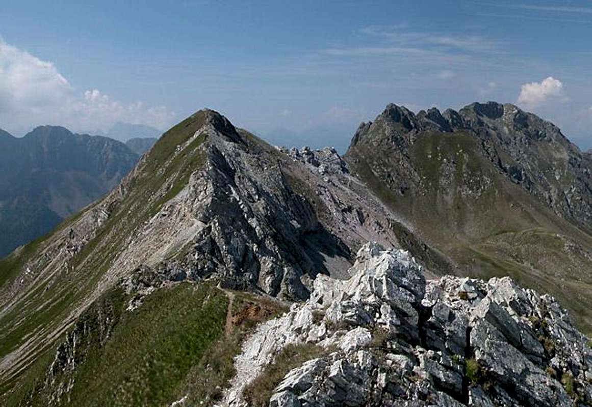
Punta what? One certainly could complain that I always put up obscure mountains on SP and Punta Allochet is certainly one of them. Though many people might have seen it from Passo di San Pellegrino while crossing the border between Trentino and Belluno few will have noticed, less will have remembered it and almost nobody will have climbed it. Why?
The obvious reason is that its neighbours are the more attractive destinations but that is only one half of the truth. Punta Allochet is located on the Monzoni Ridge in the Marmolada Group in the Dolomites and access distances are rather long. There is a rifugio nearby (Rifugio le Selle) but this is used as starting point for two very popular ferrate the "Via Ferrata Gino Badia" and the "Via Ferrata Bepi Zac" which both follow the ridges of the Costabella Chain to the north of the Monzoni Ridge.
So what is there that stands out about Punta Allochet? I have talked about what it is not but the remaining question is "What is it really?". Quite a lot of things, come to think of it. First and most obviously a mountain close to more attractive neighbours is a natural lookout peak. The southern Marmolada Group is at your fingertips as is the Cima Bocche Group to the south of the San Pellegrino Valley. On fine days (ours was hazy while good enough to provide us with a severe sunburn) you can see all southern Dolomite Groups, Civetta, Pale di San Martino, Latemar and Rosengarten / Catinaccio.
A second reason for visiting Punta Allochet is - a third ferrata, the "Alta via Bruno Federspiel". This is rated as an easy Sentiero Attrezzato (equipped trail) but due to its length - it traverses the whole Monzoni chain - it is very strenuous. The climbing parts are actually rather easy UIAA III secured by very firm cables - if you are 6 foot 4, like I am. Smaller persons can get along by using the cable bolts to step upon. But the unprotected part around Cima Malinverno to the west of Punta Allochet is very scary. Grass covered slopes mix with scree covered rock and a north face dropping vertically for several hundred meters. Sure footing is mandatory!
Speaking of the scree on the rocks :-) let me present reason no. 3: The Monzoni chain is composed of all kinds of rock - in some places even Dolomite. Most abundant is a kind of black volcanic material sintered by the pressure it was subjected to over the ages. There is porphyry (probably some lodes stretching all the way from Cima Bocche to the south) and granite. In the western part, where the Monzoni Ridge runs into the Vallaccia Group you find main dolomite whereas on Punta Allochet there is - flintstone. Therefore the northern talus slopes of Punta Allochet shimmer with a red glint, making it quite unique among all those dolomite rocks. One of my guidebook claims that you can mine minerals on the Monzoni Ridge and Punta Allochet would be the place I would start my search.
The number four reason for the visit of Punta Allochet is - history. Like many of the mountains in the area the eastern part of the Monzoni Ridge was a place of heavy fighting during World War I. From Passo Le Selle through the Rizzoni towers the Austrian Kaiserjäger kept vigil while on the other side of Valle di San Pellegrino the Italian Alpini had their positions all along the Cima Bocche Group. The object to secure or attack was Passo di San Pellegrino, a rather low and easy pass if you compare it to others in the area. The Austrians dug caves through the mountains, with supporting trails to the northern sides and the actual positions on the southern ones. Punta Allochet was taken by the Italians during the war by storming up the steep southern slopes of the mountain but they weren't able to keep it due to heavy artillery fire from Passo le Selle. They had to retreat on the same day. Today the Alta Via Federspiel follows the supporting trails of WW I and at Punta Allochet actually runs through one of the Austrian caves. Together with the Via Ferrata Bepi Zac it has been equipped with plaques comemorating certain events of the war.
Solitary as it may be - Punta Allochet is the last point the average hiker is able to get to without having to bother with any climbing sections. The trail is exposed but poses few problems - if you come from Passo le Selle. Many (make that some) people do but most stop at Punta le Selle, where the summit is quite exposed. Directly behind the Allochet Summit the real fun begins with a 10m UIAA III downclimb.
We didn't meet a single person on the whole Monzoni Ridge. The date was July 27th 2005 where all the obvious places in the surrounding groups were crowded like hell...
 |
 |
 |
 |
Panoramic View
Punta AllochetR i z z o n i C r e s tSpiz di TariciognCima Malinverno Punta VallacciaSas MorinRosengarten / Catinaccio Group
 |
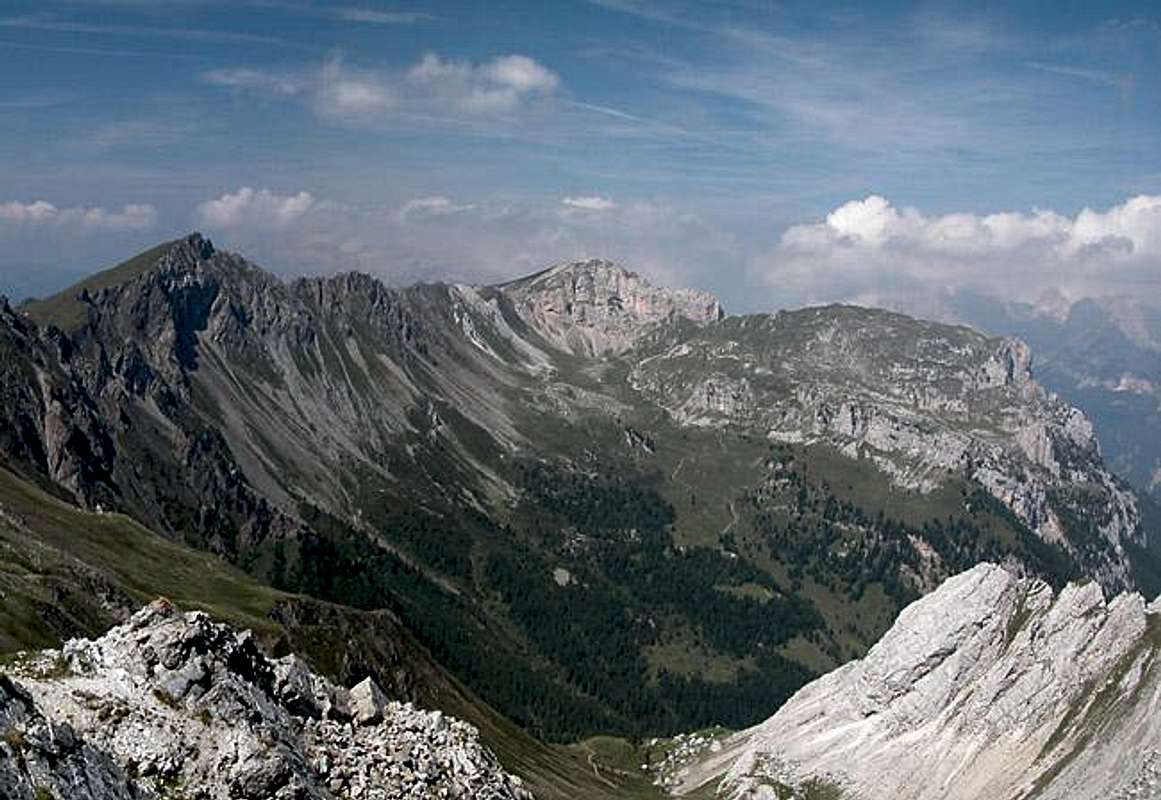 |
The summit views

Been there on a not quite perfect day. Lots of sun but lots of haze too. Only the direct neighbourhood could be seen. Good views of the Monzoni and Costabella Ridges that would say.
 |
 |
 |
 |
Getting There
There are two possible trailheads for the climb to Punta Allochet: Passo di San Pellegrino to the south-east and Malga Crocifisso in Val di San Nicolò to the north. Depending on what you want to do one might be preferrable to the other.
If you want to climb Punta Allochet only (improbable) you better start from Passo di San Pellegrino. If you want to climb the Alta Via Federspiel along the whole Monzoni Ridge you better start from Malga Crocifisso. You're in for a long day with 1700m overall elevation gain!!
Passo di San Pellegrino
- From the North (Brenner / Brennero)
Follow motorway A22 down to Cornedo (north of Bozen / Bolzano). There turn east on SS241 (Dolomite Highway) across Karerpass / Passo Carezza to Vigo di Fassa. At Vigo turn southward on SS48 which leads you to Moena. In the centre of the town SP346 turns off eastward in direction of Passo San Pellegrino. Park your car at the free lot near the hospice and take trail 604 to Passo le Selle - From Verona
Take A22 north until the exit Ora / Auer. There turn east on SS48 direction Val die Fiemme which in the end will take you to Moena. Turn onto SP346 east in the centre of the town. For the remainder follow the instructions above.
Malga Crocifisso
- From the North (Brenner / Brennero)
Follow motorway A22 down to Cornedo (north of Bozen / Bolzano). There turn east on SS241 (Dolomite Highway) across Karerpass / Passo Carezza to Vigo di Fassa. At Vigo turn northward on SS48 which leads you to Pozza. In the centre of the town a small road leads into Val di San Nicolò. Drive to its end at Malga di Crocefisso. You can take advantage of a shuttle service to Malga Monzoni saving you 30 - 45min. - From Verona
Take A22 north until the exit Ora / Auer. There turn east on SS48 direction Val die Fiemme which in the end will take you to Pozza. Turn east into Val di San Nicolò.
 |
 |
Red Tape

I'm not aware of any red tape on the Monzoni Ridge. Take your refuse with you and don't disturb wild animals. Orchids are protected and during the long approach to Passo le Selle from Malga Crocifisso you will encounter them in big numbers.
When To Climb
Passo Le Selle can be reached all year round. You will be able to get to Punta le Selle in winter (tour skis or snowshoes) but I'm not sure you'll be able to get to Punta Allochet. The summer season runs from June through September.
Camping
Camping
The closest campground is Vidor in Val di San Nicolò. Its address and the ones for the other nearby campgrounds are:
- Vidor
Località Vidor
Pozza di Fassa
Tel.: +39 0462.763247
Fax: +39 0462.764780 - Catinaccio
via Avisio 15
Pozza di Fassa
Tel.: +39 0462.763305
Fax: +39 0462.763501 - Soal
via Dolomiti 32
Pera di Fassa
Tel.: +39 0462.764519
Fax: +39 0462.764609 - Camping Eden
Via Pecol 2
32022 Falcade
Tel.:+39 0437 599138
Fax: +39 0437 599138
Other accommodation
The best information on boarding houses and hotels can be found on www.dolomiti.it. The site is not complete – you might find more information on local tourist web sites, but it already offers an impressive list. The following listing gives you an overview for the surrounding villages and towns:
Val di Fassa
Agordino
Mountain Conditions
Weather conditions in Belluno: www.meteoalpin.com. For the english text you have to scroll down the right frame.
Weather and avalanche conditions in Trentino: www.meteotrentino.it
Weather conditions Dolomites:www.dolomitimeteo.com
Maps 'n' Books
Books:
- Vie Ferrate
- Hülslers Klettersteigführer
E.E.Hülsler
Bruckmann Verlag
ISBN: 3 7654 4161 9
- Hülslers Klettersteigführer
- Hiking and Trecking
- Höhenwege in den Dolomiten
H. Dumler
Bruckmann Verlag
ISBN: 3 7654 3860 X - Dolomiten
P. Fleischmann
Kompass Verlag
ISBN: 3 8705 1409 4 - Dolomiten 4
F. Hauleitner
Rother Verlag
ISBN: 3-7633-4061-0
- Höhenwege in den Dolomiten
Maps:
- Val di Fassa, Marmolada, Gruppo di Sella
Kompass Map WK 686
ISBN: 3 8549 1768 6
Scale: 1:25000 - Sellagruppe / Gruppo di Sella
Kompass Map WK 59
ISBN: 3 8549 1066 5
Scale: 1:50000
Claude Mauguier - Aug 17, 2005 9:23 am - Voted 10/10
Untitled CommentAs a first try, let's consider that a place name was usually linked with a special use of the land directly situated in the neighborhood of a peak, the latter being used only as an orientation point. "alus", "alos" is an old celtic name for a more or less 90 cm plant = Symphytus officinale (english : Common Comfrey, deutsch : Gemeiner Beinwell), usually growing on basic to neutral pH ground, up to 1500 m. So, that would show that meadows somewhere under that peak could be colonized by that plant, of which another variety : Symphytus tuberosum exists, more keen to accept slightly acid pH ground. The colour of the flowers rank from violet, pink, to bright yellow, as pH moves from basic to acid ground. Of course, there were particular medicinal uses of that plant, reasons for which such a place could be precisely named.
Allochet = allos-eg = place where allos grows. But this is only an hypothesis...