Some More "Unfinished Business"
Having successfully summited Matterhorn Peak and Mt Morgan (S), Mt Tom posed the next piece of “unfinished business” on Ruvicha’s and my summer 2013 hiking agenda. In August 2012, along with friends Brian and Jim, we had hiked to Horton Lake, camped there, and attempted Tom the next day. Jim and I made it to the Tungstar Mine on the northwest side of Tom, about 1800 vertical feet below the summit. We set off up the scree trail, which we found to be pure misery: step up and slide most of the way back down. We made it about one-third of the way from the mine to the summit before running out of steam. Meeting two other climbers who were turning back on their third attempt at Tom took away some of the sting, but Tom made the list as a key target for this year.
I’d been interested in doing Tom for some time, impressed by the way it dominates the view west of Bishop as one drives down Highway 395 from Lee Vining. It is equally impressive from the air. I live in northern Virginia and regularly fly Washington/Dulles to San Francisco. The left side of the aircraft about 40 minutes before landing generally affords great views of the White Mountains, Owens Valley and Bishop, and the Sierra looking down to Whitney. Tom is very obvious from the plane. The same is true from the west: Tom’s massive peak clearly stood out last spring during a San Diego to Seattle flight over the Sierra foothills above the San Joaquin Valley.
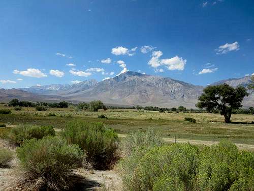
![Mt Tom from 395]() Mt Tom from Highway 395
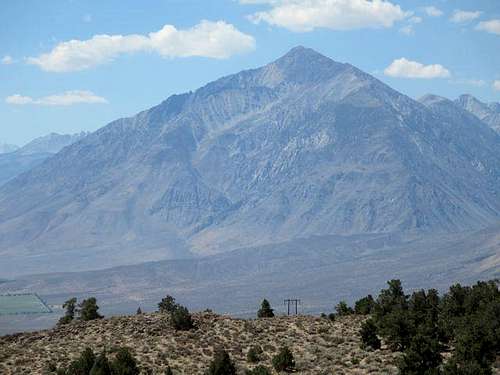
Mt Tom from Highway 395![Mt Tom from 395]() A closer view of Mt Tom from Highway 395
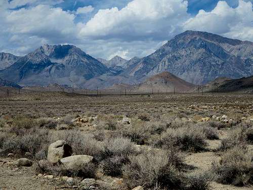
A closer view of Mt Tom from Highway 395![Basin Mountain and Mt Tom]() Basin Mountain and Mt Tom (right) from Buttermilk Road
Basin Mountain and Mt Tom (right) from Buttermilk RoadButtermilk Road to the Trailhead
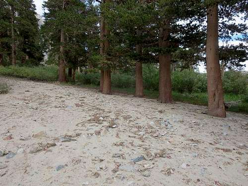
Ruvicha and I drove from Bishop into the Buttermilks early afternoon of August 18. Bearbnz’s Summitpost mountain page provided good directions to find the road to the trailhead. Once we turned off Highway 168 onto Buttermilk Road, we almost immediately lost the pavement, after which it was slow going. We had a small SUV with decent clearance but only two-wheel drive. As during the year before, we found no problem getting up to the turnout about seven miles from 168 (though we bottomed out a few times). The turnout is about one-third of a mile below the gate and actual trailhead. Cars with very high clearance and four-wheel drive can get to the gate; our Chevrolet Captiva never would have made it.
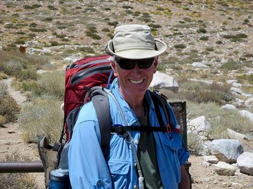
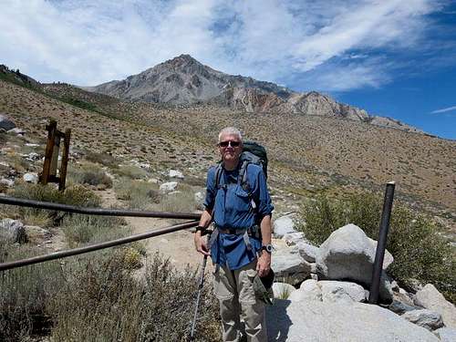
![Ruvicha at Trailhead]() Ruvicha at the gated trailhead to Horton Lake and Mt Tom
Ruvicha at the gated trailhead to Horton Lake and Mt Tom![At Trailhead]() At the gated trailhead to Horton Lake and Mt Tom
At the gated trailhead to Horton Lake and Mt TomHike to Horton Lake
We hiked a little over four miles with 2000 feet altitude gain to get to Horton Lake, a pretty lake at about 10,000 feet where we had enjoyed camping in 2012. We followed the old jeep trail from the gate. At times, one could clearly see that jeeps or vehicles of some kind had used the trail; at other times, the trail was no more than a sketchy single footpath, with vegetation having erased the other track. About halfway to Horton Lake we found a washout that had not been there the previous year: water had carved an eight-foot deep trench down Tom’s southern flank and across the trail, with the mud on either side having hardened almost to concrete. (A ranger in Bishop later told us that the area had suffered a monsoon-like rain in July, which had triggered a number of slides on the mountains.)
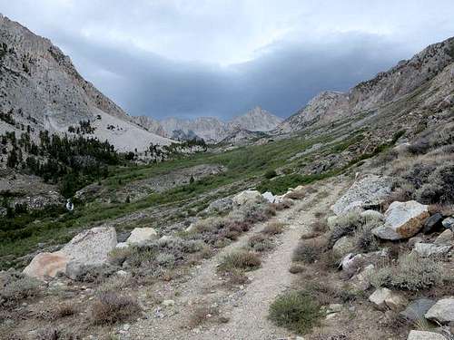
![Weather Over Horton Lake]() On trail to Horton Lake; sketchy weather above
On trail to Horton Lake; sketchy weather above![Wash on Trail to Mt Tom]() Wash on trail to Horton Lake (photo credit: Ruvicha)
Wash on trail to Horton Lake (photo credit: Ruvicha)Horton Lake Campsite
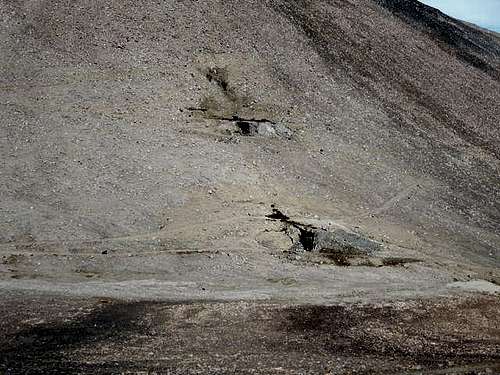
We arrived at Horton Lake to find that a mud and rock landslide had covered the area where we camped in 2012, but we found another site not far away, with relatively easy access to the lake. We had our tents and rain flaps up just in time before a thunderstorm began, giving a foretaste of the weather to come.
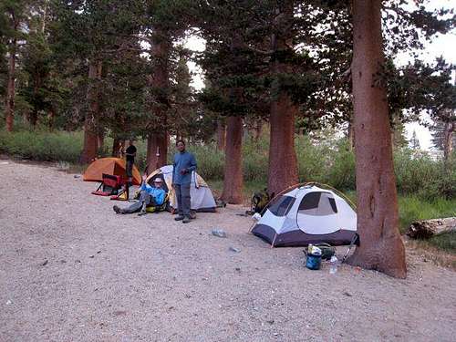
![Campsite near Horton Lake]() Campsite near Horton Lake in 2012
Campsite near Horton Lake in 2012![Mudslide near Horton Lake]() Debris from mudslide near Horton Lake
Debris from mudslide near Horton LakeHiking Up the Valley Wall
Ruvicha and I started out the next morning, which began clear and dry, returning to the jeep trail and following it as it switched back and forth up the steep north valley wall above Horton Lake. The trail clearly had suffered since 2012, with new slides and washes, likely from the July monsoon. Still, following the trail was straightforward, and we easily crossed the slides and washes to pick up the trail on the other side. At one point about midway up the wall, a major wash (which we had encountered in 2012) completely obliterated the trail; there, instead of crossing the wash, we followed a small use trail and worked our way directly up to regain the main trail on its next switchback.
![Horton Lake]() Horton Lake from trail to Mt Tom
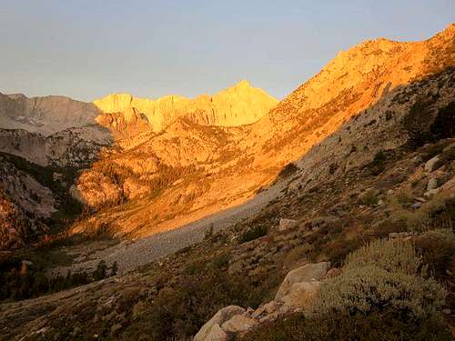
Horton Lake from trail to Mt Tom![Alpen Glow on Four Gables]() Alpen Glow on Four Gables from trail to Mt Tom
Alpen Glow on Four Gables from trail to Mt TomCrossing into Hanging Valley
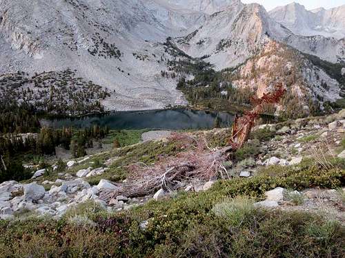
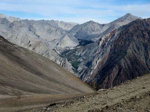
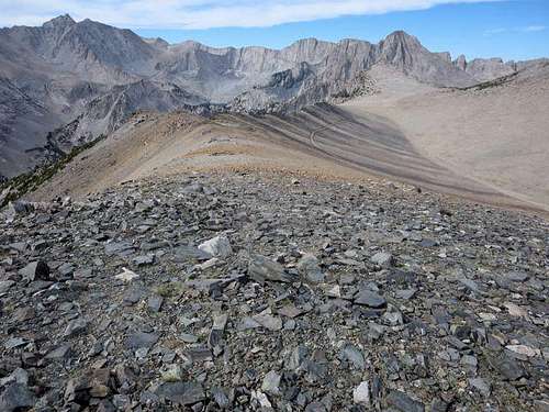
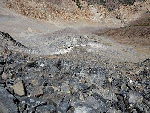
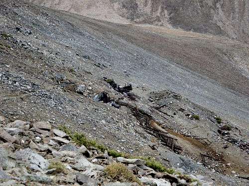
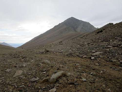
After two miles and at an elevation of about 11,650 feet (about 1700 feet above our starting point at the campsite), we crossed out of Horton Lake Valley over the ridge into Hanging Valley, with good views of Mt Tom, two abandoned mines nearby, and Pine Creek Valley to the north. There we had a choice to make: we could either follow the road to the Tungstar Mine and from there ascend up the scree trails to Tom’s summit, or we could follow the southwest ridge to Tom’s summit and avoid the scree.
![Nearing Top of Horton Lake Valley]() Near top of trail in Horton Lake Valley
Near top of trail in Horton Lake Valley![Old Mines in Hanging Valley]() Old mines in Hanging Valley
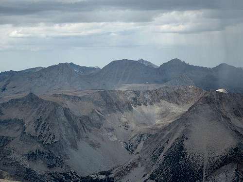
Old mines in Hanging Valley![Mountains Northwest of Mt Tom]() View to Northwest
View to NorthwestThe Scree Trail or Ascend the Southwest Ridge?
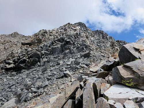
A couple of weeks earlier, I had posed a question about this on a Summitpost forum. Calipidder reported the scree trails went a long way up, making for an unpleasant climb, a taste of which Jim and I had experienced a year earlier. Boyblue recommended proceeding up the southwest ridge, noting that it made for more enjoyable scrambling than ascending the scree trails. He posted some helpful photos from his climb and added that, as long as one stayed on the northern side of the ridge (overlooking Hanging Valley), there should be no exposure issues.
![Road or SW Ridge?]() Looking up the southwest ridge toward Tom's summit
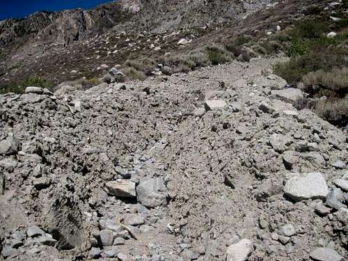
Looking up the southwest ridge toward Tom's summit![Scree Trail to Tom s Summit]() The scree trail to Tom's summit (from 2012 attempt)
The scree trail to Tom's summit (from 2012 attempt)Follow the Road, then Ascend to the Ridge
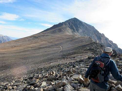
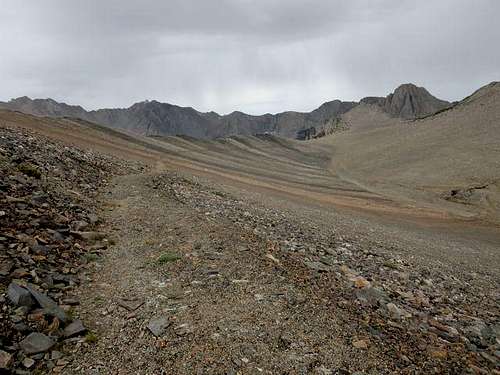
We decided to take boyblue’s advice, with a slight modification. The first half-mile of ridge from the point where the trail crosses out of Horton Lake Valley into Hanging Valley does not gain much altitude. So we decided to proceed about one-half mile along the jeep road toward the Tungstar Mine, at which point two jeep roads angle back up to the southwest ridge (while these are very obvious walking along the road
from the Tungstar Mine, they angle up and toward the rear when one is walking
toward the mine and can be easy to miss). We found the second road and followed it to the top of the ridge, where we turned left (toward the northeast) and began ascending the ridge, just below the ridge’s first big “bump."
![Road to Tungstar Mine]() Walking the road toward the Tungstar Mine
Walking the road toward the Tungstar Mine![Road to Ridge]() Ascending an off-shoot road to gain the southwest ridge
Ascending an off-shoot road to gain the southwest ridge![Looking Back on Mt Tom s SW Ridge]() Looking back down the southwest ridge
Looking back down the southwest ridgeMaking Progress Up the Ridge
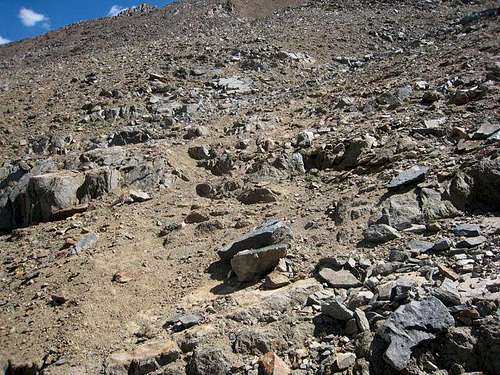
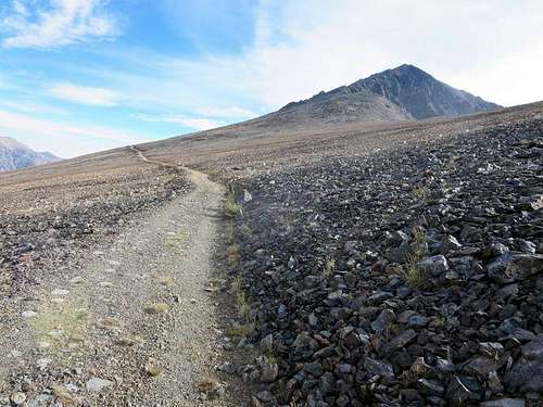
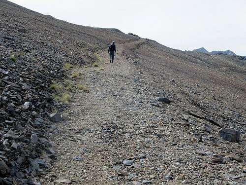
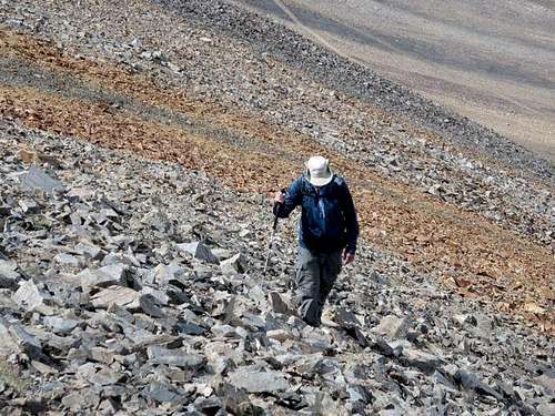
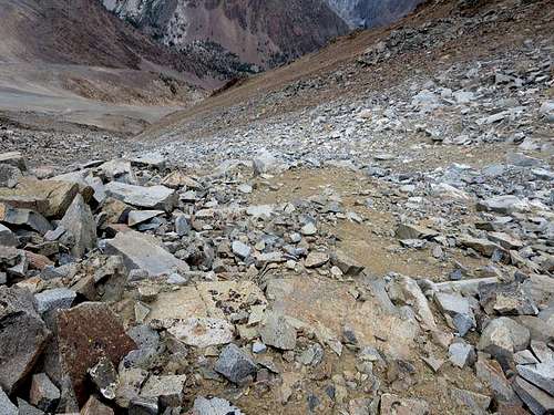
We found talus and boulders along the northern side of the ridge, with generally solid footing though a fair amount of boulder-hopping. We came across some striking color patterns: a band of grey rock, followed by a band of iron-colored orange rock before returning to grey. We did not stay right on the ridge but several hundred feet below it. While we did not make particularly fast time, we found the hiking easier and more fun than the scree would have been.
![Rock Bands on Mt T0m]() Orange and grey rock bands on southwest ridge
Orange and grey rock bands on southwest ridge![Ruvicha on SW Ridge]() Ruvicha ascending southwest ridge
Ruvicha ascending southwest ridgeAbove the Tungstar Mine ... To a False Summit
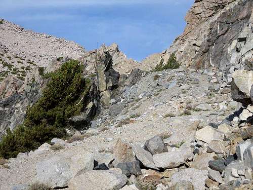
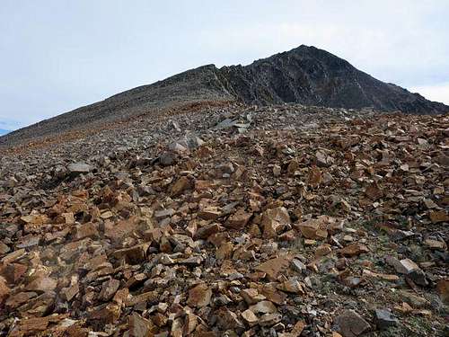
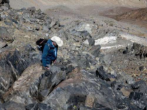
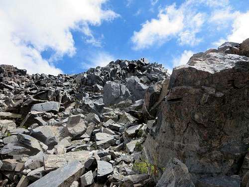
At a point about 3.5 miles from our start at Horton Lake and an elevation of 12,600 feet, we found ourselves directly above the Tungstar Mine, about 800 vertical feet below. We then started heading more directly up. The footing was not as good as earlier, but we still found it possible to stay mostly on boulders, sometimes on solid rock, and avoid the scree trails which now became apparent. At an elevation of 12,900 feet, Ruvicha decided to call it a day and descend to wait at the mine. I continued upward, still able to avoid the scree trails, thinking the summit was in sight … until I saw higher rock to the left (northeast). I then remembered Calipidder’s account of hiking Tom, which noted that the chute leading up from the Tungstar Mine did not go directly to the summit; one had to cross ribs and get to the third chute to the left to reach the chute to the true summit.
![Ruvicha above Tungstar Mine]() Ruvicha above the Tungstar Mine
Ruvicha above the Tungstar Mine![Tungstar Mine Below]() View down chute to Tungstar Mine
View down chute to Tungstar Mine![False Summit on Tom]() False summit on Mt Tom
False summit on Mt TomFinding the True Summit
I worked my way over to the third chute, crossing – and avoiding – several scree trails. Once in the third chute, it appeared that it was about 200 vertical feet to the summit, and I headed up, again able to find boulders and even solid rock to climb. By this point, my hiking poles were stowed in my daypack so that both hands were free to grab rock.
![Final Stretch]() Final stretch of rock to true summit of Mt Tom
Final stretch of rock to true summit of Mt TomSummit Views
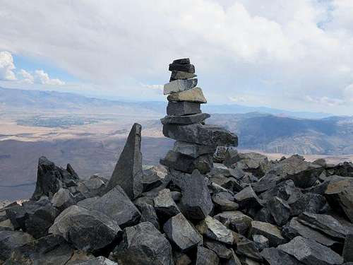
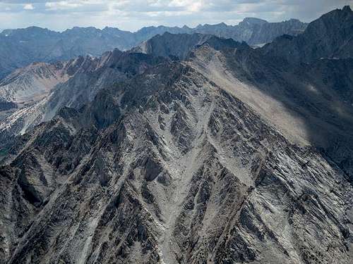
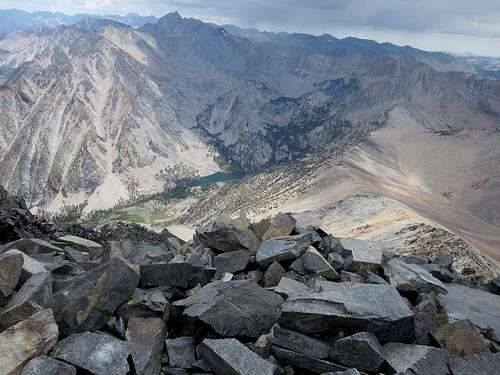
The tall rock cairn and summit register box marked the true summit. I called Ruvicha on the walkie-talkie to report success. His response: “Great. Congratulations. Look west and get down.” I turned to the west, where clouds that 45 minutes earlier had appeared not so threatening were now a menacing, angry blackish-grey and getting uncomfortably close. I signed the register, took some pictures – Tom’s summit offers great views, though in this case the clouds to the west and north obscured many of them – and after less than ten minutes on the summit headed down, this time following scree trails to lose elevation as quickly as possible.
![Mt Tom s Summit]() Summit cairn on Mt Tom
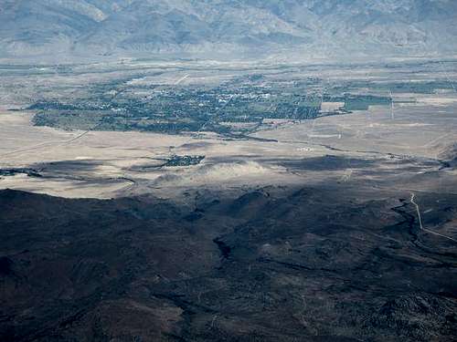
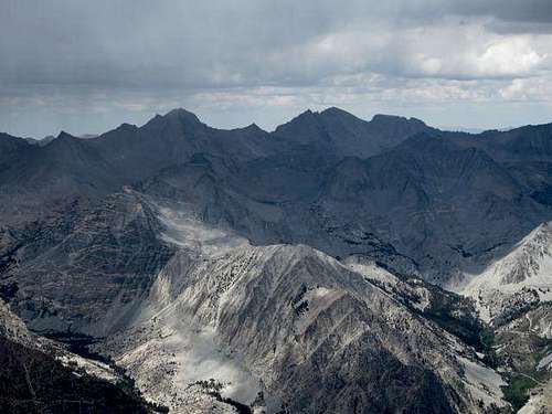
Summit cairn on Mt Tom![Bishop]() Bishop from summit of Mt Tom
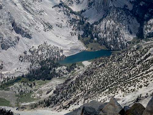
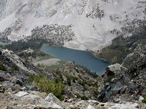
Bishop from summit of Mt Tom![Horton Lake]() Horton Lake, 4000 feet below, from summit of Mt Tom
Horton Lake, 4000 feet below, from summit of Mt Tom![Basin Mountain and Mt Tom]() Basin Mountain from summit of Mt Tom
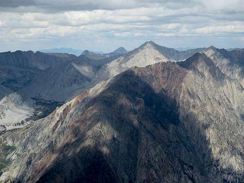
Basin Mountain from summit of Mt Tom![View to Northwest]() View to northwest from summit of Mt Tom
View to northwest from summit of Mt Tom![Mt Morgan Summit]() Mt Morgan from summit of Mt Tom
Mt Morgan from summit of Mt TomHeading Down in Deteriorating Weather
Ruvicha, watching the incoming storm from 1800 feet below at the Tungstar Mine, radioed that he was going to move on up the road. He figured that sitting next to a lot of old metal in a lightning storm was not the best idea. Five minutes after I left the summit, the hailstorm began, while lightning started to pound the mountains to the west and Mt. Morgan to the northwest. One lightning bolt, which Ruvicha reported seeing as well, seemed to last about four seconds (okay, lightning bolts are virtually instantaneous, but the image on the eyeball certainly lingered). Fortunately, the wind moved the storm to the northeast rather than due east, though the first hour heading down from Tom’s summit was about as nervous as I have been on a mountain.
![Deteriorating Weather]() Deteriorating weather to the west
Deteriorating weather to the west![Deteriorating Weather]() Deteriorating weather to southwest over Horton Lake and Basin Mountain
Deteriorating weather to southwest over Horton Lake and Basin Mountain![Heading Down Scree Trail]() Heading down a loose and slippery scree trail
Heading down a loose and slippery scree trailThe Slog Back to Camp in the Drizzle
Hiking down the scree trail was not much fun, and I ended slipping several times on the loose gravel and rock. In any case, I made it down to the mine and proceeded on the jeep trail back to the crossing over into Horton Lake Valley, then down to our campsite, walking much of the time in a light rain as the thunder subsided.
![Tungstar Mine Below]() Nearing Tungstar Mine on the way down from Tom's summit
Nearing Tungstar Mine on the way down from Tom's summit![On Trail from Tungstar Mine]() Hiking back on trail from Tungstar Mine
Hiking back on trail from Tungstar Mine![Clouds over Mt Tom]() Clouds close in over Mt Tom
Clouds close in over Mt Tom![Descending to Horton Lake]() Descending trail to Horton Lake
Descending trail to Horton LakeBack at Camp
Ruvicha had dinner going and graciously let me use his camp chair. As we ate in the drizzle, he reported that the weather report for the next two days promised more of the same. We had planned to hike to Upper Horton Lake the next day (Tuesday) and then summit Basin Mountain, break camp and return to Bishop on Wednesday. But the prospect of more thunderstorms – and summiting Basin or having to break camp in the rain – held little appeal. Before retiring to our tents as the rain beat down harder, we decided to return to Bishop the next morning, leaving Basin “unfinished” for another time. (Events vindicated our decision: the next two afternoons in Bishop, we watched as lightning and rain poured down on Basin, Horton Lake and Tom.)
I would strongly second boyblue’s recommendation to ascend Tom’s southwest slope rather than the scree trail from the Tungstar Mine. I nevertheless found Tom a hard mountain, as did Ruvicha. Even though Matterhorn Peak and Mt. Morgan had been considerably longer hikes, in both cases with greater altitude gain, Tom left me the most beat of the three. For this or some other reason, Tom does not appear to have as much appeal as other mountains. We saw no one else attempting Tom this time, and my signature in the summit register was the first in a week. Still, it was nice to get it done.
(Thanks again to Calipidder and boyblue for their advice; thanks also to Ruvicha for comments on the draft of this trip report.)


Comments
Post a Comment