
-
 1472 Hits
-
 84.27% Score
-
 18 Votes
|
|
Mountain/Rock |
|---|---|
|
|
46.29624°N / 11.16389°E |
|
|
Trentino |
|
|
Hiking, Scrambling, Skiing |
|
|
Spring, Summer, Fall, Winter |
|
|
5945 ft / 1812 m |
|
|
Overview
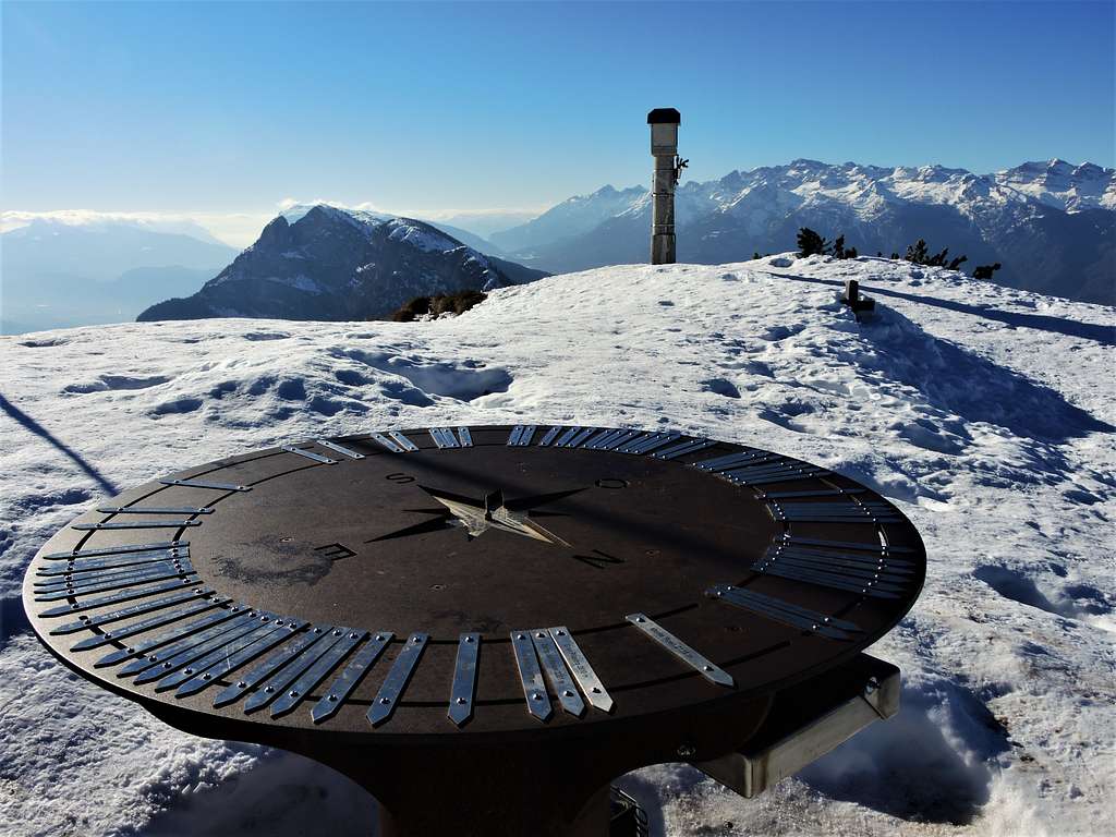
Corno di Tres 1812 m
Corno di Tres 1812 m - Tresner Horn in German - is a mountain belonging to the Southern Rhaetian Alps, Mendola Chain and located on the watershed between the Val di Non and the Val d'Adige, on the border between the province of Trento and the province of Bolzano. The Southern sector of the Catena della Mendola takes the name of Cime di Vigo. They include the Roèn 2116 m, the highest peak, Roccapiana, Cima d'Arza and Corno di Tres.
Corno di Tres is a rather popular destination for ski mountaineers and hikers in snow shoes, thanks to an easy itinerary located on the North-North-East side, but above all for the vast panorama that can be enjoyed from the top. The route is generally safe from avalanches even after copious snowfalls. It is often practicable even on foot without specific equipment since there is almost always a good beaten track.
Getting There
The standard route starts from the Refuge Predaia Ai Todes'ci.
Coming from Trento or from Bolzano take the Brennero Motorway A22 exit San Michele Mezzocorona and here take the SS43 Val di Non road. In the village of Coredo exit the Val di Non state road and take on the right the road to the nearby village of Smarano and from here go up further following the signspost to the locality 7 Larici. Continue further until you reach Passo Predaia with its large parking area. To reach the Refuge Predaia continue straight and at the Rifugio Sores take the detour to the Refuge Predaia ai Todes'ci, a concrete narrow road that leads steeply in a few minutes to the Rifugio Predaia 1400 m. Parking lot. In the case of snow/ice on the road after the Rifugio Sores you can park at Passo Predaia and reach the Rifugio Predaia following the road by foot in about 20 minutes.
Route
Corno di Tres Normal Route report
Summit altitude: 1817 m
Difficulty: EE
Difference in level: 420 m from Rifugio Predaia Ai Todes'ci
Starting point: Rifugio Predaia Ai Todes'ci
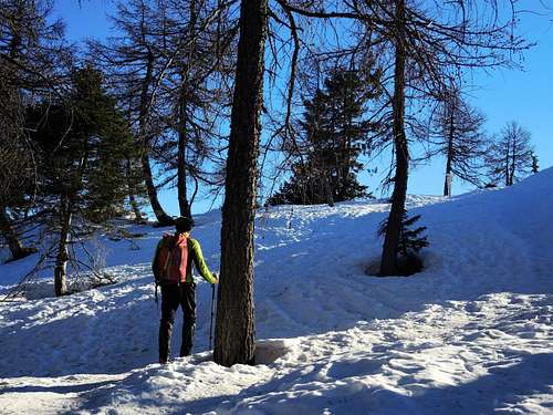
Safe route even after heavy snowfall, at first on forest roads and on a brief and steep path in the final part.
The starting point is the Refuge Predaia Ai Todes'ci, reachable by car on a concrete road. In case of snow or ice you can leave your car at the convenient parking area at Passo Predaia and walk to the Predaia refuge in about 20 minutes.
From the parking lot located at an altitude of 1400 m near the Refuge Predaia Ai Todesci take the forest road with signpost n. 503, which continues with a moderate gradient across the forest to the clearing called Bus del Spin. Continue to the beautiful forest in the woods up to Malga Rodeza 1570 m.
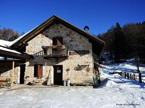
From the alm continue along the trail 503, also called Sentiero Italia, which makes a long cross in the direction of the Sella di Favogna. After about 2 km you reach the crossroads marked by a signpost indicating the summit of Corno di Tres. Here leave the main trail and take on the left a steep track up the wooded ridge, getting the summit in about 20 minutes with easy zig zags.
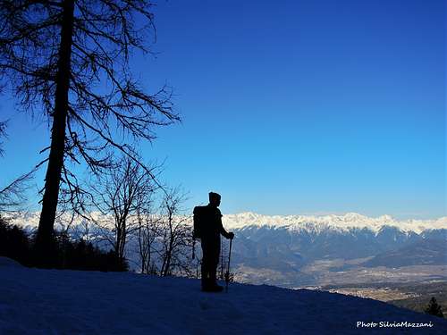
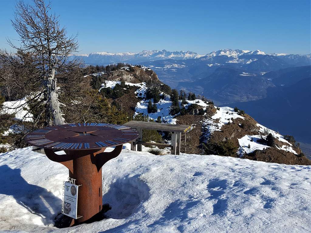
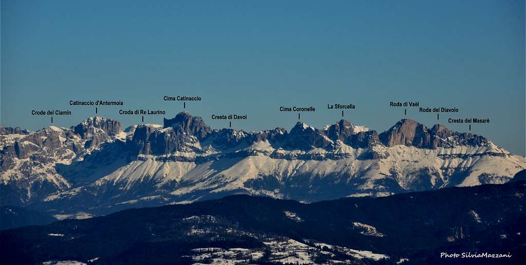
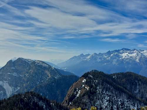
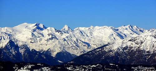
The 360° panorama that this summit offers is extensive: the view ranges from the Adamello and Presanella to the Ortles-Cevedale in the Western direction to the Western Dolomites in the NE direction with the Catinaccio group, to the nearest Dolomiti di Brenta and Maddalene.
Descent: reversing the same route. Alternatively is possible to choose another way. Continue in the NE direction along the easy and aerial ridge, which with slight ups and downs, after passing the Corno del Cervo and the Roccialarga leads to the saddle of Costa Larga. From here take the path 525b to return to Malga Rodeza.
Red Tape
No fees no permits required
Summit views
When to Climb
All year round. The winter ascents require the use of specific equipment such as snowshoes, skis or ice axe and crampons depending on the conditions
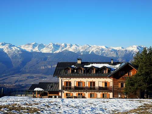
Accomodation
Different possibilities of accomodation in the surroundings.
Meteo
Meteo Trentino
Meteo Provincia di Bolzano