
|
|
Mountain/Rock |
|---|---|
|
|
40.19620°N / 106.1581°W |
|
|
Grand |
|
|
Hiking, Mountaineering, Scrambling, Skiing |
|
|
Summer, Fall |
|
|
11252 ft / 3430 m |
|
|
Overview
The Corral Peaks are a pair of two nicely matched peaks in the Rabbit Ears Range of North Central Colorado. The southern and highest peak is elevation 11,252 feet, while the northern peak is at elevation 11,191 feet. Both are close to each other and easy to climb together. By the standards of the Rabbit Ears Range, the Corral Peaks are climbed fairly frequently, but they are nowhere near as popular as some the mountains just to the east located in Rocky Mountain National Park and Indian Peaks or even Parkview Mountain to the north.
Like most of the mountains in the Rabbit Ears Range, the Corral Peaks are of volcanic origin. The Mountain was named for George Corral, one of the first homesteaders whom settled the area.
There are some fairly steep slopes on the two peaks, but there are really no technical routes available since the rock is extremely crumbly. Most of the practical routes on the peaks are class 2 in difficulty.
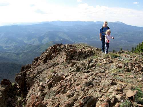 This is the final portion of the north ridge leading to the South Corral Peak.
Getting There
Via Parshall
This route offers the best road of the two driving routes to the trailhead, but the drive is longer.
Just west of Parshall and on Highway 40, turn north on County Road 21 (known as FR 112 higher up) between mile markers 194 and 195. Follow CR21/FR 112 for 15.5 miles to a road fork on the left (NW) which has a sign labeled “Corral Peaks” and is FR 112-1A. Either park here or follow the rough road 0.3 miles to the trailhead. This last 0.3 miles are considered to be a 4wd road, but we just made it in our minivan.
Via Granby/Windy Gap
Note: Due to washouts and the east Troublesome Fire, this road was closed as of 2023. It is unknown when or even if it will ever be open again.
The road via this access is pretty good, but when it is wet it is extremely slippery and the route from Parshall is recommended if the weather is not dry.
On Highway 125 north of Windy Gap Reservoir (Highway 125 turns north of Highway 40 not too far west of Granby), turn west on FR 112 between mile markers 9 and 10. Follow FR 112 for 10 miles to a road on the right (NW) which has a sign labeled “Corral Peaks” and is FR 112-1A. Either park here or follow the rough road 0.3 miles to the trailhead.
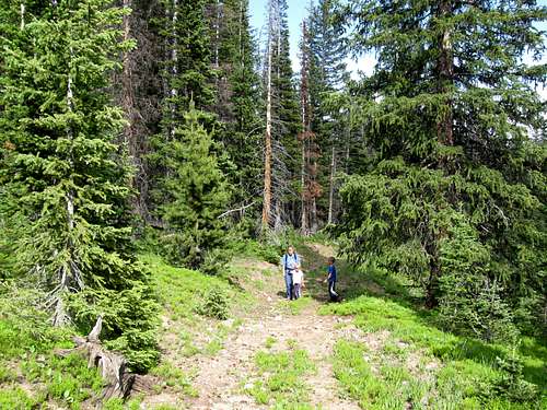 This scene is near the East Ridge Trailhead, which is the standard route up the Corral Peaks.
Routes Overview
Corral Peaks via the East Ridge
The route begins from FR 112-1A and follows the minor east ridge of the Corral Peaks. The route to the meadows between the two peaks is an old jeep road after which there is a minor trail to the south peak. There is no trail to the north peak. The trail-less climb to north peak is rated class 2 in difficulty. Even if you park at the FR 112/FR 112-1A the route is only 3.8 miles round trip. This is a nice after work climb or half day for residents of Grand County, but if you want to make the outing into a full day’s trip, you can climb Elk Mountain just to the south.
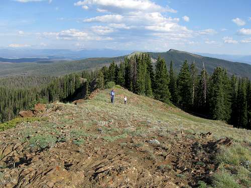 Kimberly and Shaylee on the south ridge of the South Corral Peak, which is part of the East Ridge Route. Elk Mountain is background right.
Other Routes
The above route is the only route I am familiar with, but if you want to make a longer outing of Corral Peaks you could begin from Lookout Peak and hike the trail south over Searight Mountain and to the beginning of the East Ridge Route above.
Another possibility for a longer climb would be to start at the Wheatley Creek Trailhead and follow the Wheatley Creek to the slopes west of the Corral Peaks and make your climb to the summits from there.
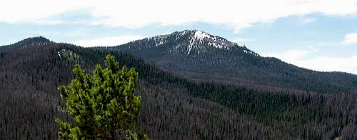 This photo was taken from the summit of Lookout Peak looking south at the Corral Peaks.
Red Tape
There is no red tape, so make sure to use LNT methods of travel.
Camping
There are campsites along both access roads, including not far from the trailhead, but make sure to camp only on public land.
When to Climb
Late June through September or sometime in October would be considered the normal climbing season.
The Corral Peaks could make a safe winter ascent, but I don’t know how far the access roads are plowed, if at all. If not, the best bet to climb the mountain would probably be to climb over the top of Lookout Peak from the north.
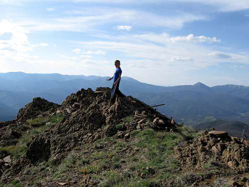 Kessler on the summit of the north peak of the Corral Peaks.
Mountain Conditions
Sulphur Ranger District
9 Ten Mile Drive
Granby, CO 80446
970-887-4100
WEATHER FORECAST
Below is the climate summary for nearby Berthoud Pass at 11,315 feet elevation which is several miles to the south and about the same elevation as the Corral Peaks. These are all averages, so expect more variation, but this will give you a good idea about the climate at higher elevations around the Corral Peaks. *National Weather Service Data 1950-1985.
| MONTH | HIGH | LOW | SNOW DEPTH | DAYS W/PRECIP |
| JAN | 21 | 1 | 42" | 19 |
| FEB | 24 | 2 | 52" | 16 |
| MAR | 29 | 6 | 63" | 20 |
| APR | 36 | 14 | 67" | 17 |
| MAY | 45 | 23 | 53" | 16 |
| JUN | 54 | 32 | 17" | 11 |
| JUL | 62 | 39 | 0 | 14 |
| AUG | 60 | 38 | 0 | 14 |
| SEP | 53 | 31 | 0 | 11 |
| OCT | 42 | 21 | 3" | 10 |
| NOV | 30 | 10 | 14" | 15 |
| DEC | 23 | 3 | 29" | 18 |