
|
|
Trailhead |
|---|---|
|
|
41.13410°N / 106.42029°W |
|
|
Summer, Fall |
|
|
7480 ft / 2280 m |
Overview
 TH access road
At the TH, you’ll find a small dirt parking area with a signboard next to a gate. A very old outhouse is also located at the TH. There is no water at the TH or any where nearby so bring your own or be prepared to filter the otherwise ample wild water supply.
Note: Take everything you need! This TH is 28 miles from a paved road and another 36 miles from the nearest services at Laramie.
Directions
 Laramie to the TH
 TH detail
Take Wyoming 230 west for 36 miles to the Foxpark turnoff (FR512). Turn right on to FR512 (the Platte River access Rd). Continue approximately 28 miles to the TH. Delays may be encountered, primarily Monday thru Friday, along this road due to logging operations.
Destinations
 Not much info on this signboard
 Sign marking the wilderness boundry
 Douglas Creek
 Fall colors decorate the trail
 Platte River Wilderness - Douglas Creek TH approach Rd parallels Douglas Creek in the foreground, North Platte River in background, center. Looking south (upstream)
Camping
Informal camping is available along the North Platte River as well as along the short approach road to the TH.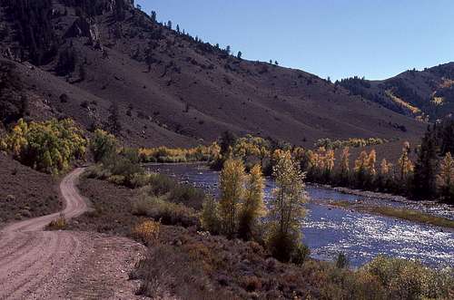 Platte River Rd looking south. Good camping spots in the trees along the river
Books and Maps
BooksHiking Wyoming’s Medicine Bow National Forest
Maps
Medicine Bow National Forest
Topos
For the Trailhead and Douglas Creek Tr - Overlook Hill, Elkhorn Point and Horatio Rock