
-
 9426 Hits
-
 71.06% Score
-
 1 Votes
|
|
Route |
|---|---|
|
|
39.00970°N / 106.861°W |
|
|
Mountaineering, Skiing |
|
|
Spring |
|
|
One to two days |
|
|
Advanced Snow Climb; Extreme Ski Descent, D14 |
|
|
Approach
Drive west on Highway 182 out of Aspen. After less than one mile at a stoplight, take a hard left onto Castle Creek Road. Drive 11 miles to Ashcroft. Continue driving 1.9 miles to a fork. Take a right onto Pearl Pass Road. Park at 0.7 miles if in a 2 wheel drive vehicle or continue 3.2 miles with 4 wheel drive to another fork. Take a left onto Pearl Pass Road and park at the snow closure (~10,600'). Follow Pearl Pass Rd. to its last Castle Creek intersection at 11,280' just before a foot bridge near Tagert Hut. Leave the road here and follow Castle Creek drainage west, then northwest to Castle Peak's East Face.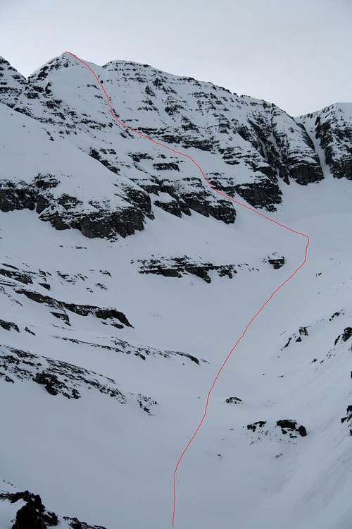
Castle Peak's East Face Route March 27, 2006.
Route Description
Climb the prominent East face couloir which is narrow, windy and has a maximum slope angle around 50 degrees. The couloir opens up to the Northeast Ridge Route, which must be followed for several hundred feet to the summit. This is a technically demanding ski route. It is rated as a D14 on the D Scale. Alternatively, the Northeast Ridge Route or Northwest Ridge Route can be used for a descent.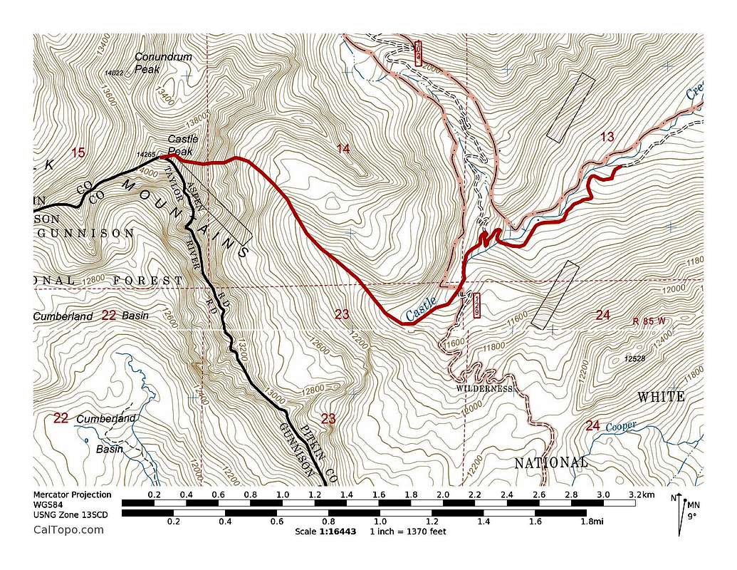
Castle Peak's East Face snow route. ~50 degree snow, 5.3 miles with ~3730' elevation gain.