
-
 7311 Hits
-
 80.49% Score
-
 12 Votes
|
|
Route |
|---|---|
|
|
46.50776°N / 13.95234°E |
|
|
Hiking, Scrambling, Via Ferrata |
|
|
Spring, Summer, Fall |
|
|
Half a day |
|
|
Class 3 |
|
|
Hike, Scramble, Ferrata |
|
|
Overview
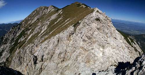 Looking across the climbing passage to the Kepa summit. |
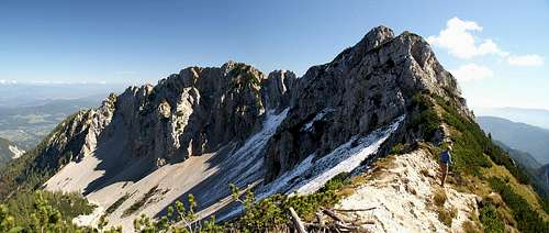
The long east ridge "traverse" from the village of Dovje to the south-east of Kepa / Mittagskogel is one of the most scenic routes to the mountain. While the first part of the route - the climb to the ridge - is hidden under trees, the main part runs along the south slopes of the various summits of the Kepa / Mittagskogel Massif. Though it is the least difficult of the currently posted routes it is far from easy. There are two protected sections, on into and out of a deep notch on the ridge, the other on a ledge beneath Mala Dovska Kepa / Lengenfelder Mittagskogel, which are both rather exposed. Between Mala Dovska Kepa and Kepa there is a long unprotected traverse on steep scree covered slopes. A bit nightmarish since there are no holds and no places to place any protection.
In all, the east ridge traverse is a worthwhile climb: good views and some adventure in the more difficult sections.
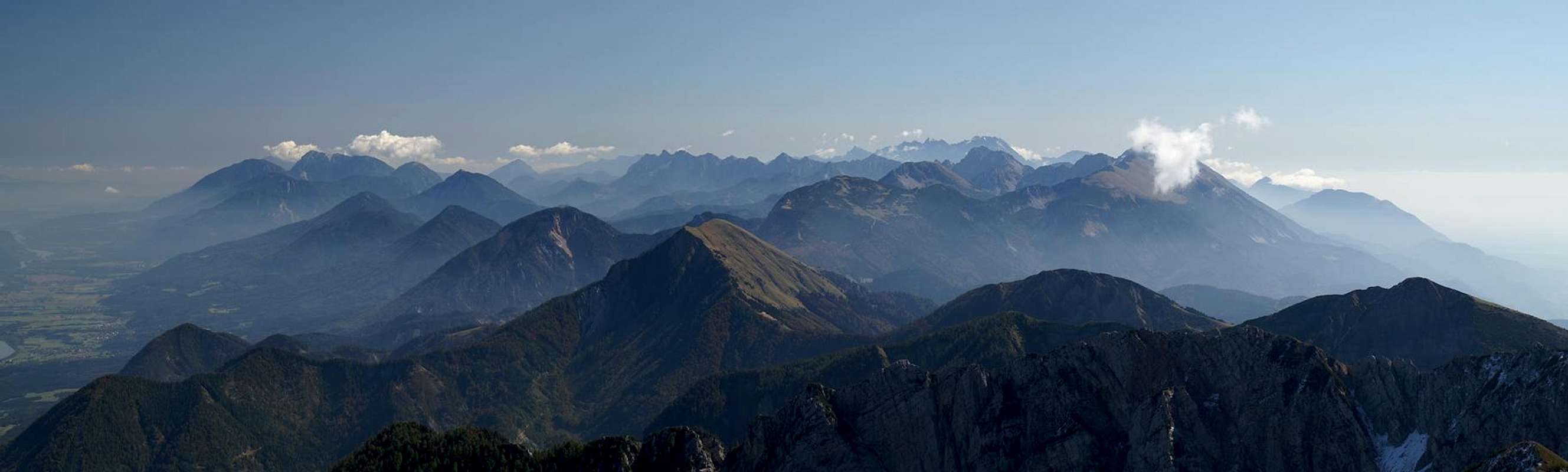
The Views:
 Triglav |  Skrlatica, Oltar |  Jalovec |
Getting There
  |
Dovje is located in the Sava Valley on the Slovenian side of the Karavanke / Karawanken ridge. You can reach it as follows:
From Austria
Take motorway A11 through the Karawanken Tunnel to Slovenia. At the first Slovenian exit (Hrusica) turn onto 637 west, direction Kranjska Gora. After a few kilometres you'll reach the exit to the village Dovje (north of the road). Drive into and through the village and follow a mountain road for some 5km (above the village you must deter left). It ends in a river bed (Mlinca River), where there is a small parking lot.
From Slovenia
Take A2 to the exit Hrusica. Turn onto 637, direction Kranjska Gora and after a few km turn right to Dovje. Drive through and turn on the mountain road, which will take you in long switchbacks to the trailhead near the Mlinca River.
Route Description
Hühnerkogel
- Start altitude: 1065m (Dovje itself is at 700m)
- Summit altitude: 2143m
- Prevailing exposure: S
- Type: 4h one way
- Protection: Two protected section
From the trailhead near the Mlinca River follow the marked path to the left of the creek. Climb a fence and head up steeply through forested slopes. There are two private huts, one near the trailhead (Mlinca meadow, also named Erjavcev rovt), one further up on a small meadow (Brvoge), where the path turns eastward. From this meadow you obtain first views across the Sava Valley towards Triglav. Several hundred metres above the meadow you'll reach an intersection (the place is called Koritec, cca 1600m). The right hand path leads to Mlinacasattel / Sedlo Mlinca, the left hand path leads to Kepa.
It climbs the Bärenkogel south slopes, avoiding the summit but rather joining the ridge to its west. After a short traverse in the direction of the next summit, Hühnerkogel, the path turns right, keeping level and passing the summit on the south side. A large bend takes you to the other side of Hühnerkogel where - for the first time - you can glimpse the Mittagskogel summit.
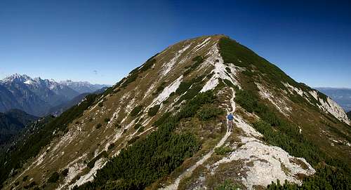
 Kepa and Dovska Mala Kepa |  Dovska Mala Kepa |  Kepa summit |
However, you soon reach a notch in the ridge, a ravine which runs off in both directions, north and south. This is the first crux of the ascent, a passage, which has been protected by firm steel cabling. However, the route is very steep and there is ample scree on the well polished rocks , even before you reach the first protection. It is an airy passage, which leads you deep down into the notch.
 Notch climbing |  View towards Julian Alps |  Notch Climbing |
The path back up leads across steel pins, then a cutaway ledge, finally a chimney back to the top of the ridge. It is easy to climb but tricky to descend. You are now on the south slopes of Dovska Mala Kepa, which you have to traverse - again on the south side of the summit. This traverse is harmless at first, but then the path heads out on an exposed ledge. The first part of this ledge is unprotected and a bit scary, especially since the ledge starts climbing steeply. After a while the first protections mark the second crux, a rocky traverse across one of the buttresses of Dovska Mala Kepa.
 Feeling the pull |  Ledge Climbing |  Ledge Climbing |
Behind the buttress the protection vanishes to reveal the scariest part of the climb: an unmarked path across a steep scree covered rocky and grass slope. Head for another notch high up on the ridge, through which the route leads. After snowfalls this notch can be iced over on its north-western side so take care when you descend it. Directly after the notch the route joins the normal route from Bertahütte which leads across steps to the main summit of Kepa / Mittagskogel. There are two crosses on the Austrian side of the summit but the highest point appears to be on the Slovenian side.
 Tricky slope |  Icy Saddle |  Protected Climbing |
Return the same way.
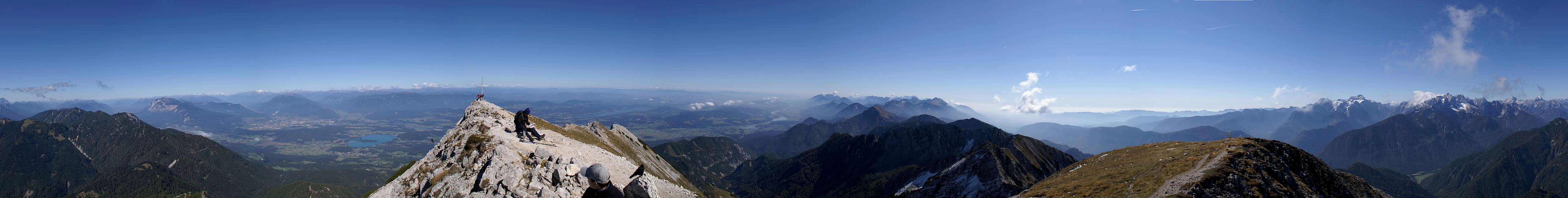
The reward: a 360° summit view
 |
Essential Gear
Lepa Plevelnica (1957m), Bärenkogel (1976m)
In general hiking gear is sufficient. After a day of snowfall you can encounter snowy and icy conditions close to the Kepa / Mittagskogel summit. Depending on the amount of ice and snow it might be advisable to bring crampons.