In the beginning...
Mount Conness's West Ridge was to be the culmination of my brother Jon and my climbing trip to Yosemite over Memorial Day, 2007. We had climbed Matthes Crest and the Dana Coulior earlier in the week and felt pretty fit so we were both optimistic about our chances of summiting Conness. Our optimism faded a little when we arrived in Yosemite the night before and found that the Sawmill Creek campsite was closed but we were not to be thwarted. Instead we camped a mile and a half further down the road which would necessitate a longer approach the next day. The next morning we were on our way a little after 4AM.
The Approach
We started off at a good pace and made the mile and a half to the Sawmill Creek campground in a half hour. Sawmill Creek is a walk-in campground and we were surprised at how far it back extended. We wished we could have camped there the night before but we were making good time so we weren't that bothered about staying down the road. We followed a dirt track through the campground and into the woods beyond. We had to cross a wide stream shortly after leaving the campground and then we followed the trail through the woods and ended up passing the Carnegie altitude research institute (basically an old barn). Once we were past the Carnegie Institute we soon started cutting cross country across a valley that was cut through by a large stream. We had to cross the stream and some of it's tributaries a few times as we worked our way up the mostly snow covered valley towards a cwm at it's terminus.
![Strapping on crampons]() Strapping on crampons
Strapping on crampons
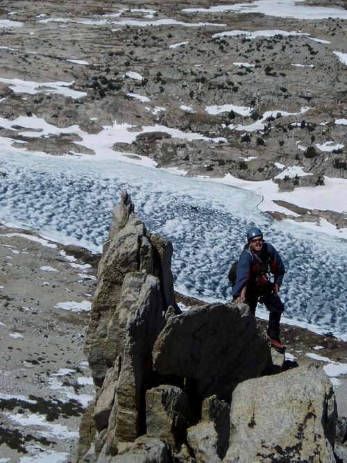
We soon started plodding up the snowfield. At this point it was about 6:30 or 7:00AM and the sun was already pretty bright. We were both getting hot and unfortunately it looked like the currently hard snow would be pretty soft on the way back. The snowfield got steadily steeper the higher we climbed and just as we reached the exit gully Jon dropped a ski pole that slid a good couple hundred vertical feet down the snowfield. Fortunately it stopped right along our return path and didn't look like it would be too hard to find on the way out. Then a few minutes later the lens cap fell off of Jon's camera and ended up sliding into an outcrop of rocks that pierced through the snow in the gully. We weren't so sure about finding the lens cap but at least we had a general idea of where he
lost it.
![The Approach]() Making my way towards the exit gully
Making my way towards the exit gullyFate intervenes...
The steep exit to the gully brought us out onto a rocky ridge which we hiked up for a few hundred yards to gain a large gravely plateau. Once we reached the plateau we could see the summit of Conness ahead in the distance. Our SuperTopo guidebook said to look for a distinctive notch along the plateau and drop down this to hike across the Southwest Face of Conness in order to gain access to the West Ridge. Once we started hiking up the plateau we saw a very distinctive notch appear on our left after a 1/4 of a mile or so. We thought this must be the one referred to in the guidebook so we ditched Jon's pack and some of our gear and then made our way down the notch.
The guidebook mentioned that once you are in the notch you should clearly be able to see the South West face of the mountain. We didn't see the face straight away but we kept hiking down the steep scree and sand covered notch hoping we would see the face soon. Well this was our first of a series of costly mistakes over the course of the day. The further we got down the notch the more sure we were that we had taken the wrong one. Sure enough after we had descended at least a couple of hundred vertical feet we could see a buttress descending from the plateau to our right which blocked our view of the face. We were beginning to think that we should have hiked quite a ways further up the plateau before we had exited left into a notch. Anyway, we tried to make the best of our mistake by scrambling onto and over the buttress. Once we surmounted the buttress we could finally see the face up close as well as the notch we should have gone down. We probably added a mile to our route and lost a lot more vertical feet than we needed to by taking the wrong notch. We didn't have much choice but to start descending the buttress and cross some steep snowfields that gained us access to the face. Once we reach the face we headed west to arrive at the base of the West Ridge.
Our guidebook was confusing here as well. It mentioned that once you reached the base of the ridge you should head north until you see a gully and then climb up the left side of the gully. Well we didn't see anything that resembled a gully at the base of the face so we ended up traversing a fair ways north until we ran into a massive gully that ran hundreds of feet up the mountain. We thought that this must have been the gully the topo referred to so we crossed it to gain the ridge on the left hand side. This was our second and most serious mistake of the day. We had actually traversed at least 300 yards too far to the north, and little did we know the arête that we were about to climb was not the West Ridge!
Fellas, it just doesn't get any better than this!
Once we found the massive gully we started scrambling our way up the lower slopes of what looked like a pretty long and spectacular arete on it's left hand side. The arete itself ended up being 2000 vertical feet of fun, mostly 4th class scrambling. Every once in a while we ran into some 5th class moves but we never seemed to encounter any sustained moves that were harder than 5.4 or longer than 20 ft. We stayed unroped the entire way apart from one pitch were Jon led up a 5.4 face.
We both agreed that this was what being in the mountains was all about. Jon and I were both feeling strong and climbing fluidly, the arete was long and exposed and each move up it seemed to put a smile on our faces. We didn't yet know for sure that we were on the wrong route but we certainly had a blast climbing the arete. I don't get to do long routes like this in England so I was soaking up the exposure and atmosphere as it would have to last me until my next trip to California in July.
![The West Arete ?]() Jon high up the arete.
Jon high up the arete.Agony...
Once we had got fairly high up the arete I began to suspect that we were on the wrong route. The topo showed that the initial gully only lasted for about a 1/3rd of the route and then the arete would lead out onto the ridge over the southwest face. Our gully seemed to go on forever though. We had reached 12,000 ft according to my altimeter and the gully still led straight up. We didn't really have a choice but to keep going. So we kept scrambling up the arete running into a few more 5th class sections and some seriously exposed moves. The gully to our right was at least 200 vertical feet below the arete and we often had to drop down to the right side of the arete which overhung the gully. But finally we came to a point were we reached the top of the gully and saw a large notch seperating our arete from the summit ridge.
At the top of the gully I climbed through a 5.4 off-width and topped out onto a very precarious perch on a satellite peak at the end of our arete. Directly in from of me was an overhung drop off of 500 vertical feet to a huge snow bowl and off to our right we could see the summit. But between us and the summit was a notch a couple hundred feet deep followed by what looked like some pretty serious 5th class climbing to the summit. We now realized conclusively that we were on the wrong ridge. It looked like we weren't the only ones though as someone had set-up a rappel station to the notch. The arete topped out at 12,300 ft and gained about 2000 vertical feet from the start of the route.
At this point it was 12:30 and we could see some clouds rolling up the valley. I hate giving up on routes and am a self admitted peak bagger but we had to make a quick decision about whether or not we should descend the notch and climb up the face to the true summit. Common sense prevailed though and as Conness is notorious for thunderstorms we decided rather than rappelling to the notch and climbing some unknown 5th class terrain to the summit that we would try and descend our arete.
The descent of the arete
The descent was a fairly serious affair. The arete that we had climbed was at least 2000 feet tall and on either side of it was a fairly deep and steep gully. We decided to downclimb the arete for a little ways and then try and scramble into the gully on our right as it looked like the gully on the right had 3rd class climbing most of the way down. We got into the gully with no problems and were able to scramble down it for approximately 500 vertical feet. But then we ran into a series of cliffs so we decided to head back to the arete and see what the gully on the left hand side looked like. Once we reached the arete we scrambled down it again
for a hundred feet or so and stopped on a portion of it that overhung the left hand gully. From here we found a spot where we thought we could rap into the gully with a single rope. We set up a slightly dodgy anchor around a horn and put in a nut to stabilize the sling. Then we rappeled off the overhung face down into the gully. What a way to exit the arete! Fortunately our 60m rope just reached the gully and we were then able to scramble down the gully and traverse out of it to a buttress that ran to the bottom of the real West Ridge. We then headed down the buttress towards the base of the southwest face.
Abject misery... and revival
From here we had a major decision to make. We could either try and hike along bottom of the face and up the true notch or we could head down the valley to the notch we had descended. Either way was a bummer as we were going to have to gain at least 800 more feet of altitude than we would have had to if we had climbed the real ridge. Going up the true notch would probably be shorter but we weren't sure of the condition of the notch whereas we already knew the type of terrain we'd have to cross the gain the notch that we had descended.
We both agreed to head back the way we had come but instead of scrambling over the buttress that separated our notch from the southwest face we would descend further towards the floor of the valley to traverse around the bottom of the buttress and then hike up the notch. Well the die was well and truly cast at this point and off we headed down towards the valley floor. The day was getting really hot by now and we had to gain 1000 ft of vertical just to get back to the notch where we had left our packs. At this point we realized we were both really low on water and that our water filter was in Jon's pack at the top of the notch. We weren’t too keen on catching giardia so we tried to put of collecting water from some of the streams that ran down the slope. But we still had a long slog through soft snow and scree to get to the pass so we knew we would have to get some water somehow or else we would likely suffer from heat exhaustion. Sure enough we both ran out of water before we even started ascending from the valley. We then traversed the buttress and had to slog uphill through wet snow followed by scree and sand in 95 degree heat. What a miserable experience!
Once we started ascending the notch we found a cleanish looking stream and refilled our platypuses. From here we had a hot and nasty hike up some steep sand and scree to reach the notch. I was in pretty bad shape at this point, most likely feeling a bit of heat exhaustion and dehydration. But we plodded on and finally made it to the top of the notch at about 4PM. I had absolutely no energy left at this point so I just collapsed near a rock at the top of the notch and ate a peanut butter and jelly sandwich while Jon grabbed his pack. Lucky for me he had a 1/2 gallon of Gatorade in his pack. I certainly would not have traded it for the Holy Grail! After my sandwich and half the Gatorade I felt loads better so we packed our gear up and made our way down the plateau to the gully that led into the cwm.
The gods intervene...
The top of the gully was really narrow and at least 50 degree steep snow so we thought we'd scramble down the rocky sides of the gully a little to try and avoid the steepest snow. Once we gained the gully we looked for Jon's lens cap but had no luck finding it. Fortunately we could still see his ski pole further down the snow basin.
I had just descended the gully to the top of the snow basin when I heard a loud clap off to our right. Just to top off our already long day a thunderstorm was rolling in. Well I haven't descended snow that fast for a long time. As soon as the thunder started I ran and boot glissaded down the basin at full tilt. Fortunately the snow wasn't as soft as we had feared and I only post holed a few times. Jon did a sit glissade and got a pretty wet in the process but we both made it to the bottom of the cwm pretty quickly. Even at the bottom of the cwm we were the tallest objects in sight and our ski poles and ice-axes looked like they would make nice lightning rods.
From here on we made our way as fast as we could into the valley while the thunder kept up it’s sinister beat. We had to cross the stream a few times and unluckily for Jon he fell through a snowbridge into the stream but after a 1/4 mile or so we started running into a few trees and rocks that were taller than us and would hopefully take the threat of lightning away. We hadn't grabbed a joint photo on top of our satellite summit so we stopped here and braved the thunder and lightning to grab a quick one.
![Celebrating our safe descent]() Safety in the storm
Safety in the storm
Then we made our way back into the woods and the thankfully tall trees near the Carnegie Institute. It was pretty much a stroll from there back to camp. It was raining though so it wasn't the most pleasant walk ever particularly after such a long day. But we made it into camp around 5:45PM and gratefully ditched the packs and downed another Gatorade. We had originally intended to climb Bear Creek Spire the next day but we were so knackered that we packed up camp instead. We stopped by the Mobile Station in Lee Vining on the way out of the park and had some really expensive Buffalo Meat Loaf and then made the trek back to Carson City.
Thoughts...
Jon and I were both disappointed that we hadn't summited but on reflection we could not bring ourselves to regret the route we had climbed. The arete was long and exposed and was certainly a great climb judged on it's own merits. We sure learned to get some more beta for a climb that is notoriusly hard on route finding and to make sure we always carry enough water or at least bring a water filter. But despite our mistakes and the storm and the 14 hour day we had completed a climb worth remembering. Jon and I live 5000 miles apart so it's great when we can get together especially when we get to do climbs like this one.
We are off to the Palisades and Mount Whitney in July so we are hoping this climb got us in shape for some of the big routes we are looking to do there. Hopefully, more trip reports will follow in the future.
Comments
No comments posted yet.