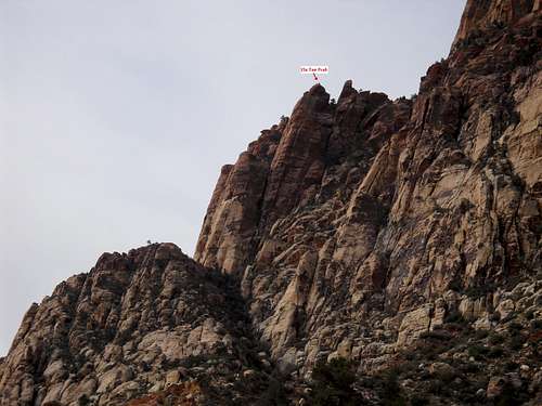
![Ela Tan Peak]() Ela Tan Pk
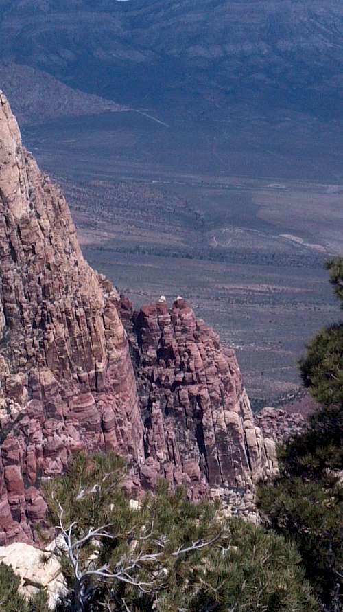
Ela Tan Pk This peak is hidden away in front of Mt Wilson, but the climb is more challenging than the main peak due to the technical nature of the East face cliffs. The route was discovered in 2013 by Richard, Eva and Steve and named for Richard by spelling his surname in reverse. This is one of those “Wow” peaks where I start worrying about getting back down almost as soon as reaching the summit. However, you will find most of the technical sections are actually a bit easier on the down climb fortunately.
![Excitment]() Don't stumble
Don't stumble The hike is slightly more than 5 miles roundtrip gaining some 2,300’ vertical due to several losses in elevation along the way. It can be climbed in approximately 5 hours roundtrip if there are not many in your group
![View from Oak Creek]() View from Oak Creek
View from Oak CreekGetting There
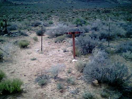
![Trailhead]() trailhead marker
trailhead markerFrom Charleston Blvd and the 215 Beltway in the western part of Las Vegas, take Charleston Blvd. (Highway 159) west for about 5 miles to the entrance to Red Rock Canyon NCA. Do not enter here…continue on Hwy 159 another couple of miles past the exit from Red Rock loop and then go another 1 3/4 miles. This trailhead (see photo) is not officially recognized and one must duck under the barb wire fencing near a metal post resembling an arrow. (It is located after you pass the formal trailhead for Oak Creek and before you reach the formal trailhead for First Creek.)
Route
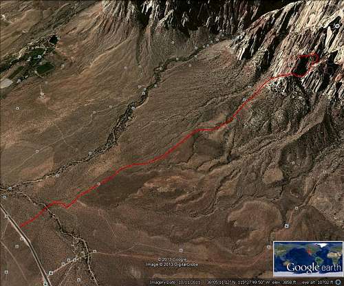
![Google Earth route trace]() Google route
Google routeAs you start hiking west across the desert, you soon encounter an old jeep trail which takes you most of the way to the base of Mt Wilson. You are heading toward a pinnacle approximately below and in front of the south summit. Below is a DeLorme topo(Note that there is a trail above the track labeled 1st Creek that is not correct...the First Creek trail is labled First Creek Spring on this topo!!)
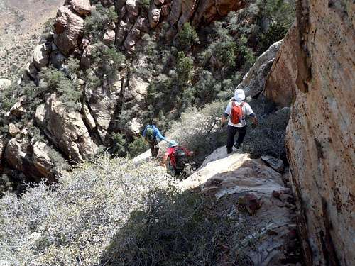
After the Jeep trail fades, there are a multitude of cairns marking the route so you will quickly know if you are not following it.
![Topo approximate route]() topo
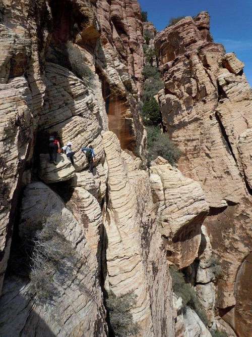
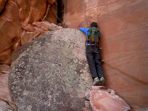
topo Attached is a Google earth trace of most of the route which may aid in giving you an very general overview. The crux for most climbers will be near the summit where several 2 x 4s have been placed in a crack to get you up to a mantle move to gain the first ledge in a 3-part climb. (see photo) There is also some cable at this spot to aid the climb.
![Crux move]() crux
crux![crux move downclimb (photo by Laszlo)]() crux downclimb
crux downclimb![Final summit climb (photo by Laszlo)]() summit climb
summit climbRed Tape
National Park entrance fees apply in Red Rock National Conservation area. Hours of operations vary by season. See
Red Rock NCA Home Page
When to Climb
![View from Indecision Pk]() View from Indecision Pk
View from Indecision Pk![Heading back down]() Heading back down
Heading back downSpring and Fall are the peak seasons as it becomes extremely hot in the summer. Winter can be an excellent time as well unless snow and ice accumulate from winter storms making the scrambling too hazardous. This is most likely to occur in January and February.
Camping
There is a campground located south of SR159 two miles east of the entrance to RRCNCA. There is no developed campground within Red Rock NCA, although backcountry camping with a permit is allowed.


 crux downclimb
 summit climb