
-
 5849 Hits
-
 82.95% Score
-
 16 Votes
|
|
Mountain/Rock |
|---|---|
|
|
36.08704°N / 115.48071°W |
|
|
Scrambling |
|
|
Spring, Fall, Winter |
|
|
6820 ft / 2079 m |
|
|
Overview
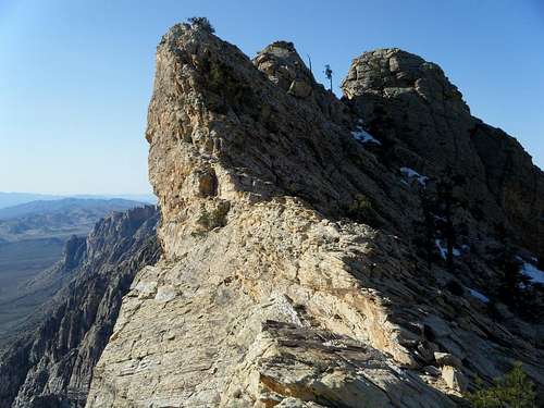
Mt.Wilson (South Summit)
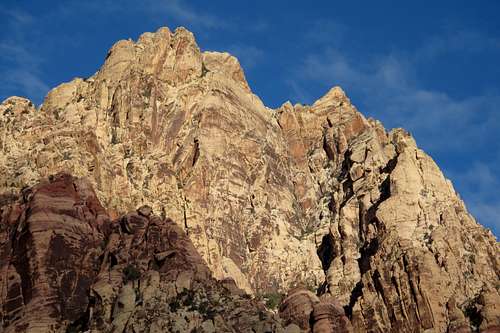
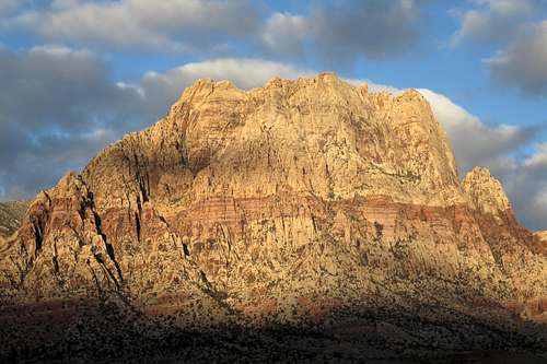
The highest sandstone peak in Red Rock Canyon National Conservation Area, Mount Wilson is a complex formation that has several subpeaks with local/unofficial names, and each has its own summit register. Some of them, such as White Rock Pinnacle, Dead Horse Point, and Ela Tan Point, are more distinct "features" than they are true subpeaks; they do not stand out prominently on their own. On the other hand, there is Cactus Flower Tower, which "grows" out of the northeastern corner of Wilson but which is separated from the main mass by a deep notch that makes the peak far more distinctive than the aforementioned features. Moreover, there is no simple way between the two peaks; to climb both in a day requires descending into a canyon bottom after climbing one peak and then taking a different route to climb the other.
Finally, there is South Wilson, sometimes called the South Summit (or Peak) of Mt. Wilson. Although it lacks the minimum 300' prominence used in many places to delineate a separate "ranked" peak, it does have a few things going for it to justify considering it as its own summit:
- First, the fact that it has a separate name.
- Second, the fact that with the exception of one pretty obscure route (going to South Wilson and then Wilson from White Rock Pinnacle and Dead Horse Point), no established scrambling route on Wilson traverses South Wilson as well.
- A summit distinct enough in form and distance from the main one to be seen as its own entity rather than a false summit or a mere bump on a ridge.
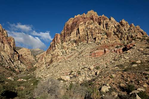
Mt. Wilson and First Creek Canyon
Were it a ranked peak, South Wilson would be the fifth-highest sandstone peak in RRCNCA, behind Mount Wilson, North Peak, Bridge Mountain, and Rainbow Wall.
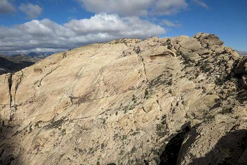
Something else that makes South Wilson worth it is that it has twin summits, virtually the same in height (the northernmost of the pair seems to be slightly higher and also houses the summit register), and each is smaller, more exposed, and harder to climb (Class 3-4) than the summit block of the main peak is (easy Class 3, maybe actually just 2+).
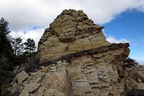 South Wilson Summit Block | 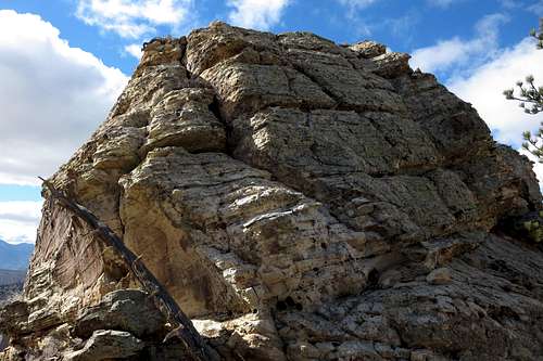 Lower Twin Summit Block | 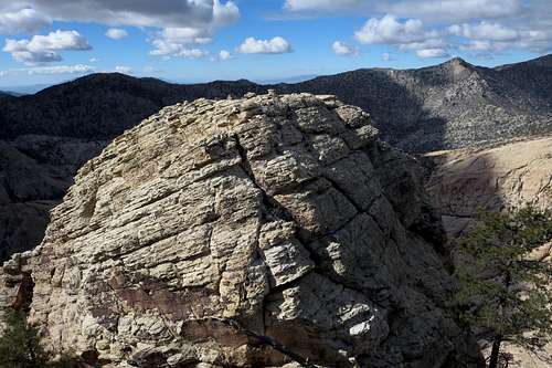 Lower Twin from Higher Twin |
While South Wilson is probably best paired with Mt. Wilson, especially if one can arrange for a vehicle shuttle (or plan on a long loop) so that one can experience different routes and both Oak Creek and First Creek Canyons, it makes a fine destination of its own. Although, probably due to the lengths of its routes, Wilson's summit is not exactly a "busy" one, anyone craving solitude is far more likely to find it on South Wilson; from checking out the register, I surmised that the summit sees on average one to two parties per month in the colder months and perhaps twice that in the spring and fall months. It probably sees few or no ascents during the summer; the routes are just too long and too exposed for most to want to take on in the scorching summer heat out here.
South Wilson
Getting There
Where you park depends on the route you want to use.
Take Charleston Boulevard (SR 159) west through Summerlin. After the development abruptly ends and the desert begins, drive a few miles to the well-marked entrance to the Scenic Drive. If you are using one of the routes via Oak Creek Canyon, you can turn off here and drive the one-way road for about 12 of its 13 miles to the trailhead for Oak Creek Canyon. This involves paying a fee at the entrance station; curves, hills, cyclists, and slow drivers will be factors as well.
The exit from the Scenic Drive is about three miles farther along 159. You can avoid the fee and the one-way loop drive by parking at the unmarked but easily seen trailhead for North Oak Creek Trail located along SR 159 a short distance west of the loop drive's exit. This, of course, adds some hiking distance each way-- 0.9 mi.
Hiking in from the signed Oak Creek Canyon TH off 159, which reaches the canyon via South Oak Creek Trail and the Chinle Trail, adds 1.5 mi each way-- definitely not recommended unless the other TH off 159 is closed for some reason.
If you are using one of the routes from First Creek Canyon, which makes far more sense if Wilson is your sole objective or if you are doing a loop, continue on just about a mile along 159 and find the roadside trailhead for that canyon. This, too, involves no fees.
View from First Creek TH
Routes
Several different scrambling routes approach the summit of South Wilson. All involve at least Class 3 scrambling, though most feature some Class 4. All require off-trail travel as well; some of them have cairns along much of them, but since cairns sometimes get destroyed by human or non-human forces and since cairned routes sometimes "go dark" in places that might befuddle first-time route users, you should not undertake any of these routes without decent route-finding skills and plenty of daylight to work with in case you get off-route.
Following is an overview of some routes that will approach the summit. Ones in bold are attached to this page as route descriptions. Note that all but one of those attachments deal with getting to the summit of Mt. Wilson, not South Wilson. The traverse between the summits will take 30-60 minutes for most people and does not have to be harder than Class 3. From Wilson, South Wilson is very easy to see, as is the way between them.
To Wilson from South Wilson
- First Creek Canyon-- the standard route on Wilson and probably the longest; Class 3.
- Hidden Bowl-- an offshoot from First Creek Canyon; shorter but more challenging, it goes at Class 4.
- White Rock Pinnacle and Dead Horse Point-- I've never done this route but once saw some cairns seeming to point in the general direction from near Dead Horse Point; I would go expecting Class 4. There definitely is Class 4, even 5.4 if you don't use a fixed line or if it isn't there, on the way to White Rock Pinnacle; this I know fom having climbed that peak and Dead Horse Point before. This is probably the shortest route to South Wilson but the most obscure of those listed here.
- Oak Creek Canyon-- very scenic and a little shorter than First Creek Canyon; Class 4.
- Cleaver Crack-- an offshoot from Oak Creek Canyon; shorter but harder, it goes at Class 4, and many descending this route choose to do a rappel in one spot.
Red Tape
Scenic Drive--
There is a daily entrance fee of $7 per vehicle (2013). Annual and interagency passes are available (the Interagency Pass, AKA the America the Beautiful Pass, grants access to all federal fee areas for a year).
Hours the Scenic Drive is open:13-Mile Scenic Drive
Note: these hours are subject to change. To be safe and sure, contact the park before visiting.
Hours the Scenic Drive is open:13-Mile Scenic Drive
| November through February | 6 a.m. to 5 p.m. |
| March | 6 a.m. to 7 p.m. |
| April through September | 6 a.m. to 8 p.m. |
| October | 6 a.m. to 7 p.m. |
Note: these hours are subject to change. To be safe and sure, contact the park before visiting.
The BLM (the agency that manages this area) allows dogs in the backcountry. Please keep them leashed and pick up their feces.
When to Climb
Spring and fall are the best. Winter is not bad, but temperatures can be cold and the canyons can be icy. Summer ascents are not advisable because even with a predawn start, you are likely to be caught in the scorching heat during the return. The canyons can offer shade and running water, but the exposed sandstone is like an oven.