
|
|
Mountain/Rock |
|---|---|
|
|
46.32789°N / 123.55099°W |
|
|
Wahkiakum |
|
|
Hiking |
|
|
Spring, Summer, Fall, Winter |
|
|
1505 ft / 459 m |
|
|
Overview
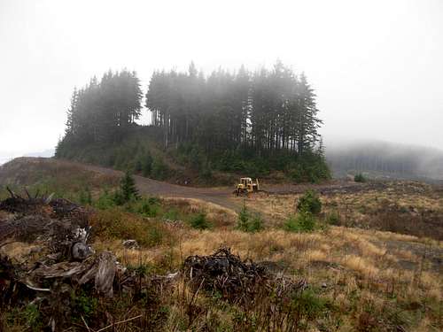
Elk Mountain is a low-elevation peak located within Wahkiakum County, Washington. Elk Mountain is most commonly known for three things: logging, quarry activity, and hunting. However, some peakbaggers know Elk Mountain for another reason: With a clean prominence of 825', the peak is officially recognized as the county's greatest prominence point (CoGPP). So despite being heavily logged and not aesthetically-pleasing to look at or explore, the mountain does provide a worthy reason to summit for some peakbaggers. Clouds Cover Elk Mountain's Summit Above Heavily Logged Areas
The mountain can be summited any season during the year. The low elevation and close proximity to the Pacific Ocean help make the area snow-free even during heavy snow Winters elsewhere in Washington and nearby Oregon.
 At One Possible Summit Candidate...
There are three 40-foot closed-contours located on the mountaintop that are summit candidates. Maps show the southwest contour as the highpoint, althought the middle contour might actually be higher. The northeastern-most contour is a minor logged bump appears to be clearly lower than at least than the middle contour (which is located nearby). The middle contour is been exposed to some logging and quarry activity which has cut out and cut down swaths of land. The highest point of that middle contour is still present, and until/unless that highpoint is eliminated then each closed-contour (southwest, middle, northeast) should be visited to claim a successful summit.
 Looking Southwest At Middle Contour
Getting There
FROM SKAMOKAWA, WA:1) Head north along Highway 4.
2) After approximately six miles, a pass is encountered. There is an emergency telephone on the right (north) side of the highway and a sign that reads "Km Mtn - ELEV 760".
3) Shortly after crossing over the pass, turn onto an unmarked logging road on the left (south) side of the highway. The logging road is initially paved, but eventually changes to gravel.
4) Within 0.5 miles, a gate is encountered. The gate is normally locked, but even if the gate is open public motorized access is not allowed.
There is a grassy parking area on the right side of the logging road just prior to the gate. Park there, walk by the gate, and begin hiking and/or biking along the forest road, "200 Road".
5) Follow "200 Road" southward for approximately three miles, until heading down to a saddle marked on maps as Point 1005. Continue straight (west), in the direction towards Elk Mountain.
6) Shortly after the saddle, the road splits. Either route can lead to the top of Elk Mountain. The left road ("300 Road") is a slightly shorter route and provides quicker access to all three summit closed-contours. Head WSW along "300 Road" for ~1-1/2 miles and then head northward onto "400/310 Road" towards the summit areas.
NOTE: Some summiters might opt to go one route for the ascent and the other route for the descent.
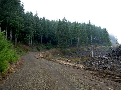 Following Logging Road Near Mountaintop
TOTAL ROUNDTRIP HIKING/BIKING DISTANCE: Approximately 14 miles.
Red Tape
Due to heavy logging activity, Elk Mountain is best visited during weekends while there is little-to-no commercial trucks or machinery operating.Elk Mountain and the surrounding areas are popular with hunters. Use extra caution if hiking or biking in the area during deer hunting or elk hunting seasons.
Although public access is granted, no motorized vehicles are allowed beyond the entrance gate near Highway 4. Violators will be prosecuted. Hiking and biking are allowed, but the local logging operations reserve the right to refuse public access at any time without notice.