Overview
In peakbagger rounds, Round Mountain is considered a
Napoleon*--a peak with small stature but big prominence. This is because the peak is not much taller than 5,000 ft high (not really a significant height in Washington) and yet boasts a prominence that is
8th-most in Washington (4,780+ ft to be specific). If the peak was a mere 220 feet higher, people from all around the country would come to climb this peak. There are those in the U.S. whose goal in life is to climb every peak in the contiguous U.S. with over 5,000 feet of prominence, of which there are 57 total (
see here). There are
an additional 64 peaks in Alaska with >5,000P and
five in Hawaii.
Round Mountain is the high-point of a range of mountains known unofficially as "Logger's Island." Logger's Island is defined by its borders. On its west is the Puget Sound lowland. On its south is the wide flat valley of the North Fork Stillaguamish River. On its east is the Sauk River valley. And on its north is the Skagit River valley. There are rocky peaks on Logger's Island but for the most part it is comprised of timbered knobs and clearcut ridges, drainages, and slopes. There's a reason it's called Logger's Island. The island itself is intersected by various deep drainages that create islands within the island. Because of this, there are actually four peaks on the Island with over 2,000 ft of prominence. These are Round (5320+ ft, 4780P), Big Gee (5080+ ft, 3120P), Silo Mountain (4150 ft, 2130P), and North Mountain (3840+ ft, 2200P). In addition, there are 12 others with over 1,000 ft of prominence.
The saddle by which Round Mountain's prominence is calculated (its "Noah's Saddle") is in and of itself a special case. The saddle is not defined by a low point in a long connecting ridge to a higher summit. Instead, the saddle is marked by the lowly 540-ft contour immediately west of the town of Darrington at the far east end of the North Fork Stillguamish River valley. One must travel down through this saddle then up to Whitehorse Mountain (6,852 ft) across the wide valley to locate the next-higher summit. Moreover, the lowly Noah's Saddle for Round has changed through the ages. Before the last Ice Age, the Sauk River flowing from south to north to Darrington used to make a hard turn left to continue its course westward down the current North Fork Stillaguamish River valley. The lower reaches of the Sauk (north of Darrington) that flowed to the Skagit would not have been the Sauk at all, but a different river. What happened in the last Ice Age is that a glacier occupying the lower Sauk and beyond created--either on advance or in recession--a berm of gravel and silt bedding at the SE corner of Logger's Island. When the glacier retreated up the lower Sauk, the resultant upper Sauk River flow was diverted northward to follow the glacier. From that point on, that little berm became Round's Noah's Saddle. It is likely the receding glacier acted as a dam and created a lake. This lake may have spilled over the little Noah's Saddle. This outflow would have only lasted as long as the glacier was able to dam the northward flow of the Sauk to the Skagit.
From a mountaineering standpoint, the mountain is not of interest. No one should expect to go there in search of inspiring rock walls. However, nearby
Mt. Higgins does offer steep, cliffy terrain for such purposes.
* the Napoleon term was coined by Jeff Howbert.
Getting There
The mountain is located near Darrington in the NE part of the North Cascades. The highway for approach is SR-530. One can approach from the North Cascades Highway (SR-20), turning left (south) at Rockport and continuing on to Darrington. Five miles west of Darrington on 530 is Swede Heaven Road. Turn right there. From the west, the most concise approach (there are others not worth mentioning here) is to take Exit 208 off of I-5. This is SR-530. Continue east on 530 to Arlington. Stop at the grocery store there if you need supplies as there are only convenience stores for the rest of the way. Drive 25 miles east from Arlington to Swede Heaven Road on the left. Turn there. For specific routes, see the route pages.
Red Tape
There is no red tape to be concerned with. Don't litter, don't mess up the environment...at least not as much as the loggers already do. Don't shoot your shotgun at signs, don't squeeze the Charmin.
When To Climb
Provided you could get close to the mountain, you can climb this peak year-round. In winter, low snowlines may mean you'll have to start farther down thus farther away from the summit. It is a snowshoe trip in winter conditions.
Camping
This is a day-climb kind of mountain. If you have to camp and can do without the utilities (this should be ALL of you), then you can car-camp just about anywhere on Logger's Island in the vicinity of the mountain. Simply find the most suitable spur. If you need more amenities, then there are more official campgrounds near Darrington. One is Squire Creek County Park about 2 miles east along SR-530 from the Swede Heaven Road turn-off.
Mountain Conditions
Localized Forecast
Darrington weather forecast
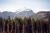
Views from the Mountain I
Views from the Mountain II