

-
 4664 Hits
-
 80.49% Score
-
 12 Votes
|
|
Route |
|---|---|
|
|
46.65013°N / 11.40824°E |
|
|
Trad Climbing |
|
|
Summer |
|
|
Half a day |
|
|
Overview
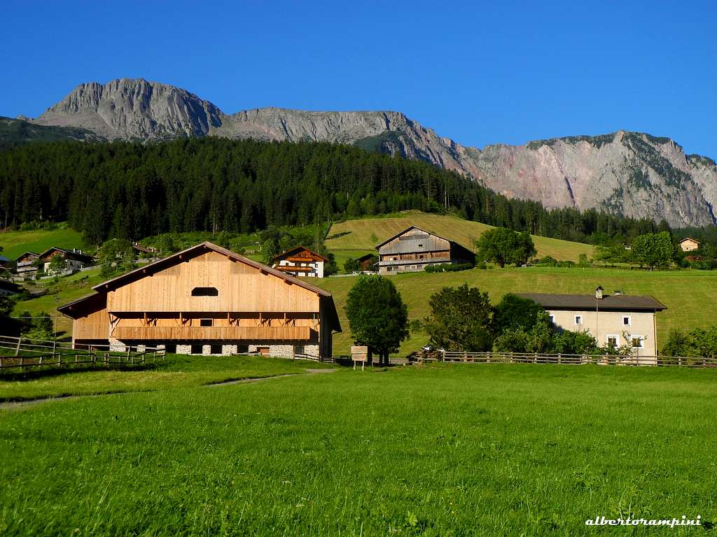
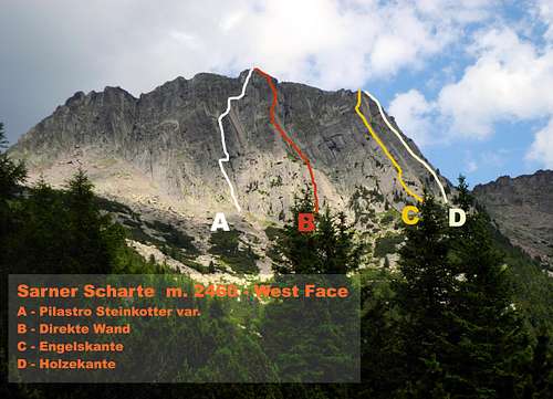
Located in the Sarentini range (Sarntal Alps), the Eastermost group of the Rhaetian Alps, the Sarner Scharte emerges with its solid volcanic rock from the perfect meadows of Val Sarentino, Sarntal in German, a fine Tyrolean valley. It's a mountain showing two conflicting and completely different sides: the large West face with its mighty ridges, smoothing slabs and wide corners dominates the village of Sarentino, the most important inhabited center in the valley. On the contrary the Sarner Scharte on the opposite side decreases with bucolic meadows, lowering Eastward and towards right to the wide saddle named Schartl, 2380 m.
The wide West Face of Sarner Scharte shows mighty ridges, smoothing slabs and great dihedrals of solid volcanic rock (Bozen Quarz-porphyry). It's a nice place for rock climbers, who can choice amongst different routes. One of the most profitable and interesting is Engelskante - meaning Angels Ridge - located on the right sector of the broad face. It's a pleasant climb completely recommended for the quality of the rock and the interesting climbing.
Getting There
The starting point to climb is the village of Sarentino.
Road access
- Road approach from Bolzano: from the Brennero Motorway exit Bolzano Sud, cross the town of Bolzano toward North (signposts Val Sarentino), then follow the SS 508 entering Val Sarentino, very narrow at its beginning, then wider, and getting to the village of Sarentino. Before the road bends to left to reach Sarentino, leave the main road turning right and taking the Riedlsberger Höfestraße, a narrow road rising for a long time (about 6 km.) between the meadows and the typical Tyrolean country - houses (“masi” in Italian). Follow th signposts “Sarner Scharte”, leading to a grassy parking close to Maso Riedlerhof and Hallerhof, at about 1510 m.
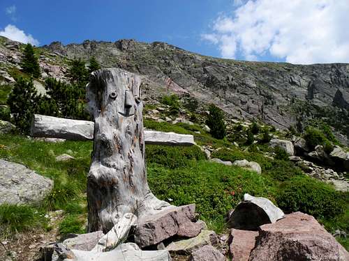 A wooden signal along the path to Sarner Scharte
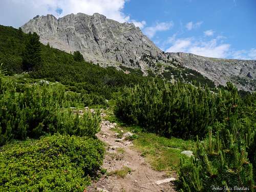 Sarner Scharte from the approach path
Route Description
Engelskante report - UIAA scale
Summit altitude: 2550 m
Difficulty: VI+ max (a couple of short moves) - UIAA scale
Climbing length: 270 m
Equipment: pegs and bolts
Exposure: South West
Starting point: Parking lot near Maso Riedlerhof
Fine route on porphyry rock of good quality, pleasant and fun, in a setting of great beauty. Some technical steps in the first pitch - avoidable along the ridge on the left - and in the fourth length.
Approach
From Riedlerhof m. 1510 follow the path n. 3 starting from the parking lot, rising amongst beautiful meadows, skirting a small lake and leading in 15 minutes to Almschank Tengler 1628 m. Here the path enters the beautiful shady forest, reaching a junction after about 45 minutes (crucifix). Follow the left path leading to the base of West wall(the right path leads to the summit of the mountain), rising steeply and reaching a wooden shrine (climbing topo inside the shrine) just below the West face. Just behind the wooden shrine it starts a track leading to the starting point of the routes Engelskante and Holzerkante. Up some rocky steps behind the shrine, then follow a trail not always clear that climbs up through the vegetation, reaching the base of a sloping edge (start of Engelskante). Continue to rise along the grassy gully, then traverse to the right below the rock reaching the base of a steep, reddish slab (visible old bolts). Traverse further to the right for about 50 meters to reach the upper part of a steep grassy gully, flanked on the left by a clear edge. Just below it starts a sloping slab with an old bolt in the middle, the starting of Holzerkante (about 1,30 h. from the parking lot).
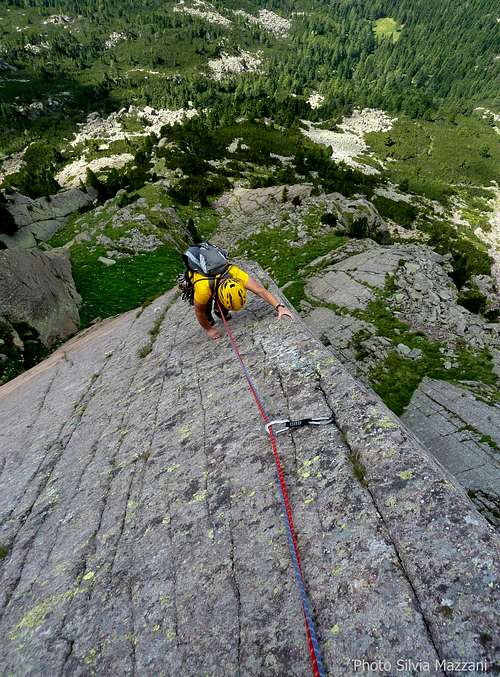 Engelskante slab
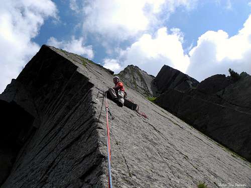 Airy belay on Engelskante (Angels Ridge)
L1 - Climb a steep wall to a small overhang, giving access to a smooth slab. Climb the slab slenting left to a ridge leading to a ledge with blocks. Climb a nice vertical crack, VI+, 50 m
L2 - Cross a grassy area to the base of a steep wall.
L3 - Slanting to the left to take the edge of the magnificent ridge to be climbed completely up to a belay on a characteristic wooden lath fixed to the smooth slab, V+, 40 m
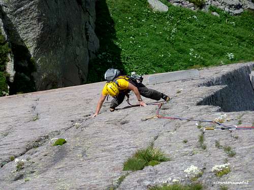
L4 - Climb the beautiful and smooth slab with technical climb, then the ridge with more holds, leading to a belay on a comfortable step, VI+, 35 m
L5 - With easier climbing reach a small fork, then climb a short wall to the belay at the base of the last stretch, III, 30 m
L6 - Follow the edge above on delicate rock at the beginning to exit the wall, IV 30 m
Reach the wood tabernacle and the bench at the end of the difficulties, then on grassy slopes skirting a fence up to the vast summit meadows, then to the summit cross.
Descent: follow the broad meadows in the East direction, then heading right reach the saddle (wooden bivouac) and here take the path n. 3 getting to a junction below the wall. Take the shortest path to the left that leads to the wooden crucifix and the parking lot.
Essential Gear
Normal climbing gear: ropes 2x55, helmet, 10 quickdraws
Red Tape
No fees no permits required
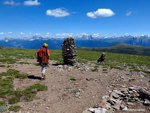 Sarner Scharte summit tableland
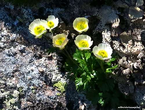 Glacier buttercups (Sarner Scharte)
Accomodation
Various possibilities in Sarentino
When to climb
Best season goes from June to October
Meteo
Meteo Provincia di Bolzano
Meteo Alto Adige
Guidebooks and maps

Guidebooks
- “Perfidi Porfidi” by Roberto Jacopelli - Pareti Edizioni
- “Dolomiti & dintorni” by Roberto Jacopelli – CIERRE edizioni
Maps - "TABACCO 040 Monti Sarentini – Sarntaler Alpen" 1:25000