
-
 9001 Hits
-
 89.39% Score
-
 29 Votes
|
|
Mountain/Rock |
|---|---|
|
|
46.65021°N / 11.40817°E |
|
|
Bolzano Alto-Adige |
|
|
Hiking, Mountaineering, Trad Climbing, Sport Climbing |
|
|
Summer, Fall |
|
|
8071 ft / 2460 m |
|
|
Overview
Sarner Scharte m. 2460
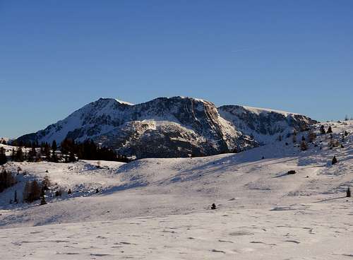
Sarner Scharte is a mighty mountain sprouting from the perfect combed meadows of Val Sarentino, Sarntal in German, and overlooking the village of Sarentino, the most important center of this beautiful Tyrolean valley and the greatest municipality of the whole autonomous district of Bolzano Alto Adige. The mountain is situated in the group named Monti Sarentini or Sarntal Alps, the Eastermost group of Rhaetian Alps. This singular mountain, whose ridge is extending from Totenrücken as far as the town of Bolzano, has two summits: the main one is the West summit (Westgipfel), towered by a high summit cross, while the minor one is the South-West summit. Sarner Scharte has also two different and contrasting sides: a large and difficult side facing West, showing towards the village of Sarentino mighty ridges, wide corners and smoothing slabs of solid volcanic rock (Bozen Quarz-porphyry), a true paradise for rock climbers, and on the contrary bucolic slopes of meadows in the opposite side, gently lowering towards East and towards Schartl, a wide saddle at the height of 2380 m.
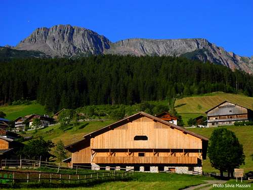
The West face is surrounded by a wide extent of woods and meadows, creating a surprising contrast. Hikers can follow a simple but absolutely satisfactory and magnificent hike starting from Maso Riedlerhof m. 1510 and getting to the mountain’s highest point at 2460 m., while mountaineers can choose amongst various routes to climb the attractive West face.
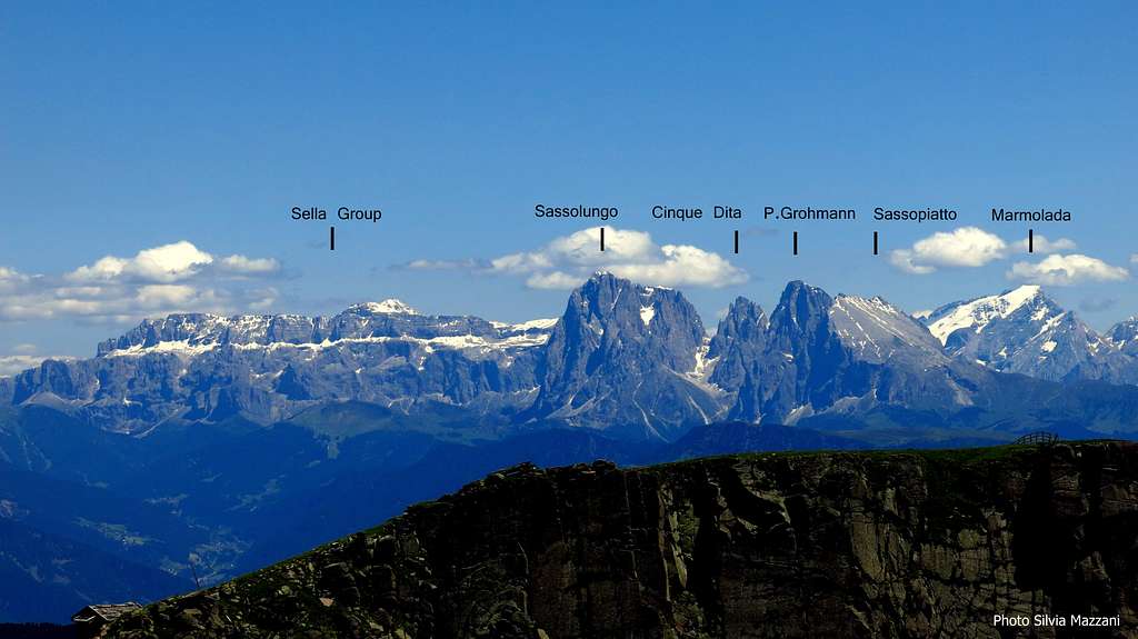
From the beautiful grazing ground of the summit both hikers and climbers can enjoy and unforgettable panorama: to the East the Dolomites – Catinaccio, Marmolada, Sassolungo, Sella – and to the West Val Sarentino, Ortles-Cevedale and Brenta Dolomites.
Getting There
Road access
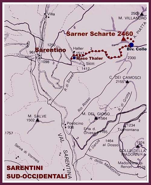
- Road approach from Bolzano: from the Brennero Motorway exit Bolzano Sud, cross the town of Bolzano toward North (signposts Val Sarentino), then follow the SS 508 entering Val Sarentino, very narrow at its beginning, then wider, and getting to the village of Sarentino. Before the road bends to left to reach Sarentino, leave the main road turning right and taking the Riedlsberger Höfestraße, a narrow road rising for a long time (about 6 km.) between the meadows and the typical Tyrolean country - houses (“masi” in Italian). Follow th signposts “Sarner Scharte”, leading to a grassy parking close to Maso Riedlerhof and Hallerhof, at about 1510 m


Approach to West Face
From Riedlerhof m. 1510 follow the path n. 3 starting from the parking lot, rising amongst beautiful meadows, skirting a small lake and leading in 15 minutes to Almschank Tengler 1628 m. Here the path enters the beautiful shady forest, rising to a junction after about 45 minutes. Follow the left trail (marked 3B, then 3A), rising steeply to the wooden shrine (climbing topo inside the shrine) below West face (1,30 h. from the parking)
Sarner Scharte West Face selected routes
Main climbing routes on Sarner Scharte West face (UIAA Scale)
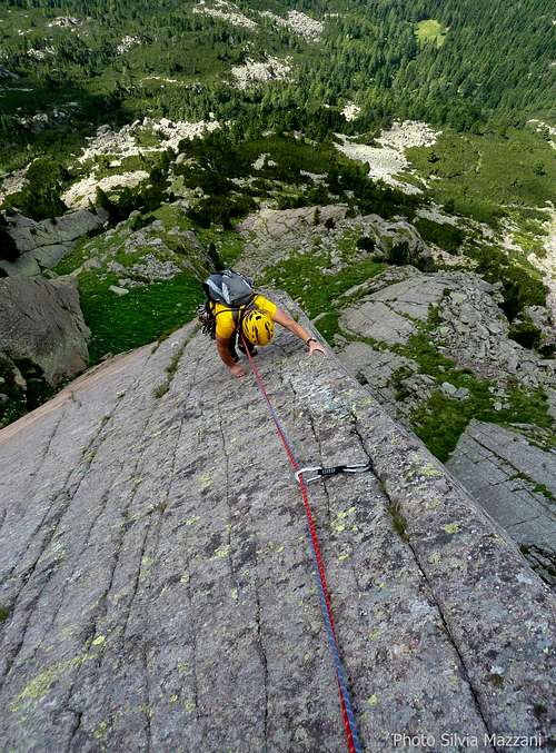
The wide and fine West Face of Sarner Scharte projects mighty ridges, smoothing slabs and great dihedrals of solid volcanic rock (Bozen Quarz-porphyry) towards the village of Sarentino. It's a nice place for rock climbers, who can choice amongst several routes.

A selection:
- Westgipfel Schöne Aussicht VI, A1 300 m. Ulrich and Toni Messner 1987
- Westgipfel Steinkötterpfeiler V, IV 300 m. Heinz Steinkötter 1970
- Westgipfel Sarner Verschneidung V 300 m.
- Westgipfel Direkte Westverschneidung V, IV 300 m. Heini Holzer 1968
- Direkte Wand V, VI, A0 300 m. Ulrich Messner and Co. 1995
- Engelskante (Angels Ridge) IV,V, VI 280 m. H.Holzer and H.Steinkötter 1970
- Holzerkante (Wood Ridge) III, IV, V- (a short move) 270 m.
")
Descent: following the Normal Route (path n. 3) across Schartle. Head eastward along the wide summit meadows, then traverse right getting the obvious saddle (Schartle, wooden bivouac) and here follow the path n. 3 getting to a junction below the wall. Here you can take both the trails to return to the parking lot: the left one is steeper and direct, the right one follows a wider ride.
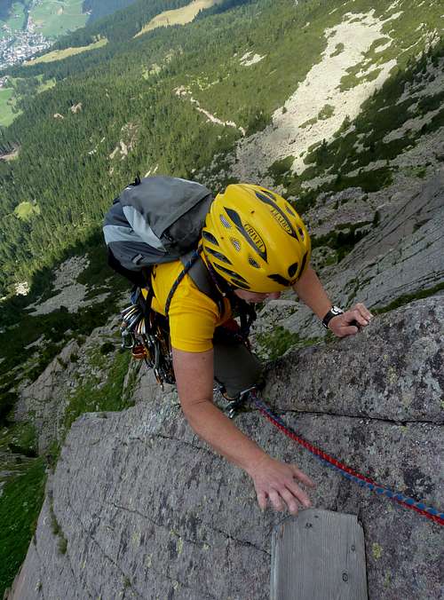
Engelskante, getting the wooden step belay |
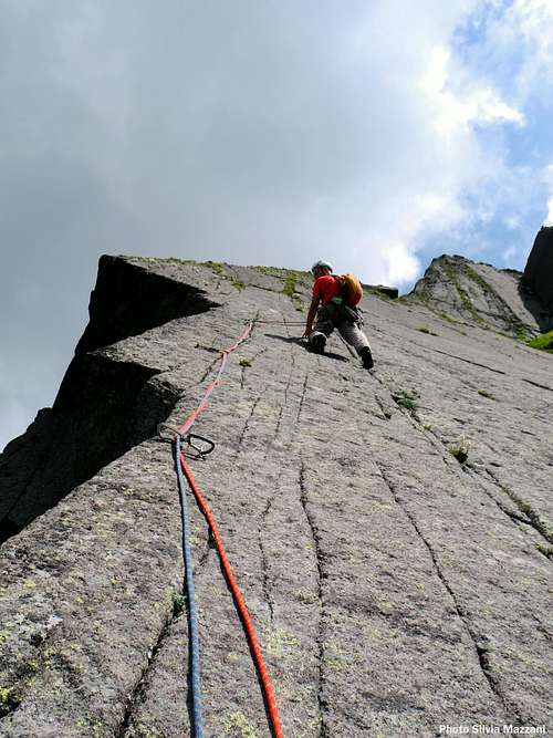
Engelskante, the crux slab |
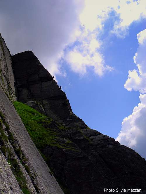
Climbers on Holzekante |
Sarner Scharte Normal Route from Riedlerhof
Sarner Scharte Normal Route
Difficulty: Easy Walk
Vertical gain: 950 m
Ascent time: about 2,30 hours
Total time: 4,30 hours


An amazing trail leading easily to the summit of Sarner Scharte.
From Riedlerhof m. 1510 follow the path n. 3 starting from the parking lot, rising amongst beautiful meadows, skirting a small lake and leading in 15 minutes to the Almschank Tengler 1628 m. Here the path enters the beautiful shady forest, rising to a junction after about 45 minutes. Follow the right trail, coming in a short time out of the forest, and developing on rocky terrain, steep but not difficult, to get to the Schartle, a wide saddle at 2380 m., where rises a small shelter. From here follow the steep but easy slope on the left, getting to the wide summit pastures – some big cairns – and to the high summit cross.
When to hike and climb
Best season goes from June to October
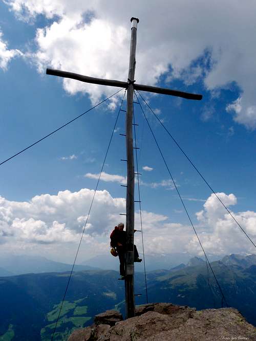
Sarner Scharte summit cross |
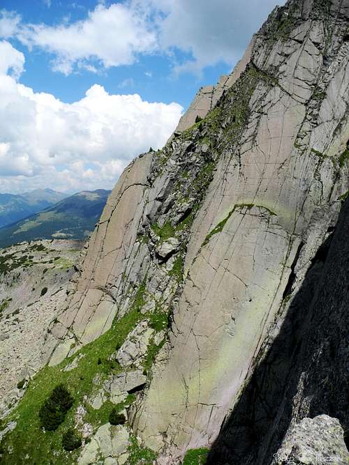
Sarner Scharte great central slab |
A slab on Engelskante |
Where to stay
Various possibilities in Sarentino - Touristic Info Tel +390471623091
Red Tape
There are not particulary restrictions in hiking and climbing.
Meteo
METEO BOLZANO ALTO ADIGE Adige
METEO ALTO ADIGE
Guidebooks and maps
Guidebooks

- “Perfidi Porfidi” by Roberto Jacopelli - Pareti Edizioni
- “Dolomiti & dintorni” by Roberto Jacopelli – CIERRE edizioni
Maps
- "TABACCO 040 Monti Sarentini – Sarntaler Alpen" 1:25000