

|
|
Mountain/Rock |
|---|---|
|
|
47.92140°N / 24.45016°E |
|
|
Hiking, Skiing |
|
|
Spring, Summer, Fall, Winter |
|
|
6421 ft / 1957 m |
|
|
Overview
|
||
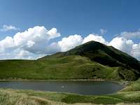
| The massif of Farcău-Mihailecu belongs in the series of the high lateral ridges that branch off the main ridge of the Marmarosh Mountains to run into the territory of Romania. Farcău at 1957m, formed of hard, dark basalt, is the highest summit of the Marmarosh Mountains. Mihailecu at 1918m, of white limestone, ranks fourth in elevation. Between them is Lake Vinderel – a little lake, nonetheless the largest of all in these mountains. The lake sits at 1684m, which means that the prominence of Mihailecu (a walk up from the lake to either summit takes less than half an hour) is over 230m. Farcău, with 620m of prominence, is the second most prominent summit in the Marmarosh Mountains. (The most prominent is Dosul Grebenului - a forest-clad mountain at less than 1600m, on the left bank of the River Vaser). The name Mykhailek is a diminutive form of Mykhailo (Michael in Ukrainian/Rusyn). The name of the highest peak is more of a mystery. Unlike the names of the other peaks in the area, it does not seem to have Slavic or Romanian roots. I suppose it was originally Far-kő, which means Rear Rock in Hungarian. Such a name would fit the location of the peak and it does appear (as Farko) on an Austrian map from the 19th century (2nd military survey of the Habsburg Empire). | ||
|
||
| There are three villages at the foot of the Farcău-Mihailecu massif: Repedea (Krivyi), once Oroszkő (Rusyn Rock in Hungarian) at about 500m, Poienile de sub Munte (also known as Poiana Ruscă (Rusyn Clearing) at 550m) and Luhei (Luhi) at 600m. They form a 'conurbation' along the Ruscova River. All the altitudes listed above translate to an elevation gain of about 1400m (and the total elevation gain for Farcău nearly 1700m if you hike over the summit of Mihailecu) on a route with a trailhead in the Ruscova Valley. You can have a perfect day hike doing a loop following the red and then blue stripes (or the other way round) starting or finishing at Repedea or Luhei. | ||
|
||
| The toponyms along the Ruscova River, including the very name of the river, betray the fact that Rusyn/Ruthenians, here also known as Hutsuls, or more recently Ukrainians have long lived here. And they still do, being an overwhelming majority in the villages. The male traditional occupations are breeding livestock and cutting timber, which results in most of the forest near the villages as well as nearly all of the dwarf mountain pine on the ridge having vanished, converted into meadows or clearings. | ||
|
Getting There, Routes, Map & Accommodation
To get to the trailhead - if you don't go by car - take a bus or taxi from Vişeu de Jos. In theory, a more convenient option is to get off at Leordina, at the mouth of the valley of the Ruscova, then hitchhike/catch a bus/minibus heading up the valley. But this may depend on luck more than getting off at Vişeu de Jos, which is a bigger village/a little town. Without a heavy backpack, you can get to Lake Vinderel in about 4 hours, having started either at Repedea (blue stripe) or Luhei (red stripe). Fortunately, good maps of the area can be studied online:
Online maps
Paper maps
- 1:65,000 by by Muntii Nostri
As you can see, there is also a network of unmarked paths but if you are not a local, you are likely to spend more time on them than expected. If you pick Luhei for your trailhead, take good care just after the start so as not to walk along the brook past the spot where the trail leaves it to climb up the slope.
 NE face of Farcău about two miles away.
Time (no heavy pack): 4.5-5h (way down 3.5-4h; up and back down: 8-9h)
Total Elevation Gain (including Mihailecu): 1,580m (Luhei start) to 1,680m (Repedea start)
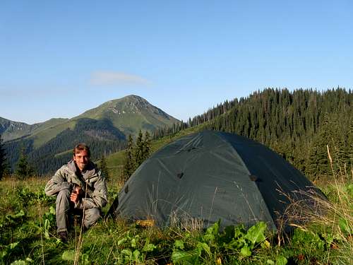
You can stay at one of the villages on the Ruscova River. But to many hikers a night somewhere up there can be more appealing. If you decide to stay by the lake, and you have come in summertime, you are not going to be alone – the lake is a waterhole for the cattle, sheep and horses – do not drink water from any lakes or puddles.
![Maramures seen from Chornohora]() Farcău top left, seen from the Chornohora - photo by Petro
Farcău top left, seen from the Chornohora - photo by Petro
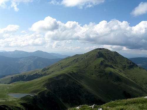
![Farcău-Mihailecu summits]() Farcău-Mihailecu from W
Farcău-Mihailecu from W
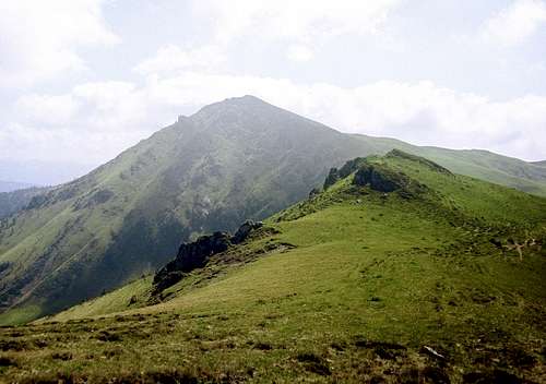
![Mica Mare (1815m)]() Towards the borderline
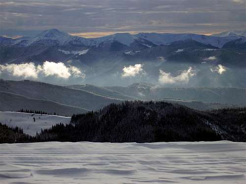
Despite the area being part of a nature park there is no red tape as long as you keep away from the Romania-Ukraine border. See the area page for more information. In winter and spring, the avalanche risk can be high.
Towards the borderline
Despite the area being part of a nature park there is no red tape as long as you keep away from the Romania-Ukraine border. See the area page for more information. In winter and spring, the avalanche risk can be high.
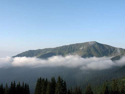
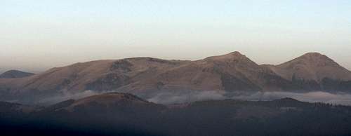
![Autumn panorama]() East face of Farcău-Mihailecu in October (seen from the border)
East face of Farcău-Mihailecu in October (seen from the border)
 Farcău Farcău |
 Lacul Vinderel Lacul Vinderel |
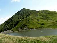 Mihailecu Mihailecu |
Red Tape & Hazards
 Farcău top left, seen from the Chornohora - photo by Petro
 Farcău-Mihailecu from W
 Towards the borderline
Select External Links
- Excellent photo TR
- Poienile de Sub Munte by Chicago Jews
 East face of Farcău-Mihailecu in October (seen from the border)