Page Type Page Type: Mountain/Rock
Location Lat/Lon: 50.81440°N / 115.35679°W
Additional Information Elevation: 8628 ft / 2630 m
Sign the Climber's Log

Overview

The Fist (2,630 metres) as...
Imposing from the Smith-Dorrien, Spray Lakes road this peak is shaped like a clenched Fist which easily explains how this mountain got its name. The east side looks to be an impossible scramble but if you venture around the back it can be done as a difficult scramble with some loose rock near the summit. The route for this summit is described well in Alan Kane’s Scrambles in the Canadian Rockies pages 108-109, which is a worthwhile purchase.

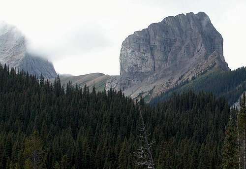
Excellent views of the surrounding area. Mount Shark (2,786 metres), Mount Smuts (2,938 metres), and Commonwealth peak (2,775 metres) among others.

Elevation gain 770 metres

Getting There

The Fist
Head out of Canmore on the Smith-Dorrien/Spray Lakes road past the Grassi Lakes and the Goat Creek day use parking. Continue on the unpaved Spray lakes road for about 38km. Turn right at the Mount Shark, Engadine Lodge road. Follow this road west for a about a kilometre over Smuts creek, turning left at the first chance onto an old logging road. You should park here. Don't leave items visible in the back of your car. While this area does not see a lot of traffic why tempt fate. Follow the logging road south for about 1/2 an hour. When the road dips towards a creek (called Commonwealth creek) turn right onto another logging road which becomes a trail which follows the right side of the creek. After an hour it opens up onto avalanche slopes and meadows that lead to the col between Mount Smuts and The Fist. Follow the drainage up the slope to the ridge. From here you will have to scramble up the left or right side of the outcrop or fin as it is described in the book. There is loose rock here so a helmet is recommended the rest of the way.

Red Tape

In the crux of the Fist...Looking down the route up the gully
No red tape. This is a day trip. 5-7 hours
Don't leave items visible in the back of your car. Why tempt fate.

Weather conditions and when To Climb

The Fist from the col between...The route is up the gully in the centre
Spray Lake Ranger Station. (403) 678-5533
Alberta Tourist Visitor Centre (403) 678-5277
The Alpine Club of Canada (403) 678-3200, ext 1
weather office or (403) 762-2088 for weather conditions

The summer months would be the most popular. June to end of September.

Camping

The finish of the crux in the...A portion of the route
There are campgrounds in the area if desired
Spray Lakes West Shore Campground has 50 sites (403) 591-7226
There is also the Alpine Club of Canada lodge with rooms and excellent facilities of 19$ CDN a night. The Alpine Club of Canada (403) 678-3200, ext 1

Engadine Lodge is a good base camp if you want some comfort at the end of the day.

Engadine Lodge
Box 40025 Canmore, Alberta T1W 3H9
Tel.: (403) 678-4080
Fax: 678-4020
E mail: lodge@mountengadine.com
Web address www.mountengadine.com

Alpine Club of Canada

Joining a club such as The Alpine Club of Canada is recommended when climbing in Canada. While it is not obligatory, useful information can be had at any of their Clubhouse in Canmore, or at their website which is open to everyone.

http://www.alpineclubofcanada.ca/

Staying at the club in Canmore is 18$ Canadian for members and a little more for non-members. It can get quite crowded in the summer so a reservation is recommended.


Children

Children

Children refers to the set of objects that logically fall under a given object. For example, the Aconcagua mountain page is a child of the 'Aconcagua Group' and the 'Seven Summits.' The Aconcagua mountain itself has many routes, photos, and trip reports as children.