
-
 2008 Hits
-
 74.92% Score
-
 5 Votes
|
|
Mountain/Rock |
|---|---|
|
|
38.60328°N / 78.3681°W |
|
|
Trad Climbing, Toprope |
|
|
Spring, Summer, Fall, Winter |
|
|
3398 ft / 1036 m |
|
|
Overview
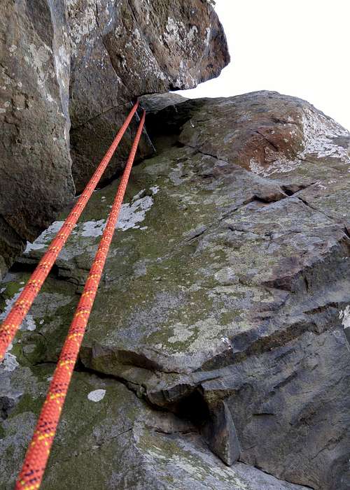
Sucking Crack (5.8)-- Crux
Named for a rock feature resembling a flatiron, this is the third climbing spot at Little Stony Man as one heads north-south, and it has two established trad routes, both moderates. One of those routes has two variations and the other has one, bringing the number of possible lines to six.
At up to 100', Little Stony Man offers the longest single-pitch routes in Shenandoah National Park and perhaps in all of Virginia.
The best resource for climbing here is this online PATC guide, but this page should cover you nonetheless.
Toproping here is a hassle because unless you know the area well, most routes are difficult to locate from the top, necessitating a lot of yelling back and forth with one's partner or extra trips up and down if one is solo; and because you will have to build a gear anchor, as the only trees are on the other side of the clifftop trail and you are not allowed to have ropes crossing the trail (nor should you want to).
Getting There
The Little Stony Man parking area is in the park’s Central District at MP 39 on Skyline Drive. If entering the park at the Front Royal or Thornton Gap entrance, drive south. If entering at Rockfish Gap or Swift Run Gap, drive north. Note that there is an entrance fee for Skyline Drive. In 2015, it was either $15 or $20.
To get directly to the base of the cliffs, hike on the AT to the junction with the Passamaquoddy Trail, which leads to a ledge offering a great view of the cliffs and then turns left to run directly beneath the cliffs.
Note-- Some boulders and outcrops near the northern end offer interesting bouldering and scrambling, and I have, in fact, done some bouldering there, but current management plans have made for the closure of this area to human activity.
One can also hike to the top of the cliffs instead and then follow The Chute down to the base, but it is much faster and easier to use the Passamaquoddy Trail. The Chute begins south of the open clifftop area.
Routes
The Flatiron area is an "amphitheater" between two buttresses; there is an obvious route up top. Near the bottom is a pillar, and above-right of the pillar is a triangular section of rock that is the spot's namesake.The two established trad routes here:
- Sucking Crack (5.8)-- Climb the pillar and then move left into a crack system leading to the roof. Pull the roof (crux) and then follow easier ground to the finish. The names denotes the apparent tendency of climbers to head too far up the crack under the roof, forcing a scary (bad hands and feet) 5.6 traverse right called Traverse of the Goddams because there is no pro and, as already noted, holds are not good. The direct start is up a dirty off-width, but there is an alternate to its left. I did this as a solo TR, had no trouble with the crux, and even thought I would have no trouble leading it even though I had not led 5.8 at the time, but take that with a proverbial grain of salt since I wasn't actually trusting my life to a piece on a crux move.
- Flatiron Right (5.7-)-- Climb the pillar and then go up and around the right side of the Flatiron and then up the corner. Again, take this with a grain of salt, but I thought the pro didn't look so great on this route and found myself thinking I'd rather lead the 5.8. Variation-- Flatiron Left (5.7 R) goes up the left side of the Flatiron, but the pro is bad.
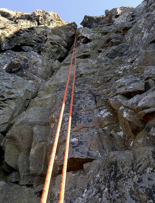 Sucking Crack (5.8) | 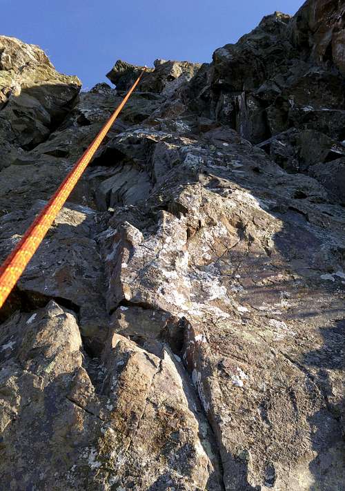 Flatiron Left and Right (5.7-) |
Red Tape
It costs $15 to enter the park, and that provides access for a week. Annual passes cost $30. The interagency pass, good for yearlong entry to areas managed by NPS, USDA Forest Service, USFWS, BLM, and the Bureau of Reclamation, costs $80.It’s common sense to wear a helmet when climbing, anyway, but it’s especially important here since people at the top might toss rocks over the edge.
There are plans to close a section 35 meters north of the Chute and all of the cliffs south of the Chute to human activity. Also, there are plans to use low-impact barriers to close off a boulder area at the north end where the Passamaquoddy Trail bends to approach the base of the cliffs. I do not know when these closures will go into effect; they did not seem to be in effect as of November 2010, the last time I was out here.
The park is open all year, but Skyline Drive does sometimes close after snow or ice storms. The park site does not give current road conditions, so call ahead (540-999-3500).
To reduce poaching, Skyline Drive is subject to closures during hunting season. The information below, copied and pasted from the park site, illustrates the 2006 restrictions—
From November 13, 2006, through January 6, 2007
Skyline Drive
•between Front Royal (Mile 0 at U.S. Highway 340) and Thornton Gap (Mile 31 at U.S. Highway 211), and
•between Swift Run Gap (Mile 65 at U.S. Highway 33) and Rockfish Gap (Mile 105 at U.S. Highway 250),
will be closed daily between 5:00 p.m. and 8:00 a.m.
The central portion of the Drive, between Thornton Gap and Swift Run Gap, will remain open for overnight access to Skyland Resort and Big Meadows Campground until those facilities close on November 26.
Then, beginning November 27, 2006, through January 6, 2007, the entire length of the Skyline Drive will be closed daily from 5:00 p.m. until 8:00 a.m.
When to Climb
All year. The cliffs face west and can make for decent climbing in winter when it isn't windy (which it usually is here). In the summer, finish climbing by solar noon or prepare to bake.Camping
The nearest campground is Big Meadows, about 14 miles south. The campground is usually open from early March through Thanksgiving weekend. Reservations are strongly advised. The lodges are seasonally open, with Skyland opening earlier than Big Meadows. For more comfort, consider staying at Skyland Lodge, about three miles south, or at Big Meadows lodge. See the External Links section for links to pertinent information.External Links
Official park siteCamping info
Lodging info