
Comments
No comments posted yet.
|
|
Trip Report |
|---|---|
|
|
32.63516°N / 16.94241°W |
|
|
Oct 13, 2020 |
|
|
Hiking |
|
|
Fall |
Have you ever heard of the island of Madeira?” Marie asked me.
“Yes.” I replied. “It’s in the middle of the Atlantic isn’t it?”
I knew that Madeira was supposed to have some mountains and a friend of mine had visited and walked some of the levadas – the water channels that bring water down from the mountains to the towns and villages in the valleys. He had enjoyed his visit.
“I went there a few years ago with my mother and sister.” Marie continued. “It was good, lovely and warm in the middle of winter. How about going there at New Year?”
Marie and I had met a few months before during the summer of 2004. She lived in Dublin and I lived in England so, as we had decided to spend Christmas visiting each other’s families, we needed a nice place to spend the New Year.
Madeira was chosen and we had a great time there. So much so that it became our “go to” destination for week long breaks over the next 6 years.
We had 5 visits and each time we explored unfamiliar routes and repeated old favourites. We enjoyed every trip but inevitably, we started to look elsewhere. Madeira became “one of our favourite places that we would return to someday.”
Since 2011, we hadn’t been back.
Like the rest of the world, the UK has been hit by the Coronavirus pandemic. Consequently, travel has been severely restricted and a lot of foreign travel has been almost impossible. On top of that, the rules have changed almost weekly. An area that would be ok one week might be off limits a few weeks later. By late September I had more or less given up hope of a trip abroad but Marie was always researching what was possible.
“We could go to Madeira.” She said one day. “They are allowing travel from the UK if you get tested… and are negative of course!”
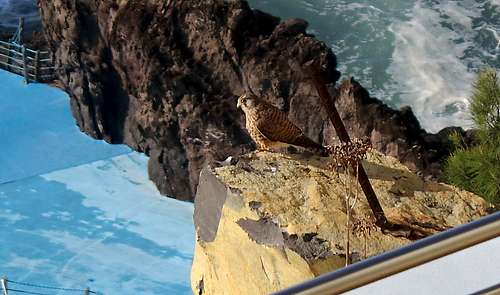
A week later we had left the cool, dampness of Autumn in the UK and landed in the balmy, warmth of Madeira. We were tested at the airport, an efficient and quick operation – the worst bit being the test itself – and delivered to our hotel room to isolate while we awaited our results. Sitting on our balcony in the sunshine, Marie noticed something we did not remember seeing before.
“I think that’s a Kestrel.” Marie pointed at a bird swooping and gliding in front of our cliff top balcony. The bird was constantly making a “chip…chip…chip” sound as it put on its display. It soared up to our level and paused to look at us for effect, as if to say…
“That’s right, it’s me!”
“I don’t remember seeing Kestrels before.” I said, “How did we miss them?”
I ggogled them, sure enough, the Canarian Kestrel (Falco tinnunculus canariensis) is very common on Madeira.
In the evening, we got our test results, both negative. We could start our holiday.
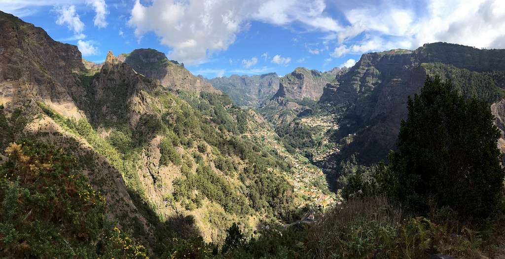
Although we have explored routes all over the island, we have our favourite areas that we naturally gravitate towards and we decided that we would like to re-visit some of these to see what changes the previous 9 years had bought.
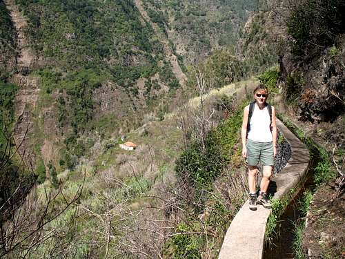
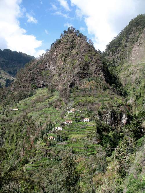
The Levada dos Piornais flows down from the Socorridos valley towards the coast at the western end of Funchal, the island’s capital. We have always stayed around the Lido area of Funchal where there are lots of tourist hotels, bus routes and this Levada walk is easily accessible.
On our first trip in 2004, this was the first outing we had on the first day. So, we really wanted to repeat it. We had already noticed how the volume of traffic had increased on the roads and also, there seemed to more local residents to make up for the lower number of tourists.
We had remembered this levada as being on a hillside above most of the town buildings with small farm buildings and open views. Now, the residential area has grown up the hillside, obscuring some of the views, the big cars and bars at the windows of the houses suggests this is a moneyed area.
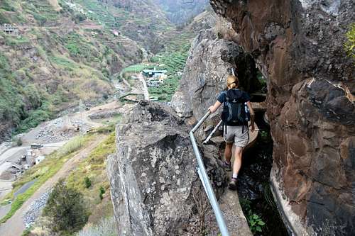
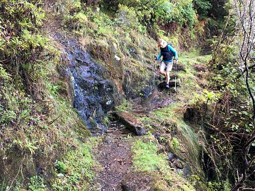
Soon, we were skirting the first of the banana plantations. The levada is a narrow concrete path that runs about 2 meters above the roots of the banana trees, often with no safety rail, leaving us level with the huge leaves and fruit.
We traversed around a small valley lined with banana plantations and villas. There are a lot more barking dogs than I remember from before. None of them looked friendly but they were all secure behind gates and fences.
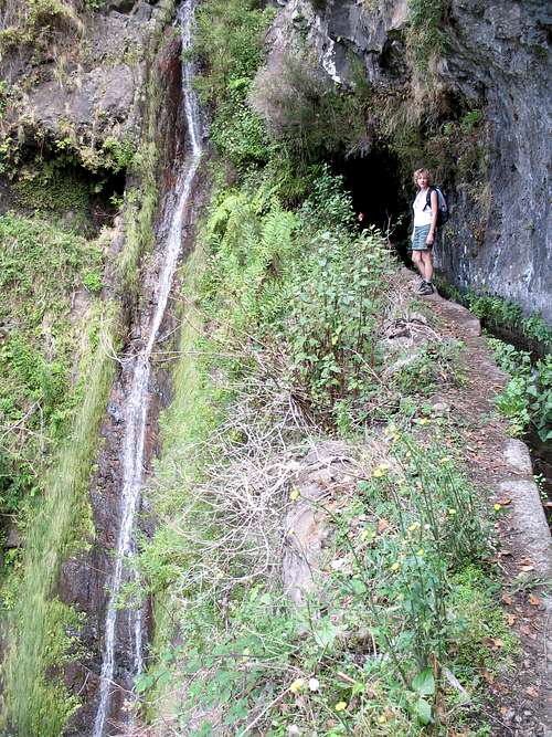
The levada turns northwards and takes an improbable route as it traverses the cliffsides above the valley, passing through small tunnels hewn in the rock face. Most people will need to duck here to get through but the tunnels aren’t long enough to warrant a head torch. There are handrails to ease any fears and in order to avoid the tunnels, it’s possible to descend on a path below the levada which of course, has to be re-ascended later. On a previous visit in 2008, the handrails here had been damaged but now they were all intact. Also, I was surprised to see bolts and a hanger on a rockface, signifying a sport rock climb, that was definitely new to me.
(After an internet search, this appears to be called “Multi pitch dos Amigos”, graded at 5.10 and is a mixture of traditional and bolted pitches!)
All too soon, this part of the levada is passed and we reached a flight of steps cross the path, heading upwards to Pinheiro das Voltas.
It’s possible to continue along the Levada dos Piornais for a while until it becomes too dangerous and you would have to return. We did that in 2004 but this time we went straight up to the town, then followed the road upwards again to reach the Levada do Curral.
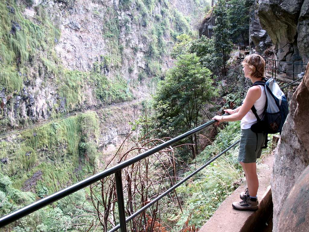
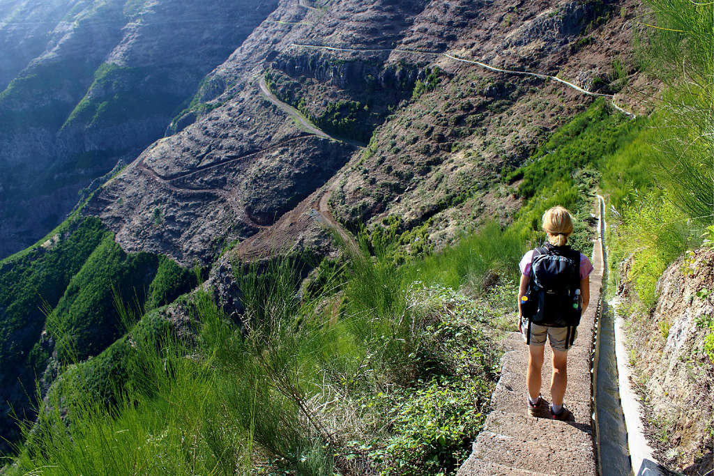
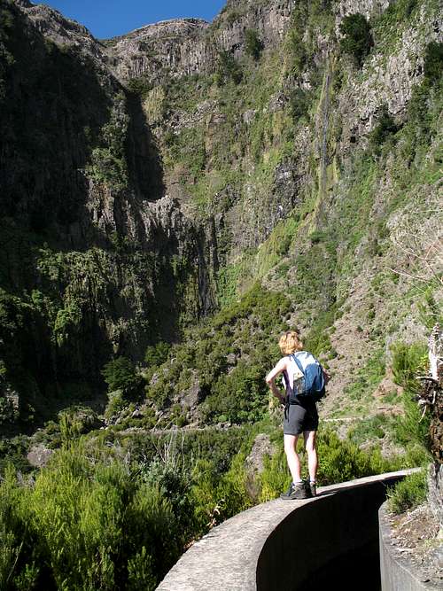
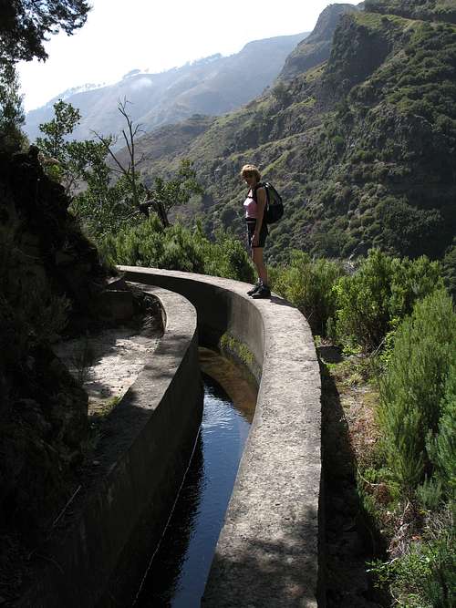
Again, we skirted some farms and plantations before emerging on a steep hillside above the Socorridos valley covered with Eucalyptus trees and dripping vegetation on the cliffs above us. The valley dropped away approximately 150m beneath us but the levada was protected by railings.
Ahead of us, we could see the semi buried hamlet of Faja, deserted after a landslide occurred many years ago. On our first visit in 2004, we turned around where the guidebook advised (there used to be a sign advising you to do so but this has been destroyed) to return to Pinheiro das Voltas for the bus back to Funchal.
When we did this route in March 2008, we were surprised to find that some of the handrails had been destroyed by landslides but in order to carry out repairs, the workmen had cleared a lot of the vegetation and for the first time we managed to continue along the levada all the way up to the abandoned buildings of Faja.
Vegetation hung from the steep cliffs above us and constantly dripped water. Marie found an abandoned umbrella to keep us a little drier than we might have been whilst we negotiated this precipitous path.
We knew that in theory, we could carry on all the way up to the town of Curral das Freiras but the afternoon was moving on and we thought it was too late to attempt it especially as most of our guide books advised against it due to the dangerous nature of the route.
|
|
We returned to Madeira in September 2008, on the first good weather day we caught a bus to Pinheiro das Voltas first thing in the morning and started from there. We soon reached Faja again and although, a lot of the route was not protected by handrails and we had no umbrella to keep us dry, we carried on all the way up to Curral das Freiras. It felt adventurous at the time but was not really a very spectacular route once we had passed above Faja. Having said that, it was a nice tick in our books!
This year, in 2020, it was clear that the vegetation had taken over the route again and after we had both got caught up on thorns on the tendrils of brambles, we decided to turn around again before we reached Faja and get the bus back from Pinheiro das Voltas.
We have a number of routes we like in this area and a few we wanted to do for the first time. One of these was a route from the town of Corticeiras over the Boca dos Namorados (Lovers pass) and down to the town of Curral das Freiras.
The bus driver stopped and called out “Corticeiras” when it was time for us to get off the bus – just as well as none of the villages had any road signs. A walkers sign for the Boca dos Namorados sent us along the correct road, we managed to take a road not marked on our map incorrectly and returned (after asking a passer by the way) and found our path opposite the Quinta Mis Muchachos to the Eucalyptus forest.
We continued upwards on an easy to follow path before crossing a road to a viewpoint at the Lovers pass that looked down on Curral das Freiras from 1060m.
After admiring the view, we started the descent through more Eucalyptus trees and wild Hydrangea and Agapanthus plants. The views of the Curral valley were spectacular in the sunshine and hillsides around Pico Areiro to the east were all clear of clouds.
We passed over Pico do Cedro, a rocky spur and found somewhere to sit for a bite to eat. It was lovely to be there but it was clear that we had already completed most of the walking as we had now just to descend to the town. This turned out to be a longer descent that I had realised, dropping down to about 300m. Then, we had to reascend another 300m in the hot, afternoon sun to reach our bus stop and take a detour to a café for some Chestnut cake and a coke.
Next day, we had skipped our hotel breakfast in order to be at the bus stop in the dark for the 8:10 am bus up to Corrida. Again, the bus driver helped us out by telling us where to change for the connecting bus, our stop was the end of the line and by then we were the only passengers left.
It was cool in the shade at 1200m but we had a steep uphill road to climb which warmed us up. The roadside was lined again by Eucalyptus trees, Agapanthus and flowering pink lilies.
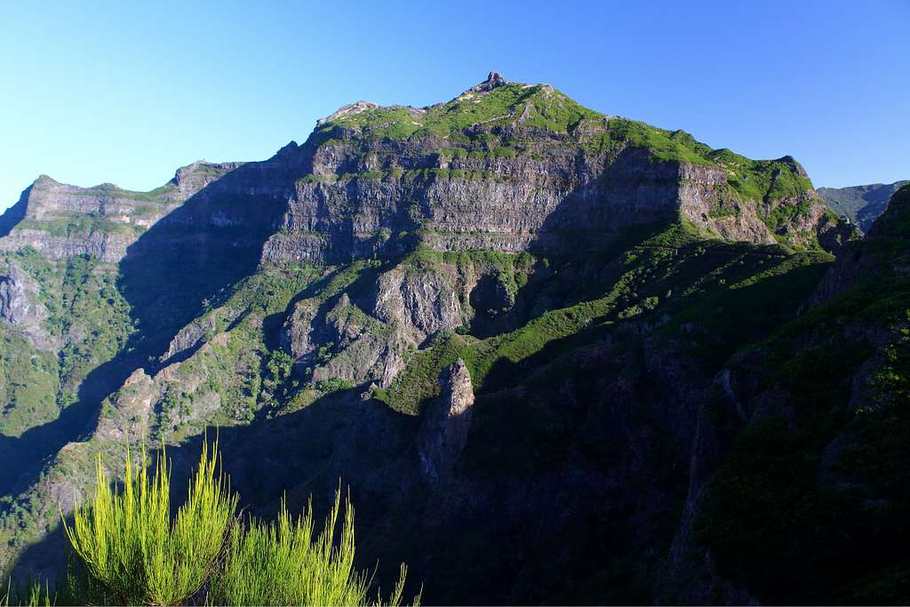
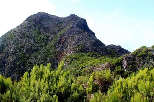
We reached the Boca da Corrida (1235m) at 9:30 am, we were the only walkers there and it was a crystal clear morning. We had fantastic views over to Pico Areiro and Pico Ruivo and in our foreground, Pico Grande looked inviting.
We had decided to descend to the Encumeada pass to catch the 15:55 bus but as we admired the views in the lovely sunshine, I wondered if we could take in Pico Grande on the way?
Back in 2007, we had climbed this peak and descended to Curral das Freiras but we had already decided not to do this as it was Saturday, the bus timetable was different and we would have a long wait for the bus.
“Perhaps we could do it and still descend to Encumeada?” I wondered as we sat in the sun at Boca do Cerro.
I knew as I said it that there wasn’t time and reluctantly, we descended westwards towards Encumeada. The route descended beneath the cliffs and was sodden with the water runoff from higher up.
This was another route we had previously done in 2006 and we had stopped for lunch on a rocky promontory. I looked for it as we descended but maybe the route has changed as I never saw it.
The route descended into eucalyptus trees and as the afternoon wore on, clouds filled the sky. We reached Encumeada at about 15:15pm and spent some time having a beer and toastie in the bar.
“Can we pay the bill, we need to get the bus.” Marie said to the owner.
“There are no buses up here now.” He replied. “Not since March, they just stopped. I can ring for a taxi from Ribeira Brava but it will cost you about 30 euro!”
We couldn’t believe it, why this bus? Also, we had wanted to use it for another route later in the trip. Obviously, that would not be possible.
Eventually, we got a taxi from the Encumeada hotel down to Riberia Brava for 28 euros. We picked up a bus to Funchal and then another back to our hotel, a long and expensive day.
Several days had passed. A storm had blown through and the weather had been both better and worse than the forecasters had predicted. We had hired a car as we worried that more buses may not be running and we left Funchal in good weather and headed for the Encumeada pass again. The pass is on a ridge running east to west and this forms the weather dividing line between the sunny south and the cloudy, wet north of the island. We wanted to explore the path on this ridge.
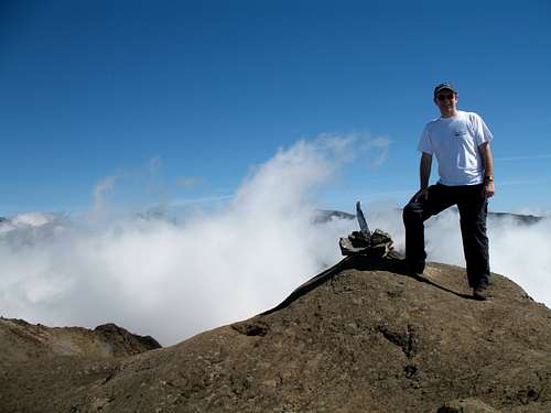
Encumeada was very windy, with clouds being torn by the craggy ridge which runs eastwards all the way to Pico Ruivo at 1862m, the highpoint of the island, so we gave up on our walk.
We decided instead to drive over the Paul da Serra and set off up the road. We made it a few hundred meters to the first tunnel where a barrier blocked the way, the road was closed.
We tried descending to the coast to find another route but after being stopped by another closed road, we gave up.
Next day we returned to Encumeada. Again, it had been fine in Funchal but if anything, the weather at Encumeada was worse than before.
We sat in the car, hoping the weather would improve. Down the road, a drama was playing out. An ambulance appeared, then another. Then, the Police arrived, then a TV film crew. A crowd was watching the proceedings which were finishing as we walked passed, still none the wiser.
We had decided to walk along the Levada das Rabacas, something we had done on a sunny day in 2007. Today it was quieter and much gloomier than our first visit.
“Last time we didn’t go through the tunnel to Cascalho,” Marie said. “Why don’t we do that today?”
I agreed and we traversed the damp path, admiring a Madeiran Firecrest on a tree trunk along the way.
A group of three came towards us. The first was a Policeman, complete with gun, baton and leather boots. The other two appeared to be Firemen in orange overalls.
We stared at them in surprise and said “Hello” as they passed.
The Policeman seemed to have a sudden thought.
“Don’t go through the tunnel.” He said. “The tunnel is blocked, there has been a landslide.
We agreed we would go along to the tunnel and not go through. After they had gone, I said to Marie. “Perhaps that’s what all the commotion was about. Someone got hurt in the tunnel?”
Soon, we reached the tunnel and looked through. We could see a small circle of daylight from the other end, it looked ok. Nevertheless, as we had been told not to go through, we turned around and found an alternate route that took us up to the closed road near our car. It was drizzling in the afternoon.
Next day, we came back. It had been cloudier on the coast, so we expected it to be the same at the pass. Of course, our ridge was crystal clear!
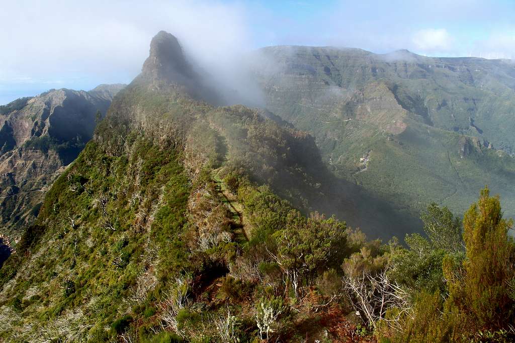
We joined the mountain path heading upwards and eastwards from the Encumeada pass on steep stone steps which were green with algae and running with water. The way commenced on the north side of the ridge in cool shade whilst more water dripped from the trees on to us.
“This is going to a nightmare coming down.” Marie told me more than once.
After a while, the path crosses to the south side of the ridge. It was just as wet but at least we were in some sunshine now. However, wispy clouds were blowing north to south across the ridge.
“Do you think this is what the Inca Trail is like?” I suggested to Marie.
We continued following the rough path upwards beneath huge Basalt cliffs. Sometimes the path was muddy and sometimes we had to scramble up rocks to gain height.
After about 90 minutes, the path forked. I realised that we had not seen any markers along the way and I guessed our way went to the left – it was the most worn path.
30 minutes later, we reached a pass between two rocky peaks.
“I guess these are Pico do Jorge and Pico Casado.” I said, checking the map.
Or were they? The guidebook suggested we “go up some steps” to the summit of Pico Jorge. I couldn’t see any steps and the summit was quite a way above us.
We continued on a path which dropped steeply northwards towards Sao Vicente but decided to turn back before we lost too much height.
After a bite to eat we descended as the clouds piled up. By the time we were descending the steep steps (very carefully) it was drizzling again. Here, we met the first people we had seen all day.
A few days later, the road had opened and the weather was perfect, we made our way to the Paul da Serra. The car park at Cristo Rei was no longer open so we parked “Madeiran style” (left the car on the side of the road.)
We picked up the Levada da Bica da Cana and headed eastwards. We hadn’t gone far when we were surprised to find the landscape had been changed. The natural vegetation that had covered the slopes has all been stripped in favour of regimented planting. It may be a vineyard (I couldn’t be sure) but the wild nature of the place has gone.
We reached the track to take us down towards Cascalho and headed down. We originally did this route in 2008 on a similarly hot day but had great memories of it.
We picked up the Levada do Paul as we went, I did notice it seemed a little poorly kept but thought nothing of it.
“Is that a bridge ahead?” Marie asked. It did look like a suspension bridge but it was huge. Surely not?
As we got closer, we realised it wasn’t a bridge, it was water pipes suspended by steel cables stretched across the valley.
“Why did they build that?” we wondered.
When we got closer again, it all became clear. The original levada that followed the walls of the steep sided valley was no longer there. We couldn’t believe what we were seeing. In 2008 we had traversed the entire length of the narrow levada path. Now, not only was it gone, it didn’t look like it had ever even been there. We began to doubt our memories.
At some point between then and now, a huge landslide had destroyed the original levada. In order to keep the water flowing, large pipes have been used to replace it but the path was gone, probably forever.
Is this the landslide that the Policeman was warning us about?
Feeling disappointed, we returned to the Levada da Bica da Cana and followed it eastwards until we reached its source. The views were spectacular but the wildness we remembered seemed to have gone. We met several other walkers and some hunters with rifles as the giant wind turbines turned above our heads.
|
|
Back in the UK, I realised that it was reported on Summitpost that the Cascalho levada route had been destroyed in 2012.
Whilst it’s inevitable that things change in the mountains all the time and it may well be that it is now unsafe to construct a pathway in this area, however, it is sad that this lovely valley has lost some of its charm.
Madeira, as a whole is changing. We had not imagined at the start of the year that we would be visiting again so soon. I wonder how long it might be before we return?