Newsticker
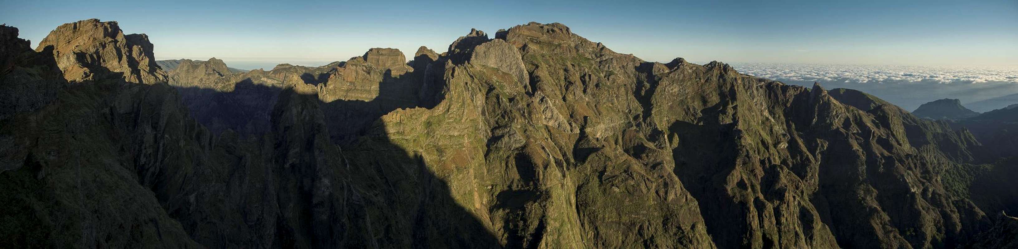
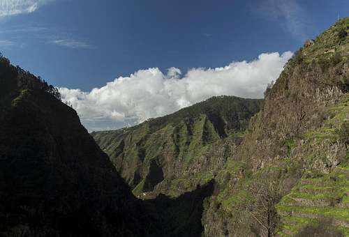
![Madeira s central range]()
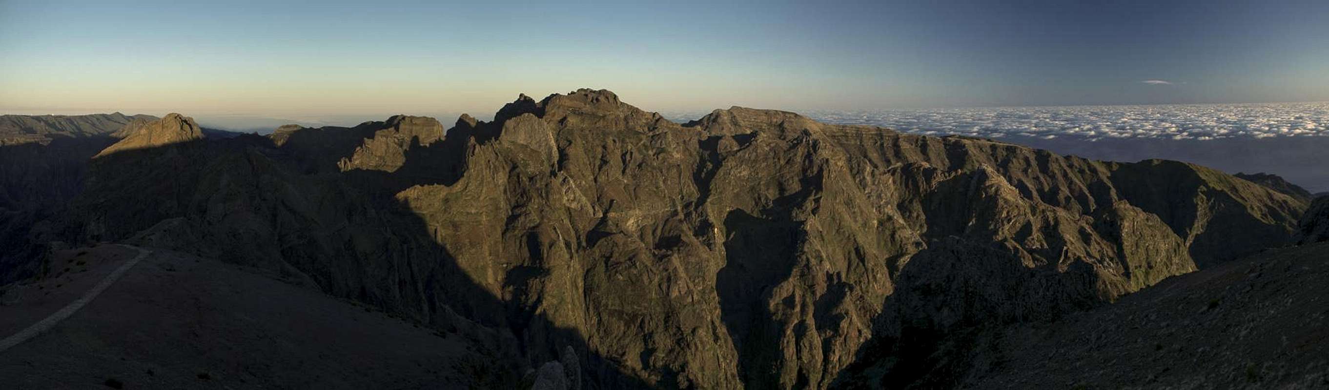
Madeira's Central Range |
It is October and I am just about to book a rental car for our Christmas vacation to Madeira. Before I do so I browse my Pad and happen to come across a brand new news message:
“Dengue Fever Outbreak on Madeira – more than 1300 cases”. It looks like the Dengue Mosquito has been introduced to the island and now ravages the inhabitants. All cases so far have been mild ones and almost all affected locals. But about 40 cases have been reported in different countries, tourists who returned with the disease in their bodies.
Wonderful!
This comes on top of the news that during the ultra hot and dry summer of 2012 forest fires raged on the island barely to be kept under control. This comes on top of serious landslides in 2009. And this comes on top of the old news of huge forest fires in Madeira’s mountain region dating back to summer 2003. Right after we visited Madeira in May of the same year.
Great!
Will it be worthwhile to visit the island? In winter when weather is bound to be cold and wet? Should we cancel the flight?
We won’t, of course. A bit of dangerous fever won’t keep us away. And we visited La Palma half a year after the last forest fires and Gran Canaria after 15 months. Pitiful views in some cases but in the end we realized that nature had already started to strike back. Which encourages a lot of hope …
The Island
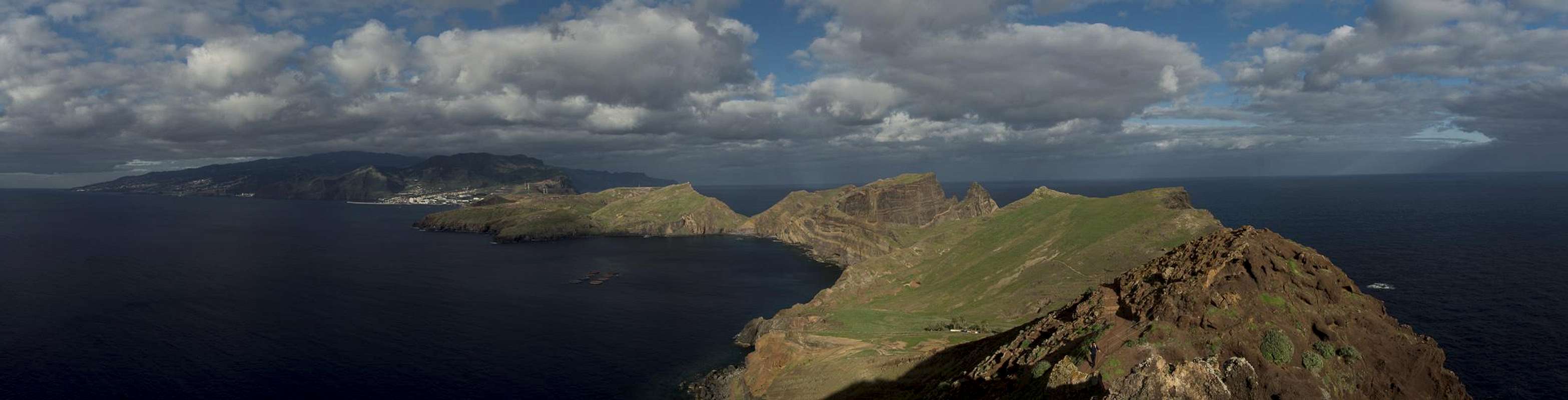
Madeira seen across the Sao Lourenco Peninsula from Pico Furado |
, together with its neighbor
Porto Santo and the uninhabited
Ilhas Desertas forms an archipelago about 600 km to the west of the Moroccan coast. Geographically it thus belongs to Africa while politically it is part of Portugal and thus part of the European Union. It is a VERY mountainous island without any sea level plains and thus only a very limited amount of beaches. Its highest mountain is
Pico Ruivo (1862m), which together with its neighbours forms a very rugged mountain scenery.
The island is divided in two parts by the
Ribeira Brava and
Sao Vicente Valleys which join at
Encumeada Pass. To the east you’ll find the rugged central mountain range while in the west there is the more than 1600m high plateau (or fenn)
Paul da Serra. In another distinction there is a division between the north and south of the island, again divided by
Encumeada Pass and the mountain crests which head away from it. Thanks to the north-eastern trade winds the north of the island is extremely humid while the south can be very dry (very similar to the taller ones of the Canary Islands). Madeirans have solved the water problem in the south by creating 1500km worth of irrigation channels (the levadas), which nowadays have become the most popular hiking routes on Madeira.
Apart from the levadas and its mountains, Madeira is mostly known for its wine, which is similar to Port or Sherry. Also, the island is famous for its many beautiful gardens and the multitude of beautiful and colourful flowers which grow there.
December 19th and 20th – Packing and Travel
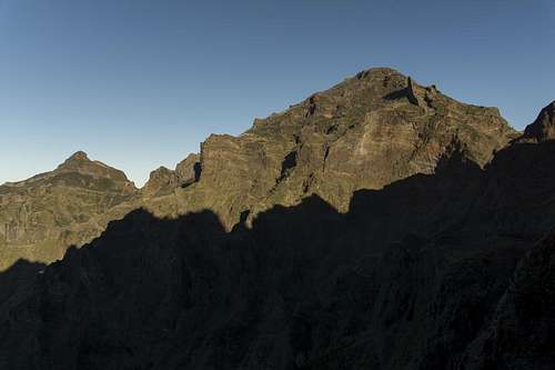
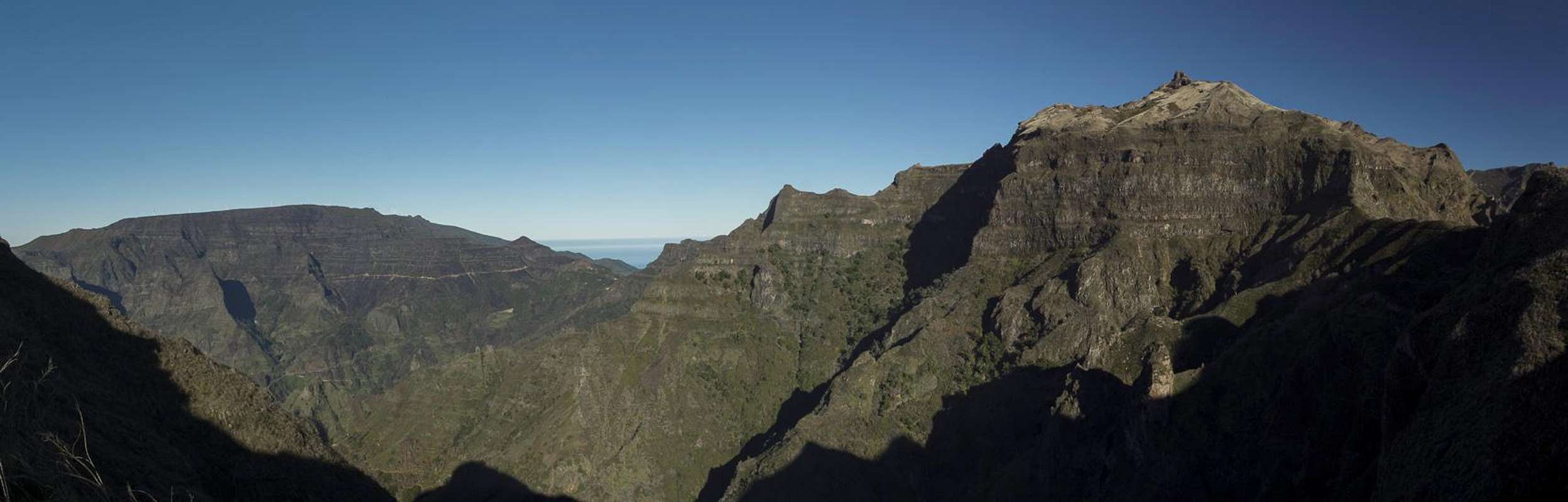
![On the Weather Divide]()
Pico Grande, Pico Jorge, Pico Cascado, Pico das Eirinhas on the weather divide
On Dec 19th, right before I shut down my computer for the year I receive an email by the Condor Carrier that online check in for our flight is now open. Naturally I decide to go for it but then have to realize that these suckers charge €20 for online check-in! Knowing the lines on Frankfurt airport during the holiday season, however, I figure that the expense will buy less stress and so enter my credit card number. Still it upsets me each time I think about it. Packing is no issue and we find time to go to a restaurant to have some dinner.
Next day lines are long at the check-in counter but we only have to wait a few minutes at the baggage drop. Still wondering whether this is worth €20 we get rid of the suitcases and head for the gates. Waiting, queuing, bus transfer to apron position, boarding, waiting, security film, takeoff, lunch, movie (Ice Age 4), three drinks, touchdown, baggage claim, rental car (two lines, on in the airport, one in the parking lot) and finally we head for our holiday home. The whole procedure is standard and for once we don’t encounter any problem.
At the holiday home – we were in the same complex nine years ago – nobody is available and we have to wait for quite a while until someone hears the tolling of the little bell, we get in motion. Finally a maid appears, telling us that the safe will be an additional €20, that we may burn as much firewood as we want but that this will be an additional €20. The vacation seems to turn into an affair by steps of €20… Afterwards we quickly unpack and start our main challenge for the day: find a supermarket.
(This is worth a note aside: supermarkets in Madeira seem to live in clusters. You’ll search for one for hours until you come across a cluster of three or four. Here, quite obviously and especially shortly before Christmas, life gets very frantic. Cars clog the streets the notoriously small parking lots ar packed full and inside the supermarket everybody seems to try to buy everything at once. As we’ll later learn, part of the problem is that the largest supermarket chain in Portugal folded over the current debt crisis and thus much smaller markets have to fulfill the needs of the population.)
We’re happy once we have found one, parked, shopped, unparked and returned home. I get the fireplace going, we cook a quick dinner and start relaxing. Plans for the morrow are postponed until next morning. After we’ll have had a look at the weather...
December 21st: Traversing from Pico do Arieiro to Pico Ruivo and beyond
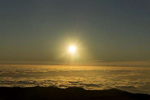
![Arieiro Sunrise]()
Sunrise seen from Pico do Arieiro
It’s still pitch dark when we get up but the number of stars on display promises a perfect day. So during our breakfast we decide to start the vacation with the most beautiful hike of them all: the traverse from Madeira’s #3 peak,
Pico do Ariero, to the #1,
Pico Ruivo, passing #2,
Pico das Torres on either side during the return trip. In 2003 we also started with this traverse and we know that it is the most beautiful tour you can do on the island.
Pico do Arieiro has a radar installation, a snack bar, a souvenir shop and a well sized parking lot right close to its summit. While this ensures an ugly summit it also gives you the opportunity to start the traverse from the top and given the fact that we’re early risers and live quite near the mountain, we can hope to get a start of any other hikers who want to attempt the traverse today.
Somehow we are disappointed in this assumption since though we arrive at the summit during sunrise, three cars are already parked and three couples (two German, one British) are getting themselves ready. We all troop to the summit pillar to catch a first view of Madeira’s central mountain range. But since we know the vista, I shoot a quick panorama and we leave for the trail. The next time we will meet somebody today, will be during the return trip …
Pico do Cidrao and Pico das Torres seen from Ninho da Mantas |
The route appears to be in perfect condition. Much of it is paved (an old Camino Real) and there are a lot of stairways, some of them reminding you of the stairs to Cirith Ungol in LOTR. Still we quickly make for
Ninho da Mantas, a lookout placed like the nest of a bird of prey (which in fact is mirrored in the name – the buzzard’s nest). More panoramaing and now we head across the spires of
Pedra Riga towards
Pico do Cidrao, Madeira’s #4 summit. Instead of climbing it (which I’ll learn is possible only after returning home) we take the Cirith Ungol stairs down the north face of the mountain. The stairway leads to a saddle where the first of the tunnels awaits us. This one is 100m long, cut through
Pico do Gato (1782m), a narrow twin peaked spire.
Right behind the tunnel the first surprise and disappointment awaits us: the eastern route, which ascends to the eastern shoulder of
Pico das Torres, has been closed, presumably due to rockfall. Where we are we can’t see anything but we forgo the attempt of hiking it nevertheless and instead head for the western “tunnel route”. The name says it all but if you don’t know Madeira you’ll be surprised: this route leads through the vertical west face of
Pico das Torres on a number of ledges. Where those ledges end, tunnels have been carved out of the rock (half a dozen), interconnecting the otherwise solitary bands.
A few steps from the
Pico Gato Tunnel lead us into rock paradise. The closeness of the towers, which make up
Pico das Torres is absolutely fascinating. The mountain – like the whole island – is made up from volcanic rock, very soft in general but reinforced by layers of basalt. Lower down in the west face these basalt layers stand out like walls, crisscrossing the chasms and gullies, which drop into the cauldron of Curral das Freiras (more about that below). Happy to have thought of bringing our torchlights, we negotiate the tunnels and quickly find ourselves on the north side of
Pico das Torres, where the closed eastern route joins.
![Pico Ruivo]()
Pico Ruivo south face
Still on ledges the trail circles one last tower and then quickly rises towards
Casa do Abrigo, a mountain hut, right underneath the
Pico Ruivo summit. Right before reaching the hut the normal hiking route for
Pico Ruivo (a 1h affair) joins. Still no other people are to be seen as we head up to the intersection to
Pico Ruivo. We follow the narrow path to the summit and soon find ourselves on the roof of Madeira, enjoying the views all around.
However, it is quite early still and since we don’t want to return to the apartment for lunch, we decide to hike on. There is a long hiking trail, another Camino Real, from
Pico Ruivo to
Boca da Encumeada. It follows the ridgeline of Madeira’s weather divide, often switching sides. Weather is perfect today so there is no weather to divide or fog to fear and we’ll see how far we’ll get before we’ll have to return. Gradually the scenery is changing. While the central mountains were our main focus before, soon our eyes get attracted by
Pico Grande,
Pico Jorge and
Pico do Cascado, the main mountains in the west of Madeira’s mountain range. Suddenly we realize that we are hiking through a forest fire area – lots of dead trees line the route and even though the fire was more than nine years ago we still get ourselves painted black by the sooty branches.
After winding our way along the ridge we decide to stop at
Pico das Eirinhas. It’s noon – best time for lunch – the weather is ok but the wind is fierce and cold. We snuggle down into a nook off a saddle and start munching. Later, we retrace our steps, only bypassing the
Pico Ruivo summit. At the mountain hut we meet half a dozen people, most of whom came by the normal route. Once we are on the tunnel route we realize that it’s already late. Colours around get a golden tint and the almost full moon is rising in the east.
While climbing up the Cirith Ungol steps I keep the moon in my vision as I think it might be a good idea to set it off against the artificial globe of the radar station on
Pico do Arieiro. But the terrain is not helpful and the plan fails. Maybe some other day. At
Pico do Areiro two dozen tourists huddle around the summit pillar but we quickly pass by straight to our car.
Dec 22nd: Pico Grande, Pico do Cerco
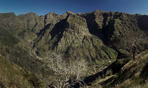
![The Curral das Freiras Cauldron]()
The Curral das Freiras Cauldron seen from Boca da Corida
Again the weather looks perfect so we decide to attempt the second most beautiful route on the island, the traverse from
Boca da Corrida to
Pico Grande. I remember steep protected sections at the summit block as well as stinging and scratching gorse bushes all the way. In 2003 we came back severely bruised in our shorts. It’s long pants day today.
The drive to
Boca da Corrida is longish and in the end turns very steep. The Renault Clio rental car manages it in first gear only but after 70 minutes we finally arrive. The saddle is located at an elevation of roughly 1300m and thus towers above the cauldron of
Curral das Freiras by almost 1000m. The view into the cauldron is impressive and I wonder, whether they get sunshine down there in winter (they do as we’ll see later today). Snapping a few shots we get prepared and start off along the trail. Again, this is one of the Camino Reales, an old trail which was important to connect the north and south coasts. It runs towards
Boca da Encumeada, but there are rumours of a second traverse driving at
Boca das Torrinhas. Maybe we’ll catch a glimpse of it for later projects.
Paul da Serra and Pico Grande |
is located on a ridge which separates the most profound valleys of the island, the
Curral Cauldron and the
Ribeira Brava Basin, the exact ridge we are following now.
Boca dos Corgos,
Passo de Ares,
Boca do Cerro – three passes on the ridge, all of them with exceptional views down the tow valleys and beyond. To the left the plateau
Paul da Serra dominates, while to the right the top 5 mountains of Madeira can be seen.
After
Boca do Cerro the first crux has to be negotiated: a steeply ascending traverse through a near vertical wall. However, as almost anywhere on the island, there are steps and an additional cable for protection so that the section turns out to be exposed but easy. It drives at a small balcony, where the path turns northward and now climbs a step in the south-eastern shoulder of
Pico Grande. Still very steep trickling creeks which pass the track make this section more difficult than the protected one before. Descending we’ll have to take extreme care.
Finally we are on the sloped plateau underneath the
Pico Grande summit. To the east a second summit of nearly equal height (
Pico do Cerco) attracts our attention and we discuss climbing it as well if time allows. The P
ico Grande path now heads directly up the steep grass slopes towards the summit block and for the next hour we rather refrain from talking. Finally we reach the little plateau underneath the summit block and directly tackle the next section. A protected ledge leads halfway up, from where some exposed slab climbing takes you to the summit. Lunch is somewhat uncomfortable due to high winds but we find a shelter eventually.
360° Panorama from Pico Grande |
It is still early so we plan the traverse to
Pico do Cerco. Off the summit block and a few switchbacks down the slope there was an intersection. There we switch towards a vanishing trail which heads for the saddle between the two mountains. There we turn east, clamber across a natural wall of basalt blocks and look for the best way up. Passing the summit to the south, then tackling it from the south-east appears to be the best option. However, long grass covers potholes in our path so that we rather ungracefully stumble to the top. A short break but then we stumble back to the saddle. Here we follow another path which might be the path to
Boca das Torrinhas but it ends at a sudden drop. Maybe we’ll have to explore this path from the other side.
Northern and Eastern view from Pico do Cerco |
The descent is easier than anticipated and back at
Boca do Cerro we still have time left. We decide to follow a path which will lead down to
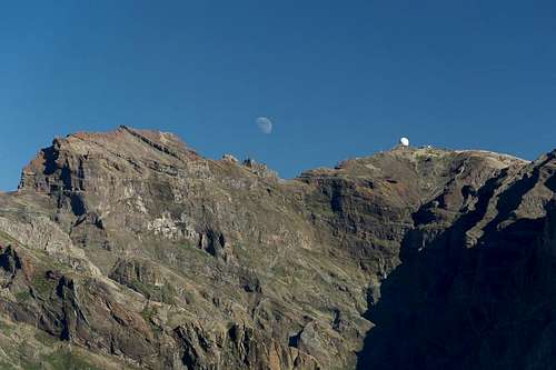
Curral das Freiras, just to see whether we can have our afternoon break in a place with a view. We are successful right before the path drops towards Curral for real and enjoy ourselves very much. Yesterday’s comparison of the radar station’s dome on Pico do Arieiro and the moon turns out more successful today.
![Big and little domes]()
A View with two globes
Now we head back across the three passes and finally end up at
Boca da Corrida where we started today. A last glimpse and the long drive back home …
Dec 23rd: Pico Ruivo do Paul, Pinaculo, Pico Bica da Cana
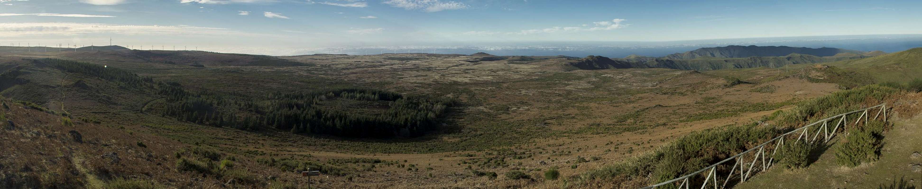
The high plateau Paul da Serra |
Today it is time to head for the plateau
Paul da Serra for the first time. Our guidebook has two short walks but a glimpse at the map shows that they can be combined by what must be a traverse through the east face of the plateau. We’re not sure, though, but try anyway. We start from the centre of the plateau, where there is a small rocky parking lot and follow our first levada. This irrigation channel is rather small, 20cm across and we have to switch between the muddy banks more than once. It heads at the highest summit of
Paul da Serra, called
Pico Ruivo da Paul. From where we are it looks like a mere hill but once on its south slopes we realize that it is a steep one. As we get higher we get more and more exposed to the winds, which today head at us from the south. On the top there is a summit pillar, which II climb but after a few minutes I’m frozen. The storm is howling around us. Views are good but it is still too early and the sun is too low. Still we realize that the mountain drops all the way to the coast to the north and thus has a far more impressive aspect from that side.
Now we descend towards the
Posto Forestal dos Estanquinhos, a forest hut with a picnic area. We get quite close to one of the windmills (there are several dozen on top of Paul da Serra) before we leave the guidebook trail. We realize that the “path” we chose is a dirt road (rather dirt highway) switchbacking all the way down to
Sao Vicente. However, after half an hour the traversing path turns off to the south and we happily leave the road.
Our path takes us upwards through the laurisilva forest on the east face of
Paul da Serra. There is far less to see than we had hoped, with the trees and bushes covering everything. Moreover, above us the windmills are running and we realize how much noise they produce. After another half hour the trail levels and behold! There is a decent view towards Madeira’s central mountain range. There is a small waterfall, Judith insists on taking a shot of me in front of it. A few steps afterwards there is an even bigger waterfall and we reverse roles. Suddenly – from this last waterfall on, a small levada is running beside us. More waterfalls join and the irrigation channel quickly fills. And here there is a waterfall spreading across the ledge we are hiking. Judith runs a few steps, I hike quickly through only to realize that one, two, thre, …, six more waterfalls have to be crossed. By the end of the procedure we are soaking wet, the guidebook has grown thicker by 100% and I decide to put on my cape for future usage. After all we’ll have to return this way later on.
A few hundred metres take us to
Pinaculo, the sugar loaf mountain of Madeira, a basalt block growing out of the east face of
Paul da Serra. We take a break, make ourselves watertight, then return towards and through the waterfall zone. Right after it, a steep slippery bath heads up to
Paul da Serra and we scramble to the top, heading for the lookout on Paul da Serra’s second highest summit
Bica de Cana. Wonderful views across the Ribeira Brava Valley await us, inducing another break.
Today’s last stage follows the maintenance paths for the windmills and we veritably walk underneath the monsters. They are huge and the storm is turning them rapidly. Though not quite a nature experience, it is still quite interesting to see the different models and how they can slow down or speed up rotation by turning the wings. The long hike thus appears quite short and we even ignore having got lost were the windmills and, struggling through the fern undergrowth straight onwards. We end up near the
Posto Forestal and take the road back to our car.
Not perfect but still a good day.
Holy Eve, Dec. 24th: Levada Nova, Levada do Moinho
Today there is heavy weather in the mountains above, the wind has turned to north-eastern direction and we decide to head for the south-west, hoping for holes in the clouds. The idea is to do the “difficult” (according to the guidebook) levada tour in the Valley of
Ribeira da Ponta do Sol. You hike in on one levada,
Levada Nova, and hike out the other,
Levada do Moinho. In between you need to scramble down the slope between the two. The tour is called difficult because of exposure and because of this scramble.
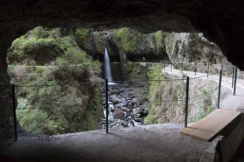
![Tunnel View]()
Tunnel view towards the waterfall at the end of Levada Nova
When we arrive, however, the irrigation channels turn out to have been maintained and rebuilt recently, complete with a thin railing so that whatever exposure there was has been reduced to a minimum. We hike into the valley at the end of which, right above the
Cascalho Cauldron, heavy weather looms. The hike is easy and in the end we encounter one of the famous levada tunnels. Muddy at the base you nevertheless have to take most care of your head. The tunnel ends in an amphtheatre-like cave, complete with a waterfall beneath which the hiking trail runs. A little later we get to the downclimbing section, wet and slippery, extremely steep but in no way dangerous. Once on
Levada do Moinho, we turn back while the clouds, which threatened the whole morning start to emit rain. Hiking back quickly we are at the car before noon and since it appears to be raining everywhere we set out for a car trip around the western part of the island. In the end we are back at the apartment at 3 p.m.
Christmas, Dec 25th: Levada do Norte between Boa Morte and Cabo Girao
Same weather as yesterday. Again we drive south but this time we can see blue skies in the very south of the island. We decide to drive up to
Boa Morte and hike
Levada do Norte, which winds through the outskirts of several villages before it reaches
Cabo Girao, Europe’s highest sea cliff. The hike is level and easy and there are some of Madeira’s famous flowers to be seen even though it is winter. Mainly the yellow clover attracts our attention, a weed, which blooms in bright yellow flowers. We don’t meet anybody until we are at
Cabo Girao where civilization has us back. Lots of tourists visit the skywalk above the abyss as we are having our lunch there. We quickly finish and return the way we came.
Dec 26th: Paul do Mar
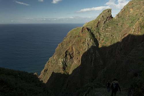
![Descending towards Paul do Mar]()
Descending into the Ribeira Seca Valley
The third day of poor weather and again we head to the south-west, this time to
Prazeres, from which we want to do a round tour, descending to the fishing village of
Paul do Mar. Unfortunately, however, Judith forgets her iPhone in (we’re not sure whether it’s on the roof of) the car and she has to return when we are already halfway down the steep descent. I wait and when she arrives she is accompanied by a busload of German tourists. Just what I need! We head down a steep Camino Real into a beautiful waterfall filled gorge, which suddenly ends right above the Atlantic Ocean and inside the village
Paul do Mar.
The busload enters a restaurant while we hike on, an ugly section along the roads of the tourist part of the village, right above the pebble beaches. Where the road ends, another camino ascends as steeply as the other one descended and we head for
Faja de Ovelha, hiking through the village (still very steep) until we reach
Levada Nova. We follow the levada forever, since it follows every valley, staying at the same level in the slopes. In the end, at
Prazeres we’re happy to have done with it. The sun has vanished and the last two hours have been very cold and boring.
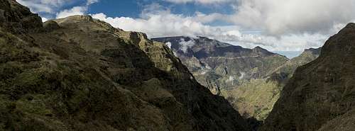
Dec 27th: The Weather Divide from Boca da Encumeada
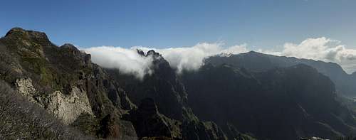
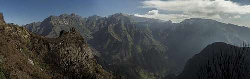
![Clouds rolling into the Curral Cauldron]()
Trade Wind Clouds over Madeira's Weather Divide
Weather appears to be much better today so that we think we can head back into the mountains. Starting point is
Boca da Encumeada, the saddle which separates the eastern half of Madeira from its western one. It is a good trailhead for quite a number of tours and easy to reach. We plan to hike the weather divide towards the point we turned around at during the first day. There will be many summits close by so maybe we can bag a few of them.
Clear skies greet us at the saddle and we immediately head out. The trail turns out to be another Camino Real, excellently maintained with a lot of staircases along the way. With the dense greenery on all sides it sometimes looks like pictures of Machu Pichu in Peru. It is freezing cold in the shade, though, and we hasten up as quickly as possible to get to the sunny side. We reach the ridge on the shoulder of
Pico da Encumeada, the first of the many summits of the weather divide.
Pico da Encumeada in front of Paul da Serra |
A view up front tells us that we slightly miscalculated the weather. Thick trade wind clouds are spilling across the mountains into the the
Curras Cauldron. The divide is free, however, and we march onwards.
Pico Grande throws a giant shadow and right in front of us
Pico Ferreiro looms. I wonder how we’ll negotiate the giant step which separates the summit from the base but since I’ve been there before I know we will. First we have to pass another unnamed summit, luckily on the sunny side but then we approach the lower basalt walls of
Pico Ferreiro.
Climbing the shoulder turns out to be easy. The path heads north into the shadows (which is why we hadn’t seen it before) and switches back and forth until it heads back into the sunlight right at the shoulder. From here a wide, sloping ledge takes us beneath another basalt wall, then several switchbacks head up to a rock window. Finally, after having negotiated the
Pico Ferreiro south face we reach a windy saddle, where the ascend to
Pico Jorge and
Pico Cascado starts.
We realize that we are back to the 2003 forest fire zone. Though the gorse bushes with their bright green branches hide most of the devastation, the old dead heather trees still dominate. The path heads for the saddle between
Pico Jorge and
Pico Cascado. Right before it a path marked “dead end” turns off to the right, probably the old camino to
Pico Grande, which we hadn’t seen while hiking the other side a few days previously. We decide that
Pico Jorge is too difficult for us and a cloud above
Pico Cascado turns us away from this summit as well. Maybe upon returning weather will be better?
Now the long and steep descent to
Boca das Torrinhas starts. It does so in several stages: a descent beside a basalt wall, an exposed traverse to a secondary summit, a steep descent into the muddy shades of the north face, a ledge traverse (again in the sun) and one of the never-ending staircases finally take us to the saddle. Here we could either descend towards
Curral das Freiras in the south or towards
Sao Vicente in the north. However, we stay on the ridge, passing another of the summits,
Pico Laie on its northern side. In the next saddle we decide to have lunch and while we do, the clouds above
Pico das Torres break open to give us a short view of this most beautiful mountains of the island.
We head onwards, again descending into the northern shades and traverse beneath the
Pico das Eirinhas north face. Still we are on the camino and still there are staircases but the going is very slippery and we have to take our time. Heading up to the saddle beyond
Pico das Eirinhas we realize that we have reached the first day’s turning point and thus have achieved our goal for the day.
![Clouds rising from the north coast]()
Clouds rising from the north coast
While we prepare for the return trip we realize that clouds start to crawl up the north face of the weather divide. Most likely we’ll end up in the fog but since the summits are still visible we’re still confident about reaching
Pico Cascado. Up to
Boca das Torrinhas the clouds don’t reach us but the long climb up to the
Jorge / Cascado Saddle turns out to be a foggy affair. Up there we can make out the
Pico Cascado summit (still above the clouds) and quickly start our pathless scramble to the top. Weather seems to favour us and we are able to pick our path. As we near the summit, however, clouds shroud everything in dense fog and we are lucky to make it. There is no summit pillar (probably meaning we are on a false summit) and we decide to quickly retrace our steps. With the help of our two GPS receivers we barely find the way we came and finally return to the saddle.
A few hundred metres beyond, the clouds break open again for a short while and
Cascado is open again. Maybe we should have stayed on to after all. But then a new wave rolls across the weather divide and for the remainder of the trip we only rarely get into open terrain. It becomes obvious, why they are calling this the divide: to the north the clouds are rising from the sea while a few steps south of the ridge there is eternal sunshine. A real thin line it is. After
Pico da Encumeada we dive into the clouds for the long final descent to
Boca da Encumeada, where we are back in civilization. A souvenir shop and two snack bars attract busloads of visitors who complain about the fogged out views. They could have started earlier but we won’t explain …
Dec 28th: From Boca da Encumeada to Boca do Cerro
Paul da Serra and Pico da Encumeada |
Today we are back to where we started yesterday. Two switchbacks beneath
Boca da Encumeada, the camino to
Boca da Corrida starts, another of the old important connections between the north and the south of Madeira. We hiked it back in 2003 and stinging and scratching gorse bushes took the fun out of the hike. Then the forest fire struck and today we should be rid of that problem.
The first section takes us through the shade underneath the weather divide until we reach the hamlet of
Curral Jangao at the head of a valley. There is little to see until we reach the houses but there we are treated with the usual display of Madeira’s flowers, evern though the hamlet appears to be deserted. After
Curral Jangao we step onto a ledge which takes us all the way back to the mouth of the valley, however, on the other side. It runs through the north face of
Pico Grande offering occasional views of the mountains on the weather divide, where we hiked yesterday.
Finally we get to a shoulder, high above the
Ribeira Brava Basin, where the further route is plainly visible. The path negotiates towards a ledge through the enormous west face of
Pico Grande, which it follows right to
Boca do Cerro, our planned destination. It is still quite early and I start to muse about a bit of triangulation –
Boca da Encumeada,
Boca do Cerro,
Boca das Torinhas,
Boca da Encumeada. But there was the “dead end” sign yesterday. What if we have to turn around late on the second leg of the triangle? We would have to hike forever …
But soon it gets obvious that we’ll only reach our destination about noon or later. What looked like a short and easy traverse turns out to be only easy. Following every bend in the west face, the ledge route gets longer and longer. Moreover, it turns out that
Boca do Cerro is not where we thought it was – when we reach the place we see that we still have two thirds of the way to go. West face turns into south face but the aspects is pretty much the same. Some pioneer gorse bushes are trying to regain the ground they lost after the 2003 fires but still they are far from getting to be a nuisance.
Paul da Serra,
Chao dos Terreiros and of course west and south face of
Pico Grande are the dominating vista with a basalt tower thrown in for a change every now and then.
Finally we are at
Boca do Cerro where our friends (
Picos Ruivo, das Torres, Cidrao and Arieiro) greet us across the
Curral Cauldron. We have lunch underneath the ruins of an old chestnut tree and enjoy the vista. While to this point we haven’t seen a single person suddenly they seem to crowd in on us. Three parties of two head for the narrow ledge traverse to
Pico Grande while a large group settles down for lunch a few hundred metres from us. All are speaking German – what a surprise …
Since triangulation is now out of the question we return the way we came. Weather is still perfect and we take our time. Part of the large group pass us – the rest of them must have gone on to
Pico Grande – and occasionally we meet others on the trail. Again the south face traverse, then the west face one and we are back at the shoulder were we take a short break. Then we plunge into the shadows beneath the north face and return to
Curral Jangao. Back out of the valley and we return to
Boca da Encumeada.
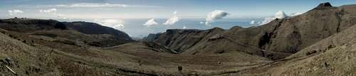
Dec 29th: Cascalho, Levada Nova, Levada das Rabacas
On Madeira there are many unique geographic features, among them the calderaios, large cauldrons carved out of the basalt walls of the mountains. You find them halfway up with conic walls several hundred metres high, dripping with waterfalls almost everywhere. In 2003 we had visited four of them, the most impressive ones
Calderaio Verde and
Calderaio do Inferno in the north of the island. This winter we decided against them mainly because of the deep shadows the north faces cast across them. We rather decided to hike to
Cascalho and its unnamed neighbor, which are carved out of the south face of
Paul da Serra.
We remembered scary sections on a levada (
Levada das Rabacas), barely protected against drops of several hundred metres while getting sprayed with the water of many waterfalls. The hike ends in front of a 2km long levada tunnel, which leads into the
Ribeira Brava Basin and from there to
Boca da Encumeada. Depending on our speed we might go all the way and back …
Starting point today is the statue of
Cristo Rei, somewhat down from the plateau
Paul da Serra to the south. There
Levada Bica da Cana flows as a small channel from the top of the plateau in south-westerly direction. We hike against the flow, soon climbing a short levada staircase. From the top we can see the two cauldrons, both looking very impressive even from afar.
Having to leave the levada we turn onto a dirt road, where a sign warns that hikers are not allowed from this point onward. But we didn’t come all the way to return here and hike on, steeply descending towards a ledge, telling us that
Levada das Rabacas will be close. We have to pass a tunnel, then waterfalls start to trickle down the walls to our right. The water is collected in a small ditch beside the road and thus
Levada das Rabacas is born. Finally there is a big waterfall and big amounts of water accompany us on our way down.
A turn in the road reveals
Cascalho – and also the fact that construction is / has been going on there. There seems to be a hanging bridge to the other side of the cauldron and we wonder what’s going on. Then the road stops where a rockslide has taken away the bulk of it and we cling to the remaining narrow path to head onwards. The hanging bridge turns out to be a construction with four tubes, carrying the water of the levada from this side of the cauldron to the other. We begin to understand that a giant rockslide has destroyed
Levada das Rabacas right in the centre of
Cascalho. Nevertheless we hike on but soon we realize that there is just no way to get across. Disappointed we return. To make matters worse clouds rise from the south coast and shroud
Paul da Serra into fog. We decide to call it a day and return.
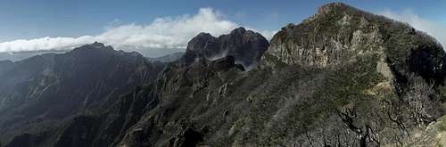
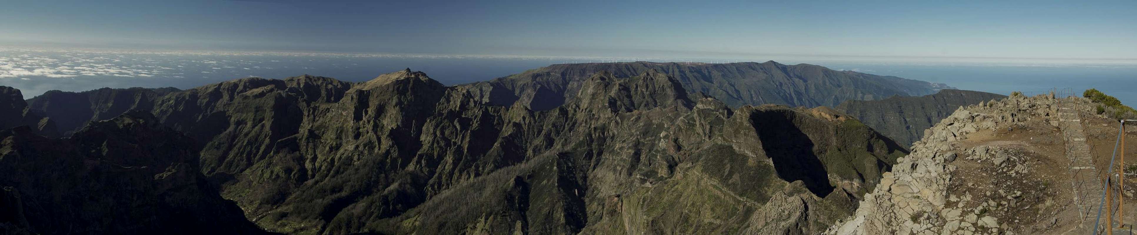
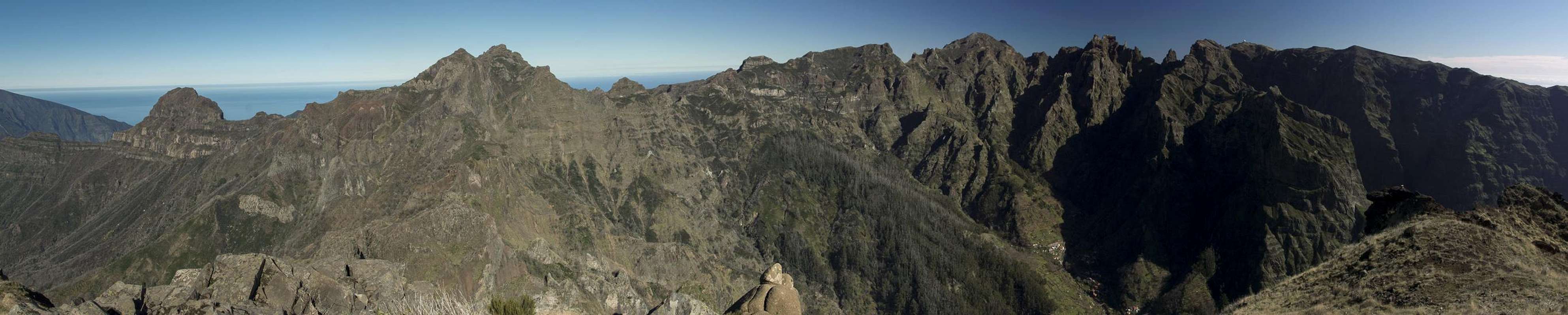
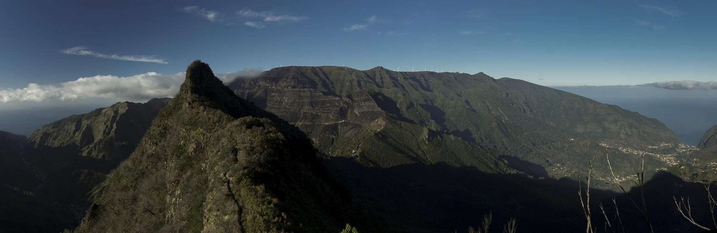
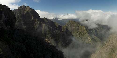
![Madeira s mountain range]()
Madeira's Central Mountains
Once in the car and driving across the plateau to the other side we realize that the clouds are a local phenomenon and that the
Ribeira Brava Basin is still sunny. We find a spot with a view beside the road and munch our lunch. All the high mountains of Madeira are on display and clouds can only be seen above the summits of the south. We decide to drive to
Boca da Encumeada and attempt the route from the other side. Then there is an additional Levada to
Folhadal and maybe we’ll hike that too if time allows.
From the saddle we climb a few steps and suddenly find ourselves close to the biggest levada we have seen so far.
Levada Nova at this point is 1.50m across at about the same depth. To the left and right of it
Lilies of the Nile (Agapanthus) can be found, some few of them even in blossom. At first we hike through dense greenery but suddenly we find ourselves in the 2012 forest fire area. Everything is black and depressing though views turn out to be exceptional. The weather divide and
Pico Grande attract most attention. At a large tunnel we get ready our torchlights but the ground is so muddy that we decide to return and try the other levada into
Folhadal.
At the intersection we turn left but after a few steps another tunnel awaits us. It is dry and we decide to go in even though Judith flashlight has stopped working. The tunnel goes on forever but finally we get out into an area of waterfalls, green bushes and a wonderfully maintained levada. We go onwards but turn around at the next tunnel, which has a length of more than a kilometre. Back at
Boca da Encumeada the clouds have retreated even further and we enjoy the hike back to the car.
Dec 30th: Chao dos Terreiros, Eira do Ribeiro
Clouds everywhere, but high ones – we decide to drive to the village of
Fontes and attempt hiking across
Chao dos Terreiros to
Boca da Corrida and back. The map shows several possible paths so we won’t get lost. However, even the start at
Fontes is depressing. There is a sunny patch along the south coast but almost everything else disappears into the clouds above some 1500m. The hike should have been panoramic but all we see is dull light with
Paul da Serra and later
Pico Grande hidden in fog. Almost all the route to
Chao dos Terreiros runs along a dirt road and only the deep views into gorges and valleys underneath are somewhat impressive. Where the road ends a few steps take us to the summit pillar on the plateau-like
Chao dos Terreiros. I snap a panorama but am disappointed deep down.
"Headless" summit panorama from Eira do Ribeiro |
Hiking forward towards the drop of the north face we realize there is a narrow marked path, which we start to follow. It heads across a cattle fence, then down the east face of the mountain. From beyond we see a group of 15 hikers head up towards us – Germans as it turns out. Instead of following the path they came we opt for a ridge traverse to
Eira do Ribeiro, a secondary summit. The traverse would be wonderful if there were less clouds but we can’t change this. Another panorama, a short appearance of
Pico Ruivo and we descend towards
Boca da Corrida. We hike on to
Pico Malhada where we have our lunch.
During the return trip we get lost twice, finally ending up within a cattle fence with the brutes watching us closely. They have young calves and we make sure never getting between them and their mothers. There is no trail to speak of and we asced steeply. Finally we find ourselves on
Chao dos Terreiros again, from where we take a different dirt road back to
Fontes.
New Years Eve, Dec 31st: The day of the Saddles
This morning Judith surprises me with the suggestion to go to
Curral das Freiras, hike out of the cauldron to
Boca das Namoradas, hike over to
Boca da Corrida, from where a long traversing path leads back into the
Curral Cauldron. On the map this tour looks possible though we ask ourselves whether the black dotted lines actually exist as trails in reality.
Weather appears to be ok, no clouds in the south and only a bit of fuzz above the weather divide. We park our car in
Curral de Baixo in the south of the cauldron and ask ourselves how we’ll manage to return there as our tour will end in the north at
Faja Escura. But first things first and we start hiking up to
Boca das Namoradas. Again, this is one of the old caminos and we quickly gain elevation. The clouds above the divide vanish and everything looks like it will become a perfect day.
At
Boca das Namoradas, however, we realize a lenticular cloud above
Pico Ruivo which soon stretches across the whole divide. We follow the path indicated on our map and soon get completely lost. There are many paths and roads here but they all seem to be directed too far southward. We don’t want to lose too much elevation, however, and thus try to bushwhack to where the GPS points. In the end we have to give in and end up on private fenced property. The gate is secured with barbed wire and we have to take care not to be cut while climbing over it.
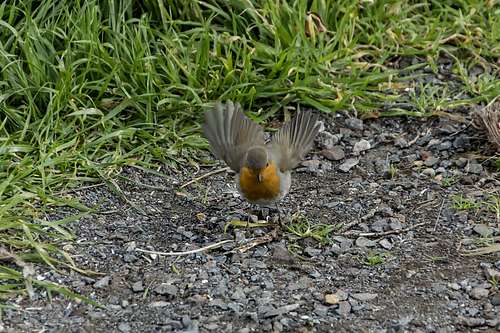
![Ready for Takeoff!]()
Robin, ready for takeoff!
Now we find ourselves on a dirt road not far from
Boca das Namoradas where we started. We decide to follow it and as if by miracle it turns toward the direction we intend to go. It hits the road to
Boca da Corrida just south of
Achada and we follow it up to the saddle. This part of the hike turns out to be much longer than anticipated but finally we get to the saddle just as its current single occupant is ready for takeoff.
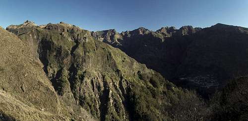
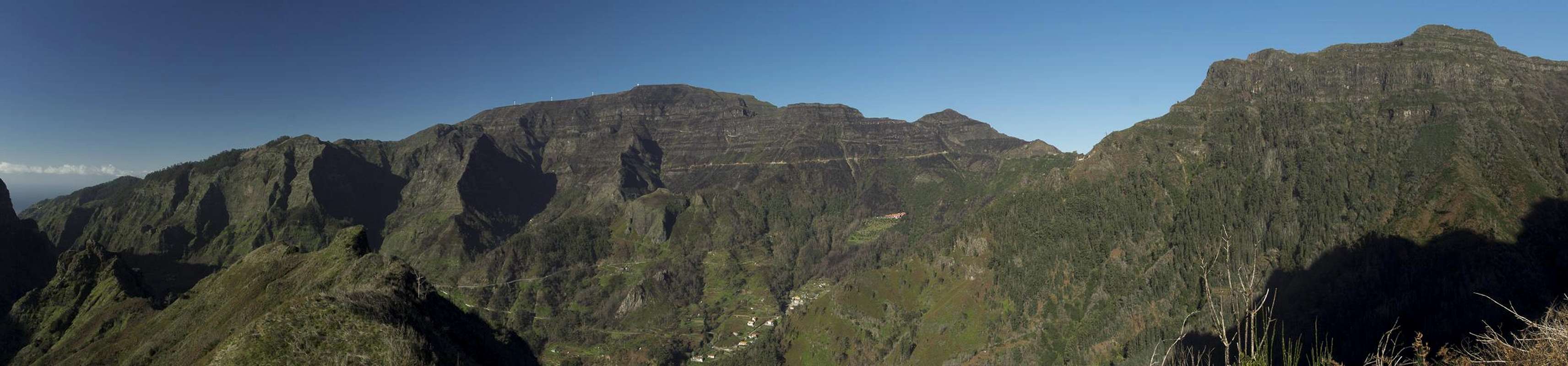
![Chao dos Terreiros and Paul da Serra]()
Chao dos Terreiros and Paul da Serra
A quick lunch and we realize that now clouds build within the
Curral Cauldron and quickly rise to the rim. Most of what follows now is shrouded in fog and we only catch occasional glances into the cauldron or towards
Paul da Serra or
Chao dos Terreiros in the west. The next saddle is
Boca dos Corgos (views to the west), then
Passo de Ares (view to Curral). Finally we reach
Boca do Cerro in a whiteout but since we have been here before twice it doesn’t matter too much.
We start descending into the cauldron and every now and then a few mountains appear on the opposite side. We hike through a forest of chestnut trees and after an hour reach the bottom of the cauldron at
Faja Escura. A nice hike along an old camino takes us through the creek bed to the road. Hiking the road at this point doesn’t appear to be an option since there is a tunnel to the south. Instead we hike up a withered staircase following a trail marked on our map, which heads into a ravine. However, landslides and fallen trees have eliminated the path so that we have to struggle through dense undergrowth. Finally we find a ramp which leads up to the village of
Achada, a “suburb” of
Curral das Freiras.
Since it is New Years Eve everybody is testing their explosives, the sounds of which get caught and thrown back within the cauldron endless times. If you don’t hear the original blast you think a thunderstorm has appeared out of nowhere. In Curral we realize that the only option to get to our car is hiking the road, which winds endlessly down into the creek bed before rising again to the last houses of
Curral de Baixo. By now we are on automatic and don’t realize what’s going on around us.
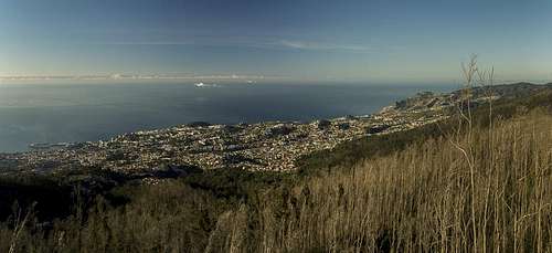
New Year, Jan 1st: Pico Alto to Poco do Neve
![View from Pico Alto to Funchal]()
View from Pico Alto across Funchal
Too exhausted to celebrate the New Year, we went to bed at 10 p.m. yesterday and slept through the revels. Judith now suggests to hike from
Pico Alto (a lookout above the south coast) to
Pico do Arieiro and back through the
Parque Ecologico do Funchal. The map shows marked trails and the topmost part of the route is described in our guidebook. Let’s have a go!
The trailhead is above
Monte, the suburb above
Funchal, famous for its toboggan run with basket cars (sleds) down the roads to the capital. We park our car at a posto forestal and first hike out to
Pico Alto for the view. On top a strange spectacle awaits us. A group of people stand around a man on his hands and knees who is chanting at the ground in front of him. Occasionally the crowd answers his shouts with murmurs. A pagan worship? We turn to the vista and realize there are huge cruise ships in Funchal’s harbor, probably come here yesterday for the New Years Fireworks.
Weather is picture perfect with the sun rising above the
Ilhas Desertas and casting a golden light across the bay. On the other side a barely waning moon sets above the mountains in the west. We head back to the posto forestal and take a road which will take us to our prime path along
Levada Barreiro. Reassuringly we find the trail along which we hope to return so that everything is well set. After a few picknick tables we get to where the path to the levada turns off. Descending steeply we soon find ourselves beside the irrigation channel.
It is a small one and it runs fast. There is not much space to either side and in some cases we have to negotiate the steep slopes besides to pass fallen trees. The whole idea of a Parque Ecologico doesn’t seem to apply here but we realize that this area also fell victim to one of the fires. The moon sets for real and to my own special joy it does so exactly on top of the summit pillar of
Pico dos Estelos on the western side of the valley.
![Southern panorama from Poco do Neve]()
Southern Panorama from Poco do Neve
After a couple of waterfalls the levada vanishes beneath the ground for a while. We have to struggle through dead bushes, trying to keep the direction. At first we succeed but later landslides make matters more difficult. Without the GPS we would be lost but with it we finally find the levada again, which has reappeared on the slopes beneath
Pico do Arieiro. We head up and finally reach
Poco do Neve, an igloo like building which was used in former times to store ice. There is a good view here and we decide to have our lunch.
![View to the north coast from Casa do Arieiro]()
View to the north coast from Casa do Arieiro
Instead of hiking the road to
Pico do Arieiro (which we visited on our first day already) we decide to
Casa do Arieiro, an old lookout, where we gain a good view of
Arieiro itself as well as down to the north coast. Clouds are starting to build, however, and we quickly head on and downwards. Next stop is
Casa do Burro, obviously used for picnics and barbecues, after which, however, we get lost. We finally end up on the road through the ecological park and since the fog is now thickening we decide to follow it instead of searching for a trail we can’t see. It gets very cold and again we are happy to be back at our car.
Jan 2nd: Levada do Norte
Low clouds are hanging above the mountains so we againhead for the south. At Judith’s suggestion we hike along
Levada do Norte from
Cabo Girao to
Estreito de Camara dos Lobos. The hike turns out to be so ugly (heading through the backsides of villages with the levada running underground) that we decide to turn around after 2km. We see a lot of beautiful flowers in the end but this attempt was not worthwhile.
![Pico Queimado]()
Pico Queimado
I propose to drive to
Boa Morte to hike the same levada to the north, right above the
Ribeira Brava Basin. We have done so before, in 2003, and there was extreme exposure. The clouds have retreated far enough for us to attempt this route. It is cold and we hurry through the shade, not feeling too well. A handful of villages are clustered precariously above the abyss. There is a levada cave and finally we get to the
Espigao Tunnel which runs directly underneath the like-named village. After the tunnel we have to realize, however, that the most impressive section has fallen victim to a landslide and thus we turn around again.
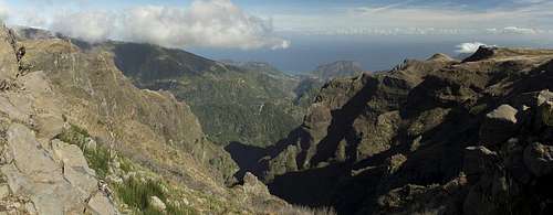
Jan 3rd: Ponta do Sao Lourenco
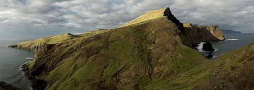
![Sao Lourenco Peninsula]()
Sao Lourenco Peninsula
Today is travel day but since the plane is only due at 16:00 we still have a morning to spend hiking. We decide for
Ponta do Sao Lourenco, the peninsula in the far east of Madeira. It is a Parque Natural and we remember it as being quite impressive even despite the low elevations. Moreover, the peninsula is close to where we live so that we won’t waste much time driving.
We are the first ones at the trailhead, a cul de sac, and quickly head out, first descending by a staircase then ascending steeply the slopes on the other side. The sun rises above clouds and right above
Pico Furado shining through the rock window at the base of Madeira’s easternmost mountain. At the isthmus of
Pedra Furada, we gain a good view of the north coast of the island, then head on. Looking back better and better views develop, sometimes showing both sides of Madeira. Down below huge waves break into wild bays.
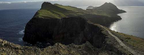
![The Isthmus with Ponta Sao Lourenco behind]()
The isthmus with Ponta Sao Lourenco behind
Now we reach the narrowest part of the peninsula, only several metres across and protected by thin railings. We hike across, taking in the vertical cliffs in the bay to the north. Now two paths descend to
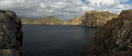
Casa do Sardinha, the park headquarters, one to the south (which we follow) and one to the north (by which we plan to return). We get to sea level catching a glimpse back across
Baia d’Abra before starting the surprisingly steep ascent to
Pico Furado. From up there we can see the whole archipelago,
Madeira,
Porto Santo to the north and the
Ilhas Deseartas to the south-east.
![Baia d Abra]()
Baia d'Abra
A first hiker meets us on top but when we return via the north loop we realize he is southbound. But once we are back near the isthmus, a whole busload of people comes at us. All are Swiss and it sounds strange to be greeted with “Grützi” on this tropical island. After they have passed more hikers and a couple of runners pass as well and once back at the trailhead we meet real crowds. But there’s no time to complain and we return to our house, take a shower and head out to the airport.
Epilogue
Madeira still is a wonderful and beautiful island but I have to admit that the natural disasters of the last years have clearly taken their toll. Many of the levadas are empty – landslides and lack of money to maintain them the most probable reasons – and the forest fires left huge areas devastated. Nature is virile on the island, though, and the scars will more or less quickly heal.
Madeira's mountains from Pico do Arieiro during sunrise |
Another problem is the Euro crisis, which struck Portugal particularly hard. For instance, the largest supermarket chain folded over the crisis and what were once were the best supermarkets on the island turned out to be almost empty. My assumption is that they stopped operation on Dec 31st. Smaller shops, located within the same buildings have now lost their clientele and will soon close as well. Given the many men idling in or around the many bars of the island, joblessness must be rampant as well.
We can only hope that economy and nature will be back to normal soon to make
Ilha de Madeira what it used to be: one of the most beautiful islands on earth.


Comments
Post a Comment