
-
 6213 Hits
-
 83.1% Score
-
 16 Votes
|
|
Mountain/Rock |
|---|---|
|
|
47.79376°N / 15.49189°E |
|
|
Hiking, Skiing |
|
|
Spring, Summer, Fall, Winter |
|
|
5794 ft / 1766 m |
|
|
Topographic isolation: 10 km
Nearest higher peak: Donnerwand (1799 m) in Schneealpe
Prominence: 632 m![The rocks of Gsenger]()
The rocks of Gsenger![View of Göller - Herbie's photo]()
View of Göller - Herbie's photoMain mountaineering activities on Göller are ski-touring and hiking. A part of the mountain is closed for ski tourers. For hikers such restrictions are not needed. There are only two marked routes on Göller![The summit cross of Göller]()
The summit cross of GöllerA big cross is erected on the grassy summit. From here you can have excellent view on the neighbouring peaks of the Alps. The most exposed neighbouring peaks are the following:![Terzer Göller]()
Terzer Göller - DoJo's photoUsually it is snowy until May. You can climb it any time of the year. In winter and in early spring expect deep snow. In these seasons ski touring is the preferred way of mountaineering here.
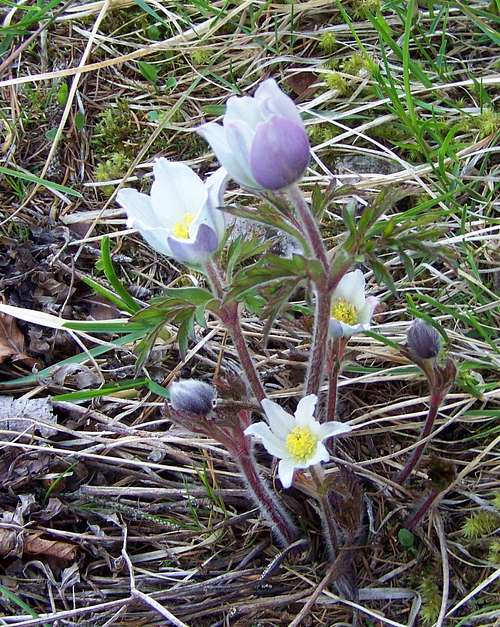
![Alpine pasqueflower]()
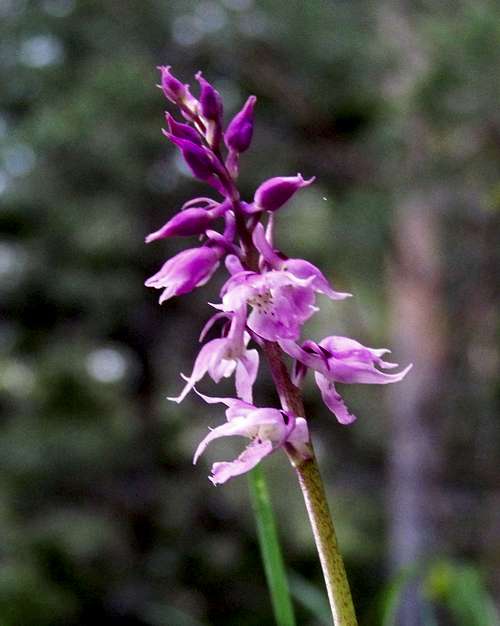
Alpine pasqueflowerCamping Gippelblick Kernhof (715 m)![Orchid]()
Orchid
Address: Kernhof, Oberkeer 1
Tel. 02768/2544
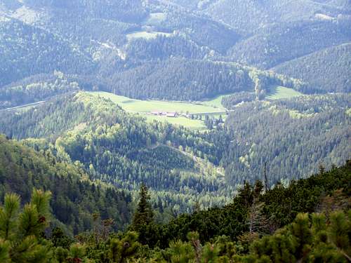
http://www.tiscover.com/at/guide/64744at,de,SCH1/objectId,CPS234889at/home.html![Gscheid down there]()
Gscheid down therePlease click here for online touris map
Nearest higher peak: Donnerwand (1799 m) in Schneealpe
Prominence: 632 m
Overview
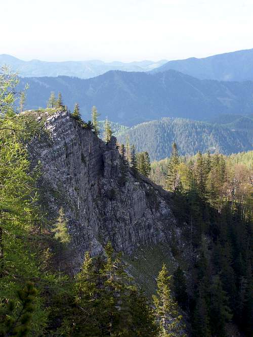
The rocks of Gsenger
Göller is the 3rd highest mountain of the range Mürzsteger Alpen. In the mountain range only Veitschalpe (1981 m) and Schneealpe (1903 m) are higher.
Also its prominence is quite big: 632 meter. With this value it has rank #11 on the prominence list of Lower Austria. Göller has well defined boundaries: Keertal in the north, the valley of Salza in the west, the valley of Terzbach in the south and Waldhüttsattel with Saugraben in the east. The eastern neighbour of Göller is the rugged Gippel (1669 m). The lowpoint of the ridge connecting Göller and Gippel is the already mentioned saddle called Waldhüttsattel (1266 m). The northern neighbour of Göller is Traitenberg (1230 m). The lowpoint of the ridge connecting Göller and Traitenberg is a saddle called Kernhofer Gscheid (970 m). This ridge between Gippel/Göller/Traitenberg form part of the watershed between river Drau and Danube. It means that when it is raining on Göller, water dropping on the northeastern slopes will meet water falling on the other slopes a few hundred kilometres further: Drau confluences with Danube on the border of Croatia and Serbia. These countries are quite far from Austria: they are not even neighbours of Austria!
This mountain – despite its height and despite its building material (dolomite) – has a quite flat hilltop. The highest summit of Göller is Grosser Göller. 1 km east to it is the lower Kleiner Göller (also called Rosskopf), with elevation of 1673 m. The western subpeak of Grosser Göller is called Terzer Göller, with elevation of 1729 m. The altitude difference between the neighbouring valleys and the summits are big: e.g. Kernhof is in elevation 690 m, so the difference between the valley and the highest summit is more than 1000 meter. This means that – despite of the quite flat hilltop – the hillsides are really steep. Most streams are only periodic on Göller. I suppose that this is result of the porous dolomite material of the mountain. The steep valleys of these periodic streams are called “Grabens” here: Schindergraben, Ahorngraben, Saugraben, Hintereckgraben, Lahngraben, Hacktongraben, Höllseichgraben, Jodlgraben, Baerengraben and Wasserkargraben/Lahngraben. The ridges between the “Grabens” are called “Riegels”, like Hochwaldriegel, Rossriegel, Karlriegel, Lusterriegel and Schützenriegel.
Though Göller is not so rugged like the neighbouring Gippel, still it has a few impressive rock formations: Turmmauer, Gsenger, Hühnerkralle and Baerenwand.
Lower sloped of the mountain is covered with beech forests. Higher parts of the slopes are covered with spruce forest. Near the hilltop only dwarf mountain pine (Pinus mugo) can survive, while the hilltop itself is grassy. In spring a lot of flowers make the mountain colourful.
Activities
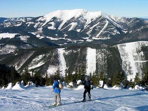
View of Göller - Herbie's photo
One of them has route #622/655. It connects the following points: Gscheid (955 m) – Gsenger (1442 m) – Grosser Göller (1766 m) – Kleiner Göller (1673 m) – Göllerhaus (1440 m) – Waldhüttsattel (1266 m)
The other route connects Waldhüttsattel (1266 m) with Kernhof (690 m)
Waldhüttsattel can be ascended also from south, from Donaudörfl, via SauGraben. It is not a marked route. Waldhüttsattel can be reached also from eastern direction, on the ridge connecting Gippel and Göller.
On the Summit
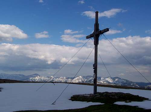
The summit cross of Göller
- NE: Reisalpe (1399 m)
- E: Gippel (1669 m) and Scheeberg (2076 m)
- SE: Rax (2007 m) and Schneealpe (1903 m)
- S: Veitsch (1981 m)
- SW: Hochstadl (1919 m), Riegerin (1939 m), Hohe Student (1539 m), Tonion (1699 m) Grosser Griesstein (2023 m) and Hochschwab (2277 m)
- W: Gemeindealpe (1626 m), Grosser Zellerhut (1639 m) and Dürrenstein (1878 m)
- NW: Ötscher (1893 m)
I was lucky to climb this mountain in crystal-clear weather. Dachstein (2995 m) is in 150 km distance from here, in western direction. Its peak was also visible from Göller!
When to Climb
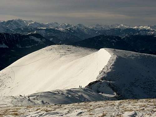
Terzer Göller - DoJo's photo
Red Tape
In order to protect wildlife from the negative impact of ski-touring, certain areas of Göller are closed for these activities. At the most important trailhead – at Kernhofer Gscheid – there is an information board showing the protected areas Gentiana clusii Gentiana clusii |  Primula clusiana Primula clusiana |  Field of Primulas Field of Primulas |  Spring Gentians Spring Gentians |
Camping and Tourist Hut
Alpine pasqueflower
Orchid
Address: Kernhof, Oberkeer 1
Tel. 02768/2544
http://www.tiscover.com/at/guide/64744at,de,SCH1/objectId,CPS234889at/home.html
Göllerhütte (1440 m)
Address: 3195 Kernhof, Lahnsattel 37
Tel. 0664/5115474, 0664/9421623
http://www.goellerhuette.at/Goellerhuette.htm
External Links
Gscheid down there