
-
 5820 Hits
-
 77.31% Score
-
 8 Votes
|
|
Route |
|---|---|
|
|
32.34630°N / 110.7267°W |
|
|
Hiking |
|
|
Spring, Fall, Winter |
|
|
Half a day |
|
|
Overview
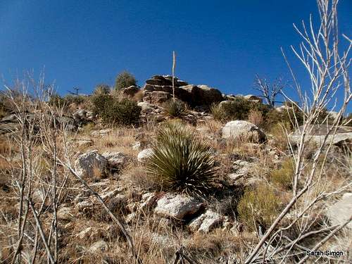
Conditions pictured here are typical of what you will encounter along this route.| 22 Nov 2012
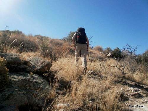
This great walk through the desert takes in history (passing through a WWII internment camp), nature (it begins as a leisurely stroll through a desert wash) and a bit of wild desert adventure (off-trail bushwhacking through scrub). The route takes in two desert summits and affords fantastic views of the surrounding Santa Catalina Mountains and the greater Tucson area.
Roundtrip Distance: 5.25 milesNET Elevation Gain: 1,400 feetYDS Class: 2March 2013
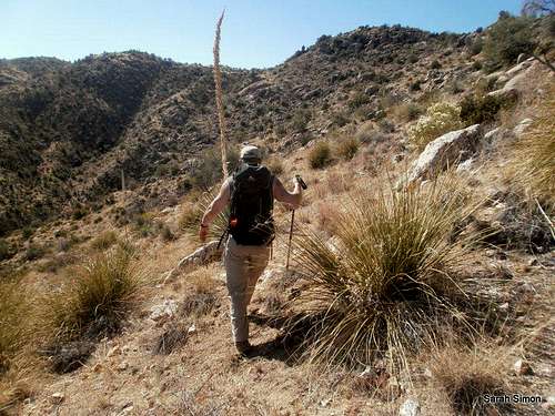
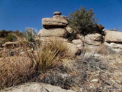
Be ready for your desert bushwhacking! While the navigation is in no way advanced,the ridgelines to both peaks are curving and line-of-sight can be limited (especially on the wriggling ridge line to Gibbon Mountain). The desert scrub, while relatively sparse, still does not readily suffer fools and demands respect: Ocatillo, prickly pear and Spanish dagger await!
Despite being convenient to Tucson and so close to the General Hitchcock Highway, there are parts of this route that leave you feeling like you’re in the middle of nowhere.
Roundtrip Distance: 5.25 miles
NET Elevation Gain: 1,400 feet
YDS Class: 2
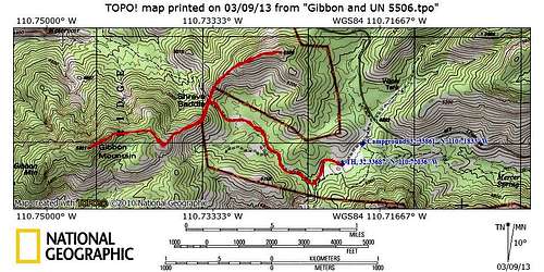
Getting There
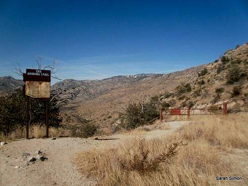
Beginning of the trail
Walking along the wash
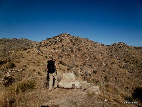
Shreve Saddle
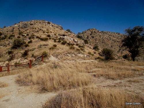
At Shreve Saddle
From the General Hitchcock Highway, also known as the Catalina Highway or the Mount Lemmon Highway. The Trailhead by the Molino Basin campground (past milepost 7), a great jumping off spot to reach the summit of Gibbon Mountain, can be reached within an hour of downtown Tucson. Take Tanque Verde (often pronounced “TANKy VURdy” by the locals) diagonally across the northeast edge of town to East Catalina Highway. Follow East Catalina Highway North for about 4.5 miles to the Forest Service boundary. Here the road becomes the General Hitchcock Highway…or the Catalina Highway…or the Mount Lemmon Highway. Take the turnoff for the Molino Basin campground, then head west until the trailhead where the road ends. The trailhead at the Gordon Hirabayashi Recreation Site (former WWII prison camp) also serves a segment of the Arizona Trail.

Note that the highway is paved, but longer vehicles (22 feet or greater) or those towing a trailer may have difficulty negotiating tight curves.
Route Description

Leaving Shreve Saddle for Gibbon

Route to UN 5506
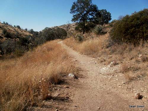
From the trailhead near the horse hitch posts, the trail is not super-evident (several footpaths run up the berm from the parking area), but simply head west through the sand and you’ll soon pick up the trail.
· The trail climbs right out of the parking area, then drops for a stretch into a sandy wash. Walking in 4 inches of sand is never easy – enjoy yourself here.
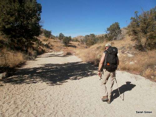
· Continue past the junction with the Soldier Trail (keeping right/straight at the junction) as the trail eventually pulls out of the wash.
· Continue up the wide trail to Shreve Saddle, marked by a sign for the Arizona Trail. From here, you can access both mountains.
 To Gibbon | 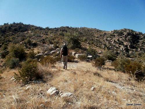 On a level area | 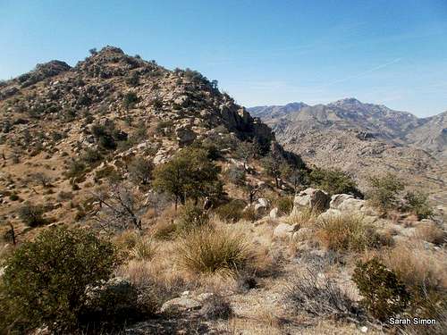 Gibbon Mountain in sight | 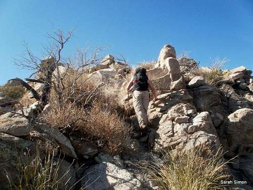 Summit ridge |
To reach Gibbon Mountain:
· Turn left (head south) up a steep slope. The footing is steep, slippy and covered in prickly plants. A footpath wraps around the mountain clockwise, but it involves side-stepping Take your pick – directly over the top of the initial hump, or side-stepping around the side.
· Continue to follow the ridgeline, which curves first southwest, then northwest, then west to the summit of Gibbon Mountain.
· Note that the highpoint is not marked by a cairn and there are three reasonable highpoint candidates, so visit them all.
· Descend back to Shreve Saddle.
 To UN 5506 | 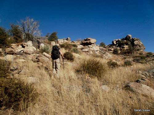 Slopes of UN 5506 | 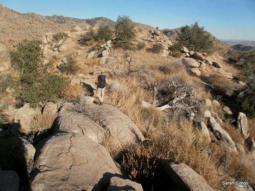 UN 5506 ridge | 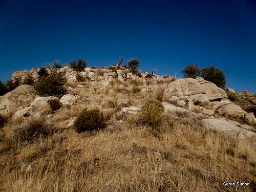 Almost to summit |
To reach UN 5506:
· From Shreve Saddle, head north directly up the ridge of UN 5506.
· Compared to the zigg-zagg path to the summit of Gibbon Mountain, the route to the top of UN 5506 is a relatively smooth, curving bushwhack to the top of the peak.
· Work your way around a few boulders to the highest boulders of the peak. There are two summit candidates, one marked with a small cairn (at the time of my visit).
Descend back to Shreve Saddle and outhike along the trail to the parking area!
Essential Gear
UN 5506 ridge
Desert scrub
• Sunscreen and sun protective clothing
• Plenty of water (the washes here do not run except after very, very heavy rains).
• Long sleeves, long pants and sturdy hiking shoes will protect your body from blood-thirsty plant life during the off-trail segment.
• Map: Green Trails Santa Catalina Mountains, AZ – NO 2886S
• Long sleeves, long pants and sturdy hiking shoes will protect your body from blood-thirsty plant life during the off-trail segment.
• Map: Green Trails Santa Catalina Mountains, AZ – NO 2886S