|
|
Route |
|---|---|
|
|
42.98683°N / 1.33394°W |
|
|
Hike |
|
|
A few days |
|
|
Walk-up |
|
|
Overview of the GR11 and this first sector
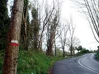
The GR (initials standing for the french "Grande Randonnée" or for the spanish "Gran Recorrido") are a network of trails all around the world (most of them are, as far as I know, in Europe, but I've also found references about some GR hikes placed as far away as New Caledonia). They cover all kinds of landscapes, terrains and areas, such as the Camino de Santiago (GR65.3), the traverse of Corsica, or the Pyrenees (two trails: GR11 on the spanish side of the range, GR10 on the french side). The paint marks made up of two parallel bands allow hikers to follow easily these trails.GR11 begins at the Cabo de Higuer, a cape placed by the village of Hondarribia (in the Basque Country) and ends at the Cap de Creus, placed by the Mediterranean in northern Catalonia. It can also be done the other way round, that's for sure, but we had to choose one of them...
Between these two spots a good number of stages make for great trekking efforts and offer wonderful views of varying landscapes. Green hills and low mountains at the basque end of the trail, with white villages placed amidst a beautiful nature. Mediterranean heat and light at the other end, close to the sea where some of the most important civilizations in history aroused centuries ago.
A densely humanized mountain covers all the area of this sector between Hondarribia and Zuriza. Agriculture, cattle and (later on, specially from the area of Urkiaga) dense forests of beech trees will be with you for some days before finding the first nude mountains between Isaba and Zuriza. Don't miss the historic monument of Roncesvalles, one of the oldest gothic churches in the whole Spain. Enjoy local food and local traditions. Who knows? You might find yourself at the summer marking of the cattle in the pastures of Sorogain (stage 4), take part in a Pilgrim's Mass at Roncesvalles or walk with the pilgrims to Santiago when climbing to the Col of Bentartea(stage 5), see the local "dantzari" (basque term for "dancers") honoring the Virgin of Muskilda in Ochagavía on September the 8th, or cross Isaba (stage 8) somewhere around July 13th, just in time to see the ancient ceremony of the Tribute of the Three Cows, held on the french-spanish border some kilometers north of the village.
Stage 1: Cabo de Higuer - Bera de Bidasoa
Distance: 30,350 km
Huts: No huts that I'm aware of. Some kind of a basic lodging might be provided by a bar in the vicinity of the San Antón Dam, but I'd recommend not to rely on this. It's better to get to Bera before thinking of a rest.
Lodging at the end of the stage:
Main landmarks: Irún, San Martzial church, Col of Erlaitz (449 m), Col of Ursain (460 m), San Antón Dam (240 m)
Feasible climbs (not too far away from the trail):Jaizkibel(547 m), Peñas de Aia(836 m), Larún/La Rhune, Erlaitz (497 m), Pagogaña (482 m)
This stage begins at the very edge of the Cantabric Sea (or the Atlantic Ocean, as you wish) and leads through the green hills of the lower Bidasoa valley towards the village of Bera de Bidasoa.
Stage 2: Bera de Bidasoa - Elizondo
Distance: 30,350 km
Huts: Right now, I don't know about any chances of shelter in this stage. A small restaurant is placed some minutes south west from the Col of Lizarrieta (about two and a half hours after leaving Bera)
Lodging at the end of the stage: Several hotels available in Elizondo. Some "Casas rurales" (official term for locals renting rooms) might be close too, but most of them only offer lodging from a weekend onwards. Will check, though
Main landmarks: Collado de Idoia (260 m), Collado de Lizarrieta (441 m), Collado de Nabarlatz (475 m), Collado de Irazako (530 m), Collado de Eskisaroi (510 m)
Feasible climbs (not too far away from the trail): Larrate Gaina (398 m), Ibantelli (698 m)
Stage 3: Elizondo - Urkiaga
Distance: 18,750 km
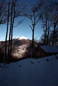
Huts: There's a hut (usually closed and probably private) at the Collado Zaldegi (947 m), about 1 hour 20 minutes after leaving Elizondo. Some old military strongpoints ("bunkers") can be found while going down from the summit of Arsal to Urkiaga. They might be in a nasty state, but bear them in mind just in case... Who knows if you will need an emergency shelter?
Lodging at the end of the stage: No real lodging available at the col of Urkiaga. The closest villages are those of Eugui (southwards, in Spain) and Alduides (northwards, in France).
Main landmarks: Santa Engracia church, Collado de Bustalmorro (1180 m)
Feasible climbs: Auza (1350 m), Peña de Alba, Peña de los Generales, Argintzo (1213 m), Arsal (1259 m), Okoro, Enekorri
Stage 4: Urkiaga - Burguete/Auritz
Distance: 15,4 km
Huts: There's a bar ("Casa Pablo") at the pastures of Sorogain, about 2h 10' after leaving Urkiaga. I believe they used to offer some kind of a lodging, but am not 100% sure at the moment.
Lodging at the end of the stage: Several small hotels and "casas rurales " available (see links section).
Main landmarks: Collado de Agatún (1200 m), Collado de Arbilleta (1135 m)
Feasible climbs:Adi (1458 m), Mendiaundi
Stage 5: Burguete - Fábrica de Orbaiceta
Distance: 20,050 km
Huts:
Lodging at the end of the stage: There's a bar (Ostatu Urkulu) at the end of the stage, but I don't know wether it offers lodging or not. The village of Orbaiceta is nevertheless 4,7 km south (following the road).
Main landmarks: Orreaga /Roncesvalles, Collado de Ibañeta, Majada de Azpegui
Feasible climbs: Astobizkar(1506 m), Orzanzurieta (1565 m), Urkulu
This is a specially symbolic stage in more than a sense. In the first kilometers it follows the line of the Way to Santiago through the monastic complex of Roncesvalles and up to the Col of Bentartea. The area of Astobizkar brings memories from the defeat of Charlemagne in the Battle of Roncesvalles (eighth century). From Bentartea to Urkulu there is a ridge walk with magnificent views if undertaken in clear weather and the final landmarks shall be the ruins of the roman monument at the summit of Urkulu and those of the 19th century weapons factory placed by the river at Orbaiceta.
Stage 6: Fábrica de Orbaiceta - Casas de Irati
Distance: 16,1 km
Huts:
Lodging at the end of the stage: No real lodging here, as far as I know there's just a small church here (Our Lady of the Snows) placed in the middle of the forest. Consider carrying bivouac equipment or a tent, for the church is usually closed. There used to be also an old house (in the old times a borderguards quarter) and it might provide some shelter if needed, but you should expect it to be in a rather bad condition.The closest village is Ochagavía (end of stage 7).
Main landmarks: Collado de Orión, Colladeta superior de Morate, Puente de la Cuestión
Stage 7: Casas de Irati- Ochagavía
Distance: 14,25 km
Huts:
Lodging at the end of the stage: A few possibilities should be available, mainly as "casas rurales" (local B&B usually quite busy in weekends, but overnight accomodation might be feasible during weekdays). Try also Hostal Auñamendi, even if only looking for a dinner.
Main landmarks: Paso de las Alforjas, Borda Botín, Sanctuary of Muskilda
Feasible climbs: Abodi
Stage 8: Ochagavía - Isaba
Distance: 23,75 km
Huts:
Lodging at the end of the stage: The same comments made in Stage 7 about "casas rurales" are useful here. There's also a hotel in the southern end of the village, but it could be closed if you get to the village in spring or autumn, for the high season takes place in summer and for the winter ski campaign.
Main landmarks: Zopotrea picnic area, Collado de Kakueta, Collado de Belozkarre, Sanctuary of Idoia
Stage 9: Isaba - Zuriza
Distance: 15,6 km
Huts:There's no shelter between Isaba and Zuriza, as far as I know. If anything, you might be lucky enough to find a temporary hut built by hunters. But don't count on it...
Lodging at the end of the stage: A beautiful camping site is placed at Zuriza. It might be quite full in tourist season (meaning summer, easter and long weekends). Though I'm not strictly sure, they might have some beds also.
Main landmarks: Ibón (local term for "mountain lake") de Ezkaurre, Peña Ezkaurre, Collado de Abizondo, Collado de Arguibiela.
Feasible climbs: Ezkaurre(2049 m), Itoleta


