Background
This marks the first trip that Gimpilator and I have done together. We met on the Perry Creek Trailhead this last February for the first time. I had finished Stillaguamish Peak and he was just heading up Mt Forgotten. In meeting each other in person, we discovered that we both were members of Summitpost.org. This started off comments back and forth over photos and trip reports. The timing worked out just right and Gimpilator planned a trip for us to climb Mt Larrabee (7,861’) on Sunday July 25th.
Brief Plan
Our plan was to meet Saturday evening at the Yellow Aster Butte Trailhead. This is found just off of the Mt Baker Highway 542. Even though Gimpilator’s Suzuki Bandit has 1,200cc of muscle, it wouldn’t be a good match for the rugged road that climbs up to Twin Lakes at (5,200’). So I planned to taxi him up the last couple miles. We planned to bivy at the lakes for the night and hit the trail early Sunday morning for the southwest gully ascent to Mt Larrabee. A possible Winchester Mountain (6,521’) summit was thrown into the plans for an added bonus.
Rugged, Red Larrabee has been on Gimpilator’s list of summits to climb for some time now. His passion for this summit has been alive far beyond our time knowing each other. I could hear the stoke in his voice just talking about this state border massive.
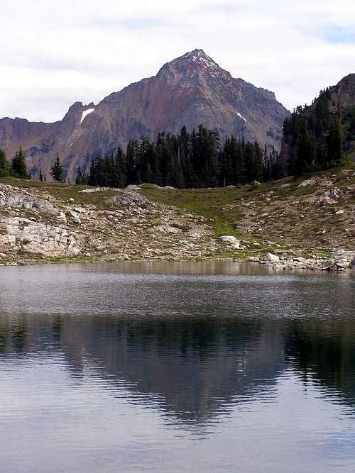
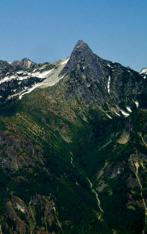
![Larrabee Reflection]() Our Objective, Mt Larrabee. Photo Taken By Gimpilator in 2008.
Our Objective, Mt Larrabee. Photo Taken By Gimpilator in 2008.Day 1
I headed up the Twin Lakes road and meet Gimplilator around 7:30pm. He parked his bike just below the Y.A.B.T.H. and piled his sweaty gear in my lifted truck. He had just spent the last night on Exelsior Peak (5,712’) and then battled the sketchy summit block of Church Mountain (6,315’) that afternoon. He had already made good use of the weekend so far and had stories to tell. We followed the steep road switch backing tightly until we reached the lakes. The lakes were snowed in, so we drove about 30’ onto the snow until finding a great parking spot. It was about 8pm now and Gimp looked over to me and said, “Let’s head up Winchester Mountain real quick so we can check out our route on Larrabee for tomorrow.” I wasn’t sure if he was serious at first, but after seeing the mountain man in his eyes I said, “Should I take my crampons?”
We hoped out, threw on some gear and headed up.
![Mt Baker]() Gimpilator looking up. Mt Baker on the horizon
Gimpilator looking up. Mt Baker on the horizon
We made great time until we hit some super steep snow traverses on pretty solid snow. Gimp kicked in some quick steps and I followed right behind.
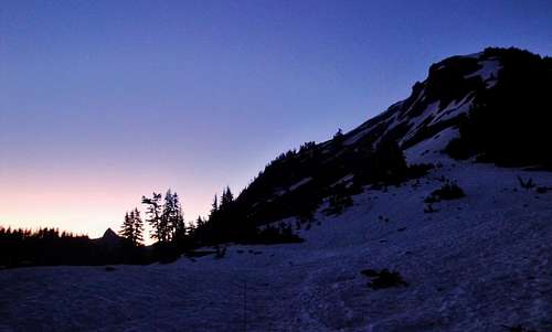
![Evening Snow Traverse]() Steep snow and nice colors
Steep snow and nice colors
It was amazing how quickly the views grew with such little effort.
![Nothing Wrong With That]() Beautiful Evening
Beautiful Evening
We were trying to catch the sunset, but it started to happen before we reached the summit. The steep snow really slowed us down as we made sure to get good purchase with our axes. After a couple small snowfields we soon were to a large moat on steep snow, with a rocky ridge above. We navigated this by dropping into its firm belly while straddling snow and rock. We did this for about 30’until Gimp found a line to climb up the rock to gain the ridge. That was pretty much the crux of the whole evening’s shindig. We crossed another snowfield and by this time the sun had set for the evening.
Its light was replaced with a glorious full moon and rich colors still lingering around. It was a breathtaking affair. We finally got to the lookout around 9:30pm or so.
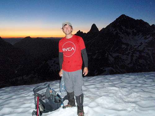
![Beaudaddy85]() Me enjoying the last moments of light on Winchester
Me enjoying the last moments of light on Winchester![Lookout at night]() Gimpilator enjoying the moonlight views from on top.
Gimpilator enjoying the moonlight views from on top.
There was still sufficient light from the evening colors and full moon to enjoy killer views.
After taking it all in, we headed back down to camp. If there wasn’t such steep snow, you could almost go down under the luminosity of the moon. Oh, the crux again was the gnarly moat, now in the murky light.
![Nightime Moat]() Gimpilator showing this Moat who's boss at night.
Gimpilator showing this Moat who's boss at night.
We got back to camp around 10:30pm.
That Night
I decided to sleep in my bag in the bed of my truck. I gave Gimpilator the offer to bivy on the bed of my truck, but he choose the snowfield instead. I guess he was too hot the night before on Exelsior, so he had a different plan by cooling off in the snow. We got our packs ready for the morning and Gimp hit the sack. I cooked some late dinner because I hadn't eaten yet. Soon, I too was clocked out for the night. The moon was high, which lighted up the whole twin lakes basin. It almost felt like taking a nap during the day, without the sunscreen or lawn chair of course. I tried to position my face, so the moon light didn't keep me awake.
2:30AM.
This time came quick with the sound of a truck pulling into camp. Not only did it pull into camp, but it started to back up a snow covered hill punching the gas. They worked on spinning tires at a high rpm for a couple minutes as I sat up in my sleeping bag watching them. They then parked the rig and it just sat for awhile. Kind of hard to sleep after that!!! I laid back down and just listened. Eventually I heard them get out and walk down to the lake. They passed within feet of my truck on the crunchy snow. I was so tempted to look up and get a view of who they were.
All of a sudden, “BOOM... BOOM...BOOM!!!” SHOTS FIRED. The echoing sound in the still of the night was overwhelming. I felt like we were in a wild west movie. I reached for my knife and then remembered the old saying, “Don’t bring a knife to a gun fight.” I barely peaked above the bed of my truck, but couldn’t see the shooter. I looked over about a 100’ where Gimp was sleeping; his head was popped up looking around. I sunk down in my bag and just listened. Two more shots fired and then it was silent. I never slept well for the rest of the night. In the morning, there was no sign of these rabble rousers. Only memories of their voices and the loud echoes of their gun.
Day 2
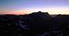
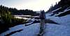
![First Light]() First light looking toward Pocket Peak and the Skagway Pass
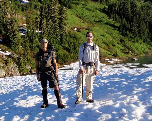
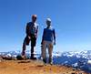
First light looking toward Pocket Peak and the Skagway Pass![The Beginning]() Gimpilator and I ready to head up.
Gimpilator and I ready to head up.
We got up at 6:30am and headed down the trail a bit after 7. We cut between the lakes and headed up the Winchester Route. Soon we were to the junction to high pass. We hung a right there and trotted along. We came around the corner and saw our first views of Mt Larrabee and The Pleiades.
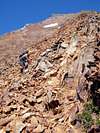
![The Route]() The Route
The Route![Starting Out]() Starting Out
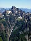
Starting Out![First Glimpse]() First Glimpse
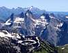
First Glimpse![Larrabee Seen From Approach]() Our Destination
Our Destination![Large Headwall]() Large Headwall
Large Headwall![Scree Basin Pano]() Scree Basin Pano
Scree Basin Pano![High Pass]() Snow on High Pass
Snow on High Pass
We traversed a couple snow fields and noticed that someone had been up there within the last couple days. We studied our route as we went. Getting to High Pass we lost some elevation until we were just below Low Pass. This is where it switchbacks up to about 5,600’ at Low Pass. There was a large snow headwall that ran about 100’.
We stayed to the right of this and made our way to High Pass(6,000'). Here we ran into two ladies who camped that night. Their destination was High Pass and told us a group of 7 climbers summited Larrabee the day before.
![Larrabee Route]() The Route We took
The Route We took![High Pass]() Looking South From Above High Pass
Looking South From Above High Pass
We continued and dropped into the large snow filled bowl. Later in the summer this is filled with nasty scree and talus. We lucked out and traversed the great snow until it was a vertical snow climb for a couple hundred feet. The top had a rim, which we were careful to climb out of.
![The Edge]() Gimplilator on the edge.
Gimplilator on the edge.![Above The Scree Basin]() Coming up out of the scree basin full of snow
Coming up out of the scree basin full of snow
Once on this ridge high above the snow filled bowl we got to our first decision.
There were two immediate gully options. One to the left which looked narrow and solid. The one to the right was wider, but very loose rock. We choose the gully to the left.
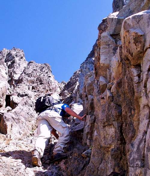
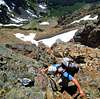
![Chimney Section]() Gimpilator in the beginning of the chimney section
Gimpilator in the beginning of the chimney section
We could only see maybe 75’ up each gully, so we went off of the rock conditions we could see. They both went in the direction to the summit. The gully to the left went good for awhile. Soon we became pretty exposed on a solid class 3 scramble. The rock turned into very loose and unstable garbage. Large rocks that appeared to be solid, would pull out very easily. This brought on danger for the climber below and obviously the climber pulling himself up. We took our time to navigate the rocks and found some decent lines here and there. We got to one section that was sketchy, exposed and required a very physical and mental move. Gimp was ahead of me and he cliffed out to the left. I tried this sketchy move to the right, knowing that right above it was better ground. I made the move and Gimp followed.
![Larrabee Chimney]() Gimpilator finally out of the narrow, steep chimney section
Gimpilator finally out of the narrow, steep chimney section
Once we were above, we decided this is not were we would be descending down. The rest of the climb was on very loose red rocks. It sounded like broken glass.
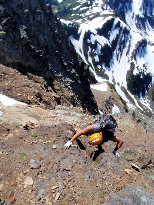
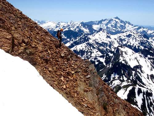
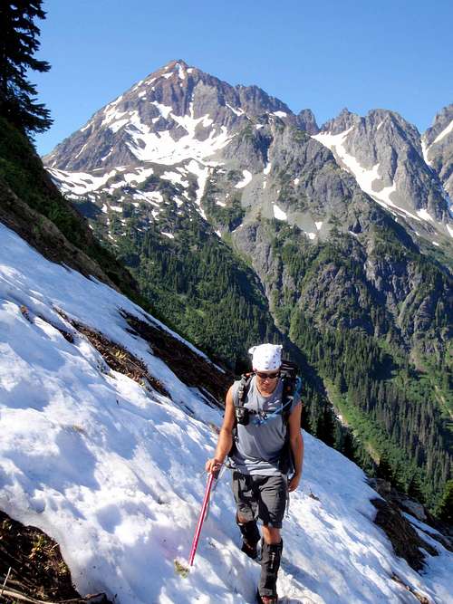
![Gnarly Scramble]() Me showing off the exposure on Larrabee
Me showing off the exposure on Larrabee
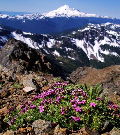
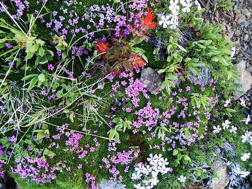
Then it was back on the nasty rock. This mountain is extremely dangerous if there are climbers above you. It does not matter how careful you are, large rocks will fall down. I would not attempt this without a helmet, and I would be very questionable to be far below another climbing party. Soon we found a faint boot path. The only reason we found this was a couple cairns that had been built along the way. We followed this faint path, more like some dust on the rocks. One bonus in all the crummy rock, was the beautiful flowers everywhere.
![Pink at 7,400]() Pink at 7,400' with Mt Baker on the horizon.
Pink at 7,400' with Mt Baker on the horizon.![Flower Garden]() Flower Garden in The Rocks
Flower Garden in The RocksMt Larrabee Summit (7,861')
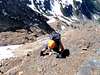
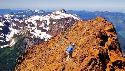
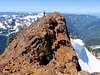
![West Summit]() Gimpilator scrambling to the Summit
Gimpilator scrambling to the Summit
Soon we could taste the summit. We became really excited for all the work that went into the climb. It was just before noon when we made it to the top.
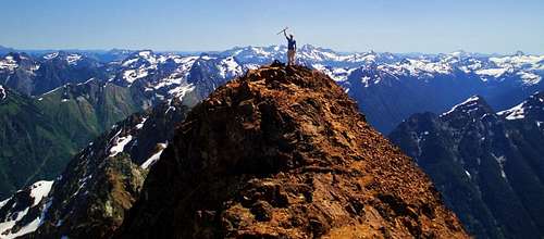
![East Summit]() Gimpilator on the East Summit of Mt Larrabee.
Gimpilator on the East Summit of Mt Larrabee.![West Summit & ABP]() West Summit and ABP
West Summit and ABP![Mount Larrabee 360° View]() Gimpilator's Summit Pano
Gimpilator's Summit Pano
There is an east and west summit. The east summit is maybe 2 feet higher and is more flat. This is where we had lunch. Both summit have different views. Wow, and the views were crazy. It was amazing to be standing at the very end of the Cascade Mountain Range. You could see the Fraser River Valley separating the ranges. Views into Canada were great, along with the views into the North Cascades.
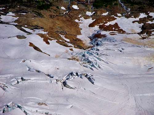
Looking north we noticed the large Glacier field a couple thousand feet below.
![North Side Glacier]() Northside Glacier
Northside Glacier
Everywhere we looked offered bigtime views. We took a short break here and headed down.
Heading Down
![Looking South]() Gimpilator ready to head down.
Gimpilator ready to head down.![Coming Down Larrabee]() Feeling so small, while God seems so Big
Feeling so small, while God seems so Big
We followed the boot path along a ridge. This worked pretty well. The rock was still very unstable. We created many small rock slides going down, trying to be super careful. As we headed down, we found the gully we didn’t take on the way up. We tried this one out, and it was much safer.
![Gimpilator Down Climbing]() Gimpilator down climbing.
Gimpilator down climbing.![More Loose Rock]() Loose Rock
Loose Rock
It still was a solid class 3 downclimb in spots, but a lot safer for us. If you’re into rock climbing, the other gully would be for you.
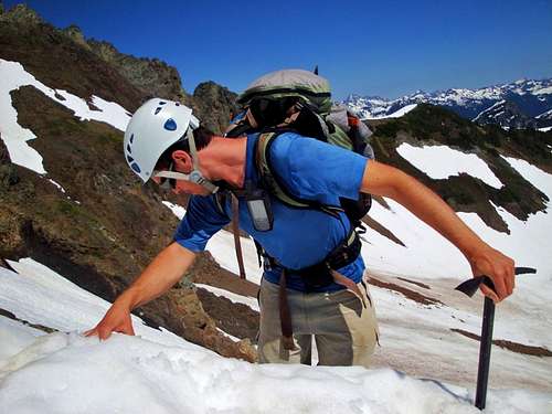
We made good time down. We got to the rim of the snow filled bowl and carefully climbed into it.
![Snow Bowl]() Gimpilator down climbing into the steep snow Basin
Gimpilator down climbing into the steep snow Basin
Then we did a slow glissade into the snow bowl making sure to stay away from moats and exposed rocks.
The rest of the way was a pretty simple hike on a very hot summer day.
![The Return]() Heading Home After Great Success
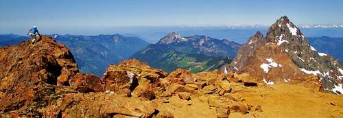
Heading Home After Great Success![Pocket Peak]() Awesome looking Pocket Peak (7,056) high above the Silesia Valley.
Awesome looking Pocket Peak (7,056) high above the Silesia Valley.
Gimpilator kept talking about this buffet in Bellingham. So the plan was for me to follow him into Bellingham and eat at this famous hole in the wall.
![Gimpilator s Bike]() Following Gimpilator to a great buffet after a long climb.
Following Gimpilator to a great buffet after a long climb.
Boy did it taste good after a great climb. Thanks Gimp for having me along. I can’t wait for what’s next.


Comments
Post a Comment