
-
 3860 Hits
-
 80.17% Score
-
 12 Votes
|
|
Route |
|---|---|
|
|
46.50620°N / 14.48720°E |
|
|
Download GPX » View Route on Map |
|
|
Hiking |
|
|
Summer, Fall |
|
|
Most of a day |
|
|
Hike |
|
|
Overview
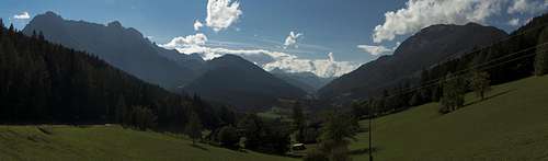
 Saddle view towards the Julian Alps Saddle view towards the Julian Alps |
Hochobir is one of the most popular lookout peaks of the Karawanken Range, mainly thanks to the fact taht it is located a bit in front of the main ridge and also similar in height to the main summits on the ridge. Also, it can be very easily be reached from Eisenkappler Hütte, to which a toll mountain road leads. This reduces the ascent to about two hours. On the other hand, there are other routes to the summit, all starting further down below. One of these routes starts at Schaidasattel, a road pass at 1180m, located to the south-west of the Hochobir.
 |  |  |
Thanks to starting so low, lots of the route runs through the forest on the south slopes of the mountain, cutting short the bends of a mountain road for much of its length. Only on the very top do you cross the timber line, close to the ruins of Rainer Hütte, which is located in a saddle some 100m underneath the summit. The remainder is a traverse along the Hochobir south ridge, decently exposed to the western side.
Getting There
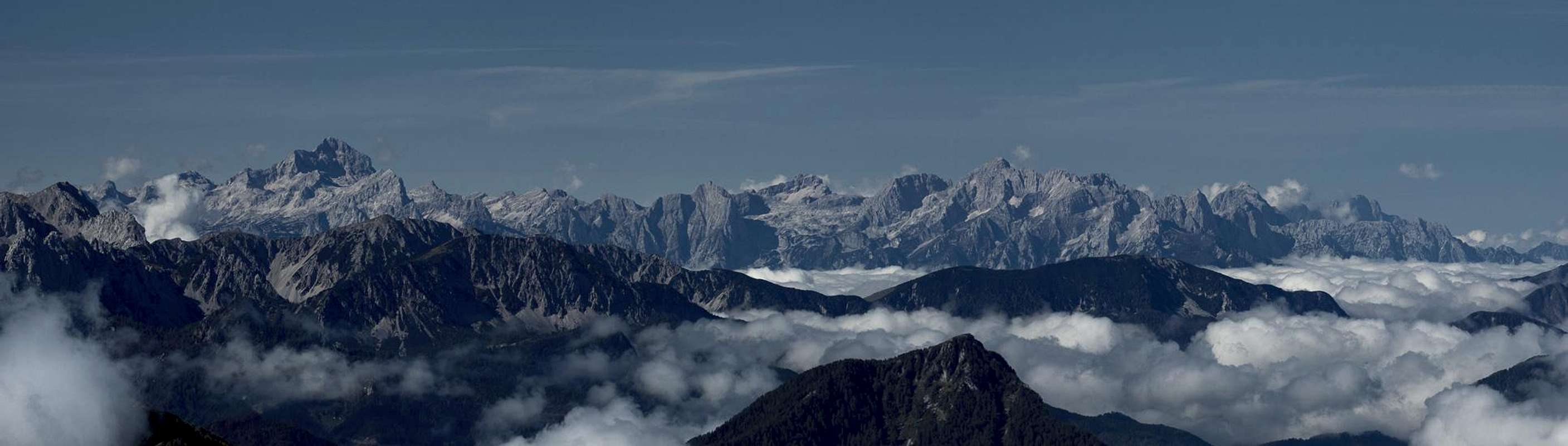
 Looking westward from Schaidasattel
The hike starts at the Schaidasattel road pass, which can be easily reached from Bad Eisenkappel by L131 / L108.
Route Description
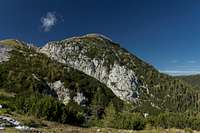
 The Hochobir summit seen from the south
- General:
- Start altitude: 1180m
- Summit altitude: 2139m
- Prevailing exposure: S
- Type: Hike
- Protection: None
- Start altitude: 1180m
- Effort: 2 - 1200m elevation gain
- Power: 2 - Long and Strenuous
- Psyche: 1 - Little exposure near the summit
- Difficulty: 1 - Easy
- Orientation: 2 - Marked and easy.
From the picnic table on Schaidasttel follow the dirt road to the north (signs: Hochobir), which heads for the south-west slopes of the mountain. You soon get under tree cover, where a steep and narrow path turns off to the right. It cuts short several bends in the road, sometimes following it for a couple of metres, sometimes running in parallel. At the elevation of 1600m the path quits the road for the last time and starts traversing towards the Hochobir south-west ridge. It follows a valley between the south-west and the lower south ridges, joining the former in one of its saddles at 1950m. Up here the first wonderful views of the eastern Karawanken and the Steiner / Kamnik Alps develop.
 |  |  |
A short south-eastern section passes a bigger obstacle / summit on the ridge and in the next saddle you get a wonderful view towards the Julian Alps in the south-west. Up aphead you see the ruins of Rainer Hütte, which is located south-east of the Hochobir summit. You can either traverse to the ruins at the same elevation or hike up to the south ridge, from where you get impressive views down the west face of the mountain. About 50m beneath the summit the trail from Eisenkappler Hütte (and Rainer Hütte) joins leading towards the top from its eastern side.
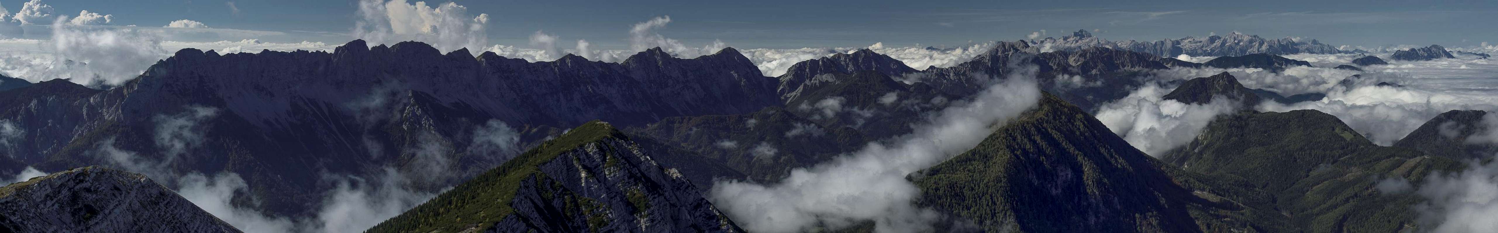
There are two summit crosses on top, a small one at the real summit and a bigger one, which is visible from the north. Summit views are best towards the south and west with the Karawanken, Steiner / Kamnik Alps and Julian Alps. The Hohe Tauern Range in the north-west can be only seen from (very) afar.
Descent
 |  |  |
You can either return the way you came or descend towards Eiseknkappler Hütte to the east, from where a longish traverse takes you back to Schaidasattel.
Essential Gear
Hiking gear is sufficient.