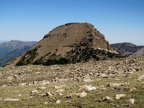
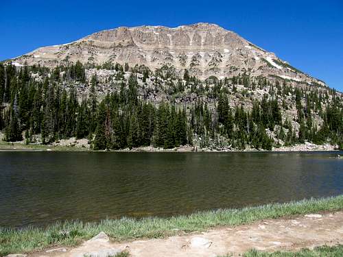
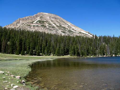
Bald Mountain - June 17th, 2012
A day after breaking 6,000’ of elevation gain for the first time on the Triple Traverse, I decided that my legs were due for an easy day. Bald Mountain in the Western Uintas seemed to fit the mold, as it offered an easy trail right off the Mirror Lake Highway. I set off Sunday morning excited to make my first foray into the Uinta Range.
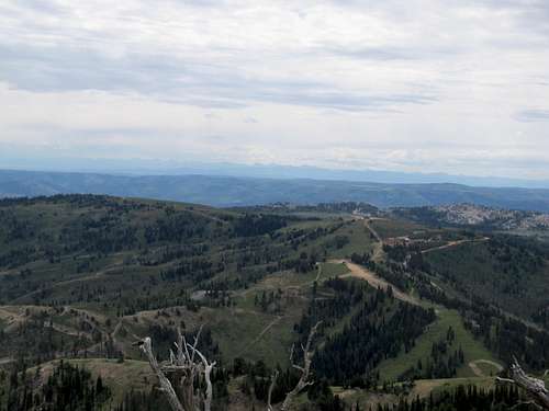
The road wound through deep forest past Kamas, and I was caught off guard at how quickly those round knobby Uinta summits suddenly rose above the trees, first in isolation then eventually in tandem. I found the trailhead for Bald and soon started up the easy trail.
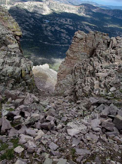
I was still tired, lungs and legs, from the day before, but the peak presented no problems until I found myself at the noted early season snowdrift blocking the trail right before the summit plateau. I scouted around for awhile before backtracking a bit to climb the slippery obstacle, then ascended through the woods lining the south side of the peak.
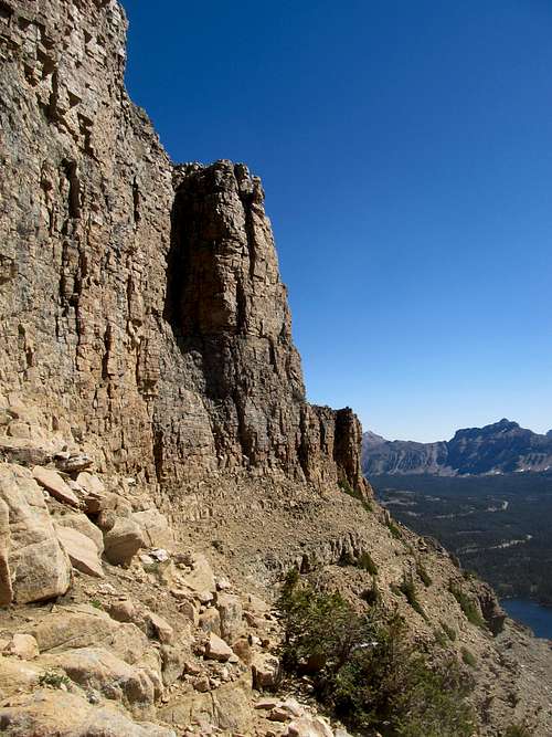
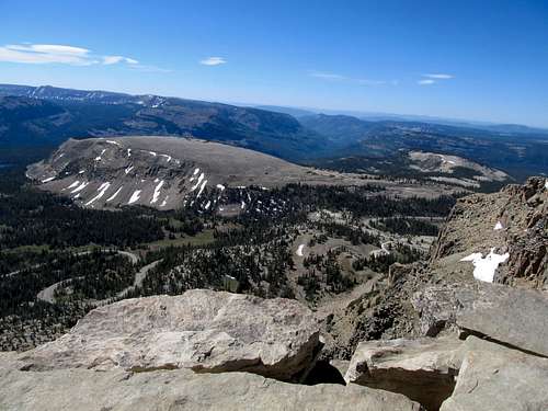
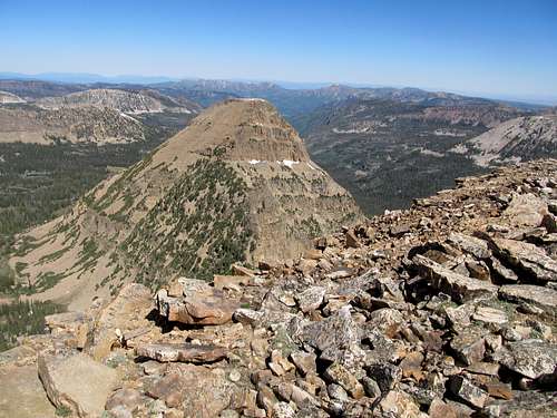
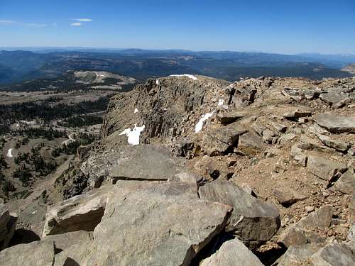
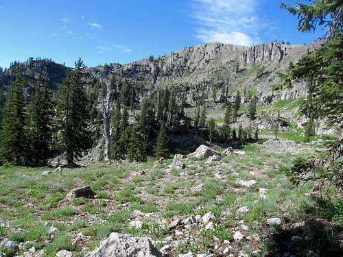
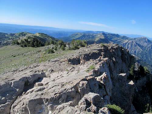
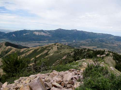
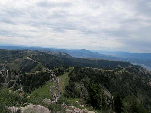
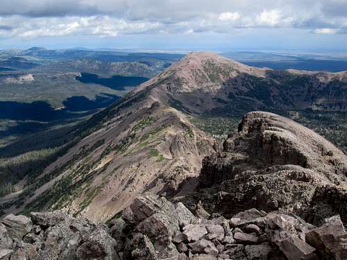
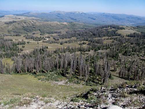
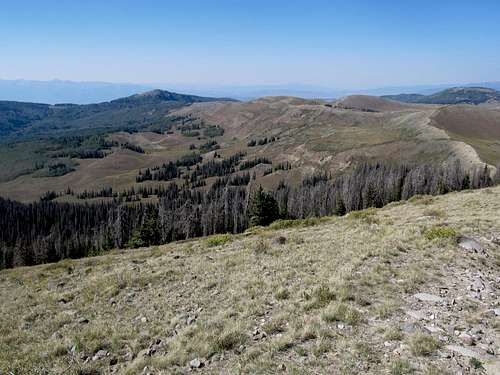
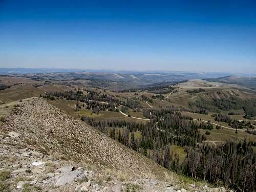
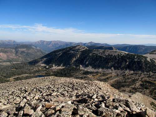
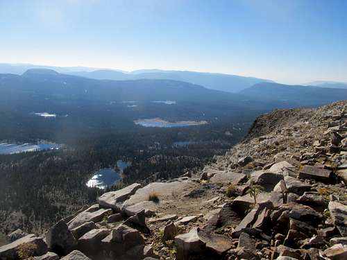
The last section seemed to last forever, flirting with the sheer cliffs lining the eastern side of the peak before rounding about to the summit. What particularly fascinated me during this stretch was the unique geology of these Western Uintas, with its massive sheer vertical blocks adorning the peripherals of the trail.
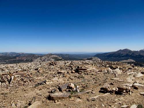
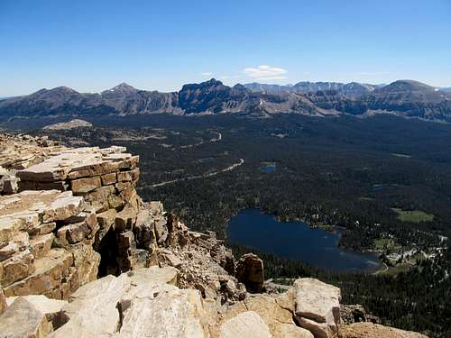
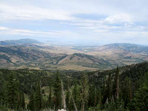
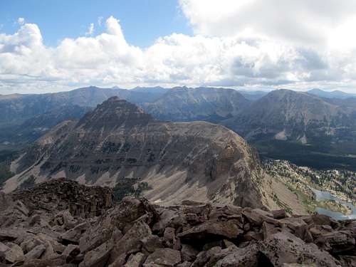
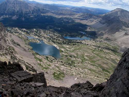
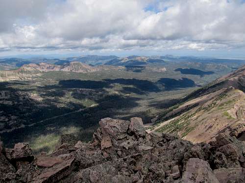
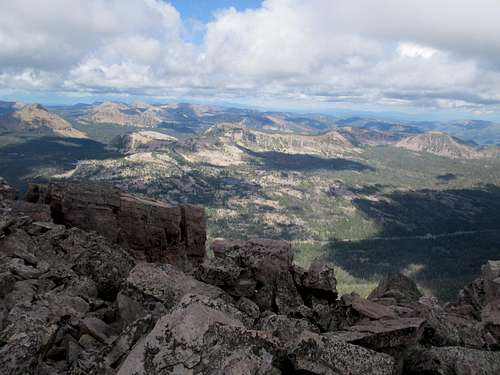
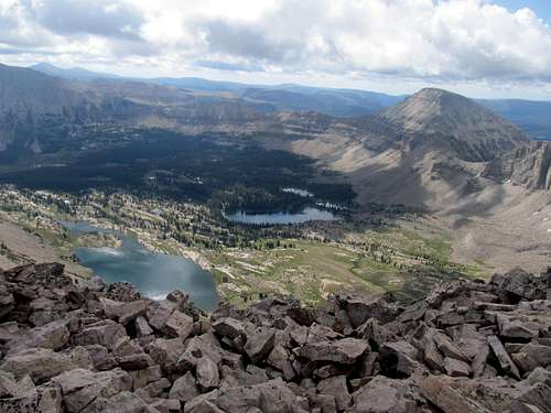
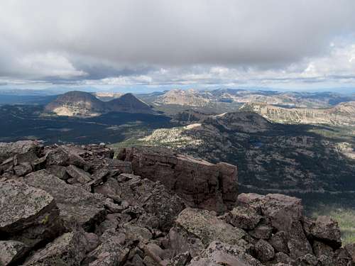
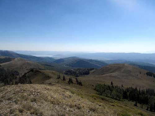
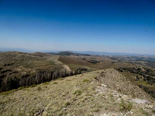
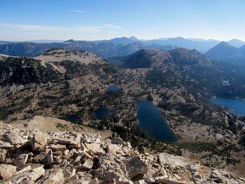
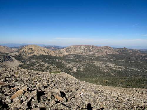
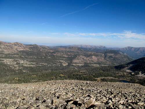
Views were amazing, as I gazed at the endless lakes and summits stretching deep into the Central Uintas, and I think I could barely make out Tokewanna and Lovenia in the distance. Back in the other direction I could see the Wasatch, Timp, and the Triple Traverse that had flogged my legs the day before.
The descent was a breeze, and afterwards I make a sidetrip to Mirror Lake before venturing into downtown Park City for the first time and enjoyed at a table lining the main street some wine along with a late lunch.
Bear River Interlude: Naomi - July 21st, 2012
June had been a remarkably clear month, and with August would arrive the great haze cloud of 2012, and amidst the two, July was marked with humidity and thunderstorms throughout the west. Coming off an exhausting week where for whatever reason I had not gotten a lot of sleep, I considered my options for the weekend. I thought of Borah, which had a slightly better weather window, but ultimately wanting to sleep in a few extra hours and do a little less driving for once, I decided after a late wakeup Saturday morning to hit the fairly easy Naomi Peak in the Bear Rivers. Driving into the Cache Valley in the early morning was a remarkable sight. It was starting to heat up a little bit as I pulled into the Tony Grove parking lot, but the trail was mostly easy going, with few steep parts.
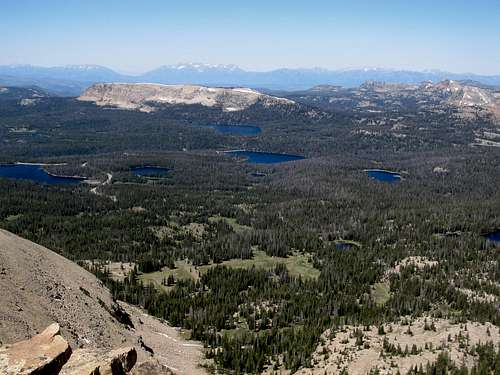
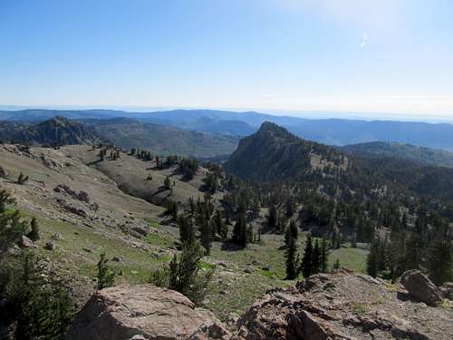
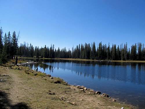
The geology of the range was certainly interesting, meadows interspersed around cliffs, and after descending a small hill I faced a number of ridges without a discernible highpoint. I lost the trail and circled around for quite awhile before refinding it in a slightly rocky area. It was ironic…often I tackled trailless peaks, just going in a general direction towards wherever the highpoint was. Give me an easy trail here, but lose for a few yards and I’m done for; Naomi's topography particularly too, it being a barely discernible ridge amid similar summits in height and shape. he higher meadows tinted blue from the wildflowers, and eventually I reached the ridge crest where amazing views of Cherry Peak and the Cache Valley greeted me. Then it was an easy hop and scramble to the rocky highpoint, where despite the earlier heat of the lake, the near 10,000 foot perch still felt like morning, and much of the ravines to the west still found themselves shrouded in shadow. Especially cool was the view of what I think were the Salt River Range in the distance, the high peaks of this remote and rugged range grazing the horizon like sharks' teeth.
The descent was easy, and I jogged down portions of the pleasant trail to get back to the car less than two and a half hours after I had left it.
Bear River Interlude: James - July 22nd, 2012
I planned for something a little more difficult Sunday, possibly Box Elder Peak (the Wasatch 11’er near Alpine), but ended up drinking till the wee hours of the night at a coworker’s house. Waking up on even less sleep and feeling even more tired than Saturday morning, I decided that nearby James Peak was the best option. I drove the Camry up to the Powder Mountain ski resort, parked, and started huffing and puffing up the steep slopes.
James is short but steep, and done hungover, it was brutal. I rounded the false summit to see the main hump of the peak still ahead of me, and bounded up inch by inch to the top.
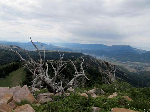
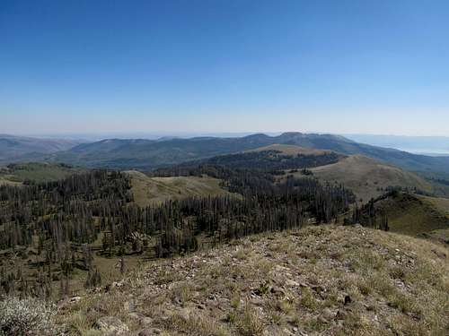
It was cloudy, and I could see precipitation from the southwest coming my way, but the views were a pleasant surprise…more than that, magnificent, especially for an almost urban peak so close to home. The back side of Willard and Ben Lomond was interesting to see, and to the north one had a backdoor perch up the Cache Valley all the way to the prominent ranges of Southern Idaho. To the SE I saw thunderheads starting to form over the high Uintas, I beat a hasty descent to avoid the incoming clouds coming my way.
The views definitely give you a great return for a relatively small amount of effort, and salvaged the day for me.
Hayden Holiday - July 24th, 2012
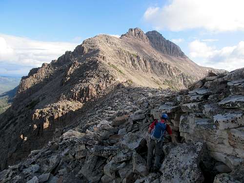
Pioneer Day is a state holiday in Utah, but unfortunately my first taste of festivities was on a weekday. I decided to team it up again with Matt to do a dayhike somewhere. Weather (tstorms) again was a factor, and we had originally considered peaks further up north such as Baird or Wyoming Peak. But in the end we decided on something closer by so that both of us could get back home earlier. Weather and exposed route not withstanding, we decided to give Hayden Peak a shot, since the brevity of its route allowed us to possibly ascend and descend before the storms got bad.
We parked at the trailhead and cross countried it through the open woods to reach quickly the massif itself. At a lower rocky section I decided to ditch the polls, thinking that we would return the same way.
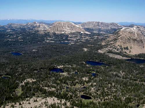
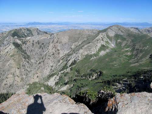
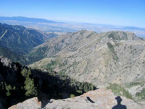
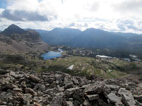
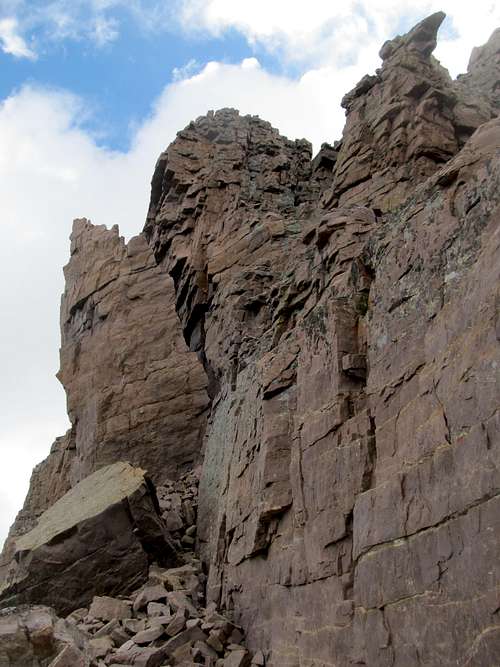
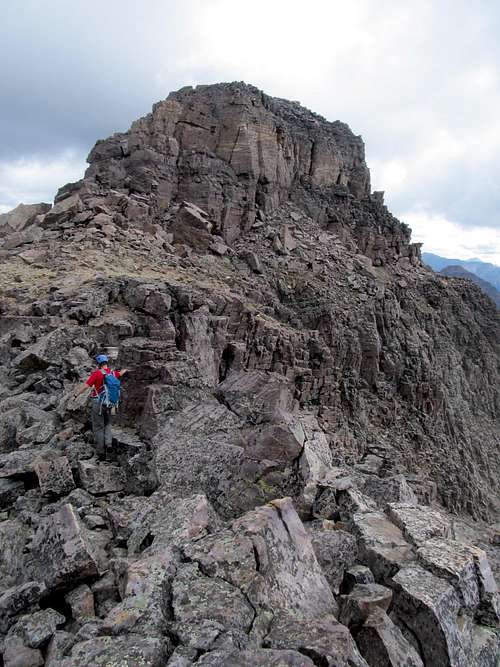
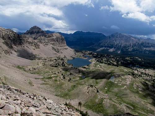
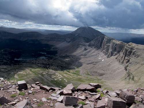
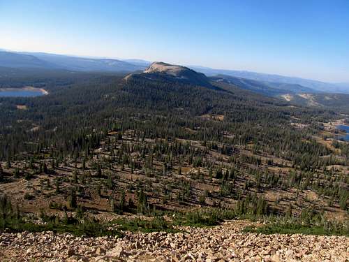
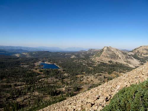
Then timberline quickly passed as we started up the quickly talusing terrain towards a band of cliffs that marked the first and most difficult crux of the route. The move wasn’t too difficult, and exposure was minimal, but still required a bit of thought. Soon we were up on the ridge crest, the giant massif of Hayden looming ominously before us. Elevation wise it wasn’t even that much, but the big loose chunk of rocks seemed larger. The lush green basin on the eastern side of the ridge looked like something out of a story book, with tiny trees and rocks dotting the landscape around lakes barely bigger.
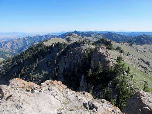
The flat march of boulders on the way to the along the ridge crest was a bit annoying. We passed the large blocky false summit and traversed along the ridge crest once more until we hit the summit block. The clouds began to get darker and puffier, and we knew that the promise of early afternoon thunderstorms would likely be soon fulfilled.
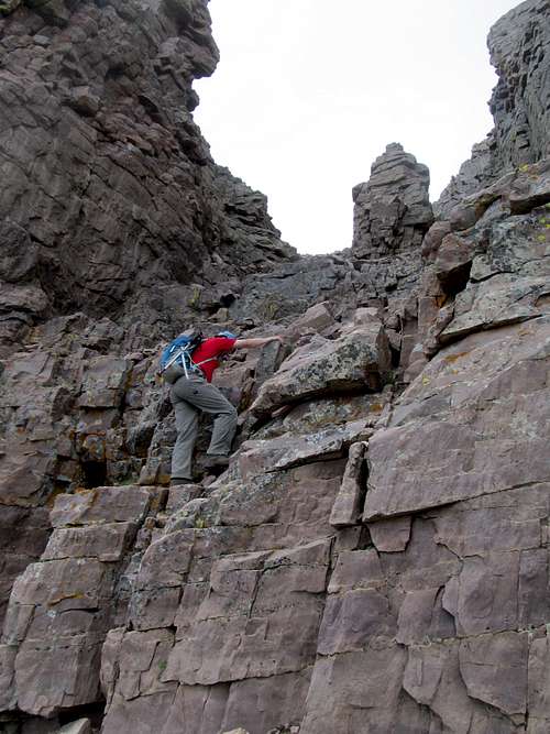
The class 3 ascent chute featured some very fun scrambling. There were a few ledges requiring higher steps to climb but nothing too difficult. The initial gully entrance was probably the hardest move, requiring a little bit of tiptoeing up some tight footholds to get into the gully proper. Once on the ridge again the traverse seemed a little more exposed and precarious. Perhaps the rocks were looser, and the landscape below further removed from us, or maybe it was the now ominous shade of the clouds, but somehow this section gave me the creeps. This was Matt’s forte though, loose rocks talus being the norm in Idaho, and the entire way he bounded ahead of me like a rockhound.
The scrambling up to the final summit block was a little looser than the rest of the route, but was nothing too difficult, and soon Matt and I found ourselves at the summit.
We did not tarry around much. Storms seemed to already break out already in the gap between us and the Wasatch, so we took our pictures and made ready for the descent. The sky alternated bright and dark, and as it hailed a little while we were between the upper traverse and the class 3 gully descent we thought we were in for it, being exposed on the ridge and having another exposed section below us, but it turned bright by the time we rounded the bottom of the gully and back onto the lower ridge.
Matt didn’t want to take his chances with the weather though, so instead of descending the originally crux we decided to take the loose escape chute further to the north. It was fairly unpleasant, the loosely packed dirt and the scree, but again Matt was in the zone as I dithered carefully behind him, trying not to slip and fall.
Back down in the woods we separated, as I had to traverse further south (and up a bit) to get back the poles I had ditched previously. The traverse was longer than I thought, but I eventually found the poles among the identical bands of rock, then started my way down, calling Matt’s name. Worst case scenario we’d meet back up near the car or somewhere along the highway. After some time descending, traversing northwest, and listening for movements in the woods, we met up shortly before reaching the car.
It was sunny again, and we made our way back to Salt Lake with all of Pioneer Day still ahead of us.
Infecting Currant Creek - September 8th, 2012
Much of the next month or so was spent further north, so it would be awhile before I returned to northern Utah peaks. Labor Day weekend I drove all the way up to Dillon Montana Saturday morning on two or so hours of sleep and felt kinda sick. Exposure to cold and windy conditions later that day didn’t help, and though I felt slightly better Sunday and Monday it was full blown flu by the time I was back at work on Tuesday. As for the coming weekend, Greg was heading up to Montana once more to go after Lone and Gallatin. I wasn’t feeling up to the peaks nor the drive being sick, nor did I want to infect them. Furthermore, another trip to Vegas was planned for the weekend afterwards, with friends from Boston flying out, so I decided to take it easy locally in order to increase my chances of being mostly recovered for the Vegas trip.
I had some work to do anyways, so I stopped by the office early afternoon on Saturday, then with a late start drove out past Kamas down the graded dirt roads leading south towards Currant Creek Peak. I figured an easy target like that would make for a good sick day peak, and perhaps I could even try my luck with nearby Red Creek Peak.
I set off in my sneakers. Though the elevation gain for Currant Creek was only a thousand feet or so it was steep and the terrain was tough going with my choice of shoes. I’m sure my body not being 100% had something to do with it too, but regardless it was tough going to the summit. The views were alright; after being spoiled by the high Wasatch, Western Uintas, and Northern Rockies all summer the placid, hazy views from atop Currant Creek was a little…eh. Even the High Uinta skyline from the south, likely spectacular on the clear day, was nearly wiped out by the haze.
I started maybe half a mile down the road towards Red Creek but it seemed a little rocky for the Camry. I could’ve made it possibly, but the nagging reminder in the back of my head of the college football games going down to the wire in the back of my head bade me to eventually turn around, and I made it to a Subway in Kamas where I saw Notre Dame pull a tight one out from Purdue and Johnny Football lose his first collegiate start to the Florida Gators.
Elementary on Watson - September 9th, 2012
Sunday I had a tight deadline, with the Pats kicking off their regular season against the Titans at 10 AM mountain time. Feeling a little better, but still sick, I hoped the clear brisk air of the higher Uintas would help clear up my lungs and throat. Watson it was, and perhaps I could make it back to Park City by kickoff.
I approached it via the South Slopes. There’s a lot of trails leading off from the Crystal Lakes trailhead, and for awhile I was confused, especially since all of the rounded summits in this area look similar.
Once I figured out I was on the right trail the approach wasn’t too difficult. It was easy to find the low saddle where I cut north from the trail cross country towards Watson’s southern slopes.
I ascended the peak boulder by boulder. Most of it was stable, but the few loose ones ruined the reputation for the rest of them. It was repetitive and a little tedious, and more importantly, was taking a little more time than I budgeted.
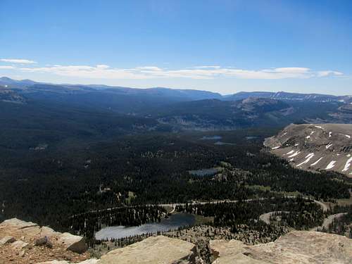
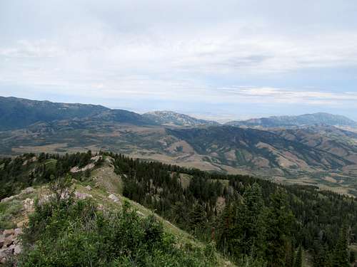
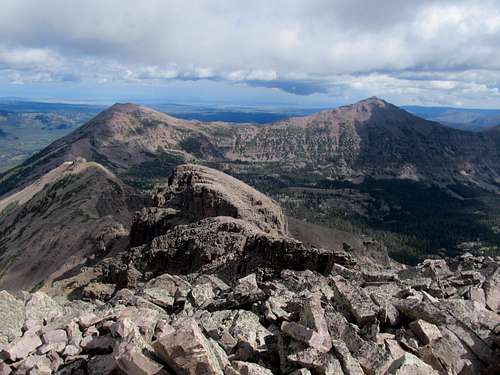
The summit views were spectacular though, and a little more satisfying since now I could stand atop an Uintas summit and start gazing and other summits previously climbed…few, but hopefully starting to add up. There’s something about the air in this range, pristine, matching the color of the blue lakes where it emanates from, that's impossible to capture with mere pictures, and I surely hope to be back.
I tried to boulder hop down as quickly as possible.
The trudge back to the trail took longer than I had hoped, but I still made it back too Park City to catch at the No Name the end of the Pats’ first quarter.


Comments
Post a Comment