
|
|
Mountain/Rock |
|---|---|
|
|
22.48562°S / 45.08388°W |
|
|
Hiking, Mountaineering, Trad Climbing, Sport Climbing, Toprope, Bouldering, Scrambling |
|
|
Fall, Winter |
|
|
7657 ft / 2334 m |
|
|
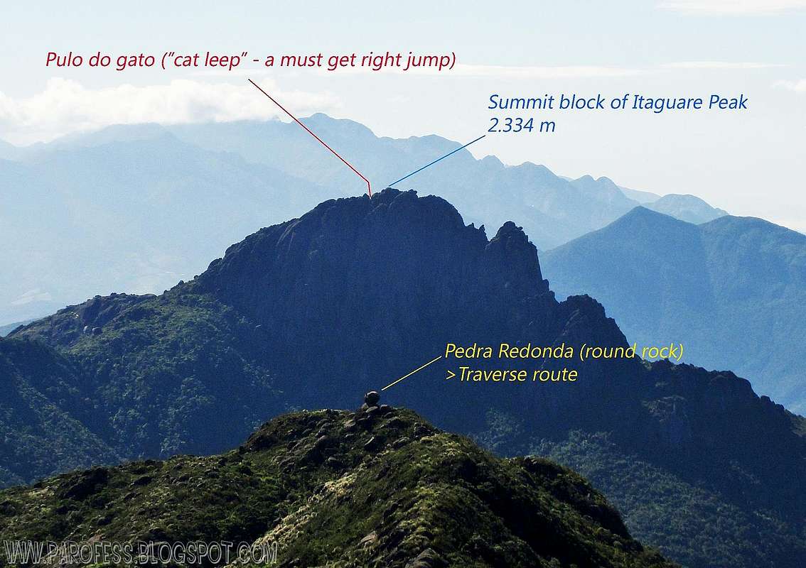
Informational view of Itaguare
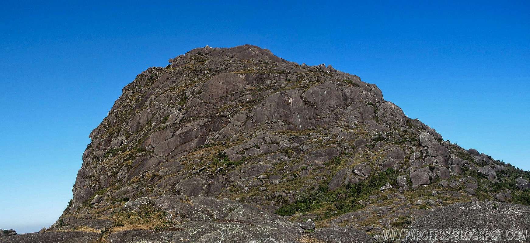
Itaguare from its base
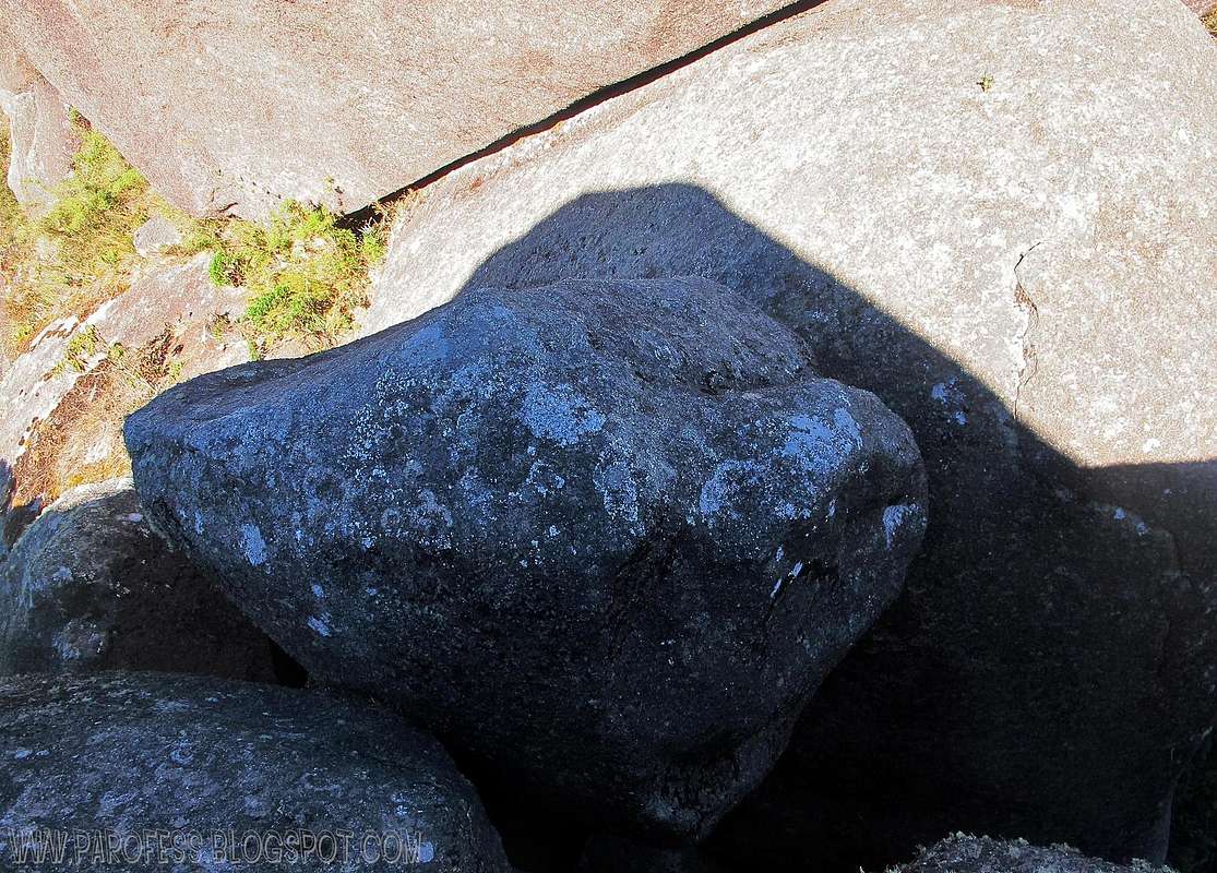
Cat leep. Don't miss that jump for your life!

The view from Cruzeiro bus terminal!
Itaguaré Peak is a mountain located on the border of Minas Gerais and São Paulo belonging to the Sierra Mantiqueira range. It has an altitude of 2.334 meters above sea level. The nearest town is Cruzeiro in São Paulo and the hike can be done through a trail that starts at a smal neighborhood called "Sertão" which can be accessed by a dirty road that leaves the main road between cruzeiro and Passa Quatro cities right after the border sign at the road: "Divisa dos estados de São Paulo e Minas Gerais".
According to research the name Itaguaré may mean "sacred rock" or even "Cracked Rock". Its slopes are steep and as the altitude increases it becomes increasingly steeper. From Cruzeiro city the peak may be seen, and its appearance is like a giant "lying" or "giant's nose". It is nicknamed "Sleeping Giant". Although Cruzeiro is only 10 km away from the peak, the region of Itaguaré Peak is practically deserted and unknown. The mountain is rugged, with extremely strong winds and winter nights where record negative temperatures. Some points of its hike can be used to practice free flight, however without any proper structure.
Itaguaré Peak is also called "Plays of the Swallows," there is a small cave that thousands of these birds use as a refuge, there were very docile. His access is difficult not in hike ways but just to reach its base, once you manage to get to its base the trail is fairly easy and it takes around 2 to 4 hours to the summit on the reverse way of Marins - Itaguare traverse.
The traverse is known here in Brazil as "Marins - Itaguare". I can honestly say it's one of the five most traditional hikes in my country. It takes around 3 days been Itaguare Peak the last objective. It requires good physical condition. Some mountaineers can do it in just one day but it is very demanding, recommended only for professionals due to the difficult conditions of the trail, full of mountains, wetlands and very high vegetation.
Also the stories are very common in unknown location of lights that come on the slopes of the mountain. According to ufologists, the peak of Itaguaré is located in a hallway Bavic, which are considered the airways of possible "flying saucers". Others, more skeptical, saying it is the frequent occurrence of "ball lightning" or "St. Elmo's fire."
About the altitude: IBGE, the people responsible for measures of all brazilian peaks, claims that Itaguare Peak is 2.308m high. But the last time they checked that out was around 20 years ago. Now everyone who gets there and uses a hand GPS finds different altitudes but all of them with very close numbers. All my friends found above 2.328m high and i found 2.334m high.
Getting There
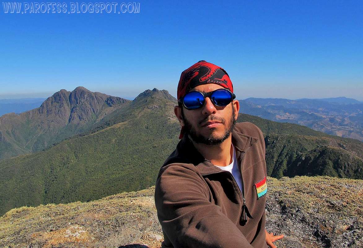
Splattski atop Itaguare Peak!
If you wanna do just Itaguare: The same way to Itatiaia National Park and the very same way to Serra Fina range, but when you get to Cruzeiro, look for the sign just outside the city that says on the road "Divisa de estados Minas Gerais e São Paulo". About 15kms away outside the city towards Passa Quatro. After that there is a small dirt exit to Sertão neighborhood. Ask for directions on any stop by the road, there's plenty of them every couple kms.
After the exit, more 15km of dirty road awaits for you till its base. If you try the hike on wet season, be advised: 4x4 needed!!!
From this point, direct ascent to Itaguare Peak is quite easy. Be advised, you might have to wait for a bit before you can step on its summit since it's very small, it fits four people tops at the time, and if you fall, well, i'm sure you got the picture...Some sections of the last part are very exposed and some people feel safer with a rope. Some scrambling to the summit as well, also very exposed.
If you wanna do the whole traverse: The peak will be the last part of the traverse. start on Piquete Town, in São Paulo State. From São Paulo city, there are 200km to Piquete and more a few kilometers to the starting point of the trail. Another base town is Delfim Moreira at Minas Gerais State, more 16 km. From Piquete: If you go to Marins group, do it with someone who knows the route, the trails get closed after wet season and that's quite dangerous. The weather is another problem. The range is hot at day and cold at night, with the temperature bordering - 10°C and constant ice over the woods.
Rock climbing routes: I know there is a few rock climbing routes by the west face of Itaguare Peak, but I couldn't find any information about it so I could fix it on this page, but I'll keep looking and as soon as i find it, I'll update this mountain page.
Helpfull images
 |  |
|---|
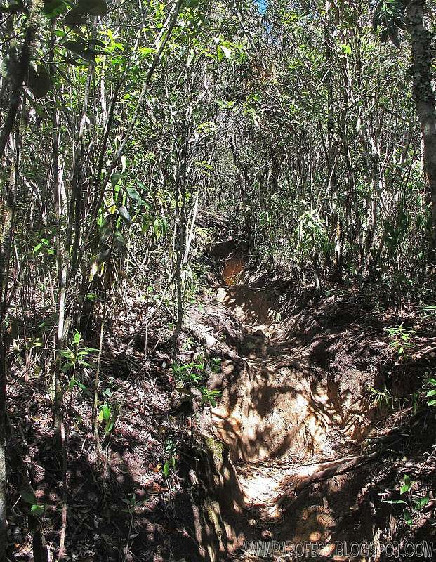
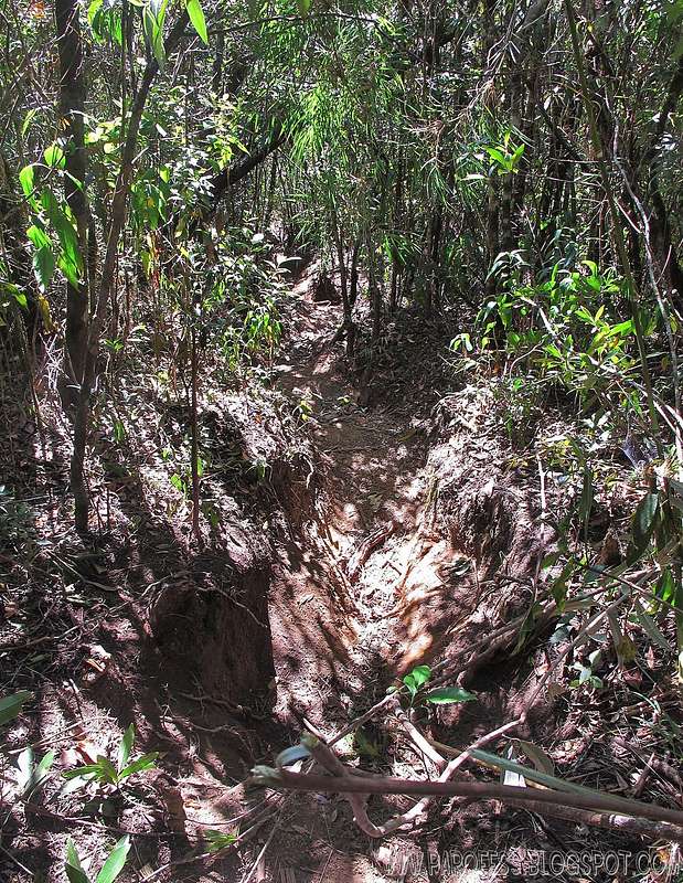
Looking up the trail and looking down the trail
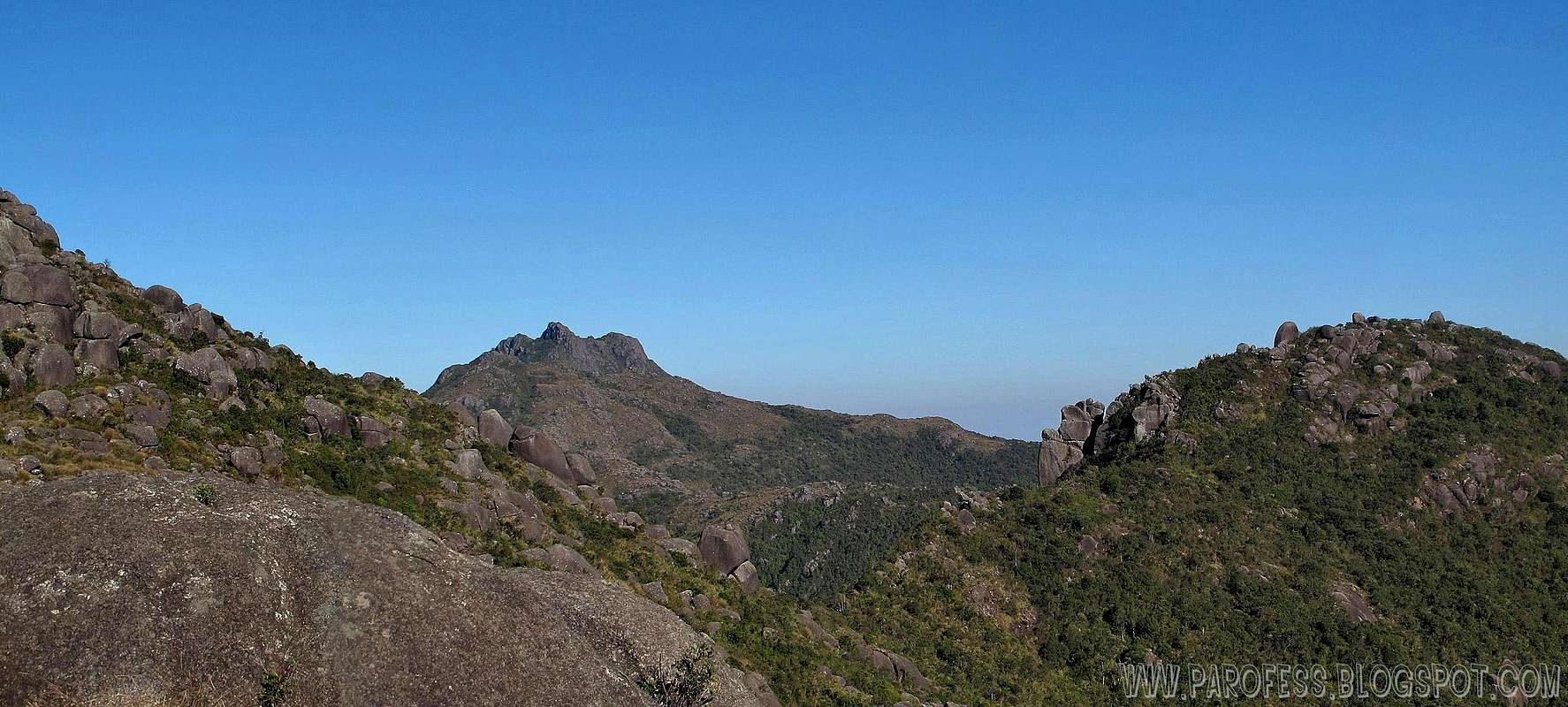
At 2.150m this is the view. The traverse route and Marinsinho Peak on the back
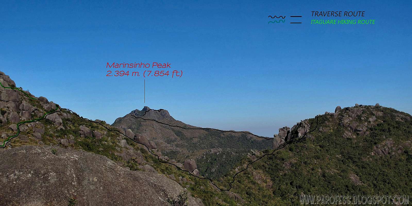
At 2.150m this is the view. Informational view of the traverse route and Marinsinho Peak on the back. Zoom in to see details.
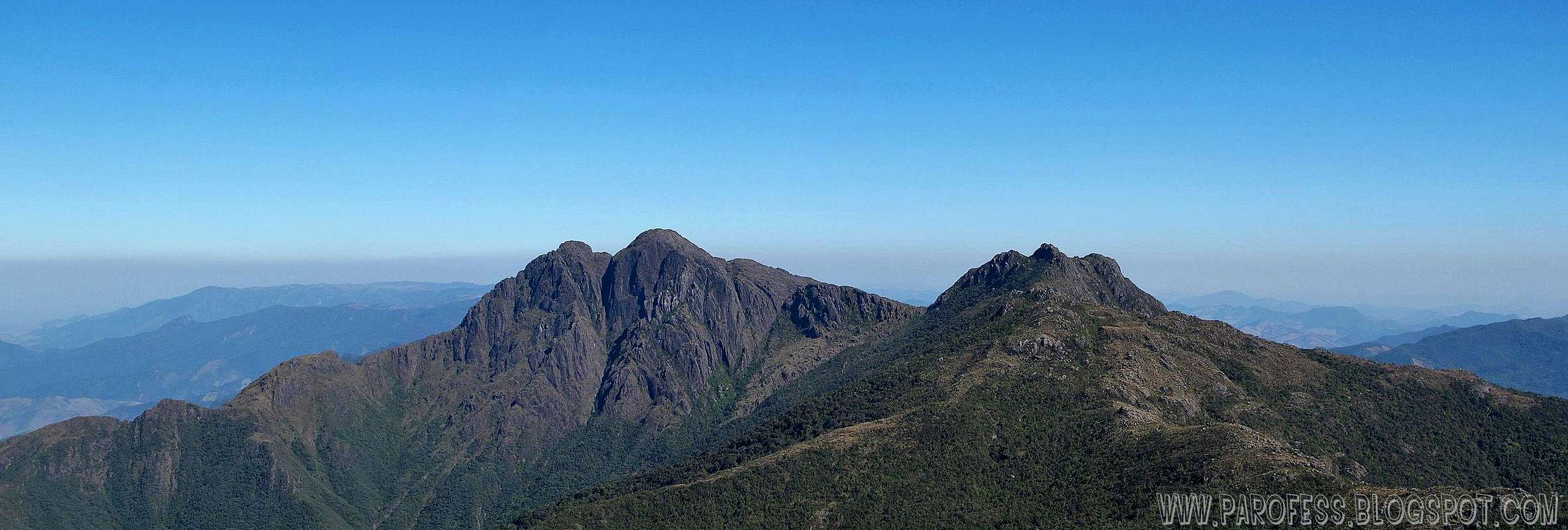
Marins and Marinsinho Peaks from Itaguare summit.
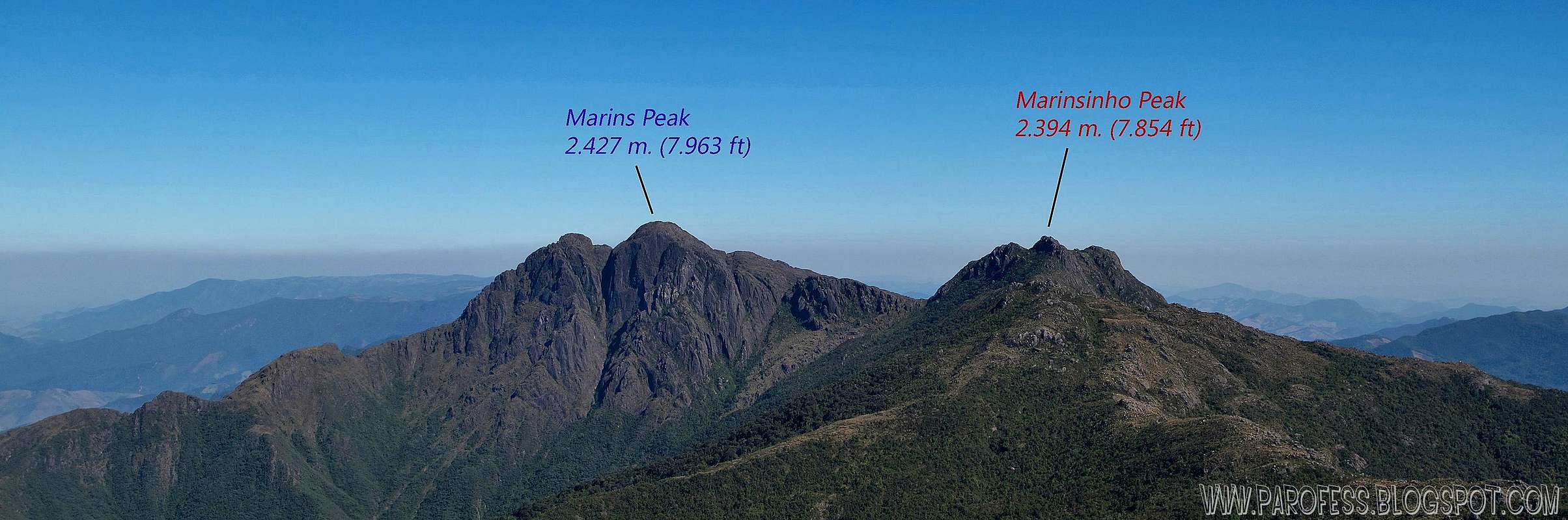
Marins and Marinsinho Peaks from Itaguare summit. Informational view. Zoom in to see details.
Summit video view. Hold your breath!
Camping
Sereral campings along the traverse route and the "last day" section, the one you get to summit this mountain. At the base there is three camping spots, not much tents on these places...One of them just a few, another around 3 or 4 and the big one around 10 tents.First day: Camping on Marins peak base, or at the huge plateau just below the summit or at the very summit of Marins Peak.
Second day: Close to Marinsinho Peak or after Redra Redonda area. Most people push it hard all the way to camp at Itaguare Base.
Fees and red tape
Parking lot at the farm for the traverse route;Well marked trail;
R$ 20,00 per night, per car(around US$ 13.00) fee.
If you hike it by the direct route (the end of the traverse as i did), no fees at all.
What’s forbidden:
At all costs, don't make fire or deforest any places. Respect the nature and wildlife please!
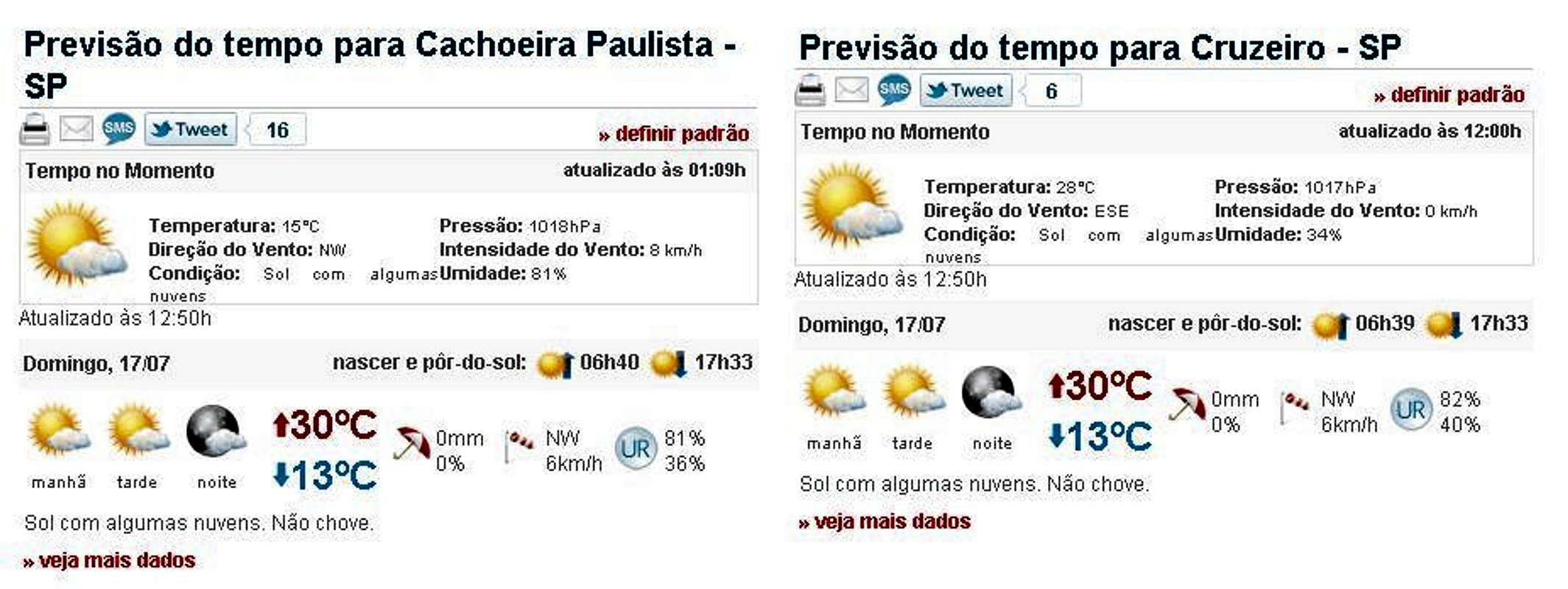
Weather forecast
Legal Issues
To hike/ climb is a dangerous activity and requires proper equipment and clothing, the owner of this page cannot be blamed by injuries caused to anyone who read this page for its info about the mountain, and eventually got hurt by doing so with reckless behaviour or bad weather conditions.
Paulo Roberto Felipe Schmidt – AKA: PAROFES
External Links
My youtube channel: www.youtube.com/parofes - Now with 270+ videos online!The biggest brazilian website about climbing and mountaineering, for which I'm a columnist: