
|
|
Mountain/Rock |
|---|---|
|
|
22.76655°S / 45.52261°W |
|
|
Hiking, Mountaineering, Sport Climbing, Bouldering, Scrambling |
|
|
Winter |
|
|
6424 ft / 1958 m |
|
|
Overview
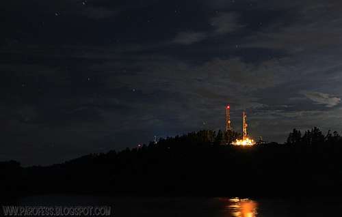
Night photography for change.

5 minutes of exposure on the peak.
This is another “occupied brazilian mountain”, with anthenas on its top and a small village in which people sell handicraft to tourists that go by car all the way up to the summit at 1.958m. Searching online it’s easy to find the completly wrong information (made by locals of course) that the mountain is the fifth highest peak of Brazil. Well, if we would put it in a position, probably it won’t be among the 70 highest peaks of my country. Wrong information sold by local tourism agencies to take unadvised tourists to the top of the mountain and to take a nice photo to remind the nice day up in Mantiqueira Sierra.
For a long time now we know here in Brazil about the informationn that the highest inhabited point of the country is Morro da Igreja (Church Hill), where employees of Air Traffic control spend the night at 1.822m high (you can see the mountain page for Church Hill here at SummitPost: Morro da Igreja). Now I must say I am against that info. Atop Itapeva Peak there is some houses of people who sell handicraft, people who actually live up there, and also the employees of tv channels that work on the antennas, maintenance, custody, calibration, spend the week atop the mountain, some at the highest point, and some at slightly lower altitude, some 30 vertical meters (about 100ft) below the main summit. Even these ones live at 1.928m high, more than 100 vertical meters higher than the people sleeping at Church Hill.
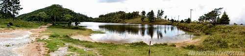
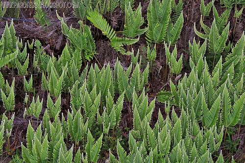
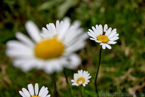
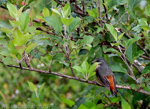
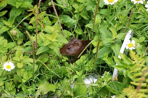
This is not a very impressive peak, not even beautifull, you can reach its summit by car, but the cool thing is the lake below the summit at around 1.865m high (where you can fish big, big trouts and carps of some 10kg!!!), set up camp, cross the lake on a Tyrolean line fixed over the lake, enjoy wildlife and some nice quality time with yourself.
Getting There
A bus from Sao Paulo to the city of Campos do Jordão, known to be (and indeed is) the highest city in Brazil to 1.660 meters of altitude. The bus takes 3 hours to let you in the main bus station, from there a taxi can get you on the mountain, where you can explore the wildlife, photography, fishing, everything has already been said.
Campos do Jordão is a municipality in the state of São Paulo here in Brazil. The population in 2003 was 47.903 inhabitants and the area is 290.27 km². Today the population probably is around 70.000 people. The city is situated 1.660 m above the sea level, and it's the highest city in Brazil. The city's economy is based mainly in tourism, due to its location at high elevation (on the Mantiqueira mountains) and European-looking architecture. Buildings are mostly German, Swiss or Italian inspired. Many of the richest people from the state of São Paulo build their winter country houses there and July (the winter season vacations) sees an enormous influx of visitors (more than quadrupling the city's population), due in part to the winter festival of classical music. Its attractions throughout the year include German and Swiss food restaurants, bars and a cable car. There are many pousadas (inns) and chalets.
Red Tape
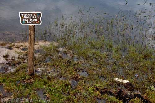
While on Itapeva Peak, keep in mind some things:No permits;
Be very careful with wildlife, especially wild jaguars (yes!);
Be careful with thieves;
Try to hide your tent inside the wooded area around the lake;
Be vary, very careful with snakes (Urutu da Serra specie, very poisonous)
Camping
By the lake, perfect to do it.But be careful with thieves, they can sneak on your tent and steal stuff while you're out there walking around.
 |  |  |  |
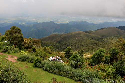
Views of the mountain
Weather Forecast
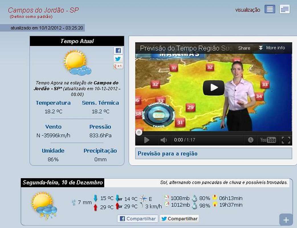
PS: The weather forecast on this link is not for the mountain itself, but the city, it will do just fine.
Legal Issues
To hike/ climb is a dangerous activity and requires proper equipment and clothing, the owner of this page cannot be blamed by injuries caused to anyone who read this page for its info about the mountain, and eventually got hurt by doing so with reckless behaviour or bad weather conditions.
Paulo Roberto Felipe Schmidt – AKA: PAROFES
External Links
My youtube channel: www.youtube.com/parofes - Now with 270+ videos online!
The biggest brazilian website about climbing and mountaineering, for which I'm a columnist: