
-
 10352 Hits
-
 78.27% Score
-
 9 Votes
|
|
Route |
|---|---|
|
|
43.96070°N / 109.3393°W |
|
|
Hiking, Scrambling |
|
|
Summer, Fall |
|
|
Most of a day |
|
|
Class 2 |
|
|
Overview
 Francs Peak above Jack Creek
There are a couple of options to choose from when climbing Francs Peak from the Jack Creek drainage. The longest is to park at the Jack Creek trail head, which is located at the very end of Road 208 past the Four Bear Oil Field. I haven't hiked this trail, so I cannot give any information about stream crossings (of which several are shown on the map), etc., but it would likely need to be done as a two-day backpack; the round trip distance to the summit of Francs from the trail head would be around 11 or 12 miles with 5500+ feet of elevation gain.
Another much shorter option which still utilizes the upper part of Jack Creek is to drive the Phelps Mountain Jeep Road to its end and to descend into the drainage from there. The distance to the summit via this route is only 3.5 miles with 2700 feet of vertical gain; while there is a lengthy and somewhat unpleasant scree slog to reach the ridge at 12,400 feet, this route would appeal to anyone to who is interested in exploring the old mining cabins and ruins located at upper east end of the drainage. It is also a good and quick route for a descent from the top after a climb of the Northeast Ridge, especially if weather is threatening.
 The upper slopes
Car Approach
 Phelps Mountain Road sign
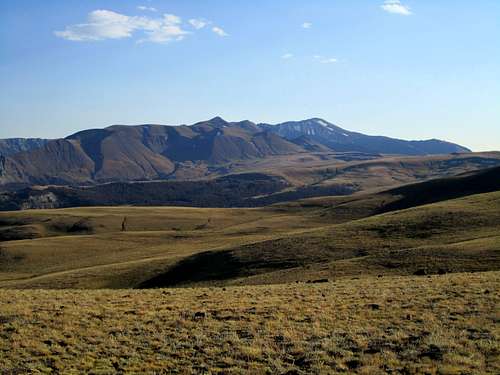 Nearing Francs Peak on the Phelps Mountain Road
This next section of the road gains 1500 feet in the next 1.5 miles, so the grade is steep and there are lots of rocks to avoid. Keep right at the only fork, which is just before a gate about a half mile up the road. Once you reach the top of the ridge, the driving gets much easier all of the way to the end of the road. After 4.5 miles, keep left at the fork and continue for another 5.0 miles to the highest point just before the end of the road. The 4WD section is a total of 9.5 miles and gains about 4500 feet of elevation!
If you want to climb the very long route from the Jack Creek trail head, continue past the oil field equipment for another 5.0 miles to reach the end of the road.
 Old mining cabins and tunnels
Route Description
 Climb this gully
 Looking back down the Jack Creek drainage
 The steep part on the ridge
 Nearing the summit
Essential Gear and External Links
Bring bear spray! This area around this peak is thick with grizzlies, and after reading the summit register, where entry after entry recounts seeing multiple bears, it would just be foolish not to bring it! Normal day hike gear should suffice for most summer weather conditions.Shoshone National Forest
Washakie Wilderness
Francs Peak on listsofjohn
 Smoky Absaroka Sunset