
-
 23344 Hits
-
 87.31% Score
-
 24 Votes
|
|
Mountain/Rock |
|---|---|
|
|
34.18659°N / 118.05295°W |
|
|
Los Angeles, Calif. |
|
|
Hiking |
|
|
Spring, Summer, Fall, Winter |
|
|
3375 ft / 1029 m |
|
|
Overview
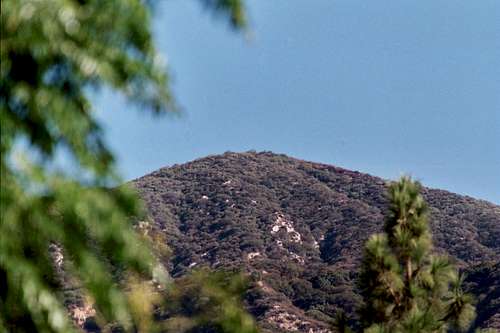 Jones Peak from Bailey Canyon Park trailhead
You get a lot of bang for your buck hiking to this lower peak in the front range of the San Gabriel Mountains. Although it stands only 3,375 feet in elevation, it is positioned to afford an unobstructed 360 degree panorama of points near and far in Southern California from its rounded summit. Furthermore, the two principal routes to this peak take you up two beautiful, rugged canyons typical of the San Gabriel range.
Once on the summit, look south and, on a clear day, you can see Catalina Island in the distance. In the opposite direction, north, 5,715 foot Mt. Wilson is in view.
 Looking north from Jones Peak to Mt. Harvard
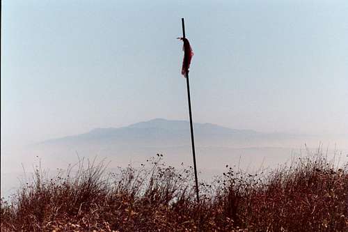 Santiago Peak, the highpoint in Orange County, from the summit of Jones Peak Oct. 21, 2006
The most direct route to Jones Peak is from the Bailey Canyon Park trailhead located in the City of Sierra Maddre. This trailhead is at 1,100 feet elevation and the route is 3.3 miles one way with 2,275 feet of gain. The route starts at the western end of the trailhead parking lot. You will walk through some trees, then through a turnstile, and then north onto a paved road that skirts the west end of the Bailey Canyon debris dam. The paved road then turns into the Bailey Canyon Trail as you enter the canyon. The trail ascends along the eastern slope of the canyon. It is a narrow, picturesque canyon. The trail tops out at Jones Saddle. Here, Jones Peak is directly behind you to the south. Hike the short one-tenth of a mile up the use trail and you are there.
 North slope of Jones Peak looking down at Jones saddle and use trail to summit
The other main route is from the Mt. Wilson Trail trailhead located in Sierra Madre. The trailhead is at 970 feet elevation and the route is about 3.7 miles one way with about 2,600 feet of gain.
The Mt. Wilson Trail ascends the western slope of Little Santa Anita Canyon, located just to the east of Bailey Canyon.
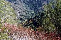 Looking down 700 feet from near Jones Saddle into Little Santa Anita Canyon and Mt. Wilson Trail (left center)
If you arrange a car shuttle between the Mt. Wilson Trail and Bailey Canyon trailheads (they are only 1 mile apart), you can make this a loop hike returning down Bailey Canyon instead of retracing your steps back to the Mt. Wilson trailhead.
Getting There
Bailey Canyon RouteThe Bailey Canyon Park Trailhead is also known as Grove Park. It is situated within the city limits of the foothill community of Sierra Madre, California. From the 210 Freeway, exit at Santa Anita Ave. and go north. Turn left (west) on Grand View. Continue several blocks to Grove. Turn right (north) onto Grove and drive directly into the Bailey Canyon/Grove Park parking lot. There is a gate at the entrance to the park open “from dawn to dusk.” If you get there before the gate is open, there is parking along adjacent residential streets.
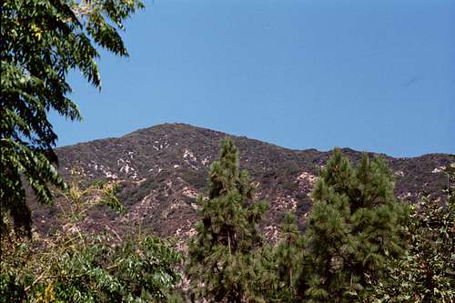 Jones Peak from the Bailey Canyon Park trailhead
Mt. Wilson Trail/Connector Trail Route
The Mt. Wilson Trail trailhead is also located within the city limits of Sierra Madre. From the 210 Freeway, exit Baldwin Ave. and go north. When you come to a traffic light where you have to go either right or left, go left to the next light and that is Baldwin Ave. Take a right and continue up Baldwin Ave. through the downtown area of Sierra Madre. Approximately ¾’s of a mile from the downtown plaza, take a right on Mira Monte. Go down about ½ mile and you will come to a small park on your left. Park anywhere in this area long Mira Monte. To get to the trail, walk up the paved road that goes north off of Mira Monte next to the park.
Red Tape
No permits are needed for the hikes to this peak. Neither is an Adventure Pass required to park at either trailhead mentioned here because neither is located within the Angeles National Forest.Camping
There are no campsites/campgrounds within the immediate vicinity of this peak.Other Information
USGS Topo: Mt. WilsonNOTE: as of July 2010, the two trailheads mentioned above are some of the few still accessible in the front range of the San Gabriels due to the devastating "Station" fire of 2009. As of this writing, SR 2 (Angeles Forest Highway)is still closed to traffic from La Canada.
External Links
History of Mt. Wilson TrailAngeles National Forest