
|
|
Mountain/Rock |
|---|---|
|
|
34.28697°N / 117.63426°W |
|
|
San Bernardino |
|
|
Hiking, Mountaineering, Ice Climbing, Mixed, Scrambling, Canyoneering, Skiing |
|
|
Spring, Summer, Fall, Winter |
|
|
9552 ft / 2911 m |
|
|
Overview
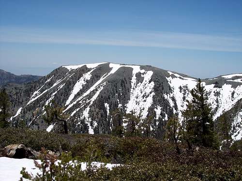
Mount Harwood is the peak directly East of Mount San Antonio (Mt Baldy). At 9552ft and with many backcountry ski and climbing routes, it is a major peak in the San Gabriel Mountains. Those who spend the time to know the area north of Harwood will have a true appreciation for this great peak, which offers excellent mountaineering routes with no crowds and pure, clean solitude. This is the key to unlocking the true spirit of Mount Harwood, and San Gabriel Mountaineering.Mt Harwood was named for Aurelia Squire Harwood, a Claremont native and supporter of the Sierra Club. Nearby Thunder Mountain was at one time named Mount Harwood, until the Mt Baldy Ski resort changed the names over.
Getting There
Most of the approaches and routes to Mt Harwood are the same as if you hiked Mt Baldy.South Side: From the 210 freeway, exit either on Baseline Road or Mountain Avenue to Mt Baldy Village. If using Baseline, make a left at the exit and a right onto Padua Ave heading towards the mountains. Make a right at the light and follow the road (which becomes the Mt Baldy Road) into the village of Mt Baldy. If using Mountain Avenue (which also can be used from I-10), make a left towards the mountains and Mountain Ave will connect with Mt Baldy Road. Follow the road through the Village and past the Ice House Canyon parking lot up switchbacks to the upper basin. A little ways up on the left is Manker Flats and about a 1/2 mile further is the Ski Area parking lot. The following routes are the most popular used to climb Mt Harwood with the top of Register Ridge ending at the summit.
North Side: One can also access Harwood's beautiful northern side by heading up Lytle Creek Road (exit off the 210) to Stockton Flats. In winter, one would be wise to bring something with 4WD. A car with AWD and above-average ground clearance is advised in all other conditions. Many possible routes exist on this side including Holtgrefe Ridge.
Red Tape
National Forest Adventure Pass day passes are $5.00; Annual passes are $30.00. Fires in the Stockton Flat area allowed only in fire pits.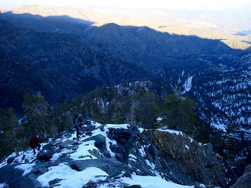
Camping
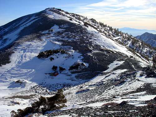
The summit receives very strong winds year-round, and often all day long. Thus, camping or bivying on the peak can be a challenge to mountaineers unless they stay low in the trees.A favored camping spot is the nice sheltered saddle with Mt Baldy.
Our Camp