
-
 3614 Hits
-
 76.65% Score
-
 7 Votes
|
|
Route |
|---|---|
|
|
34.28560°N / 118.1538°W |
|
|
Hiking |
|
|
Spring, Summer, Fall, Winter |
|
|
Half a day |
|
|
Class 1 |
|
|
Overview
 The route winding up the ridge
The Josephine Fire Road (designated County Road 2N64) is the standard route used by hikers and mountain bikers to reach the summit of Josephine Peak (5,558’). This peak is the high point along a 2-mile spur extending west from Strawberry Peak (6,164’). The fire road climbs north along the ridge separating Colby Canyon from Clear Creek. It is, for the most part, an unshaded road on its lower portion. However, this lower portion of the route is generally festively adorned with colorful flora, especially in the spring.
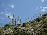 Yucca on ridge above route
 Fire road scenery
Route Description
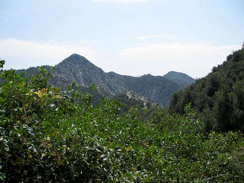 Strawberry Peak seen from along the route
 Me on Josephine's summit, 7.12.08
 Josephine Peak top left seen from road
 Strawberry Peak along the route
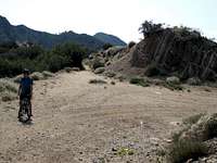 My son Daniel at route junction
For our route, go left (west) at the junction. The fire road now ascends Josephine Peak’s east ridge on its north side. The road is bordered by spruces and oaks affording some protection from the sun’s rays on hot days. From the junction, the route is 1.5 miles to Josephine’s summit and this part of the route is generally more moderate in steepness than the 2.5 miles up to the junction. This route’s round-trip stats are 8 miles with 2,100 feet of gain.
 Alternate route: Josephiine's west ridge
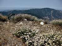 Mt. Lukens ridge from fire road
This route makes for an excellent mountain bike outing. Being a fire road, there is ample space for both hiker and biker. You can ride your bike to about 100 yards below the summit and then hoof it the rest of the way.
Driving Directions
From the 210 Freeway, exit at Angeles Crest Hwy (SR 2) and go north. At 9.5 miles, you will come to the Clear Creek Information Station and junction with Angeles Forest Highway. To park across from the trailhead, marked by a white fire road gate, take a left onto Angeles Forest Highway and go down about 50 yards. The gate is on your right on the east side of Angeles Forest Highway. The gate is directly across the street from the Clear Creek Fire Station. You can park on the west side of Angeles Forest Highway facing the fire station just across the street from the fire road gate. An alternative parking location providing more ample parking is a large unpaved area right at the Angeles Crest and Angeles Forest highway intersection. At either place, you must display your Adventure Pass.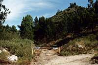 Fire road trailhead
Red Tape
You will need an Adventure Pass or Golden Eagle Pass to park your vehicle at either of the two locations mentioned.. These passes are currently sold at the Clear Creek Information Station ($5 per day or $30 for a yearly pass). This information station is located on the south side of the Angeles Crest Highway right where it intersects with the Angeles Forest Highway. Otherwise, Adventure Passes are also sold at most sporting good stores in Southern California.No permits are required for hiking any of the trails accessible from this trailhead.
Essential Gear
None required. The fire road is in good condition and trail runners are more than adequate.Other Information
This route is accessible year-round. However, during winter months when it snows, you may need chains to get to the trailhead.There is no water source along this route. Further, the section of fire road up to Josephine Peak’s east ridge has no shade to speak of so be forewarned during hot summer days.
USGS Topos Condor Peak 7.5
External Links
Angeles National ForestAdventure Pass information
California Dept. of Transportation