
-
 6509 Hits
-
 85.22% Score
-
 20 Votes
|
|
Area/Range |
|---|---|
|
|
46.17716°N / 13.97471°E |
|
|
Hiking, Sport Climbing, Ice Climbing, Skiing |
|
|
Spring, Summer, Fall, Winter |
|
|
5348 ft / 1630 m |
|
|
Overview
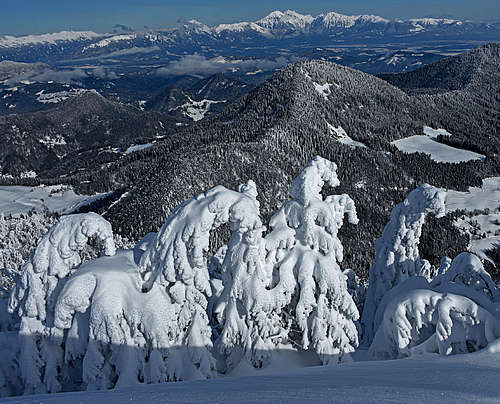
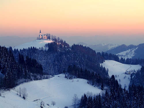 Črni vrh
What's New On This Page?
> JAN 18th, 2021: Added: imaps, images, descriptions.
> MAR 17th, 2013: Initial set up of the page.
Julian Alps Foothills Presented
To have a complete picture of a great muntain group such as Julian Alps, one should not leave out its foothills. They have their reason to exist and they serve our hiking needs well, complementary to the wild, rugged, rocky and in some times of season hardly reachable goals of high mountains.
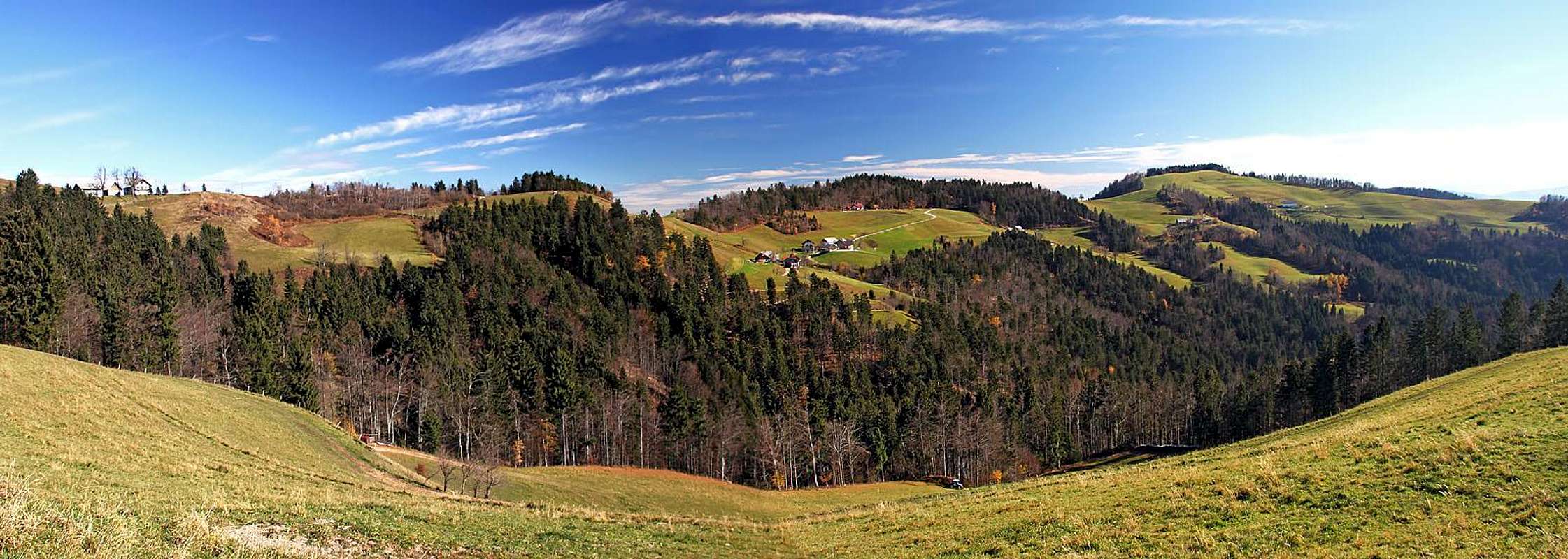
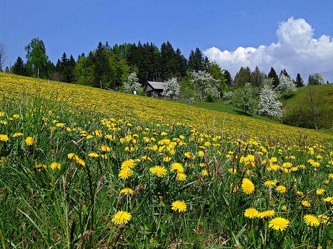
Julian Alps foothills lie close to Ljubljana, the capital of Slovenia, so they are very often visited. As elsewhere in Slovenia, there is a dense network of marked trails. The area is especially suitable for easy hiking, scenic family trips, mountain biking and tour skiing. The highest summits are rising above the neighbouring valleys with up to 1000 meters of altitude difference. Most of them are reachable within a 2-3 hours hike, but also long distance hikes, biking tours or ski tours are possible. In the area there are no big tourist attractions. Peaceful, hilly landscape, with many nice villages on the slopes, solitary farms, cute churches on hilltops. That attracts too, of course, but many people are looking for something more extraordinary. Nature is not much deteriorated, but also not well preserved, because natural resources are exploited too carelessly. The best advice for visiting this area is to choose appropriate time. Blossoming spring or golden autumn can serve well for a bike or even car ride, a clear day any time of a season will offer you nice panoramas and vistas over the landscape, and in winter, when these mountains are covered with deep snow, you can visit them with skis or snow shoes. Hundreds of meters of gentle slopes will bring you also to villages which struggle at that time to be connected with civilization. To see that is worth of a day trip.
Borders and Subgroups
|
View Foothills of Julian Alps - summits, huts and points of interest - in a larger map |
From the highest part of Julian Alps, foothills are stretching towards the south-east. So, the northern border of the area, described on this page, are the mountains of South Bohinj Range. The border runs from the confluence of rivers Bača and Idrijca towards the east and then north-east by Bača valley on the saddle of Petrovo Brdo. From there towards the east the border runs along Selška Sora river, delimiting our foothills from the massif of Ratitovec. Near the town of Škofja Loka Sora exits the foothills and there the Central Slovenia Basin forms the eastern border of foothills. The line: Ljubljana - Vrhnika - Logatec hits after Vrhnika the border with Dinaric Mountains, which are running from here far down on Balkans in the NW-SE direction. The official border between Alps and Dinaric Mountains is here the river Idrijca. We follow it from the famous mercury mine town of Idrija towards the NW, to the confluence with Bača river and later the emerald Soča river. |
There is a conventional division of Julian Alps Foothills into a few groups. But here some overlapping appears.
- Cerkljansko hribovje is the hilly area around Cerkno town. No dilemmas here, there is a quite clean border with the next here mentioned area.
- Loško hribovje is the hilly area in the "backyard" of Škofja Loka town. There are two rivers flowing through these hills: Poljanska Sora and Selška Sora. While the area south of Poljanska Sora is mostly not considered to belong to Loško hribovje any more, the hills north of Selška Sora are clearly treated as part of Loško hribovje. Ratitovec and the foothills east of it certainly belong here. But on its page, I listed a few reasons why to include Ratitovec to the South Bohinj Range, so it will not be described here.
- Polhograjsko hribovje is surrounding the small town of Polhov Gradec.
- Idrijsko hribovje is a broad area surrounding Idrijca river. The left bank of it already belongs to Dinaric Mountains, while most of the right bank belongs to Cerkljansko hribovje. So on this page we attributed to Idrijsko hribovje only a small part of hills NW of Logatec. May be it could be also called differently.
Getting There
In summer all mountain destinations are easily reached. Roads are narrow and windy, but often reach high hamlets and are free of charge. The main directions are:
- Ljubljana - Logatec - Idrija - Most na Soči.
- Škofja Loka - Gorenja vas - Žiri - Idrija.
- Škofja Loka - Železniki - Petrovo Brdo - Most na Soči.
- A nice panoramic road goes also from Poljanska dolina (near Trebija) over Kladje saddle to Cerkno.
Cerkljansko Hribovje
Šentviška Planota, 974 m
This is a mostly abandoned, poor, but quite picturesque plateau between the rivers of Bača and Idrijca, on the very west of our group. It lies on some 800 m of altitude, basically only two narrow roads cross it. The centers of the plateau are Ponikve village (named so, because all water streams sink underground there) and Šentviška gora. Pastures and hills are picturesque, otherwise no more worthwile mountain goals there. No marked paths. Many nice biking tours possible. Along both rivers there are nice places to spent time in summer. In winter a few hidden waterfalls offer possibilities of ice climbing.
 Porezen from Kojca
Kojca, 1303 m
A distinct mountain which is mostly abandoned nowadays. It is surrounded by villages, but many people left those places in the last decades. The grassy summit can best be reached by marked paths from the south (Kojca village), 1 h 30 min, and from the north, from Zakojca, 1 h 30 min. If you leave a bike on one side, you can easily combine both routes. There are also other nice biking possibilities, such as surrounding the hill or riding from one main valley into another and return by main roads. On the map below, see some of the marked trails, coming up from the N, E and S.
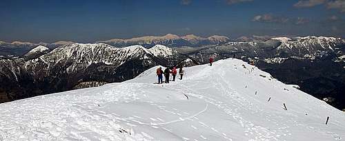
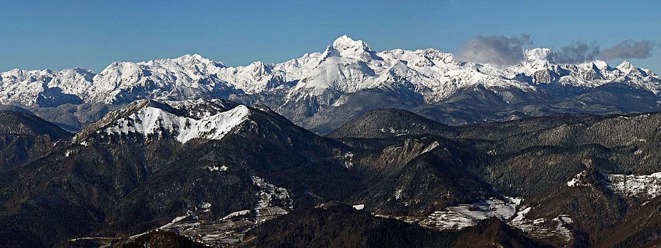
Porezen, 1630 m

Porezen is the highest summit of the whole area of Julian Alps foothills. It is a strong, nice looking pyramid, a real mountain which can pose to a hiker also some more serious challenges. The mountain has its wild and very remote areas where hardly ever a man foot is set. On the other hand it has also many popular approaches - from as many as seven directions marked paths are reaching its summit slopes. From Porezen you can enjoy a very broad panorama. Just below its top, on 1588 m, there is a mountain hut. Porezen is interesting for a visit any time of a season. Best times are late spring and autumn. In winter and early spring it offers great possibilities of tour skiing. For the most capable it can also be a goal of mountain biking. In remote places, there are also some other natural beauties. The interactive map on the left shows the location of waterfalls in Zakojška grapa (ravine) and of Zapoški slapovi. Below are some hiking and tour skiing routes: |
a. From Petrovo Brdo. We start on 803 m, the marked path is easy and keeps mostly to the N-NE ridge. 2 h 15 min. This is also the route of a quite popular ski tour. The woods are not as dense as they look. The first nice and panoramic summit is already the summit of Hoč, 1514 m. We can even stop the tour there if for some reason we don't want to ascend Porezen itself. From Hoč you can also ski down towards the NE (steep clearing), to Podhočar farm, from where you can continue by the mountain road.
 Summit ridge Summit ridge |
 On the N-NE ridge On the N-NE ridge |
b. From Davča. This village is scattered on the E slopes of the mountain. We can start low, but in summer we can reach with car as high as on Medrce meadow, 1350 m. From there we have on top an easy hike of some more than 30 min.
 Porezen ski tour
c. Davča ski tour. We usually start at Jurež farm, 1000 m. From there the track leads towards the W-NW and over a small saddle into the upper ravine of Davča creek. There the best terrains start. We first ascend over nice meadows towards the W, then, depending on eventual track, we continue either more directly up on the N-NE ridge (we reach it below the hut), or we keep more left, and cross more gentle slopes towards the SW, until we hit the SE summit ridge. 2 h for ascent. Skiing down depends again on conditions. Very nice is the shallow ravine from the N-NE ridge, which starts just before the first distinct elevation on the ridge (Pohoški kup, 1542 m).
 On the main SE ridge
d. From Črni vrh. We can either start the hike at ski resort and continue along the main ridge, or we can drive closer to the mountain.
e. From Poče. This village can be reached from Cerkno, driving northwards. We can start the tour either in the village, 653 m, or on the road east of it. Both paths cross the steep slopes of Počanska gora and reach the main ridge a bit above Medrce meadow. 3 h to the top. In the ravine N of Poče, there are two nice waterfalls.
f. From the SW. We start the tour on the crossroads 826 m, east of Kojca mountain, and follow a long marked path over the ridge summit of Otavnik and on the west ridge by which we ascend the summit. Some 3 h. In the ravine east of Zakojca village, there are a few nice waterfals, but hiking up by the ravine is a bit more demanding.
g. From Hudajužna. The tour starts deep down in Baška grapa valley, on 385 m. We keep mostly to the W ridge of Porezen, cross Jeseniška planina and reach the summit in 3 h 30 min.
h. From Podbrdo. The last village in Bača valley lies 500 m high. We can either drive up to Porezen village or walk up till there. From there we continue south on Jeseniška planina and further by the W ridge on top. 3 h 15 min.
Bevkov vrh, 1051 m
The hills south of Cerkno also offer quite some nice opportunities for hikes, bikes or ski tours. They reach the highest point on Bevkov vrh, but the neighbouring elevations are not much lower. In summer hiking can be done anywhere, there are also some marked paths. The best winter tour is from Sovodenj, 560 m, by roads and meadows towards the W on Bevkov vrh (summit), then towards the N on Cerkljanski vrh (saddle, 880 m), back towards the E in Nova Oselica village, 813 m, and by meadows and ravines down to Sovodenj. Nice skiing must be also from the summits west of Kladje saddle by the open northern slopes towards Cerkno.
 Bevkov vrh view Bevkov vrh view |
 On Bevkov vrh ski tour On Bevkov vrh ski tour |
 Nova Oselica Nova Oselica |
Ermanovec, 1005 m
NW of Stara Oselica village there is a humble elevation which still offers some nice views and in summer also a mountain hut in the middle of nature. Nice also for biking.
 Ermanovec in autumn
Sivka, 1008 m
In the southern side of Cerkljansko hribovje, there is a completely forested summit of Sivka (but nice views are from its surroundings). Mountain roads reach almost to its top, but also many marked paths cross the area. The western slopes of these hills fall steeply and more than 600 meters down into the deeply cut valley of Idrijca.
Other Places To See
Bolnica Franja. Partisans' Hospital Franja was operating during the World War II, from the start of winter 1943 till may 1945. It was hidden in a hardly reachable gorge of Pasica, near Novaki village. In the time of its operation 1000 fighters and other people were cured there. Conspiracy was on the highest possible level and the hospital was never found by Germans. Today the place is arranged for tourist visit and is currently on the list of candidates to become a UNESCO World Heritage Site. Link (in English): Bolnica Franja
Ravenska jama. This is a small karst cave in Ravne village, near Cerkno. It is a 352 m long cave, known by beautiful aragonite formations. Fragile, snowy white layers of aragonite crystals and the so-called aragonite urchins with needles as long as 10 cm can be admired. The entry is near Kramar house, currently (2013) the cave is closed for public visit.
Loško hribovje
Blegoš 1562 m

This dormant giant hill has been for centuries the protector of peasants of that area. It can be seen from all neighbouring spots, rising high from the valleys, sunshining its baldy head. Marked paths are going mostly along the main ridge, but two of them are coming up also from the south, from Hotavlje, a village widely known by its high quality marble mine. West of the summit, on Leskovška planina (meadow) a mountain hut stands, 1391 m. It can be approached very much by mountain roads (Murove parking place is only 15 min away) and from it you have only some 20 min on top of Blegoš. NE of the summit there is the saddle of Črni kal, 1112 m. Many people ascend the summit from there, they walk only some 45 min. Even further to the east there are nice mountain villages Gorenja and Dolenja Žetina.
 Blegoš from Ratitovec Blegoš from Ratitovec |
 Blegoš from the east Blegoš from the east |
 On the summit of Blegoš On the summit of Blegoš |
 Ascent on Blegoš Ascent on Blegoš |
Ascent routes are marked, most of them are easy, only on some there are steeper sections through the woods. Skiing can be done towards the SE, where we hit on Prva ravan a mountain road which leads us further down on Črni kal saddle. Even nicer is the ski tour towards the NW, where we first pass the mountain hut and then continue by meadows, woods and mountain roads down to Davča village.
Koprivnik, Mladi vrh, Stari vrh
These are less important elevations (1393 m, 1374 m, 1217 m) in the main ridge which still offer quite nice views around and are all being crossed by a marked path. In lower areas, on both north and south side, there are nice villages and farms, connected by panoramic roads. On the NE slopes of Stari vrh there is a popular ski resort. Also sledging is possible there. East of Stari vrh another mountain is crossing the ridge in the north-south direction, connecting both main valleys.
 Autumn in Javorje Autumn in Javorje |
 Spring on Martinj vrh Spring on Martinj vrh |
 Spring on Martinj vrh Spring on Martinj vrh |
 Spring in Rovte Spring in Rovte |
Lubnik, 1025 m
 Lubnik north views. Below are the hills near Škofja Loka town, in the background are Karavanke and Kamnik Alps.
This mountain is rising almost 700 altitude meters above Škofja Loka town and the confluence of both Sora rivers. Its NE slopes are very steep, but paths go also there. A mountain road crosses the southern slopes of Lubnik, bringing us on 760 m of altitude from where we have only some 40 min on top. On the summit there is also a popular mountain hut. Other paths are coming on top from the E, from Škofja Loka, from where we need some good 2 h on top.
 Sv. Tomaž near Lubnik Sv. Tomaž near Lubnik |
Polhograjsko hribovje
 Sv. Jakob
This hilly area is the closest to Ljublana, so no wonder that the net of marked paths is most dense there. There are many points of interest there, most of them are cute, panoramic churches on hilltops. Not all of them can be mentioned here, I will just post some pictures of them. Mountain summits worth of ascent are much more rare.
Grmada, 898 m
This is for sure one of the most popular hills it the whole area. On top it is even rocky and picturesque itself and the view from its top is also great. Marked paths are coming from all sides - four from the south, from the valley of Gradaščica, one from the east and some two or three from the north. Soon below the summit a cute church of St. Uršula stands - a worthwile goal of a hike itself.
 Southern views Southern views |
 The summit of Grmada The summit of Grmada |
 Towards Kamnik & Savinja Alps Towards Kamnik & Savinja Alps |
 Tošč
Tošč A farm below Tošč
Tošč, 1021 m
This summit is far less popular than Grmada. It is mostly covered with woods, but a marked path crosses it.
Pasja Ravan, 1020 m
This grassy ridge hill is almost reached by a mountain road, so it's only a short hike or an interesting bike tour.
Idrijsko hribovje
 Sveti Trije Kralji - Far is Triglav
This is a lower hilly area which is again characterised by many nice goals of hikes, such as villages, churches on hilltops etc., but no really attractive mountains. The highest elevation is the summit of Žirovski vrh. That is the forrested area when once uranium mine was operating, but it is nowadays completely abandoned.
 At Lintvern source
 At Lintvern source
Lintvern
Bela creek is a karstic tributary of Ljubljanica. Its sorce is called Lintvern (=dragon), supposedly as it brings out occasionally dragon babies. The source is a proclaimed natural landmark. It burst water intermittently, when a small underground lake gets filled with it. Some times the period is a few hours, in dry seasons it's more. Between the bursts the source gets partially or even completely dry.
Maps
See the Slovenia hiking map of Geopedia. On the home page (info tab), click on "Pohodništvo" menu option to get the layer with all marked paths. Link: Geopedia
