
-
 5672 Hits
-
 73.06% Score
-
 3 Votes
|
|
Route |
|---|---|
|
|
46.44750°N / 13.85450°E |
|
|
Mountaineering, Scrambling |
|
|
Summer, Fall |
|
|
Most of a day |
|
|
Scramble, easy rock passages (I. degree) |
|
|
Class 3 |
|
|
General Information
Overview: This is a nice tour on one of rare mountains in Martuljek group, which can be reached almost without climbing. The route offers great sceneries and from the summit you can enjoy very fine views around.
Difficulty: It's a hiking tour, with a few places of just easy climbing (up to UIAA I). On the Swiss Hiking Scale its difficulty is graded T5. The summit slope require a lot of care, as they are open and exposed.
Orientation: The route is not marked and requires quite some orientation skills. With a good map you can however not miss much. Most of the issues are not in finding general direction of the route, but the best passages, where you can avoid climbing.
Exposition: The summer slopes are very exposed and so not appropriate for people suffering from vertigo. They are opened and don't offer good options for belaying (for less experienced).
Objective dangers: In summer conditions there are not many. Take care on lose rocks on some steep places.
Best season: Summer months, normally from July till October (or first snow).
Gear: Good shoes and poles are sufficient.
Tour start: Vrata valley road, where it crosses Črlovec ravine, 900 m.
Highest point: 2427 m.
Altitude to overcome: cca 1550 m.
Time for ascent: 4 h, for descent 3 h.
Approach
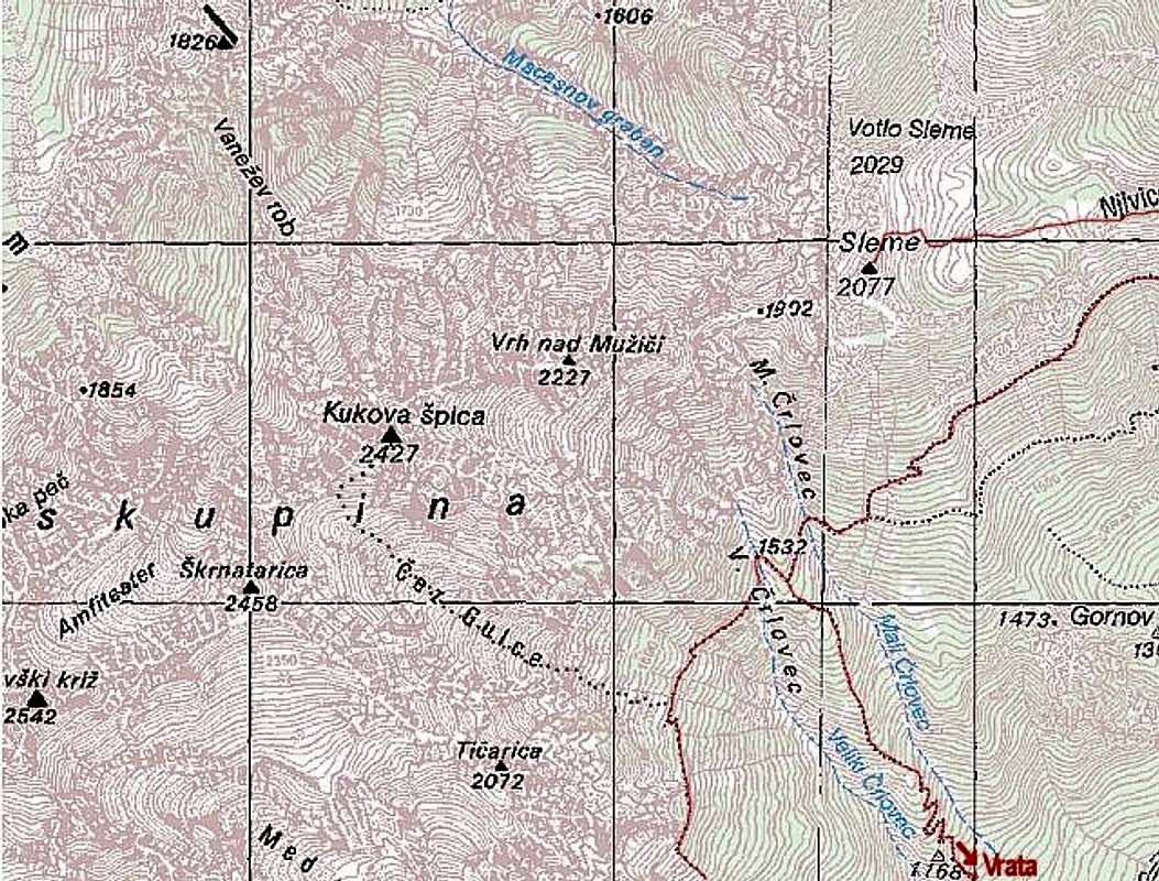 Kukova spica - red are marked routes, black dotted is the (unmarked) summit approach, described here. |
From Mojstrana in Sava valley, you drive (or walk) into the beautiful Vrata valley. Half way into the valley there's Koča pri Peričniku (mountain hut) and on the right side of the road Peričnik waterfall itself (10 minutes walk). You proceed by the road and in the middle of the first steeper rise you will see a big scree (gravel), coming down from the right (from below Kukova špica), like a river. This is called Črlovec, in the upper part being a long ravine. There's a trailhead and also a parking place. |
Route Description
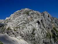
Kukova špica

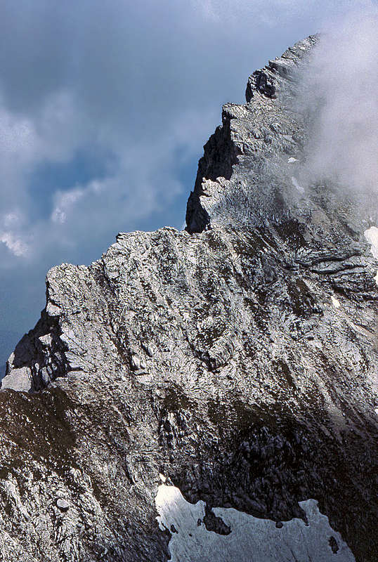
The ridge between Veliki and Mali Črlovec

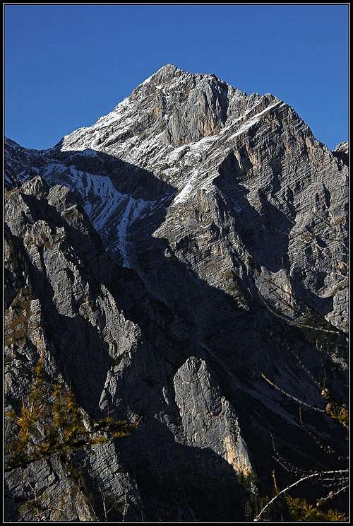
Gulce valley - between Škrnatarica (left) and Kukova špica
The trail starts on the left side of the 'gravel river', looking upwards. You will soon spot red marks of the trail which lead you across the scree of Črlovec and then upwards along its right edge (looking upwards). The path leads you in several turns through woods, after an hour or so you will see, that a similar ravine (Mali Črlovec = Small Črlovec) is also on your right side. Just below the altitude of 1500 m (see the map!) you must be careful. A much better marked path goes right, towards Sleme and Vrtaška planina (huts), but you must keep allways left. On this place the path is a bit hard to follow, it finally crosses the ravine of Veliki Črlovec and becomes more visible.
Not gaining much height you proceed on the other side, towards the rocks of Tičarica, 2072 m. Slopes on the right of the path are covered with pine bushes, intermitted with grass. Choose an appropriate grassy slope, leave the path and go directly upwards. You will be soon on a clear place, following the easiest (but still steep) grassy passages through the valley between Škrnatarica-Tičarica ridge (on your left) and Kukova špica SE ridge (on you right). Your direction is allways NW. The upper part of this valley is less steep, just below Gulce saddle (it's not a pass, because on the othes side there's a vertical drop) even flat. There long in summer a flat snowfield lies, which you cross without any problem. On the left you will see a steep couloir of Škrnatarica (the normal approach on this mountain), but you proceed a bit towards right (north).
Find the easyest passages up until you almost reach the SW ridge of Kukova špica. Proceed up right of it and when almost below the summit cross the south slope towards right and then up to the summit. On these grassy and rocky slopes you might follow weak trails, but there is no path, nor marks. Descend by the same route.
If you want to extend your hike, you may, when returning, proceed by the marked path towards the SW (very recommendable). It crosses the slopes of Tičarica, Kopica and other Martuljek peaks, high above the Vrata valley and offers a great panorama on mountains above Vrata (especially Triglav). The path finally descends to Aljažev dom (hut) in Vrata valley, from where you need another hour by the road back to your car.
The described route is in very good conditions also possible for skiing (very difficult!). The summit slopes are very steep, make sure that snow is not hard when skiing. When skiing down, after you reach the marked path, you must find passages down into Veliki Črlovec ravine and ski through it to the Vrata road.