How It Began
Our original idea was to do the Casual Route on the Diamond of Longs Peak on Labor Day. I think it was while we were climbing at Indian Creek when me and my friend Dion where talking about the Diamond and we were like "hey, that is in our limit know, we should climb it". We told ourselves we would do it Labor Day weekend, which happened to be after the first week of school.
Well the Diamond didn't happen. I had been real busy to the latter part of the summer and Dion was doing field research in Svalvard, Norway (apparently there wasn't much rock climbing going on out there). And, we were both feeling kind of under the weather from colds. To top it off, there had been lots of bad weather in the Longs Peak area and the forecast called for 40% chance of t-storms. When doing research, I had read about some guys climbing it a few weeks before and they said they were being peed on the whole time by the Diamond. I didn't want to be peed on and I didn't want to drive 12 hours to get shut down by weather and possibly a line up the "Cattle Route". So we changed our sights to something closer.
We decided we would give Lizard Head a shot. Lizard Head had been a dream of mine ever since I first started hiking Colorado's 14'ers. So far, I had pretty much only hiked easier peaks with a few harder ones thrown in their. Lizard Head would be my most technically difficult mountain summit yet. Also, we were toying around with the idea of climbing Dallas Peak, which would also be technically challenging. Dion wasnt entirely stoked on this new idea and he decided to opt out and wait for us to possibly pull off a fall ascent of the Diamond. Instead, my roommate Greg decided to go.
Day 1- An attempt and then Plan B
We left Flagstaff Friday the 31st at around 5. We arrived at the Cross Mountain Trailhead for Lizard Head around 11pm and went to bed as soon as we could. 5am came too fast and we woke up to frost everywhere and clouds...lots of them. When we decided climb Lizard Head we knew the weather wasn't going to be the best that whole weekend around the Telluride area, but we thought it was still going to be manageable. We ate breakfast and kept looking at the clouds. Greg and I were comtemplating still giving it a shot but then one car pulled up with climbers bound for Lizard Head and then another group that was camped at the trailhead started approaching Lizard Head. Two groups in front plus bad weather? We decided to opt out because we had three days to give Lizard Head a shot.
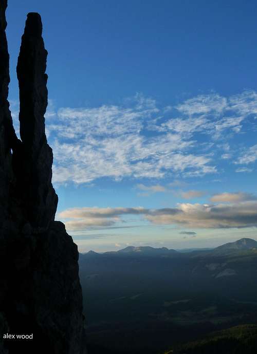
![Wilson Peak at Sunrise]() Wilson Peak Sunrise
Wilson Peak Sunrise |
![The Beast]() Our ride to the mountains
Our ride to the mountains |
Via Ferrata? I had heard of it from browsing numerous Summitpost pages and had seen in climbing magazines. When Liba posted an article on Telluride's Krogerata, I decided that I should check it out sometime. Before leaving, I cut two 12ft sections of dynamic 8mm cord incase we had time to do the Via Ferrata. With the bad weather around, we gave it a shot that day.
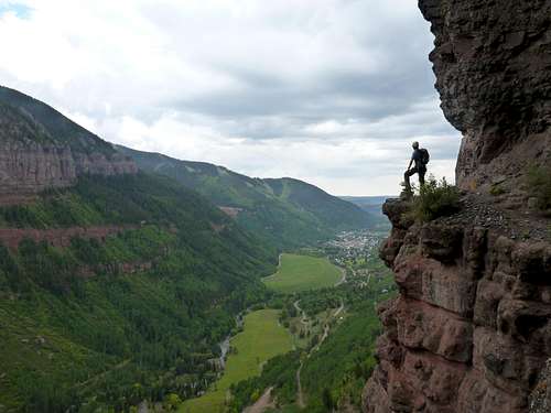
![Me Working My Way]() Me on the Via Ferrata
Me on the Via Ferrata |
![Great Views]() Awesome views
Awesome views |
Sunrise from Lizard Head pass was amazing and we got into Telluride just before 7 and head back towards Bridal Veil Falls. The start of the Via Ferrata was really easy to find and we began "Ferrataing". Soon after, it started to rain a little, which made our decision to bail of Lizard Head a good one. The Via Ferrata was neat, but it wasn't as sustained as I thought it was going to be. It was well worth it though because I had never done anything like it before. We finished around 9:30am...now we had to figure out what to do with the rest of our day.
![Greg Working Past]() Working past harder sections of the Via Ferrata
Working past harder sections of the Via Ferrata |
![Unreal Views]() Greg on the more picturesque part
Greg on the more picturesque part |
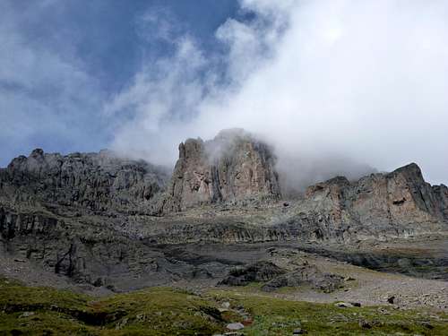
We went to Bridal Veil Falls and got a closer look-too bad you can't rappel it...Then we decided to go into town and make the rounds by all the gear shops. We talked with the dudes at Jagged Edge and they told us we should do some climbing on the Pipeline Wall, right below the Ferrata. We thought that was a good idea. We also got beta and info about climbing Dallas Peak. We picked up Roach's 13'ers book and some beer and went back up towards Bridal Veil Falls.
![Telluride]() Telluride in all of its glory!
Telluride in all of its glory! |
![A Scene From]() Bridal Veil Falls
Bridal Veil Falls |
We hope on two sport 3 pitch routes: a 5.8 and a 5.9. The climbing was fun and like the Via Ferrata, the views were drop dead gorgeous. We hung out and drank beer and looked over the route information for Dallas Peak. From where we were sitting we could see its summit looming far above Telluride. After eating some food, we headed over to the Mill Creek Trailhead and made camp at the trailhead.
![Skylight Arete and Ames Way]() The start of our route
The start of our route |
![Greg Making the Moves on]() Greg following in Skylight Arete
Greg following in Skylight Arete |
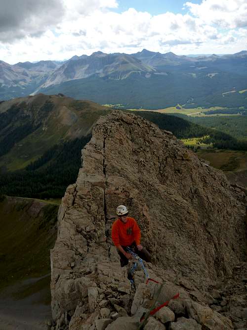
![Greg Leading]() Greg leading the last pitch of Skylight Arete
Greg leading the last pitch of Skylight Arete |
![Greg Rappeling Down]() Rappeling Down Ames Ways
Rappeling Down Ames Ways |
Day 2- Dallas Peak
We woke up just before 5am and got moving pretty quick. We had heard about the shortcut up the Mill Creek Drainage and decided to give that a shot. When we got to the meadow where you turn off for the shortcut, we could just see Dallas Peak in the early pre-dawn hours. The shortcut was a maze of game trails. As Roach says in his guide, the "Elk know best" and we followed the game trails to the Mill Creek Waterfall (which is one of the prettiest waterfalls in Colorado in my mind). In this section, sunrise started to happen just as we topped out on the sloping ramp about 100 yards to the right of the waterfall. If you just get to the base of the cliff bands next to the waterfall and traverse the bottom of the cliff bands southeast, it is easy to find the ledge system to get out of the Mill Creek Basin. Once atop the cliff bands above the waterfall, we made for the Sneffels Highline Trail. The sun finally hit us here and we ate some breakfast.
![The Outline of Dallas Peak]() Dallas in its predawn bulk
Dallas in its predawn bulk |
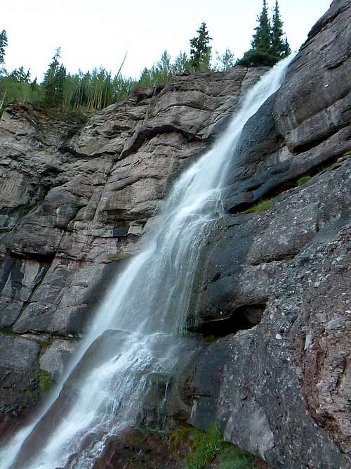
![Mill Creek Waterfall]() Mill Creek Waterfall..gorgeous!
Mill Creek Waterfall..gorgeous! |
Next, it was the grassy slope to the base of the Dallas Peaks shear south face. This part was hell. The grass slope wouldn't stop and it went on for what seemed like forever. To make matters even better, it turned into some ball bearing sized scree. Locating the start of the route was easy- there are some 30ft high cliff bands that bar passage and you just traverse left up them until you get to a perched scree/talus feild. At first when we were at the Sneffels Highline Trail, we though we were supposed to traverse right at the base of the 30 ft cliff bands-don't do this cause you will probably die. The cairns were easy enough to follow over the cliff bands...From the perched talus fields, we did an ascending traverse to the right and got to the east face in what seemed like minutes.
![On the Highline Trail at Sunrise]() Grassy Slopes around the Sneffels Highline Trail
Grassy Slopes around the Sneffels Highline Trail |
![Grassy Slope from Hell]() Grassy slopes from HELL
Grassy slopes from HELL |
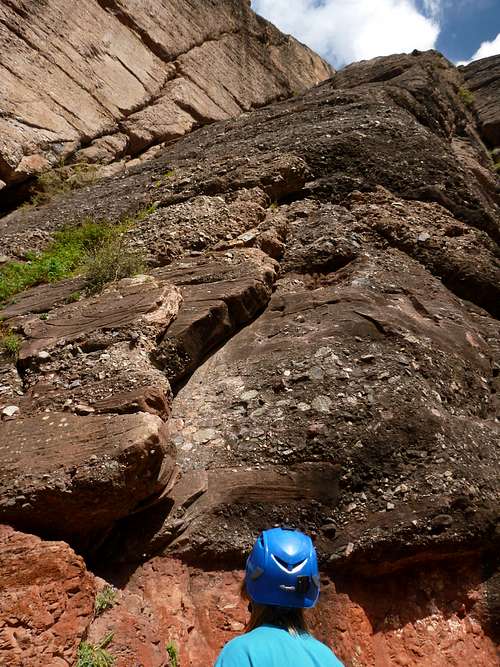
![At the 30ft Cliff]() 30ft Cliff Bands
30ft Cliff Bands |
![Talus Above the 30ft Cliff]() Ugly talus slopes..yuck
Ugly talus slopes..yuck |
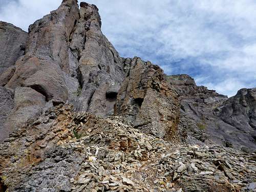
From here, we could easily see the most of lay ahead of us. It was mostly class 3 chossyness and traversing in and out. The first real technical part came just past this..a class 4+ or low 5th class section. Atop this was webbing wrapped around a big block to rappel this section on the descent. A little bit more scrambling took us to the base of the summitblock. This was around 10:30am
![Our Route]() Looking up the east side of Dallas
Looking up the east side of Dallas |
![Making the Moves]() Airy moves in the first crux
Airy moves in the first crux |
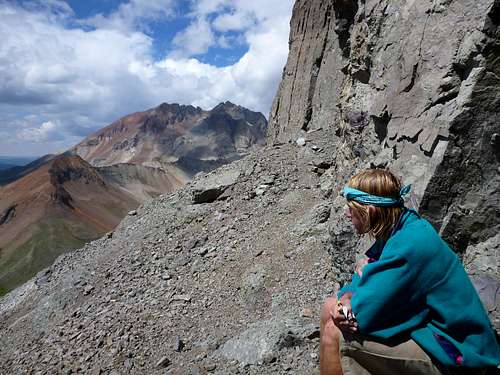
This was going to be my first alpine climb and I was kind of nervous. Instead of taking the standard 5.2 route to the summit, we were trying to find a 5.7 variation that the guy at Jagged Edge had told us about. We got to the "Southeast" corner and tried to commit to a route that I thought was the 5.7 (we saw webbing higher up). It seemed doable, but pro for the first few moves was lacking and the fall would have been gnarly. So I downclimbed and looked for something else. We went two crack systems over and found a flack that looked doable. Once again, I did the first few moves and placed some pro but then it turned into an offwidth nightmare. So I downclimbed once again. Then we went up to the base of the rappel route for the summit block (we didn't really know this at the time) and we decided the crack system there look good. I started up a little higher in the the gully and placed a .5 in a flake and then did a step/reach across move (5.7+) to the main crack system. Now I was committed. Solid hand jams and ledges led me to flat area that is right below the summitblock and above the hole which you rappel through from the summit block.
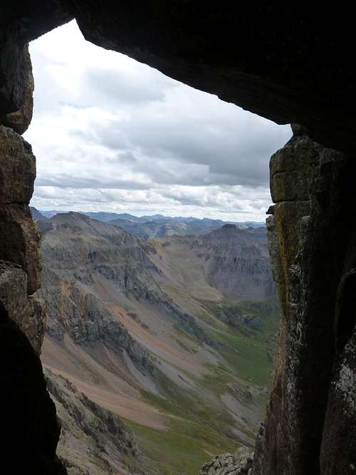
![A Window to the Mountains]() The view that one normally gets after the summit rappel. This was where we started our climb
The view that one normally gets after the summit rappel. This was where we started our climb |
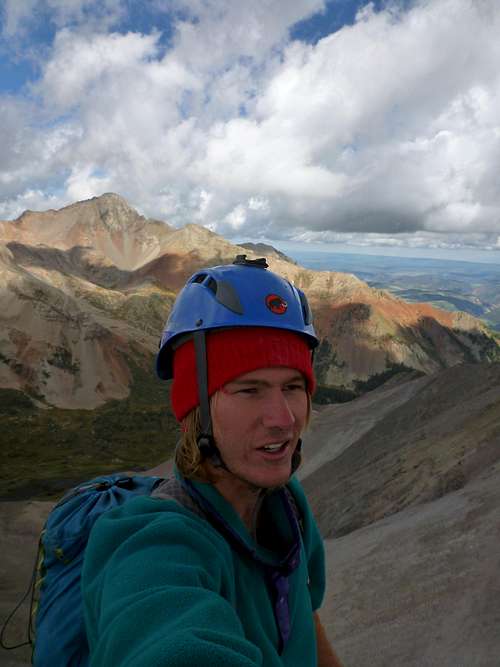
![Splattski Shot]() Yours truly just above the flat area on our summit pitch
Yours truly just above the flat area on our summit pitch |
I quickly realized our mistake. We weren't at the base of the summit block when we started climbing. The standard route to Dallas heads north from below the exit of the rappel route then gets to this flat area via a few 5th class moves. Ooops, but not wanting to dilly daly anymore and waste time, I kept climbing up to a broken dihedral that looked doable. Immediately above the flat area there were some god-awful flakes that I had to use to get into the dihedral. Sketchy pro and pulling under and overhang led me into the dihedral proper. It was a little wet, but the rock was better. More 5.7 climbing resumed and then there was a roof to contend with. It was awkward cause you were all bunched up and had to reach out for a hand jam which got you out to a solid foot. From here, I was eye level with the summit of Dallas. I placed a blue Metilous TCU and did a mantle onto tallus and rolled onto the summit block. This route topped out a few feet away from the summit rappel anchors. I made a quick belay and belayed Greg up.
![Looking Down the Dihedral]() Looking down the dihedral just below the summit
Looking down the dihedral just below the summit |
![Greg Topping Out]() Greg topping out on the pile'o choss
Greg topping out on the pile'o choss |
The top of Dallas is pretty sweet. But by this time, it was already 12:20 and it was getting pretty clouded up-time to get moving. We took a few summit shots and then set up the rappel and went back down to our packs. What an awesome rappel!
![Summit Shot on top of Dallas]() Yours truly on the summit!
Yours truly on the summit! |
![Greg s Summit Shot]() Greg on the summit
Greg on the summit |
We then hastily made our way down to the next rappel at the class 4+ section. As we were setting up the ropes and wall of hail hit us.Shit, I didn't want this to happen at all. Being exposed high up in a summer monsoon is about the scariest thing and I had been there too many times. Now the stakes were higher on a more committing mountain and we had let that happen to us. More hail reigned down and then crack! Thunder. It was getting worse. Greg went down the rappel first and had to work with tangled ropes while I hung out by the anchor. I had totally thought I had felt this feeling before on different mountains but I really hadn't until this moment. Weird sensations came over my body and I felt my hair around my helmet move up and down-not due to wind. My harness with my aluminum climbing gear began to vibrate. Crap, I knew what was next. I frantically yelled out to Greg "Lightning! Hurry up" and I got in lightning position. As I was going into lightning position, I looked to my right and saw a pika running around frantically-he seemed to know what was coming next. CRACK! again another one struck right by us and the hail became worse..but I was still alive much to my disbelief.
![Hail at the 2nd Rappel]() All hail breaking loose
All hail breaking loose |
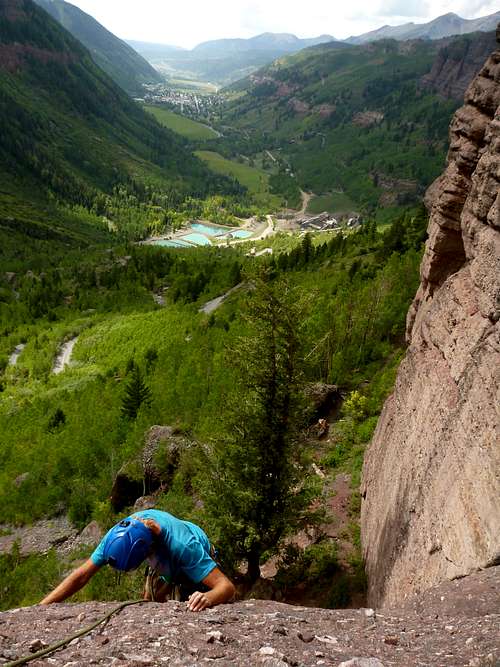
![Moving Down With the Storm on our Heels]() Greg scurrying down after cleaning the rappel
Greg scurrying down after cleaning the rappel |
![A Hurried Descent]() Greg moving around the corner back to the south face of Dallas
Greg moving around the corner back to the south face of Dallas |
![Dripping Wet]() Dripping wet rocks
Dripping wet rocks |
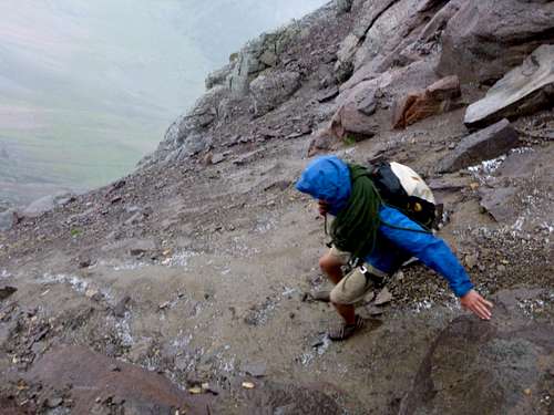
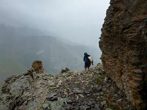
Greg got off rappel and I booked it down this rappel faster then I had for any rappel I had ever done. We hurriedly coiled the rope and got to the South Face as fast as we could. The hail went away and it gradually started to clear up. Down the long and grassy slope (it still sucks on the way down) took us to the Sneffels Trail again and we hung out by a stand of trees while it rained for 20 or so minutes. We really didn't say too much. We knew we got lucky. The rest of the day was uneventful camparitably. The Sneffles Highline Trail is gorgeous and we hiked that back to our cars. Apparently it was the start of bow hunting season so we were greeted by camouflaged hunters periodically as we made our way down the trail.
![Dallas Shrouded in Clouds]() Dallas Peak shrouded in the clouds
Dallas Peak shrouded in the clouds |
![Views from the Sneffels HighlineTrail]() Views from the Sneffels Highline Trail
Views from the Sneffels Highline Trail |
We arrived back at the car around 3:45 pm. We packed our things and went to the park again in Telluride to make more food and get more beer. What an epic first for a technical summit. We left telluride around 5:30 and got up to Trout Lake in time for sunset and set up camp on the south side of Trout Lake along a forest road. We racked up and prepared for Lizard Head the next day.
![Alpenglow on the Vermilion Group]() Views from our camp that night. Pilot Knob, Golden Horn and Vermillion Peak (left to right)
Views from our camp that night. Pilot Knob, Golden Horn and Vermillion Peak (left to right)
Day 3- Lizard Head
More photos to come!
Not wanting to get stuck in a storm again, we set our alarms for even earlier. We decided to wake up a 3:45am and drive to the Cross Mountain Trailhead. When we got to the trailhead, it was warmer then two days ago and no one else was there. However, there were some clouds. They didn't look that threatening and we decided to start hiking and just see what happens. The clouds moved out along the hike and we labored on the forever long uphill to until we reached the base of Lizard Head. From the saddle at Lizard Head, we followed the scree up to the base of Lizard Head and easily found the Southwest Chimney Route. Sunrise from the base of Lizard Head was amazing as hit touched the Wilsons (which we climbed back in June) and the surrounding valleys.
![Lizard s Shadow]() Lizard Heads shadow on the Wilsons
Lizard Heads shadow on the Wilsons |
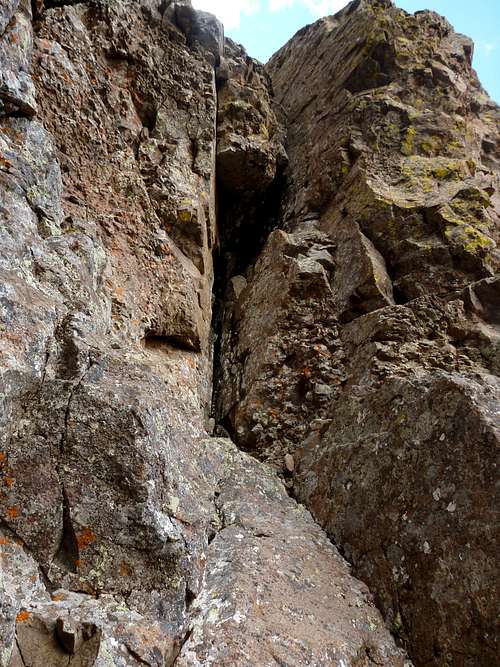
![Lone Pilar]() Lone pilar that is at the start of the Southwest Chimeny.
Lone pilar that is at the start of the Southwest Chimeny. |
We broked the first pitch up into two pitches. Greg led the first pitch (5.6) and I followed. I was pretty damn cold so I wore gloves on the first pitch, which worked out somehow. I led the second (5.6++) and followed the actual chimney was easier then going out on an exposed face protected by to aged pitons. After a struggle, I reach the top of the 2nd pitch and belayed Greg up. Finally we were in the sun!
![First Pitch Anchors]() First pitch anchors
First pitch anchors |
![Looking down the First Pitch]() Looking down the first pitch
Looking down the first pitch |
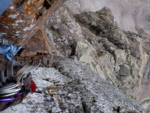
Greg led the 3rd class perched death talus from hell pitch (he didn't place any pro, he just took the rope up pretty much and gave me a hip belay). With some difficulty, we located to the start of the summit pitch. The piton makes the route easy to spot, but for some reason we didn't see it initially. My hands were pretty cold and making the 5.8+ bulge move was harder then I thought it was going to be. I pulled the bulge and then headed out route into a broad ramp and place some pro. Placements ran out and ran it out on easier, but loose climbing.
![Perched Talus From Hell]() 3rd class choss pitch from hell
3rd class choss pitch from hell |
![Lizard Head s Summit Pitch]() Start of the summit pitch
Start of the summit pitch |
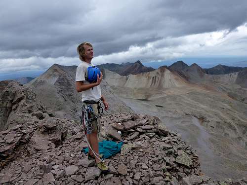
I got too stoked on the summit and lost track of where I was on the route. I looked back and saw the anchors for the top of the summit pitch. I had missed them, shoot. That meant I was really close to the summit. I built a quick belay and belayed Greg up. We were practically right below the summit, so Greg hope on top and got his summit shots and then came back down to my stance. I belayed him across to the real anchors (3rd class, but kinda scary). He set up a belay and then I went to the summit, got my summit shots and then went back to his stance. We topped out around 11am..perfect timing and the weather still looked good.
![Looking Down the Final Pitch]() Looking down the final pitch to the crux.
Looking down the final pitch to the crux. |
![My Belay]() My belay on the summit ridge
My belay on the summit ridge |
![Greg on Lizard Heads Summit]() Gregs summit shot
Gregs summit shot |
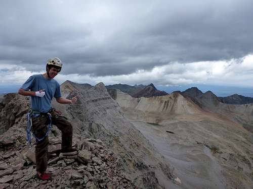
![My Lizard Head Summit Shot]() Yours truly
Yours truly |
The summit rappel was awesome and with a 70m rope we bypassed some of the sketchier 3rd class terrain on the perched death scree from hell. We made a belay here and then I went to the top of the first pitch (our second pitch) and place a few piece of pro along the way. We rappeled down from the anchors to the ground and bypassed the mid-anchors that break up this rappel. We pulled the rope and then it hit us...we just climbed Lizard Head!
![Rappeling from the Summit Ridge]() Me rappelling off the summit ridge
Me rappelling off the summit ridge |
![At the Base]() At the base of the climb taking in what we just did
At the base of the climb taking in what we just did |
The weather started to get a little bad and we packed up and booked it down the the scree back to the cross mountain trail. I started to rain a little but then that went away. It really didn't concern us though because our position was safe. Along the hike back, we feasted on the numerous ripe gooseberrys growing all along the trail. We got back to our car around 2pm. Success!
![On the Lizard Head Sign]() Flagpoling!
Flagpoling! |
![Gregs Flagpole]() Gregs flagpole
Gregs flagpole |
We hung around for awhile looking at what we just climbed and then went to Rico to soak it up in the hot springs. It turned out to be a gorgeous day and small white puffy cumulus clouds just floated over head the rest of the day. We got back to Flagstaff around 10pm that night.Hopefully More to Come
I have hiked a decent amount of peaks for my age, but most of them have been easy walk ups..especially in Colorado. I had my blinders set on the 14'ers, but after hiking 27 of them, Dallas Peak and Lizard Head were far more memorable then most of them. The San Juans have a ton of 13'ers and that is relatively close to Flagstaff. Hopefully I can keep going up to the San Juans. I am convinced that the San Juans are the prettiest mountain range in Colorado, if not the whole country. I am blessed to have them in my backyard pretty much.
Comments
No comments posted yet.