
-
 3630 Hits
-
 80.84% Score
-
 13 Votes
|
|
Mountain/Rock |
|---|---|
|
|
39.01731°N / 122.94278°W |
|
|
Lake |
|
|
Hiking |
|
|
Spring, Summer, Fall, Winter |
|
|
2180 ft / 664 m |
|
|
Overview
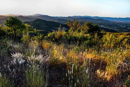
North from Lakeport Peak
This is an open grassy hill with outstanding views of the high county around the northwest end of Clear Lake as well as Mount Konocti. Lakeport Peak is a short hike that can easily be done in a few hours. The route can be extended to include the rolling ridge to the south.
This approximately 3 miles and 800' gain round trip. 4.5 miles and 1,200' if you take it the ridge as well.
![Clear Lake and Mt. Konocti]()
Clear Lake and Mt. Konocti from Lakeport PeakFrom Hwy. 29 about a mile south of Lakeport take Hwy. 175 west only about a half block. Immediately turn right on Parallel Drive (frontage road) and go less than 2 tenths mile to Linda Lane. Turn left on Linda Lane and go .5 mile to the locked gate. Park off to the side.![Dramatic dead oak with living cattle]()
Dead oak below Lakeport PeakHop the gate and go a short distance to a road on the right going towards the peak, which is visible to the west. Hop that fence and follow the road beyond its' paved section up and around to the left about .7 mile. Here it connects to another 2 track road at a junction. Go right up the obvious southeast ridge as it climbs up and around to the summit. ![Across Clear Lake to Pine Mtn. from Lakeport peak]()
Across Clear Lake from Lakeport PeakAs I mentioned in the overview this is a private property approach. It was no problem for me on a Saturday with no one around. You may want to call the Lakeport Water District and ask for permission. It's your call.
Regarding private property hikes: I figure the number of people responding to this page and doing the hike would not be significant enough to cause friction with the authorities that be. Please use discriminative respect.
![North Clear Lake from Lakeport peak]()
North Clear Lake from Lakeport PeakYear around. It can get over 100 degrees in summer. There could be some snow in winter.![Lakeport Peak east view]()
East from Lakeport PeakThere is camping at Clearlake State Park less than 10 miles southeast of Lakeport by Clear Lake.![Red Mountain and Lakeport Peak (below right)]()
Red Mtn. and Lakeport peak from the southClick here for current weather and 10 day forecast.
Getting There
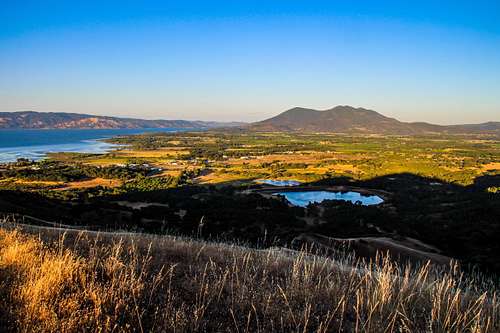
Clear Lake and Mt. Konocti from Lakeport Peak
Route

Dead oak below Lakeport Peak
Red Tape
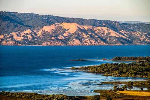
Across Clear Lake from Lakeport Peak
Regarding private property hikes: I figure the number of people responding to this page and doing the hike would not be significant enough to cause friction with the authorities that be. Please use discriminative respect.
When to Climb

North Clear Lake from Lakeport Peak
Camping

East from Lakeport Peak
Lakeport weather and forecast

Red Mtn. and Lakeport peak from the south