
-
 12689 Hits
-
 86.85% Score
-
 23 Votes
|
|
Area/Range |
|---|---|
|
|
39.04900°N / 122.825°W |
|
|
Hiking, Scrambling |
|
|
Spring, Summer, Fall, Winter |
|
|
1326 ft / 404 m |
|
|
Overview
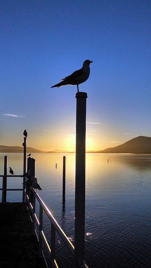
Clear Lake is now full as of Mar. 20 '16 after years of drought.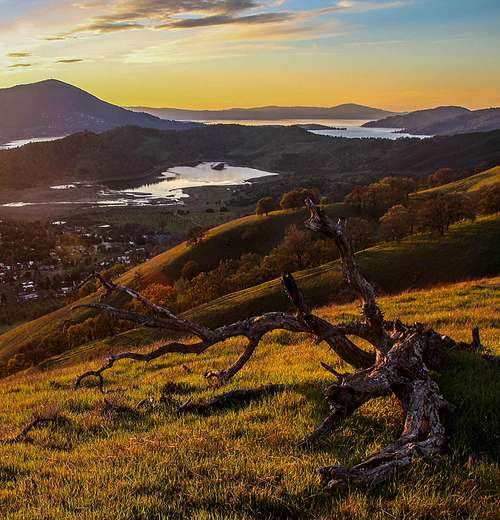
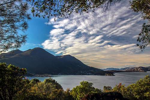
Clear Lake from Bald Mountain, Borax Lake foreground
Clear Lake is a large complex lake in the north Coast Range a few hours north of the SF bay area.
It is the 2nd largest fresh water lake in California after Lake Tahoe fed by a multitude of streams and springs with the only outlet being Cache Creek flowing east into the Central Valley.
The Lake is 19 miles long, 8 miles wide at it's widest point with an average depth of 27 ft., 60 ft. max. depth. Lake elevation 1,326'.
Clear Lake is believed to be as much as 500,000 years old making it one of the oldest lakes in North America.
The lake was even bigger extending to the northwest but volcanic activity changed the topography and blocked off the portion that partially still remains as the Blue Lakes. The lake sits on a huge block tilting to the north leading to the higher mountains of the Mendocino National Forest.
For a geological history of Clear Lake click here
For a further description of the Mayacamas Mountains and general area go to Bubba Suess's page The Palisades.
Clear Lake State Park It is the 2nd largest fresh water lake in California after Lake Tahoe fed by a multitude of streams and springs with the only outlet being Cache Creek flowing east into the Central Valley.
The Lake is 19 miles long, 8 miles wide at it's widest point with an average depth of 27 ft., 60 ft. max. depth. Lake elevation 1,326'.
Clear Lake is believed to be as much as 500,000 years old making it one of the oldest lakes in North America.
The lake was even bigger extending to the northwest but volcanic activity changed the topography and blocked off the portion that partially still remains as the Blue Lakes. The lake sits on a huge block tilting to the north leading to the higher mountains of the Mendocino National Forest.
For a geological history of Clear Lake click here
For a further description of the Mayacamas Mountains and general area go to Bubba Suess's page The Palisades.
These high points are almost all walk up or drive up hikes often on forest roads leading to the top of to many of these mountains. If you go off trail the main challenges are dense brush, forests and private property.
For this page the boundaries are extended to provide an area to include a larger collection of surrounding mountains and ridges.
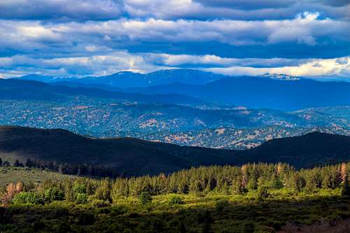
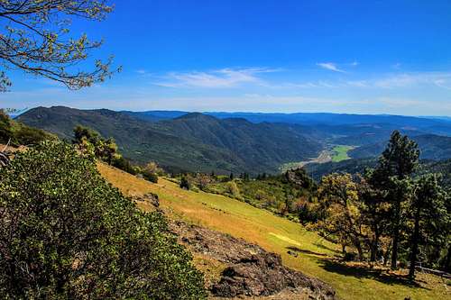
The western boundary the Mayacamas Mountains, the eastern boundary the Cortina and Blue Ridge. To the north Snow Mountain, St. John Mountain and and Hull Mountain the high points of the southern portion of the Mendocino National Forest and to the south Mt. St. Helena and the Palisades.![Snow Mtn. from Clark Peak]()
Snow Mtn. from Clark Peak, south side of Clear Lake ![Mt. St. Helena from across Napa Valley]()
Mt. St. Helena from Napa Valley![Snow and Goat Mountain from south of Clear Lake]()
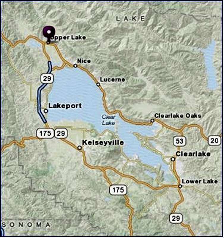
Mendocino National Forest north of Clear Lake ![Map of Clear Lake area]() From Interstate 5 at Williams: Take Hwy 20 west into the mountains 37 miles to the junction with Hwy. 53 at the east side of the lake.
From Interstate 5 at Williams: Take Hwy 20 west into the mountains 37 miles to the junction with Hwy. 53 at the east side of the lake.
From I 5 out of Woodland: Take Hwy. 16 approximately 50 miles to the junction with Hwy. 20. Take 20 west to the junction with Hwy. 53.
From Calistoga: Take Hwy. 29 35 miles north to Lower Lake.
From Hwy. 101 at Ukiah: Take Hwy 101 north then Hwy. 20 a total of 26.5 miles to Upper Lake.![A swell Mary Poppins kind of view]()
East to Long Valley from Pinnacle RockThe red tape varies from what type of land. National Forest, State Parks, County Parks, Wilderness areas and private property. Check in external links.
For this page the boundaries are extended to provide an area to include a larger collection of surrounding mountains and ridges.
The western boundary the Mayacamas Mountains, the eastern boundary the Cortina and Blue Ridge. To the north Snow Mountain, St. John Mountain and and Hull Mountain the high points of the southern portion of the Mendocino National Forest and to the south Mt. St. Helena and the Palisades.
Snow Mtn. from Clark Peak, south side of Clear Lake
Mt. St. Helena from Napa Valley
Getting There
Mendocino National Forest north of Clear Lake
From I 5 out of Woodland: Take Hwy. 16 approximately 50 miles to the junction with Hwy. 20. Take 20 west to the junction with Hwy. 53.
From Calistoga: Take Hwy. 29 35 miles north to Lower Lake.
From Hwy. 101 at Ukiah: Take Hwy 101 north then Hwy. 20 a total of 26.5 miles to Upper Lake.
Red Tape
East to Long Valley from Pinnacle Rock
A word about hiking forested mountains: Always get back before dark!
SARed in the Dead of Night![Late afternoon above Clear Lake]()
Borax Ridge east Clear LakeClear Lake State Park offers the only Campground by the south side of the lake near Mt. Konocti.
For Mendocino National Forest camping click here.
For Cache Creek possiblilities click here.![Palisades Napa Valley]()
Palisades from Napa Valley. ![Clear Lake sunrise]()
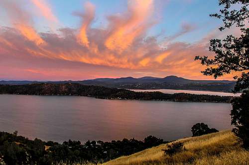
Sunrise from Lakeport ![Sunset over Clear Lake]()
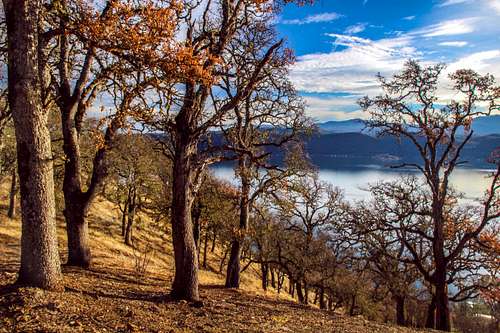
Sunset over Clear Lake from the northeast shore ![Over Pine Mtn. and Clear Lake from High Valley Ridge]()
Over Pine Mtn. from High Valley Ridge ![Northwest Clear Lake]()
Northwest from Sulfur Bank Ridge ![Mt. Konocti from the east]()
Mt. Konocti from Konocti BayThis is a collection of prominent named high points moving clockwise around Clear Lake. This first draft is open to expansion. The ones with links have pages on SP.
South of Clear Lake
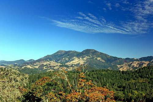
Mount St. Helena, 4,343'
Table Rock, 2,462'
The Palisades, 2,925'
Duff 2,576'
Browns Hill, 2,788'
Sugarloaf Mountain, 2,988'
Table Mountain, 2,865'
"Calistoga Ridge", 1,600+ '
Three Peaks, 2,675'
McGuire Peak, 2,785
Snelly Peak, 2,123'
Pine Mountain, 3,600' (north of St. Helena)
Red Hill 2,527'
Castle Rock 2,662'
Black Mountain, 3,128'
Geyser Peak, 3,458'
Harbin Mountain, 2,585'
Boggs Mountain, 3,740'
Cobb Mountain, 4,728'
Seigler Mountain, 3,691'
Mount Hannah, 3,978'
Mount Konocti, 4,299'
Clark Peak, 2,900'
West of Clear Lake
Lakeport Peak, 2,180'
Red Mountain, 3,389'
Cow Mountain, 3,924'
Cow Mountain Ridge, 3,572'
Mendo Rock, 3,377'
Shell Peak, 2,704'
White Rock Mountain, 2,690'
SARed in the Dead of Night
Camping
Borax Ridge east Clear Lake
For Mendocino National Forest camping click here.
For Cache Creek possiblilities click here.
List of area High Points
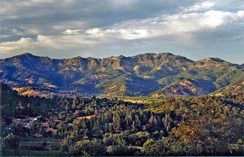
Palisades from Napa Valley.
Sunrise from Lakeport
Sunset over Clear Lake from the northeast shore
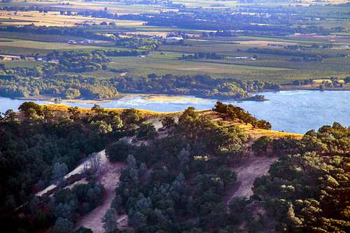
Over Pine Mtn. from High Valley Ridge
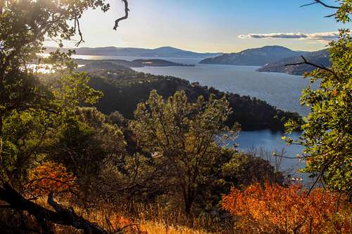
Northwest from Sulfur Bank Ridge
Mt. Konocti from Konocti Bay
South of Clear Lake
Mount St. Helena, 4,343'
Table Rock, 2,462'
The Palisades, 2,925'
Duff 2,576'
Browns Hill, 2,788'
Sugarloaf Mountain, 2,988'
Table Mountain, 2,865'
"Calistoga Ridge", 1,600+ '
Three Peaks, 2,675'
McGuire Peak, 2,785
Snelly Peak, 2,123'
Pine Mountain, 3,600' (north of St. Helena)
Red Hill 2,527'
Castle Rock 2,662'
Black Mountain, 3,128'
Geyser Peak, 3,458'
Harbin Mountain, 2,585'
Boggs Mountain, 3,740'
Cobb Mountain, 4,728'
Seigler Mountain, 3,691'
Mount Hannah, 3,978'
Mount Konocti, 4,299'
Clark Peak, 2,900'
West of Clear Lake
Lakeport Peak, 2,180'
Red Mountain, 3,389'
Cow Mountain, 3,924'
Cow Mountain Ridge, 3,572'
Mendo Rock, 3,377'
Shell Peak, 2,704'
White Rock Mountain, 2,690'
Middle Mountain, 3,735'
Sleeper Peak, 2,800'
Hell's Peak, 2,325'
Hunter Point, 2,964'
Poe Mountain, 2,408'
North of Clear Lake
Hogback Ridge, 2,978'
Pine Mountain, 2,533'
High Valley Ridge, 3,491'
Wolf Creek Ridge, 2,838'
Rocky Ridge, 3,891'
Evans Peak, 4,002'
Pine Mountain (Rupert Ridge), 4,420'
High Glade 4,840'
Sleeper Peak, 2,800'
Hell's Peak, 2,325'
Hunter Point, 2,964'
Poe Mountain, 2,408'
North of Clear Lake
Hogback Ridge, 2,978'
Pine Mountain, 2,533'
High Valley Ridge, 3,491'
Wolf Creek Ridge, 2,838'
Rocky Ridge, 3,891'
Evans Peak, 4,002'
Pine Mountain (Rupert Ridge), 4,420'
High Glade 4,840'
Pinnacle Rock, 4,618'
Little Pinnacle, 4,524'
Windy Point, 4,772'
Youngs Peak, 3,683'
Horse Mountain, 4,686'
Little Pinnacle, 4,524'
Windy Point, 4,772'
Youngs Peak, 3,683'
Horse Mountain, 4,686'
Sanhedrin Mountain (Big Signal Peak), 6,175'
Hull Mountain, 6,873'
St. John Mountain, 6,746'
St. John Mountain, 6,746'
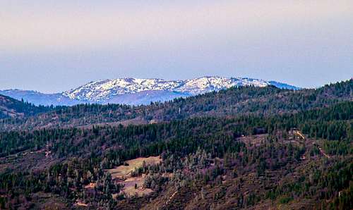
Snow Mountain, 7,056'
East of Clear Lake
Bald Mountain, 2,196'
Quackenbush Mountain, 2,140'
Bally Peak, 2,288'
Brushy Sky High, 3,196'
Grizzly Peak, 3,009'
Jim Dollar Mountain, 2,394'
Petticoat Mountain, 2,121'
Buck Mountain, 2,780'
Baldy Mountain, 2,220'
Round Mountain, 1,906'
Cold Spring Mountain, 3,587'
Little Blue Peak, 3,120'
Jackson Mountain (Cortina Ridge), 2,790'
Cache BM, 2,805' (Cortina Ridge)
Glascock Mountain, 2,540'
Fiske Peak, 2,868'
Lowery, 3,038'![Hull Mtn. 6,873 from Horse Mtn.]()
Hull Mountain above Lake Pillsbury ![Mt. Konocti from an orchard]()
Mt. Konocti from an orchard to the southeastSummers are hot and dry. Winters are cold and wet with occasional snow.
Cache BM, 2,805' (Cortina Ridge)
Glascock Mountain, 2,540'
Fiske Peak, 2,868'
Lowery, 3,038'
Clear Lake Weather

Hull Mountain above Lake Pillsbury

Mt. Konocti from an orchard to the southeast
Click here for the current weather and 10 day forecast ![North from Pinnacle Rock]()
North from Pinnacle Rock ![Looking down on Buckingham Peak from Konocti summit]()
North from Mt. Konocti's Wright Peak
Mount Konocti County Park
Cache Creek Wilderness
Boggs Mountain State Forest
Robert Louis Stevenson State Park
Snow Mountain Wilderness
Cow Mountain Recreation Area
External Links

North from Pinnacle Rock

North from Mt. Konocti's Wright Peak
Mount Konocti County Park
Cache Creek Wilderness
Boggs Mountain State Forest
Robert Louis Stevenson State Park
Snow Mountain Wilderness
Cow Mountain Recreation Area
Berryessa Snow Mountain National Monument recently made by Obama