They were in fact to separate corner from the valley floor, where flows the Dora Baltea. They had the Grand'Eyvia (Great Water) and others Torrents de Arpisson, Grua, Lussert, Grauson, Doreire, Urtier, Eaux Rouges, Bardoney, Valeille, Valnontey, Lauzon and Nomenon, but not called in this way
. What were the names we do not know, but we know that
, where today has remained only a small Church with the ruins of an ancient mountain pasture. Sheltered by the floods, was spread in the small plain that reaches Champlong and Lillaz and, above the Quertatset, the Etsélei, the Bouc and the two Goilles Dessous and Damon. Over there rose the great mountain of Iseran and there, but a lot more besides, Gaul. There were many other small Iseran with different names which usually bore the name of the owner who owned pastures at the base, as Becca Montandayné, ie the Mountain Dayné. Or marked a passage as les Laures, Fénis, Pontonnet Fenetre de Champorcher and other possessions as a name Piedmont Ciarforòn, Monciair and Gay.
They invented in '800. But
from which divided all the walloons of this great valley that descends to the Dora. But parallel and not perpendicular. From birth the
required due respect and did not accept any subjection. With
, the only virgin left in the Valley of Aosta. But they were okay with the
with whom exchanged goods, carried the ore down to Eporedia and maybe even marrying. stepping over the waters of the Acque Rosse, the Arietta and the Bocchetta of Rancio (Nozzle or Pass above the alp where the shepherds eat rations). These were the actual ore steps, crossing the Cotes du Piemont, they reached the Po Valley. This was long before the construction of the cable car at the Villages of
near Aosta City. All this events before the closure of the loadstones or magnetite mines in Seventies with untruthful grounds that they were no longer productive and cost-effective.
Cogne, sappiam già esser l'Ombelico del Mondo.Se voi chiedete ad un
"vero" abitante di Cogne se lui é Italiano vi risponderà:
"Non lo sò"; se chiedete se é Valdostano vi dirà:
"Può darsi". Ma alla fine sempre vi dirà, per toglier dai piedi la vostra curiosità:
"Me sò de Cogne" (Io son di Cogne). Già non andavano daccordo con i
Salassi, tanto meno coi
Romani, ch'eran venuti a scavar sotto il Monte Creià (attuale Creya, cioé bucato) per prendere la pregiata magnetite con la qual forgiare monete per l'
Impero, Cesari ed Imperatori. Così la chiamarono
Conia, da conio. Ma loro eran già da sempre
Coing, voce Celtica che significa angolo. Un posto, come Cuneo (
Cuneum) in Piemonte, che costituisce appunto un cuneo inserito nel cuore delle montagne dividendo distintamente le stesse e le loro valli; spartendo chi é di qua da chi é di là. Gli Amici dai Nemici, quelli che sono all'
"Adret" (al sole) da quelli che abitano l'
"Envers" (all'ombra). Anche Cogne presenta questa situazione, per la qual cosa la nostra scelta di dividere in due il lavoro trova praticamente riscontro nella realtà. Sono luoghi
"tagliati" con la scure e con le posizioni bene definite e sicure: dividono anche gli abitanti von solo dalla
"Voella" (il centro più importante), ma anche tra frazione e frazione, tra villaggio e villaggio, un'alpe dall'altra. Quelli di Lillaz non son quelli di Crètaz e quelli d'Epinel gli
"altri" di Valnontey. Non parliam poi di chi é giù a Vyeies o Sylvenoire, all'ingresso, oppur di quelli che son
"abbarbicati" lassù a Dzimillan. Son quasi dei mondi diversi in questo identico angolo della Valle di Aosta.
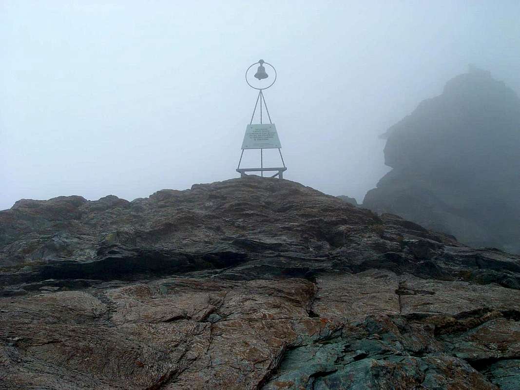
Angolo che le Montagne nascondevan da tutto il Resto del Mondo.
![]()
Erano infatti quell'angolo separato dal fondovalle, dove scorre la Dora Baltea. Loro avevano la Grand'Eyvia (la Grande Acqua) e gli altri Torrents de Arpisson, Grua, Lussert, Grauson, Doreire, Urtier, Eaux Rouges, Bardoney, Valeille, Valnontey, Lauzon e Nomenon, che però non si chiamavano in sto modo
"francesizzato". Come si chiamavan non lo sappiamo, ma sappiamo che
la vecchia Cogne era sù al Cret, dove oggi é rimasta solo una Chiesetta con il rudere d'una antichissima alpe. Al riparo dalle inondazioni, si distendeva nella piccola pianura che raggiunge Lillaz e Champlong e, più sopra il Quertatset, l'Etsélei, il Bouc ed i due Goilles Dessous e Damon. Là in fondo si alzava la grande montagna dell'Iseran e laggiù, ma molto più oltre, la Gallia. C'eran tanti altri piccoli Iseran con diversi nomi in genere assumenti il nome del proprietario che possedeva i pascoli alla base, come la Becca di Montandayné, cioé la Montagna di Dayné. Oppure segnavano un passaggio come Les Laures, Fénis, Pontonnet Fenetre de Champorcher ed altre che possedevano un nome piemontese come Ciarforòn, Monciair e Gay.
Il Gran Paradiso non esisteva. L'hanno inventato nell'800. Ma
Coing era un perfetto angolo dal quale dividevansi tutti i valloni di questa grande vallata che scende verso la Dora. Ma parallela e non in modo perpendicolare. Già dalla nascita i
"Cogneins" richiedevano dovuto rispetto e non accettavan nessuna sudditanza. Con i
Ciamporcieri c'era stata sempre una certa rivalità; come con i
Valsaverains con i quali avevano gareggiato per conquistare
la Grivola, l'unica Vergine rimasta in Valle di Aosta. Ma andavano daccordo con i
"Piemùnteis" con i quali scambiavano le merci, portavano il minerale giù a Eporedia e magari anche prendevano moglie. scavalcando i Colli di Acque Rosse, della Arietta e la Bocchetta del Rancio. Questi erano i reali passaggi del minerale che, attraversando le Cotes du Piemont, raggiungevano la Pianura Padana. Questo avveniva molto tempo prima della costruzione della teleferica presso i villaggi tra
Moline (1539 m) e
Montroz (1681 m) ove il minerale veniva selezionato, catalogato ed accatastato, donde ad
Acque Fredde sotto a Pila
(1662 m) e quindi all'ex
"Ansaldo" di Genova, poi sin alla conversione nel 1916 nell'attuale
"Società Nazionale Cogne" di Aosta. Tutto ciò prima della chiusura delle miniere avvenuta negli Anni Settanta con la motivazione non veritiera che fossero non più convenienti.
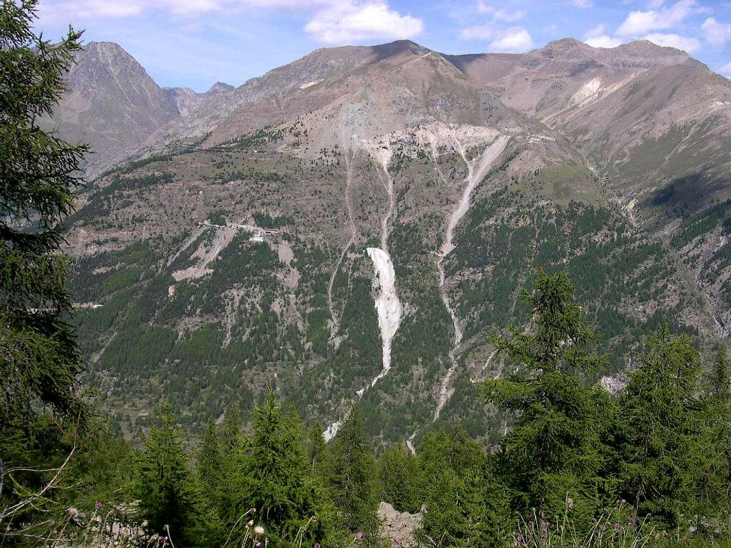
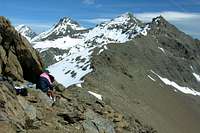
An ancient iron transit through the Arietta Hill & others
The History of the Arietta's Pass is very old and predates the arrival of the Romans, it had to be frequented by
Salassians, People of Celtic origin. Indeed it seems that already inhabitants of Cogne come from the Orco Valley-Soana and only then are transferred in the Valley of Cogne at Crest, coming from what was then
not called the Hill of th'Arietta but the Noua or New. Ie new step as an alternative to the Champorcher Window, however, such as to require the passage before or at the Rosa and of the Balma Hills, at the Rosa of Banchi, and the descent to great Lake Miserin, in Champorcher Valley. The Hill of the Noua allowed a more direct transit, however, complicated by a crossing far from simple, especially in Piedmont side of a steep ledge, where oblique cut through the rock, diagonally from Northeast to Souhwest. A passage to say the least harsh and not too well known, so much so that even the Cartographers Italian Military Geographic Institute (I.G.M.) represent it in a rather inaccurate. Also, the path to the North to arrive in Aosta Valley was not easy and also very exposed to falling stones from the West Face of the Head of the Nouva
(3034m). The use was donated to the transition between the two valleys , and also to
transport the precious mineral Mines Cogne (Magnetite or Loadstone of Veins Larsinaz, Colonna and Costa of the Pino), the same was not brought exclusively in the valley to be worked in Aosta but mainly the last two strands, followed the path through the various hills of the Piedmont. On top of the great rock band above the dirt farm road along the Urtier Valley there is a Côte Piemont that leads to Alp Tsavanis, a name that clearly indicate a way forward in order to get from the Colonna's Mine and passing through the Taveron(n)a, Seutse or Suches, Gueula Dessus and Desot Pastures, the vallons of the aforementioned hills allege in this region.
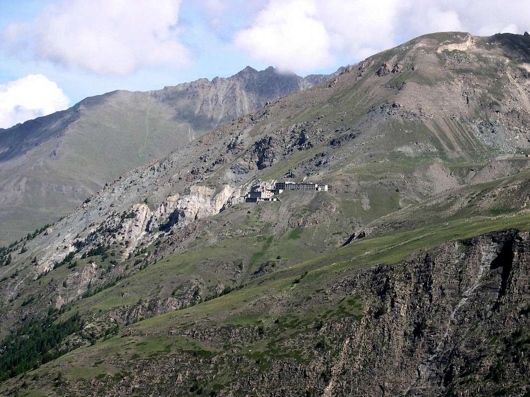
Remain the clear traces of Drive-Ways built for this purpose, not only to Colle dell'Arietta but also to that of the Acque Rosse, under the Tower of Lavina. These steps, along with those of the Hills, from the Northeast to the Southwest, of the Miserino, Scaletta Pass and the Rancio's Bocchetta favored trade, business, culture and even the eventual marriages at least.
![]()
La Storia del Colle dell'Arietta é molto antica e precede l'arrivo dei Romani; esso doveva essere frequentato già dai Salassi, popolo di origine Celtica. Anzi pare che gi abitanti di Cogne provengano dalla Valle dell'Orco-Soana e solo successivamente si sian trasferiti nella Valle di Cogne in località Crest, arrivando da quello che allora si chiamava non Colle di Arietta bensì della Noua o Nouva. Cioé nuovo passaggio in alternativa a quello della Finestra di Champorcher, tale però da richiedere lo scavalcamento antecedente tramite i Colli o della Rosa o della Balma, presso la Rosa dei Banchi, e la discesa al grande Lago Miserin, in Valle di Champorcher. Il Colle della Noua permetteva transito maggiormente diretto, complicato però da un'attraversata per nulla semplice, soprattutto nel versante Piemontese, ove una ripida cengia obliqua tagliava diagonalmente da Nordest a Sudovest la parete rocciosa. Un passaggio a dir poco impervio e neppur troppo ben conosciuto, tanto ne é che anche i Cartografi dell'Istituto Geografico Militare Italiano (I.G.M.) lo rappresentano in modo alquanto impreciso. Inoltre anche il percorso a Settentrione per giungere in Valle di Aosta non era semplice ed inoltre molto esposto alla caduta di Pietre dal Versante Ovest della Testa della Nouva (3034 m). L'utilizzo era devoluto al passaggio tra le due vallate ed inoltre al trasporto del pregiato minerale delle Miniere di Cogne (Magnetite dei Filoni di Larsinaz, Colonna e Costa del Pino). Non veniva portato esclusivamente a valle per esser lavorato ad Aosta ma, principalmente i due ultimi filoni, seguiva la via del Piemonte tramite i vari colli. Sopra della grande fascia rocciosa soprastante la poderale del Vallone dell'Urtier esiste una Côte Piemont che raggiunge l'Alpe Tsavanis, toponimo tal da indicare chiaramente una via da seguire onde raggiungere, partendo da Colonna e transitando per l'Alpi Taverona, Seutse, Gueula Dessus e Desot, i valloni dei predetti colli adducenti a questa regione. Rimangon le nette tracce di Carraie costruite allo scopo, non solo all'Arietta ma anche ad Acque Rosse, sotto la Torre di Lavina. Questi passaggi, insieme ai Colli, da Nordest a Sudovest, di Miserino, Passo della Scaletta e la Bocchetta del Rancio favorivan scambi, commerciali, culturali ed anche matrimoni.
Old Pathways to Steel
The Routes most important & the recommended Excursions towards the Ironmines
1)- Pila Alp and Waterfall
(2221m, 2250): walk Gimillian by trail base in Northeast before to Tchezeu/Ecloseurs Alp, after North over Grua Torrent (
E/F; 1h'20/1h'40).
2)- Ecloseur, Pila, Créuzet Alps, Money Lake, Monte Creya (1903m, 2221m, 2244m, 2550, 3015m): excursion from Gimillian with various paths before in North-northeast
n° 8/TVC, after in Southeast
n° 8D to loch end final part on Northern Slope through a small
unnumbered path and sparce traces (
EE/F; 4h'00/4h'30).
3- Ecloseur Alp, Larsinaz Loadstone Mines (1903m, 1899m): walk Gimillian with paths before in North-northeast, after South-southheast
n° 8D (
T/F; 1h'30/1h'45).
4)- Montroz Village, Larsinaz Loadstone Mines, Plan de Mont Salet collar (1702m, 1899m, 2301m): excursion from Montroz or Gimillan Villages with various paths before in North-northeast
n° 8/TVC, after in South
n° 8D, East
n° 9 and North
n° 5 towards Colonna and Liconi Magnetite Mines
(2390m, 2495m) (
E/F; 2h'30/3h'00).
5)- Montroz Village, Costa del Pino Loadstone Vein (1702m, 2026m): walk from Montroz with paths
n° 9/5 in Eastnortheast and North to Mines (
T/F; 1h'20/1h'40).
6)- Moline Village, Costa del Pino Loadstone Vein (1702m, 2026m): walk from Moline with paths
n° 5/9/5 in East-northeast and North to Mines (
T/F; 1h'30/1h'45).
7)- Champlong/Saint-Pierre (1596m) near Lillaz Hamlet, Costa del Pino Colonna Veins (2026m, 2386m): excursion from this locality taking the path in Northwest
n° 7A reaching Facette Alp
(1662m). Leaving left (West) the trail with a long crossing to the West-northwest is directed Montroz Village always with path
n° 5/9. Continuing instead to the North dominating from the Liconi Vallon reaching the largest concentration which is the old remains of the
Miners's Houses Colonna (
E/F; 1h'45/2h'15 Lillaz).
Comments
No comments posted yet.