La montagna chiama i suoi figli, ed essi rispondono fedelmente al suo appello…
Osvaldo Cardellina, Diario alpinistico, 1964-65
Page texts: @ OsvaldoCardellina"Osva", passed away on May 2, 2022. Page owners: Christian Cardellina e Osvaldo Cardellina. Any updates from September 12, 2022: Antonio Giani, page administrator, friend and climbing companion.
Testi della pagina: @ OsvaldoCardellina "Osva", scomparso il 2 maggio 2022. Proprietari pagina:Christian Cardellina e Osvaldo Cardellina. Eventuali aggiornamenti dal 12 settembre 2022: Antonio Giani, amministratore della pagina, amico e compagno di salite.
Roman Conia with Grand'Eyvia Overview
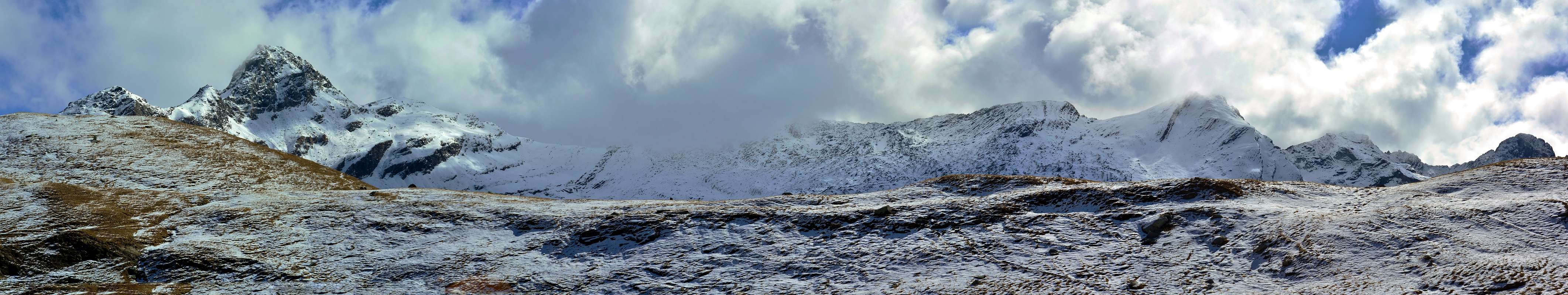
Cogne has a multitude of large and small valleys. But 10 are the important ones. But if you want to know them all, but everyone, look, in My Areas & Ranges", to AOSTA VALLEY Southern Or. & Hydr. VALLEYS & Vallons - First Part/B. There you will find them in a comprehensive manner. We here, however, we want to present to you the ten most important, because we want to indicate Climbs, Hiking, and why not, even the most beautiful Walks and, in our opinion, rewarding. in this way you "get close" most at this beautiful valley and its Pioneers. Including George Yield that frequent visitor and admirer, in 1893 he wrote for the Fisher-Unwin London "The Mountains of Cogne", reaffirmed in 1900 with "Scrambles in the Eastern Graians 1878-1897", always with the same Publisher. In the words of the Abbé Gorret in 1861: "These young Intrepid British win our mountains, while our young people indulge in the softness ...". And, we might add, also wrote of them. Let's see, if possible, to recover a little in time, maybe expanding the horizon by George. But, along the way, we will discover other young Englishmen and no loitering around here ... And maybe we meet again with George with Guides Gerard and Pession who are climbing the West Face of Pousset or C.K.F. Carfrae with Brocherel upward for East Ridge, while the Austrians H. Dielter and R. Winterhalter are still there hanging on the vertical Wall South. All are "sculpted" there, on the rock; since 1913, 1909 and 1903, as the Pousset who is always there to represent Cogne. Cogne is really the Coing Celtic, ie the angle from which you can take in all directions its vallons. To the South towards the Tribulation Glacier and the Summit of Gran Paradiso, as North to the mountainous area that separates it from the Central Valley of Dora Baltea; West towards La Grivola, as in the East to the Fenêtre Champorcher that divides it into this valley, it also disposed in parallel to the Central Valley, but going in the opposite direction. It is therefore really like The Navel of the World. At least for Cogne.
Cogne possiede una infinità di valloni grandi e piccoli. Ma 10 sono quelli importanti. Però se volete conoscerli tutti, ma proprio tutti, date un'occhiata, in My Areas & Ranges", ad AOSTA VALLEY Southern Or. & Hydr. VALLEYS & VALLONS - First Part/B. Lì li troverete in modo completo. Noi qui però vogliamo presentarVi i dieci più importanti, anche perché cerchiamo di indicarne le Ascensioni, Escursioni, e perché no, anche Passeggiate più belle e, a nostro avviso, gratificanti. In questa maniera v'"avvicinerete" maggiormente a questa bella valle ed ai suoi Pionieri. Compreso George Yeld che, assiduo frequentatore nonché estimatore, nel 1893 scrisse per la Fisher-Unwin di Londra "The Mountains of Cogne", ribadito nel 1900 con "Scrambles in the Eastern Graians 1878-1897", sempre con lo stesso Editore. Come diceva l'Abbé Gorret nel 1861: "Questi giovani Intrepidi Inglesi vincon le nostre montagne, mentre i nostri giovani s'abbandonano nelle mollezze ...". Aggiungiam noi, scrivevan pur d'esse. Vediamo, se possibile, di recuperar un pò, magari allargando l'orizzonte di George. Ma, strada facendo, scopriremo altri giovanotti Inglesi e no gironzolanti da ste parti ... E, magari, incontriamo ancora George con le Guide Gerard e Pession che stanno salendo la Parete Ovest del Pousset oppure C.K.F. Carfrae con Brocherel sù per la Cresta Est, mentre gli Austriaci H. Dielter e R. Winterhalter sono ancor lì appesi sulla verticale Parete sud. Dal 1913, 1909 e 1903, come il Pousset che é da sempre a rappresentar Cogne. Cogne é veramente il Coing dei Celti, ovvero l'angolo da quale partono in tutte le direzioni i suoi valloni. A Sud verso il Ghiacciaio della Tribolazione e la Vetta del Gran Paradiso, come a Nord verso quell'area montuosa divisoria dalla Valle Centrale della Dora Baltea; ad Ovest verso La Grivola, come ad Est verso la Fenêtre di Champorcher che la separa da questa vallata, anch'essa disposta in parallelo alla Valle Centrale, ma discendente in senso opposto. Risulta quindi veramente come L'Ombelico del Mondo. Almeno per Cogne.
Getting There
BY CAR:
From TORINO, MILANO, etc: Motorway A5. Exit at IVREA or Quincinetto (PIEDMONT) AOSTA West/Aymavilles, Cogne Municipalities.
From Aymavilles(646m) towards Cogne Valley: Vieyes (1.132m), Gontier private Shelter, through path in Nomenon Vallon. To Cogne(1.534m); through Main Road. To Valnontey(1.678m); Money, Alessandro Martinotti, Stefano Borghi, Pol, Gerard-Grappein, Lionello e Lucio Leonessa, Mario Balzola, Damiano Gratton. (This last from Epinel(1.436m)(1.494m) or Crétaz Fractions) Bivouacs, through paths, moraines and glacier, & Sella Refuge, through muletrack). From Lillaz Fraction (1.607m) to Sogno di Berdzé, under the Fenêtre of Champorcher, and Antoldi-Malvezzi Refuges, by dirt road, muletrack or paths in Urtier and Valeille Vallon. To Gimillan Village(1.785m), Nebbia Bivouac, with path in Arpisson Vallon. All the three last through Regional Roads from Cogne.
From FRANCE: through the Mont Blanc Tunnel to Entrèves-crossroads to Vény/Ferret Valleys - Mountain Guides of Courmayeur - La Saxe Rock Gym - Courmayeur.
By Little Saint Bernard Hill, closed since November until half May to La Thuile Valley - Pré Saint Didier - Courmayeur. It is not necessary to take Motorway A5: you can drive on SS.26, in the direction of AOSTA - IVREA - TURIN.
BY PLANE:
Aeroporto "Corrado Gex" Saint Christophe (Aosta).
Suggested Routes on Tsa Sètse, Arpissson, Grauson-Lussert-Doreire Vallons
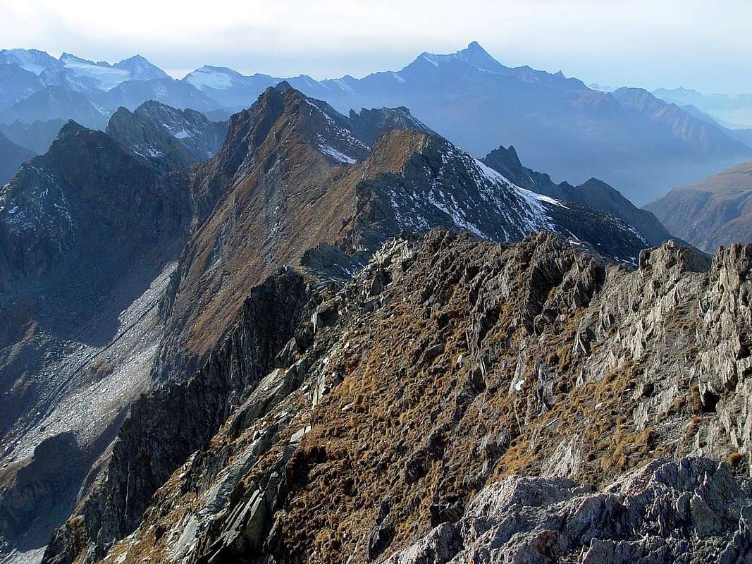
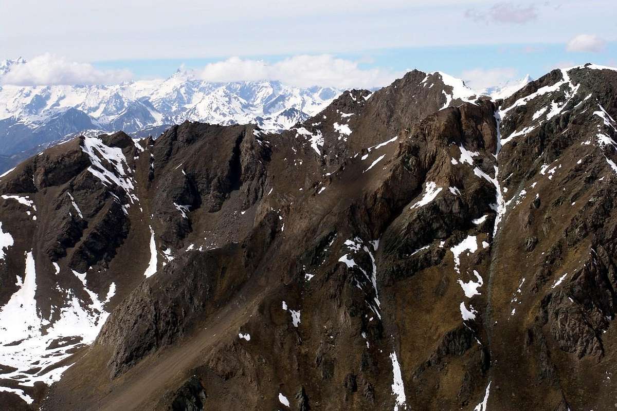
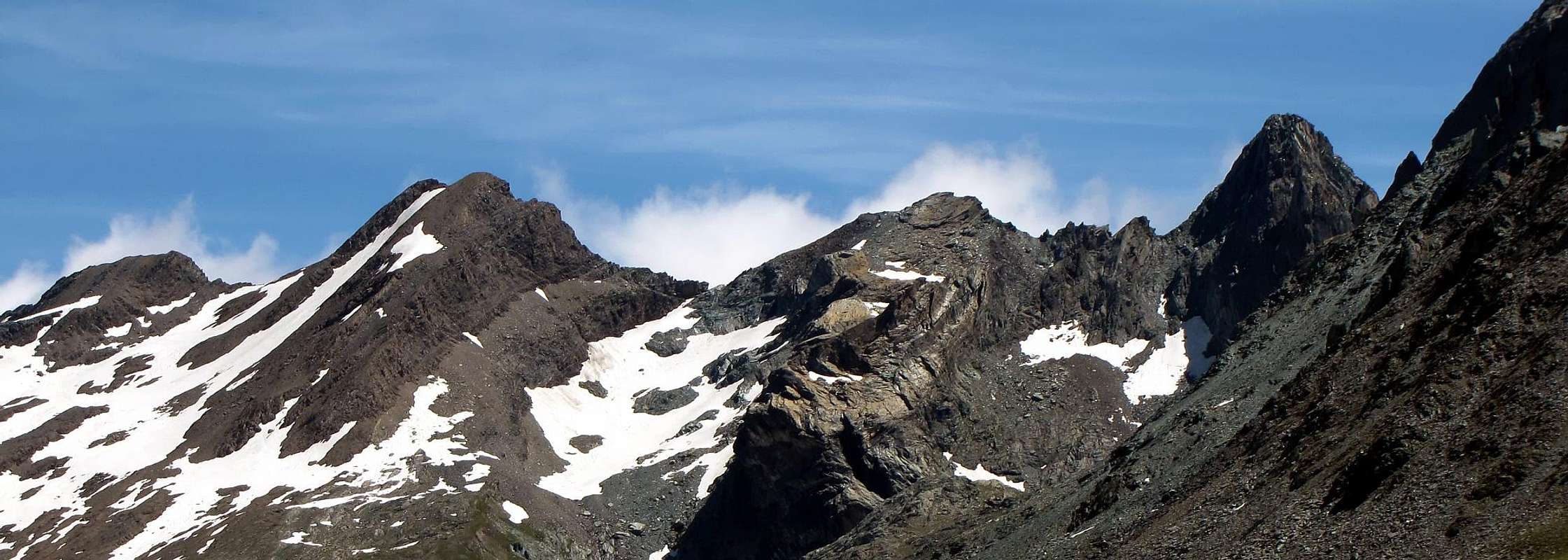
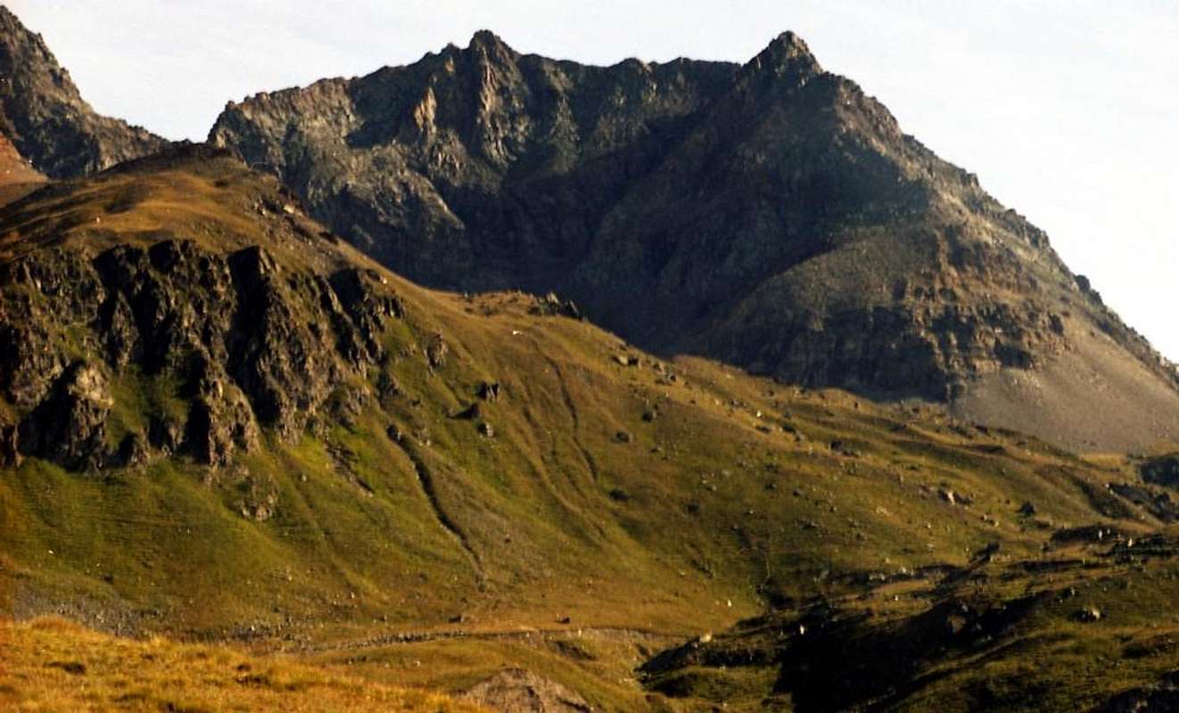
Starting from the Northwest, the entrance of the Valley, and continuing clockwise, after the appendices on the watershed Punta de la Pierre/Punta Valletta (see Pila Basin), we find the first great valley above the Village Gimillan. This opens up, like a large canopy tree, sending a first branch in the Northwest into the valley below Arpisson which in turn "gives birth" a smaller one on its edges towards the East Hill of Tsa Sètze. The main branch or North up towards the Pian di Bessey, Bivouac, Lake Garin and namesake hill below the pyramid Pic Garin forming the Vallon of Arpisson. This area offers climbing, hiking, walking and two equipped routes. The third branch opens more towards forming the Northeast Vallon of Grauson: this also doubles sending a large area to the West in the direction of the other Lakes Lussert and from Passes Valaisan and des Laures, at the foot of a basin consists Tour Grauson, Pic Garin, Punta Rossa, Punta and Mont des Laures. A smaller section and "crushed" is aimed first at North-northeast and then East to the Lower Lake Lussert, the eponymous Punta, Punta di Leppe from which descends the watershed with the Valley of Saint Marcel. The same form sloping Col Vallonet, Mont Vallonet, the two Summits of Laval and Punta Gianni Vert. A marked collar, said the Tessonet, gets up its cape and then "run" towards tessonet coastline, tersiva Pass and Punta Tersiva, the highest of all this great area. The Southern edge of the same is formed by small Soubgroup of Penne Blanche (Testa Vallonet, the two Penne Blanche Eastern and Western, Punta Coupée, Testa of Money and Mont Creya) from Pas d'Invergneux or des Hevergnes reach Mount Creya with its fine Loadstonemines.
The Vallons most important & the recommended Excursions
1) - Epinel Hamlet, Tavaillon, Pian de Seutse Alps (1.436m, 2.013m, 2.198m): Excursion with path in Northwest to Drinc Hill (2.565m), near Arno Bivouac (EE/F; 3h'00).
2) - Col Tsa Sètze (2.815m): Excursion from Gimillian with path in Northwest before to Arpisson Alp, after in a vallon under P. di Pian Bessey/P. della Valletta (E/F; 3h'00).
3) - Col Tsa Sètze-P. de la Pierre Traverse (2.653m): Excursion by hill on crest (Piatta Grevon-P. Monpers-P. Couìss-P. Drinc) equipped "Via Panorama" (EE/F; 2h'15).
4) - Col Tsa Sètze-P. della Valletta (3.090m): Climbing from hill on Southwest Ridge; equipped route "Via Ferrata" (EE/A/F+; 1h'15/1h'30).
5) - Bivouac Franco Nebbia (2.740m), Col Garin (2.815m), Lake (2.854m): Excursion from Gimillian with path Northwest towards Arpisson Alp, Pian Bessey (E/F; 3h'30).
6) - Nebbia Bivouac, Lake, Mont Valaisan (3.307m), Pic Garin (3.451m): Climbing by various routes, better Norhwest Crest and North Edge (A/F+/PD-; 3h'15/3h'45).
7) - Pila Alp and Waterfall (2.221m, 2.250): Walk from Gimillian with path in Northeast before to Tchezeu/Ecloseurs Alp, after in North over Grua Torrent (E/F; 1h'20/1h'40).
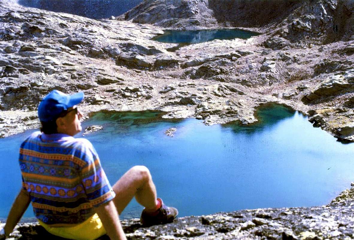
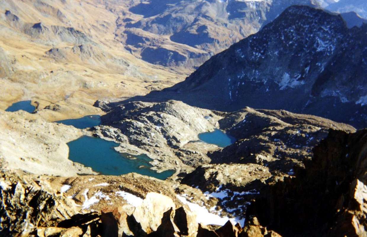
8) - Ecloseur, Pila, Grauson Vieux and Nuove Alps, Lussert three Lakes (1.903m, 2.273m, 2.500, 2.713m, 2.790m, 2.906m), Laures Hill (3.305m): long Excursion from Gimillian with various paths before in North, after in Northwest along Grua and Lussert Torrents (EE/F; 5h'00/5h'30).
9) - Gimillan, Grauson Nuove, Valaisan Pass, Mont Valaisan (1.787m, 2.500m, 3.210m, 3.307m), Pic Garin (3.451m): Climbing through Norh-northwest Ridge and North Edge (A/F+/PD-; 8h'00/8h'30).
10) - Grauson Nuove, Valaisan Pass (2.500m, 3.210m), Western Punta Rossa (3.401m): Climbing through South-southwest Crest (E/E/A/F+; 7h'00/7h'15).
11) - Ecloseur, Pila, Grauson Vieux and Nuove Alps, Frog's and Corona Lakes (1.903m, 2.221m, 2.273m, 2.500m, 2.641m, 2.702m), Saint Marcel Hill (2.913m): Excursion from Gimillian with various paths before in North, after in East-northeast (E/F; 4h'00/4h'30).
12) - Gimillan, Saint Marcel Hill (2.913m): Excursion-Climbing from hill in North to two Laval Summits and Punta Gianni Vert (3.091m, 3.099m, 3.150m) (E/F; 5h'30/6h'00). 13) - Grauson Nuove and Tsezéire Alps, Vallonet Pass (2.500, 2.645m, 3.062m) to Punta di leppe (3.305m): Excursion-Climbing from Gimillian with various paths before in North, after in Northeast, Western Slope of pass and through East-southeast Crest in terminal part (EE/F; 5h'00/5h'30).
14) - Grauson Vieux, Pralognan and Ervillières Alps, (2.273m, 2.416, 2.515m): long Excursion-Climbing from Gimillian with various paths before in Northeast, after in East along Lussert-Grauson-Doreire Torrents and crossing Tessonet Glacier to Tersiva Pass (3.310m) and North-northwest ridge in terminal part (A/F+; 6h'00/7h'00).
15) - Ecloseur, Pila, Créuzet Alps, Money Lake, Monte Creya (1.903m, 2.221m, 2.244m, 2.550, 3.015m): Excursion from Gimillian with various paths before in North-northeast, after in Southeast to loch end final part on North Slope (EE/F; 4h'00/4h'30).
16) - Ecloseur Alp, Larsinaz Loadstone Mines (1.903m, 1.899m): Walk from Gimillian with paths before in North-northeast, after in South-southheast (T/F; 1h'30/1h'45).
17) - Montroz Village, Larsinaz Loadstone Mines, Plan de Mont Salet collar (1.702m, 1.899m, 2.301m): Excursion from Montroz or Gimillan Villages with various paths before in North-northeast, after in South, East and North to Colonna and Liconi Magnetite Mines (2.390m, 2.495m) (E/F; 2h'30/3h'00).
18) - Montroz Village, Costa del Pino Loadstone Vein (1.702m, 2.026m): Walk from Montroz with path in Eastnortheast to Mines (T/F; 1h'20/1h'40).
Partendo da Nordovest, all'ingresso della Valle, e continuando in senso orario,dopo le appendici sullo spartiacque Punta de la Pierre/Punta della Valletta (vedi Pila Basin), troviamo il primo grande vallone sopra il Villaggio di Gimillan. Questo s'apre, a guisa di grande chioma d'albero, inviando un primo ramo a Nordovest verso il Vallone di Arpisson che, a sua volta ne "partorisce" uno più piccolo ai suoi margini Orientali verso il Colle di Tsa Sètze. Il ramo principale o Settentrionale sale verso il Pian di Bessey, Bivacco, Lago Garin ed omonimo Colle al di sotto della piramide del Pic Garin, formando il Vallone d'Arpisson. Quest'area offre ascensioni, escursioni, passeggiate e due vie attrezzate. Il terzo ramo s'apre maggiormente verso Nordest costituendo il Vallone del Grauson: anche questo si sdoppia inviando un ampio settore verso Ovest in direzione degli altri Laghi del Lussert e verso i Passi di Valaisan e des Laures, ai piedi d'un bacino composto da Tour Grauson, Pic Garin, Punta Rossa, Punta e Mont des Laures. Una sezione più ridotta e "schiacciata" si rivolge prima a Nord-nordest e poi ad Est verso il Lago Inferiore di Lussert, l'omonima Punta, la Punta di Leppe dalla quale scende lo spartiacque con il Vallone di Saint Marcel. Lo stesso forma digradando il Col e Mont Vallonet, le due Punte di Laval e la Gianni Vert. Un marcato colletto, detto del Tessonet, si rialza all'omonima Punta per poi "correre" verso la Tersiva, la più elevata di tutta questa grande area. Il bordo Meridionale della stessa é costituito dal piccolo Sottogruppo dei Penne Blanche (Testa di Vallonet, Penne Blanche Est ed Ovest, Punta Coupée e Testa di Money) che dal Passo d'Invergneux o des Hevergnes raggiunge il Monte Creya con le sue pregiate Miniere di magnetite.
Advised Routes on Urtier Vallon
Starting from Lillaz Fraction at the entrance of the Urtier Vallon, and continuing clockwise, along this long and popular vallon that leads to the Refuge "Sogno di Berdzè" (Dream of the Shepherd), at the foot of the Fenêtre de Champorcher. the same is crossed by a private farms dirt road, not always feasible, which reaches the Pastures of Goilles Damon, Tsavanis and Manda; different bifurcations depart from it, namely: from the junction 2.280 meters to the West-northwest towards the Pastures of Gueula Dèsott and Damon, Seutse and Taveronna, at the foot of the watershed that falls from Penne Blanche. From the 2.363 meters towards Southeast Alpe Broillot or Broillat. The next part of the bifurcation 2.360 meters towards the Alps Pianas and des Invergneux also called Hevergnes, under the hill of the same name, just before this last 2.507 meters a second fork leads to the "Baita Hunters Orlando" and the nearby Alp Ponton, under the Tower Ponton. In addition, the road continues linearly to the Hut at the Alpage of Péradza. All this can be done as an alternative path with the path of the High Via, which first runs through the valley floor and then move to the South side of the Torrent Urtier and reach, having doubled in some branches to the Southern vallons, the refuge. This area is divided into two distinct characteristics and particular features: to the North lies the Punta Tersiva, only mountain of some importance in an area free of glaciers but rich waters. Even this mountain on this side provides arid slopes with walls and ridges that day by day are shattered. On the opposite side is not that things change much even presenting the same appearance and you have to wait to get into Valeille to find glaciers. In this area we will consider, however, only the specific areas of the Northern slope reaching up to the Hill of Arietta, but is already in the South. In any case, here is no shortage of proposals for beautiful Walks, including cultural and historical, beautiful Hiking and some Climbing.
The Vallons most important & the recommended Excursions
1) - Champlong-St. Pierre, Facette Alp (1.596m, 1.692m): Walk-Excursion with path in North to Colonna Magnetitemines ( 2.390m) (T/E; 2h'45/3h'15).
2) - Champlong-St. Pierre Village, Facette Pasture, Colonna and Liconi Magnetite Mines with miners' houses (1.596m, 2.495m): Excursion from Lillaz Hamlet (1.607m) with path in North along Liconi Torrent to Monte Creya (3.015m), through Southern Slope (E/F; 4h'30/5h'00).
3) - Lillaz, Goilles Damon Pasture, Cret Church, Tsavanis Waterfall and Pasture, fork 2.360 meters, Pianas and invergneux Alps (1.607m, 1.869m, 2.020m, 2.293m, 2.405m, 2.524m): Excursion from Lillaz with path-dirt road before in East, after North to Invergneux Pass (2.902m) through Southern Slope (E/F; 5h'30/6h'00).
4) - Lillaz, fork 2.360 meters, Invergneux Alp (1.607m, 2.524m): Excursion-Climbing from Lillaz towards Invergneux Pass through Southern Slope and Eastern Penne Blanche (3.252m) by East Ridge, bypassing quotas and carvings 3.020m, 3.012m, 3.080m, 3.075m, 3.127m, 3.088 meters and Testa Vallonet (3.152m) (A/F+; 6h'45/7h'00).
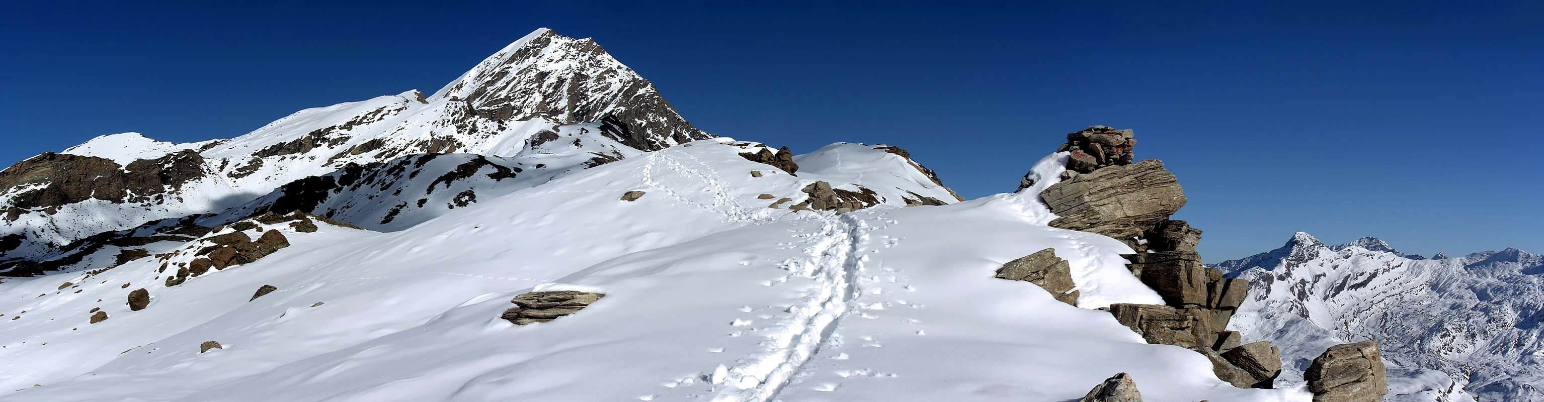
5) - Lillaz, Invergneux Pass (2.902m): Climbing to pass with crossing towards Serra Madù (3.220m), collar (3.198m) Tersiva, by West Crest (A/PD-/PD; 7h'30/8h'00).
6) - Lillaz, alternative 2.360 meters after Tsavanis Pasture, fork 2.507 meters, "Baita Hunters Orlando" (2.641m): Excursion-Climbing to two Pontonnet Lakes and Hill (2.808m, 2.816m, 2.897m), Tour Ponton (3.101m), by North-northwest Crest (EE/A/F; 6h'30/7h'00).
7) - Lillaz, Cret Church, Tsavanis Waterfall and Pasture, fork 2.360 meters, Manda Alp (1.607m, 2.020m, 2.293m, 2.374m): Excursion from Lillaz with path-dirt road in East to "Sogno di Berdzé" Refuge (2.532m) near Peradzà Alp and Fenêtre de Champorcher (2.826m) through Western Slope (E/F; 4h'45/5h'15).
8) - "Sogno di Berdzé" Refuge (2.532m), Ponton Loch and Alp (2.600m, 2.632m): Walk through paths before in Northeast, after Northwest (T/E/F; 1h'00/1h'15).
9) - "Sogno di Berdzé" Refuge, Ponton Alp, Invergneux Hill: Excursion with paths in Northwest to pass and Climbing through Serra Madou to Tersiva, by Western Crest or, after a short descent and crossing on Tessonet Glacier, to Tersiva Pass and by North-northwest Crest (Standard Route from Grauson Vallon) (A/PD-/F+; 4h'30/5h'00).
10) - "Sogno di Berdzé" Refuge, saddle (2.946m): Excursion-Climbing pathless in Southeast, after by Southern Crest to Bec Costazza (3.092m) (A/F+; 2h'30/3h'00).
11) - "Sogno di Berdzé" Refuge, saddle: Excursion-Climbing pathless before in Southeast, after by Northern Slope to Cima di Peradzà (3.021m) (EE/A/F+; 2h'00/2h'30).
12) - "Sogno di Berdzé" Refuge or from fork 2.468 meters on dirt road neighbor Torrent de la Nouva: Excursion-Climbing pathless in Southeast to collar 2.974 meters, after by East Crest to Tête de la Nouva (3.034m) (A/F+/PD-; 2h'00/2h'30).
13) - Refuge or from fork (2.468m) on dirt road neighbor Torrent de la Nouva: Excursion with paths in South to Arietta Pass (2.947m) (EE/A/F+; 1h'45/2h'15).
14) - Lillaz, Quertatset, Bioulé (1.631m, 1.750m, 1.721m): neighbor Torrent Urtier and above Lillaz Waterfalls Walk with path in East-southeast (T; 0h'50/1h'05).
15) - Lillaz, Loie Pasture (1.631m, 2.217m): Walk-Excursion with path in East-southeast at the beginning of valeille towards Loee Lake (2.346m) (T/E/F; 0h'50/1h'05).
Partendo dalla Frazione di Lillaz all'entrata del Vallone dell'Urtier, e continuando in senso orario, percorrendo questo lungo e frequentato vallone che conduce al Rifugio "Sogno di Berdzé", ai piedi della Fenêtre de Champorcher. Il medesimo viene percorso da una strada poderale, non sempre percorribile, che raggiunge gli Alpeggi di Goilles Damon, Tsavanis e Manda; diverse biforcazioni partono dalle medesima e precisamente: dal bivio 2.280 metri circa ad Ovest-nordovest verso gli Alpeggi di Gueula di Sotto e di Sopra, Seutse e Taveronna, ai piedi dello spartiacque discendente dal Penne Blanche. Da quello 2.363 metri verso Sudest all'Alpe Broillot o Broillat. Il successivo parte dalla biforcazione 2.360 metri verso le Alpi Pianas e d'Invergneux oppure des Hevergnes, sotto l'omonimo colle, appena prima di quest'ultima un secondo bivio 2.507 metri conduce alla "Baita dei Cacciatori Orlando" ed alla vicina Alpe Ponton, sotto la Torre Ponton. Oltre, la strada prosegue in modo lineare fino al rifugio, presso l'Alpe di Peradzà. Tutto questo percorso può essere fatto in alternativa con il sentiero dell'Alta Via, che dapprima percorre il fondo del vallone per poi portarsi sulla sponda Meridionale del Torrent Urtier e raggiungere, dopo essersi sdoppiato in alcune diramazioni verso i valloni Meridionali, il rifugio. Quest'area si divide nettamente in due per caratteristiche e peculiarietà: a Settentrione trovasi la Punta Tersiva, unica montagna d'un certo rilievo in una zona priva di ghiacciai ma ricca di acque. Anche questa montagna su questo lato offre aridi versanti con pareti e creste che di giorno in giorno van in frantumi. Sul versante opposto non é che le cose cambino di molto presentando anche lo stesso uguali sembianze e si deve attendere d'entrar nella Valeille per trovar ghiacciai. In questa zona prenderemo in considerazione, comunque, soltanto le aree specifiche del versante Settentrionale arrivando fino al Colle dell'Arietta, che però trovasi di già a Mezzogiorno. In ogni caso anche qui non mancan le proposte per belle Passeggiate, anche culturali e storiche, splendide Escursioni e qualche Arrampicata.
Tell me, tell me, or Mirror Wish: who is it the most beautiful woman of the Realm
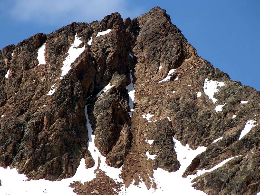
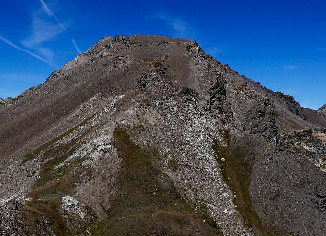
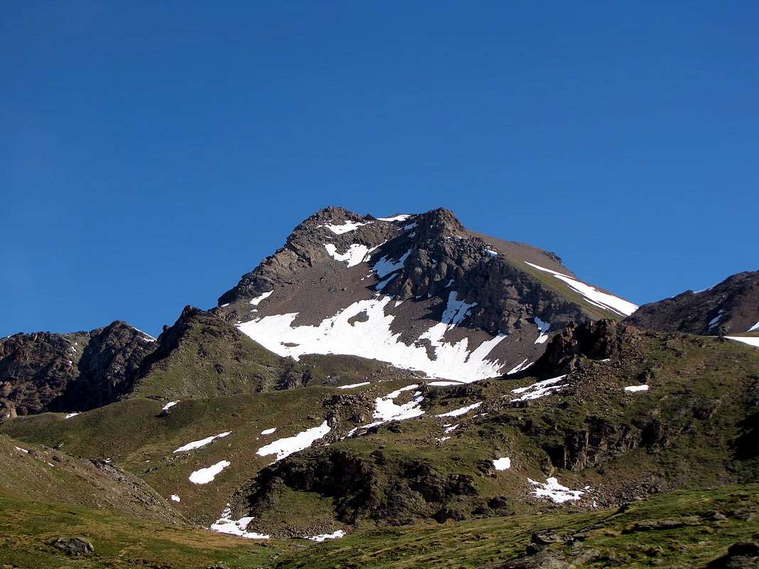
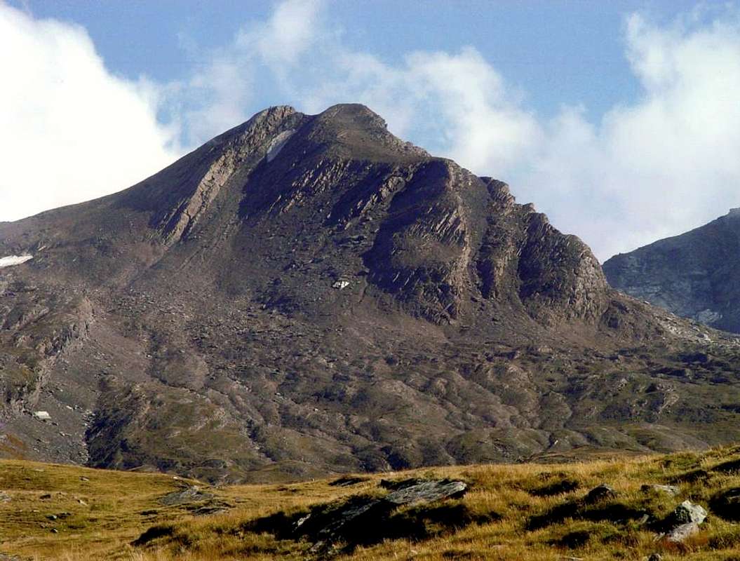
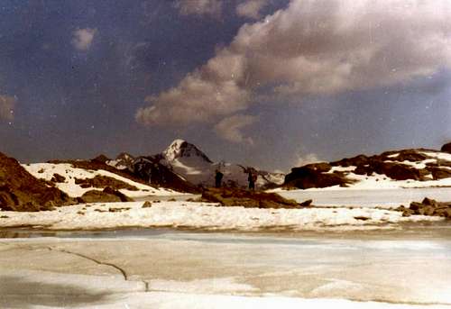
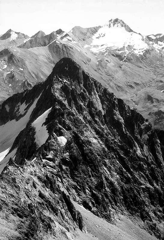
Each Atlas Mountains, Group or subgroup has a Mountain that represents him. It may be the most high, that the characteristics most daring, one that presents difficult routes and in time become famous or desirable routes that still require the first ascent, or simply the most visible. But this is not the case here, since "large" mountains do not exist locally in Northern Sector. Some famous, yes, but of a past time, as the Punta Tersiva, which happens to be also the highest of all this vast area compared to the North respectively over the two Torrents Grand'Eyvia and Urtier. Could be the Monte Emilius with its 3.559 metres but is outside the area and is therefore "foreign" to the Val de Cogne. Let's say a "bad cousin" in plain sight, but nothing more, for the something "we are content with 3.515 meters of our", perhaps giving a glance at the Garin. It is known that Women love Rivalry ...
Ogni Catena Montuosa, Gruppo o Sottogruppo possiede una Montagna rappresentantelo. Può esser la maggiormente elevata, quella dalla caratteristiche più ardite, quella che offre itinerari difficili e nel tempo divenuti famosi o vie ambite richiedenti ancora la prima ascensione, oppure semplicemente quella più in vista. Ma qui non è il caso nostro, poiché "grandi" montagne non esistono in loco. Qualcuna famosa sì, ma d'un tempo passato, come la Tersiva, che risulta essere anche la più alta di tutta questa vasta Area Settentrionale rispetto al corso dei due Torrenti Grand'Eyvia ed Urtier. Potrebbe essere l'Emilius con i suoi 3.559 metri ma é fuori zona e quindi risulta "straniero" alla Val de Cogne. Diciamo un "cuginastro" ben in vista, ma nulla più, per la qualcosa "accontentiamoci coi 3.515 metri della nostra", dando magari un'occhiatina alla Garin. Si sà come le Donne amin le Rivalità ...
Mountain Condition
Meteo: you can find all the needed informations at the official site of the Valle d'Aosta Region:
"Il Parco Nazionale del Gran Paradiso (Valli di Champorcher-Clavalitè-Saint Marcel-Laures-Cogne-Valsavarenche-Conca di Pila" di Giulio Berutto 3/volume 2°, I.G.C., Torino 1981, 2a Ed. 2000.
"Guida dei Monti d'Italia-Gran Paradiso Parco Nazionale" E. Andreis, R. Chabod, M. C. Santis, Club Alpino Italiano/Touring Club Italiano, prima Ed. 1939; seconda Ed. 1963; terza Ed. 1980.
"Guida delle Alpi Occidentali", di Giovanni Bobba e Luigi Vaccarone C.A.I. Sezione di Torino Volume II (parte II), 25 Maggio 1896.
"Rifugi e bivacchi in Valle d'Aosta", di Cosimo Zappelli aggiornata da Pietro Giglio, Musumeci Editore, Luglio 2002.
MAPS:
Kompass "Gran Paradiso Valle d'Aosta Sentieri e Rifugi" Carta Turistica 1:50.000.
Enrico Editore Ivrea-Aosta "Gruppo del Gran Paradiso" 1:50.000.
I.G.C. Istituto Geografico Centrale "Il Parco Nazionale del Gran Paradiso" 1:50.000.
L'Escursionista "Valle di Cogne Carta dei Sentieri" (n° 10) 1:25.000.
L'Escursionista "Tour de la Vallée de Cogne Grand Paradis" 1:25.000.
Children refers to the set of objects that logically fall under a given object. For example, the
Aconcagua mountain page is a child of the 'Aconcagua Group' and the 'Seven Summits.' The
Aconcagua mountain itself has many routes, photos, and trip reports as children.
Parents refers to a larger category under which an object falls. For example, theAconcagua mountain page has the 'Aconcagua Group' and the 'Seven Summits' asparents and is a parent itself to many routes, photos, and Trip Reports.


 3681 Hits
 78.27% Score
 9 Votes